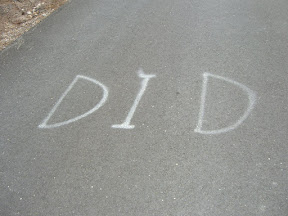
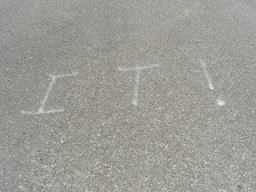
Posted: June 16, 2009 at 4:02 am | Tags: Cleveland National Forest, Maple Spring Road, Santiago Canyon, Silverado Canyon
A long, long while ago (about a year ago), when a flat, 40 mile ride was my idea of an epic ride, I rode a great loop in the Irvine area that included the length of Santiago Canyon Road. At the time, this was also one of the most scenic rides I’d done. A year passes, things happen, and you forget about some of your old, but great, rides. Santiago Canyon ended up being one of those forgotten rides for me, sadly. That is, until my mom (visiting for my brother’s graduation from college) ended up flipping through a book of rides in Orange County and asking me about Santiago Canyon. Memory sparked! So, going to mapmyride to show her the loop and the profile of the ride, I stumbled upon a ride that included Santiago Canyon and an interesting out-and-back on Silverado Canyon Road. An out-and-back that added a good 2,000+ feet of climbing. Now I was getting interested… A little more research (thank you bikeforums.net), and I was sold. Without further adieu, the actual ride report!
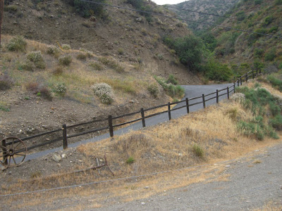
Given time constraints, I opted not to do a full loop. Portola Hills proved to be a nice place to park that would give me 6 miles along Santiago Canyon before heading up Silverado Canyon. Nice little area:
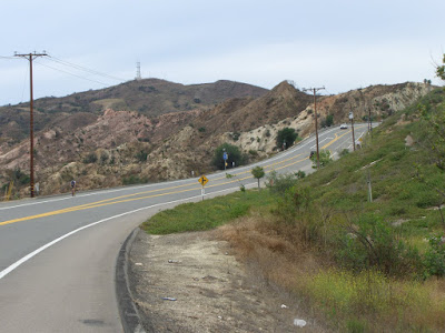
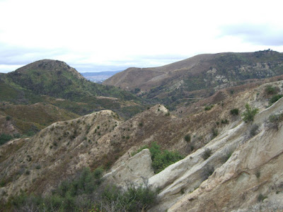
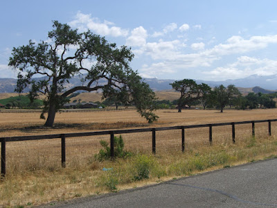
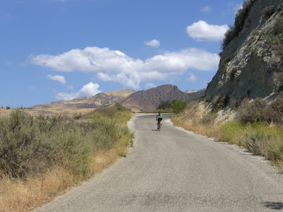
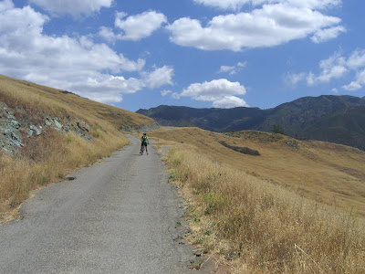
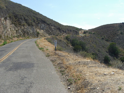
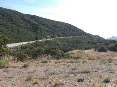
After a quick, steep descent down Ridgeline Rd to Santiago Canyon Road, the climbing starts immediately. I suppose finding a few miles of flats beforehand would be nice, but at least this climbing is rather tame. Anyway, starting around here does keep the entire route along scenic roads. The roads southwest of Santiago Canyon Road are just nowhere near as scenic (not bad roads, just not as sweet). The nice thing about Santiago Canyon Road is that, to the west and south, you butt up against Whiting Ranch Wilderness Park and Limestone Canyon Regional Park, providing you with some spectacular scenes:
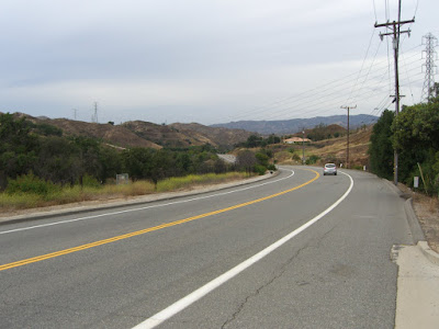
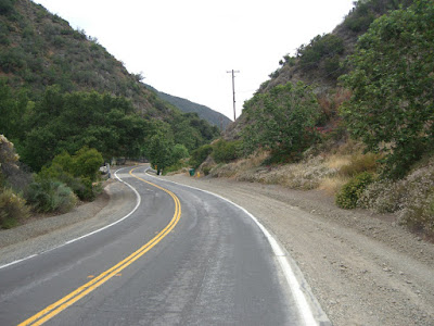
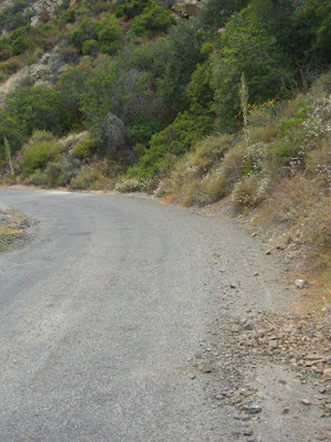
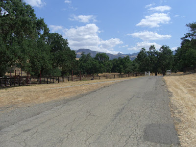
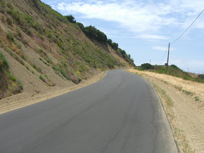
Even the less striking sections of Santiago Canyon are still rather scenic (and note the generous shoulders as well):
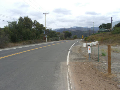
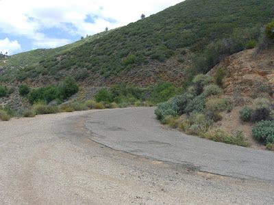
So after lots of rolling hills and 6.4 miles on the Garmin, the turnoff for Silverado Canyon appears (and does not seem to be marked all that well, so keep an eye out when you get near). A couple of hundred feet later, and Silverado Canyon intersects Black Star Canyon. Why the mention? Native American massacres. Ghost and haunting stories. Crazy residents and squatters along the road. Homemade “Private Road” signs to ward off the public. And also, apparently, a good mountain bike ride. A good page about the road can be found here. When I get a mountain bike, I will be riding that road. Anyway, back to the ride at hand. Initially, the road is decent with a gentle gradient. No real shoulder, relatively low traffic but slightly higher speed than I would prefer. That is nitpicking though. Here is the beginning of Silverado Canyon:
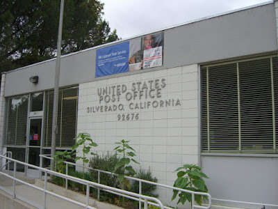
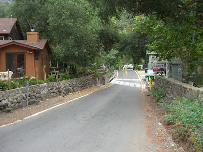
After almost no time, you hit the beginning of the town of Silverado:
Just big enough to have its own post office:
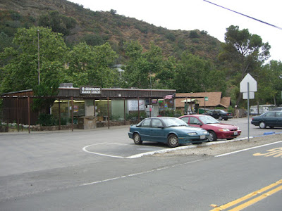
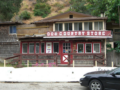
A sad note as you climb. This is what remains of the Shady Brook County Market:
In 2004, heavy rains loosened a huge boulder above the store and sent it through the residential portion of the building, killing a teenage girl.
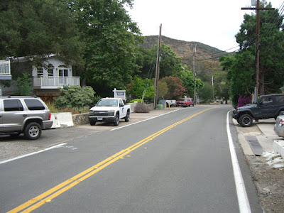
As you wind along and up the road, the traffic speed decreases (25mph limit for much of it…nice!), and there are pleasant looking residences scattered about:
While concentrated a bit around the main part of town, the density of the housing decreases pretty quickly. Continuing up, you get a mix of completely undeveloped sections mixed in with some very lightly developed sections (most of which seem to embrace the natural setting of their lot, thankfully).
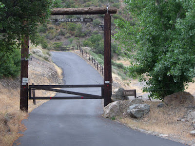
A ranch or two can even be seen along the way (well, the entrances at least):
Looks like a nice, steep road up to the ranch. I wish I could ride up it…
And one of the less developed sections along the road (looking back down on it):
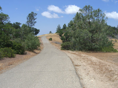
And, finally, we hit the end of the developed section (rather pleasant, no?):
This last section was, most definitely, a pleasant climb through a rural, semi-residential canyon. And, an easy climb as well. The entire stretch averages just under 3%. Regardless, you have still gained nearly a thousand feet here. Not insignificant.
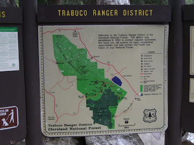
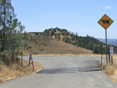
Also, technically, we have been in Cleveland National Forest for almost all of Silverado Canyon Road. However, this is the point where it will become obvious that you are in National Forest Land:
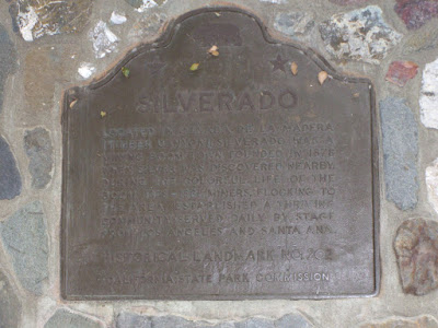
This is also where Silverado Canyon Road turns into Maple Springs Road (and is also a National Forest Trailhead). If you want to start your climb at the bottom of Maple Springs, you can park in a small lot here (note that you will need a Forest Adventure Pass to do so..go buy one and support access to great places like this!). This is also the location of Historical Landmark No. 202 (Silverado):
The picture is tough to read, I know. It was tough enough to read in person with the lighting and all as it was (click on it for a bigger version that is slightly more readable)! Anyway, cliff notes: Silverado was a booming mining town from 1878-1881. And it thrived. And stage coaches served it daily. That is about all (on the sign, at least).
The gate at this point is closed at times. When I was there, it was open to vehicular traffic. You can check to see if Maple Springs is closed on the Forest Service site here. Even when open, though, traffic is pretty light. When the road is closed, you should have no problem continuing up on bike (unless fun weather conditions block passage at some point) – and you will have the road all to yourself!
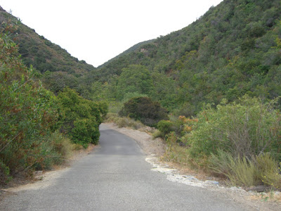
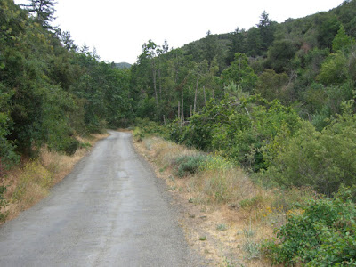
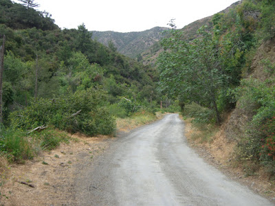
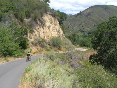
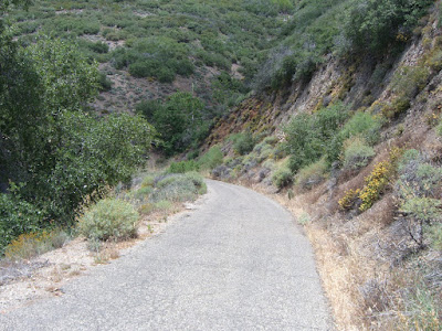
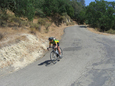
The road itself is one lane and paved from this point – 1900 ft or so – up until about 3000 ft where it turns to dirt. Maple Springs Road, from the “trailhead” start to the end of the paved section is 3 miles..so yes, you get some awesome climbing here. 3 miles of 7%+ climbing. Nice. Very nice. Initially, the road is not super steep, but is surrounded by some lush vegetation:
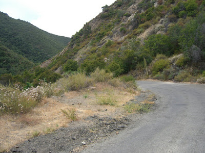
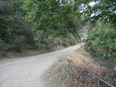
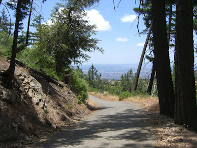
Looking back down from that vantage point:
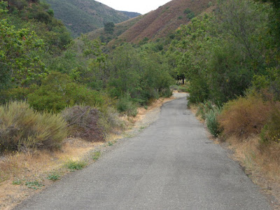
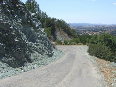
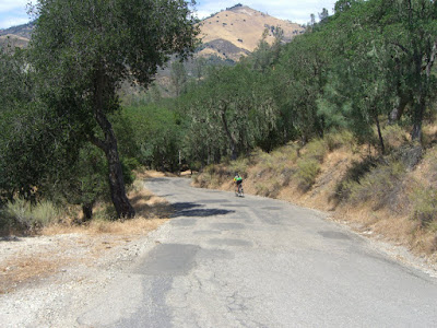
As you can see, skinny road..but what a beautiful canyon! While Silverado Canyon Road was nice, Maple Springs is the sort of road that would keep me coming back time and time again. A little farther up, and some beautiful, open canyon riding:
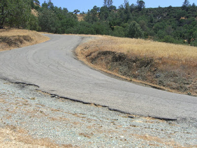
And watch the debris on the descent:
One of many mini-creek crossings (well, practically a river by SoCal standards):
So many beautiful hillsides you pass with many native shrubs and flowers:
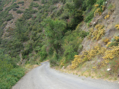
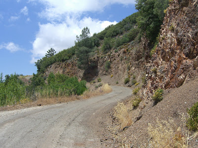
Heading up a bit more, some steeper sections (with some lovely yellow flowers on the hillside):
The last few hundred steep feet before it turns to dirt (unfortunately, no perspective to really give you a sense of its steepness):
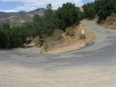
Looking back down:
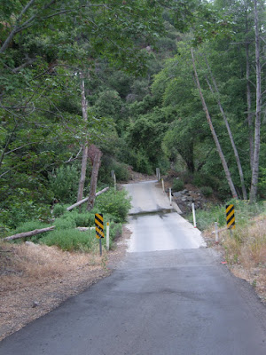
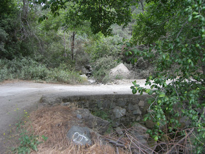
The curve and bridge that leads you to dirt:
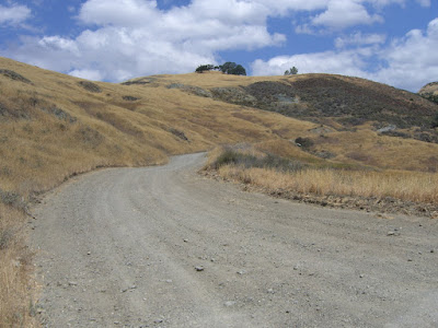
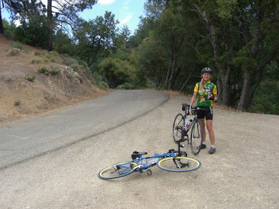
And, the dirt road leading up to the over 5000 ft summit of Santiago Peak:
I am actually tempted to do this subsequent part on my road bike. Mainly because it has already been done. Although a mountain bike might make it more pleasant! Another day though. For today, this was a great climb. I never knew such roads existed behind the Orange Curtain.
Well, time for the descent! Maple Springs Road is a slow descent, that is for sure. One lane, bumpy and lots of debris. Oh, and chilly too. Well, today at least. There had been clouds all day and the sky was looking a little unsettled. Luckily no rain on the ride, but the radio was reporting possible rain at night. Glad I had the arm warmers..just barely enough clothing to stay warm. But yes, a rather sucky road for descending, so watch yourself going down. Once you hit Silverado Canyon Road though, all is good. Minimal debris and mostly sweeping curves. Of course, the grade is rather shallow at times so you will never hit ludicrous speed either. But not a bad descent by any means.
Finally, back down to Santiago Canyon for a repeat of those rolling hills, just in the opposite direction. The brief downhills are nice (and, in this case, scenic):
And looking into Limestone Canyon Regional Park:
29.4 miles and 2 hours, 20 minutes later and I am back to the car. Nice ride. I am definitely glad I did this one. Santiago Canyon is a good ride. Silverado Canyon, however, makes this great. Actually, just give me the Maple Springs section and I would be happy any day! A couple of stats on the paved portion of Maple Springs Road:
Length: 3 miles
Average Gradient: Just over 7%
Last Mile: About 9.3% average with some 15+% ramps
Last Half Mile: Almost 12% average
Progressively steeper? Yes, indeed! That road is awesome after having already climbed a thousand feet 😉
After all this, you might actually want the whole route map:
And, if you just want the Maple Springs Road paved section ascent, here you go (check out the elevation profile on this one!):
To wrap this long post up, here is the album link for all the pictures from this ride.
Cheers to cycling!
Posted: June 9, 2009 at 3:47 am | Tags: Figueroa Mountain, Happy Canyon, Los Olivos, Santa Ynez Valley
Figueroa Mountain. One of the famous Santa Barbara County climbs (though a bit of a drive from Santa Barbara proper!). Training ride for the Discovery Channel Pro Team. Often compared to classic European mountain climbs. 3,000+ feet of strong climbing. With such a reputation, this had been on my must-do list for a while. As my family lives in Santa Barbara (well, Goleta, technically), and my mom loves cycling as well, a free weekend was all the reason I needed to hop in the car and head up to SB County. That, and a pick-up party at Foxen Winery (with about a dozen, awesome Foxen wines available for tasting!) sealed the deal. On to the ride!
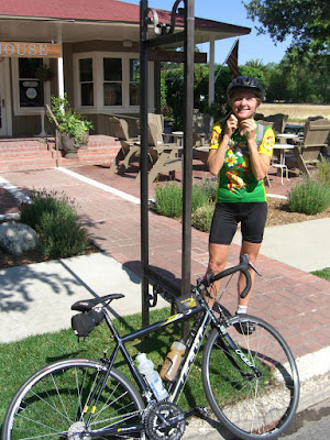
Woke up at just after 7 (not a fan…not a morning person…grrr), got ready and got the bikes and supplies loaded into the car. A short, coffee-enhanced 45 minute drive later, we were parked in the too-cute town of Los Olivos (highly recommended, actually…beautiful and lots of great winery tasting rooms all around..and the sandwiches at Panino are quite good). So, just mom and me gearing up for the ride:
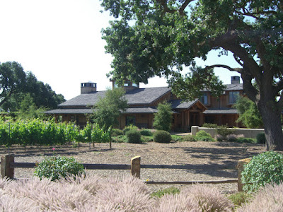
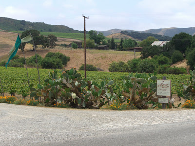
Parked right outside…you guessed it…a winery tasting room (it would seem that half the buildings in Los Olivos are tasting rooms!). Heading out, we went south on Grand, which shortly turned into Roblar after veering east. Roblar Avenue is home to Roblar winery (hmmm, wonder if there is a connection with the names…), a gorgeous establishment you pass right before crossing 154:
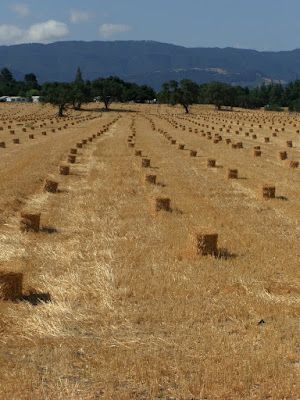
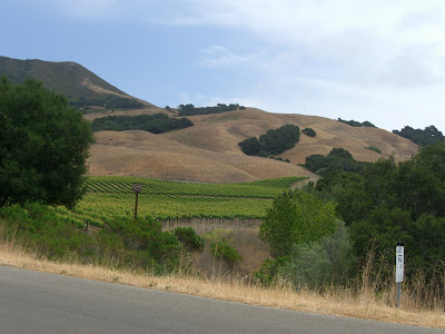
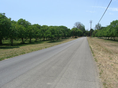
After crossing 154, you meander through the beautiful countryside of the area. Relatively flat for this section, you pass vineyards, farms and horse stables. Tough not to stop every mile or so to take photos!
Not too long after (and shortly after seeing a hawk snacking on a freshly caught mouse!), we intersect Happy Canyon Road and truly commit ourselves to this ride. Can’t believe I talked my mom into this! Actually, she can more than handle this sort of stuff..pretty cool, no? Happy Canyon quickly turns into a true country road – barely two lanes, no lane markings, etc. Is that a problem? Not at all. The drivers are courteous and infrequent. The scenery is wonderful:
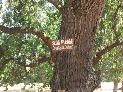
And the signs along the road…not something I see every day in Long Beach…
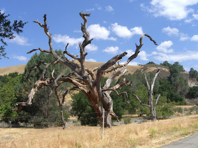
And nature even provides for some of its own art:
And, back to the riding! While being relatively flat to this point (some false flats and some rollers, but no real climbing), the climbing is soon to start! Rounding a bend on Happy Canyon, the real climbing starts:
The wind, at this point, is basically absent. The temperature is not too bad (despite being early June, this day was relatively cool), but the climbing and the absence of a breeze still makes this part hard enough. Nothing crazy, but some good, solid climbing.
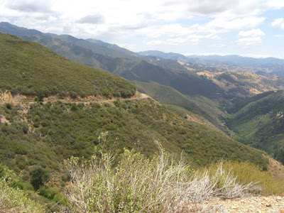
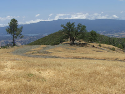
Pretty soon, we are quite exposed and get some incredible views:
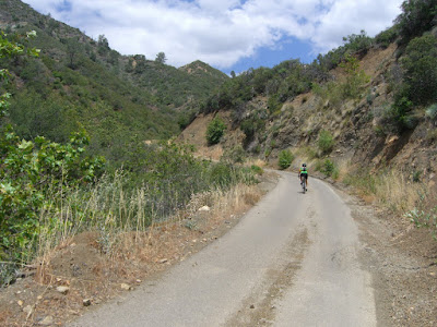
The golden hills surround us. A bit more climbing, and just after passing a shooting ground (gun shots are surprisingly startling when heard in what is otherwise such quiet countryside!), we hit the 9/10s of a mile of unpaved road. Having driven this previously, I was actually kind of worried about riding over this on a road bike. It definitely did not look welcoming to standard road bike tires. And walking almost a mile while pushing a bike along did not..surprise, surprise..sound fun. So, I picked the (theoretically) fastest option…to ride straight through. Dumb, maybe. But, I also had two spare tubes. Anyway, despite being slow, I made it (and with nary a flat tire!). Fun though was hitting the slightly steeper sections..the smallest amount of torque would spin the rear wheel!
Finishing the unpaved section unscathed, we get a nice respite in the form of a small descent nestled amongst some beautiful scenery (of course, the whole thing basically has great scenery):
After this, we encounter a nice, shaded section with a couple of creek crossings (this time of year, the water was only about 2 inches deep at most, so no worries there), before finally starting our relentless climb up:
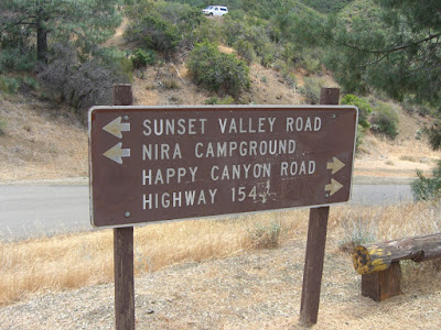
In this section, the road basically winds along the canyon. While it doesn’t give you expansive views, the canyon itself is quite rugged and scenic. At this point, the road has been one lane for quite a while with basically no traffic. Lots of debris as you climb (so if you descend this, be careful). So, finally, almost 20 miles in, we hit Cachuma Saddle…a huge, highly-trafficked intersection:
And, by highly-trafficked, I mean virtually no traffic. Good hiking if you head towards Nira. You can get to Hurricane Deck out there by hiking (also something on my to-do list..the views are supposed to be really good). Anyway, a little break for refueling, and off we go up Figueroa Mountain Road:
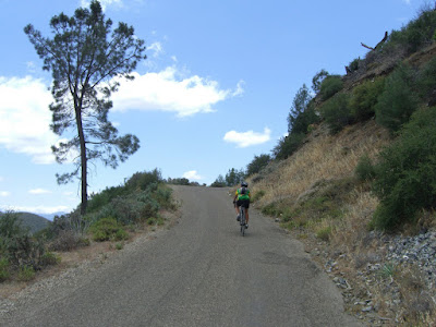
Figueroa Mountain Road, quite literally, cuts right into the mountainside:
Incredible road and incredible scenery. Of course, the road itself is a decaying, slight strip of asphalt:
Rather narrow at times:
But, can you beat that scenery? Wow. That is the sort of road I live for. And, of course, lots of rock/gravel in certain sections:
Doesn’t matter too much when ascending though, since you are going so slow! And finally, the last 200m:
And you even get some well-deserved cheering at the top:
Awesome. Seriously. That made my day. Happy to be at 4500 feet:
And happy for a descent too! The first short section of the descent is quite forested (quite odd for being so high and having been exposed for the last 2500+ feet of climbing). Nice change of pace though! After a couple of minutes of this wooded section, we break out:
And are left with a wonderful, rolling ribbon of asphalt:
Once out to some sun and hitting some incredible views, we take a 5 minute break to rest and refuel. The scene out towards Lake Cachuma is truly incredible:
After some more nice descending (with some very cool rock formations):
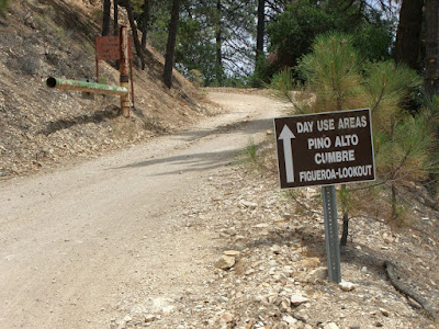
We hit one more last ascent. Only a couple hundred feet, so it really wasn’t that bad. The top of this little ascent is also the turnoff for the Figueroa Lookout Day Use Area:
I have fond memories of going up here as a kid when it would snow. Cool area. Descending beyond this, we start to encounter more of a mix of environment..and some steeper, winding sections of asphalt:
Fun, no? And, one of many cattle gates:
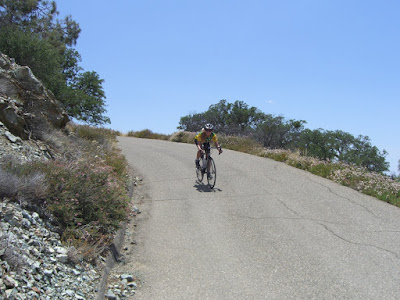
Nearing the last few miles, we start to get into some steep switchbacks:
And this section here was very steep as well:
Without much reference, it may not look steep. But, it is. Having also climbed this section a month or so previous, I hated this stretch. Steep. No wind. Sun beating off the rocks. Fun times  And, a bit farther, another steep switchback:
High speed descent:
Into a beautiful, moss-covered forest:
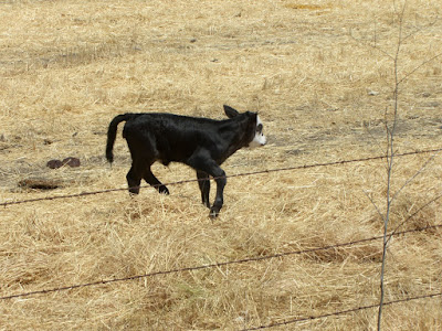
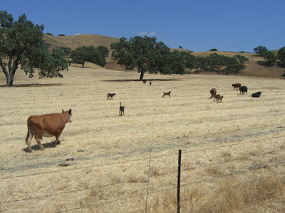
And yeah, that section is steeper than it looks as well. The first two miles of the climb on this side average around 10%..maybe slightly more. But hey, at this point, we are basically at the bottom. Round the steep curve at the bottom (where the bridge is), and we have finished Figueroa Mountain. We are not back to the car yet, but we are done with the mountain and, thankfully, have only a nice, scenic, slightly downhill 7 miles back to Los Olivos. Pass Neverland Estate on the right after a mile or two (yes, the infamous estate of Michael Jackson..and no, you can’t actually see anything interesting from the road aside from the gatepost), then on past some cattle farms…with some awfully cute young ones getting a taste of the world/their pasture:
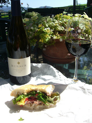
And, finally, just 40 miles of cycling later, we are back in Los Olivos. Load the bikes back on the car, stop in to Panino for a prosciutto, mozzarella, tomato and basil sandwich and a chicken, sun-dried tomato and provolone sandwich and head over to Rusack Winery (a 5 minute drive from Los Olivos), for the reward:
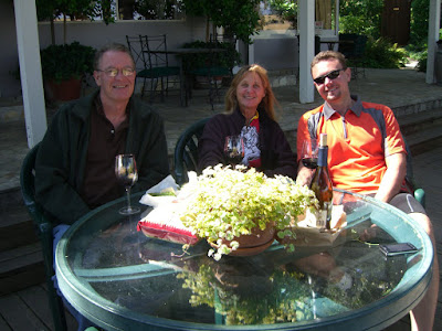
We earned this stop 😉 A couple of happy cyclists (and a supportive dad…well, he was drinking good wine, so he would be happy anyway!):
Ok, long post! Guess I liked this ride! Having ascended from the west side previously, I was very glad to do the backside ascent. Both are incredible ascents. This one (the east side), is more rugged but doesn’t have some of the ridiculously steep sections like the west side does. Tough, but the grades are more consistent than the west side. Also, the east side has extremely limited cell phone reception. Bring a buddy, multiple spare tubes and extra water/food – there is little traffic and Happy Canyon can get very hot. Be prepared. Of course, if you want some nice torture, the first 2 miles of the west side ascent sure are fun 😉
In summary…incredible ride, scenery, climb, etc. And both the east and west side ascents are worth doing separately – they are each unique. Do the loop counter-clockwise first, then do it clockwise next. Anyway, the route map:
And, the full album can be viewed here.
Enjoy!
Posted: June 3, 2009 at 5:10 am | Tags: Buellton, Jalama Beach, Santa Ynez Valley
So, 2 days after doing a double metric century (with a fair amount of climbing)..what to do? Why not ride a 68 mile round trip route from Buellton to Jalama Beach? Yeah, great idea..
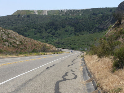
Anyway, started by parking in the Park & Ride lot on Santa Rosa Ave/Avenue of the Flags right to the west of the 101. Seemed to be a pretty safe parking spot. Heading west on Santa Rosa Avenue, the scenery was quite nice. Initially, lots of open space, rolling hills and some farms along the way (and somewhat bumpy road surface):
Quickly, this led into some beautiful vineyards:
Parts of this section were repaved (probably within the last month or so, as you could still smell the tar!). The newly paved sections are brief respites from what is otherwise a rather bumpy road. I didn’t mind though; the scenery was quite nice. A couple of tasting rooms along the way too…maybe I should have stopped here:
Looked quite inviting! But, sad to say, I hammered on and did not taste a single drop of the nectars offered along Santa Rosa Road. A bit farther and a touch of climbing was encountered. 100-200ft max..but, with a newly repaved section, and a hillside blooming with native flowers, the climb was well worth it (if you can even call that a climb!):
A bit farther and some orchards..maybe apple..beautiful nonetheless:
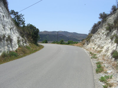
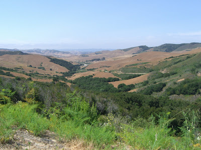
And, shortly thereafter, climbing through a limestone (I think) ridge:
before descending into a striking valley:
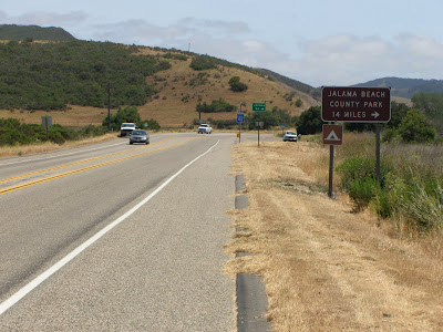
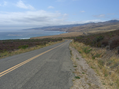
So, finally, after a great 16 miles on Santa Rosa Rd, I turn left on CA-1 for a couple of miles of incredible beauty before intersecting Jalama Rd. You may not find the ocean in this picture, but it is one more reason I consider 1 to be a breathtaking road:
Soon enough, the turnoff:
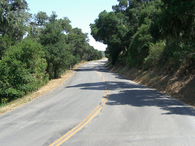
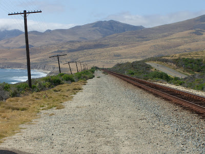
Initially, Jalama Rd (the single road out to Jalama Beach), is secluded and shaded:
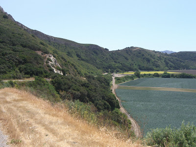
The secluded aspect remains, but the shade quickly disappears (not usually a problem…either the cooler temperatures or the wind will almost always keep you from overheating!). Initially, you meander, then climb, through a beautiful valley (complete with working farms and all):
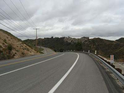
After a decent climb out of that valley, and some nice descents, you have one final, scenic and dramatic climb:
Only a couple hundred feet, but quite striking. The reward?
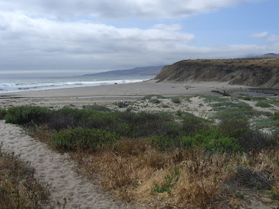
Yup. Doesn’t get much better than that. Epic. One nice way to see the Pacific Coast:
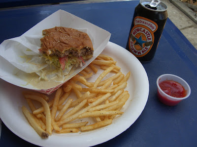
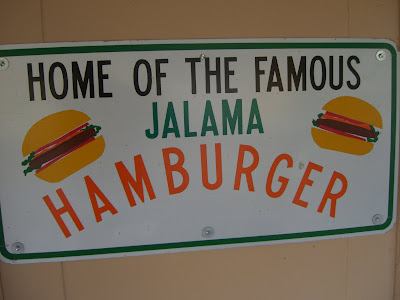
So, after all that, could anything top such views? Yes. This:
Huge, juicy burger. Fries. Can of Newcastle. All for $10. Nice. Highly recommended!
Oh, and the scenery at Jalama Beach is not so bad either!
All the pictures from the ride can be viewed here.
And, for those of you who want an incredibly scenic, out and back route, here you go:
By the way, I was hurting on the way back. Having definitely not recovered from the double metric two days prior, every mile on the way back (especially sea level [Jalama Beach] to the 1100 ft high point on Jalama Rd) was slow and tough. Regardless, I urge everyone to do this ride…incredibly scenic with some varied terrain. If you don’t want such a long ride, you can always park in Lompoc and make this a 35 mile or so roundtrip. You’ll miss Santa Rosa Road, but you’ll still hit Jalama Rd for some of the most incredible scenery. Can’t go too far wrong either way!
Posted: June 3, 2009 at 3:28 am | Tags: 33, Double Metric, Ojai, Ojai Valley Century, Organized Rides, Santa Paula, Ventura
So, being a masochist and all, I decided to sign up for the longest, toughest ride in the Ojai Valley last weekend. This ride is organized by a couple of the local Boy Scout Troops..and, they did an excellent job of providing support!
Starting out in Libbey Park in Ojai, I realized it was still too early in the morning. I don’t wake up this early. I don’t enjoy waking up this early. In fact, I didn’t even know 5AM existed. Some more sleep would have been quite welcome. Sad to say, sleep was not on the agenda. Ok, ok..enough whining about sleep. The initial climbing on this ride definitely woke me up.
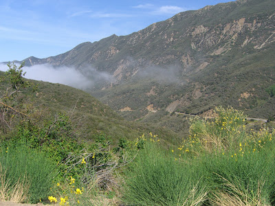
A few miles after departing from the park (and going through some gorgeous residential neighborhoods), we started the ascent up the 33. Initially, we were tormented by heavy fog and general dreariness..but, about halfway up, we broke out of the fog and into sunshine..
What a beautiful climb! Another thousand or fifteen hundred feet and we reached the turnaround point (elevation 3600 ft or so):
Of course, part of me wanted to continue up:
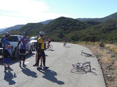
Doesn’t get much better than that for scenic climbing. Oh well, some day I will do the full 33 climb. The descent back down was great – aside from some rock debris in certain sections, this was a fun, high speed, sweeping descent for almost 15 miles. 30-40mph for almost all of it! After finishing the descent, we headed west to tackle Casitas Pass, stopping briefly for some nutrition at a ranger station rest stop. While resting there, I ran into one of the premier riders for this ride:
If only I were so fast :p
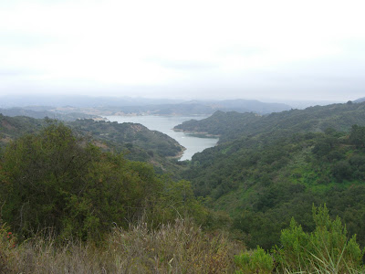
Beyond that, we climbed Casitas Pass and got some nice views of the lake:
Pretty easy ascent after having done the 33. Beautiful though, despite the fog. Completing that, we headed out to Montecito and had some gorgeous riding out there (was getting tired and mostly stopped taking photos at this point..sorry!). After meandering through Montecito, we headed back towards the coast and then back along 192 before hitting 150 and taking it to the 101. The section along the 101 was actually not that bad. 4 or 5 miles for that section, and there seemed to be a tailwind, so I was able to maintain 22-25 mph for that entire stretch. Cars passing at 65+mph is not the most pleasant, but there is a huge shoulder so it isn’t too bad. And the ocean scenery on the right is not so bad either!
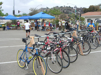
About 77 miles in, you exited at the turnoff for 1 South. This then brought you along some incredibly cute coastal villages (wish I had pictures of them!) before getting into Ventura proper. And, finally, after putting up with a rather bumpy bike path for most of this stretch, we hit the lunch stop. A sandwich loaded with mayo, meat and mustard never tasted so good. As there were few riders doing the full double metric, we were rather late to the lunch stop…but no worries, food was still there. And a few nice bikes as well:
And yes, still foggy here. After experiencing some nice coastal Ventura neighborhoods, then some auto malls (one that was blasting horrible 80s music and doing a tent sale bbq), we started to head inland and finally got some more sun. This section was definitely interesting (it paralleled the 126 basically), and really gave you a feel for the farming roots of the area. Tons of farms and orchards along the way. Mostly flat, but some rolling hills. Again, I was getting tired so I didn’t get to take enough pictures. Sad.
The next rest stop was quite awesome. Set against the beautiful train station in Santa Paula, Boy Scout volunteers handed out never-ending supplies of popsicles (and vitamin water, pretzels, etc) for those hurting (and we were all hurting a bit at this point). Taking a good rest here, I knew 20 more miles were ahead of me (and some climbing too). My legs were begging to retire at this point, but there was no way I could quit now. So, yes, power on I did, up to 1600 ft for the saddle of 150 before the final descent back into Ojai. And there were more popsicles to be had on this ascent. Twice, in fact. And, those popsicles were probably the best popsicles I have ever had. I’m sure it had nothing to do with having ridden 120 miles already. No, definitely not.
126 miles. The final mileage. 10,000+ calories burned according to the Garmin. 9,000 ft climbed. And a huge bowl of McConnell’s ice cream to devour at the finish. Life is good.
Pictures from the ride are here.
Oh, and the official map for the double metric (click View Full for a nice, big version of the map):
Previous Page Next Page