San Diego – Palomar Mountain South Grade Climb
Posted: August 15, 2009 at 1:52 am | Tags: Pala Rd, Palomar Mountain, South Grade Road, SR-76Palomar has been on my list of must-do climbs for a long time, but one thing or another kept it from happening. The distance to get to the climb from Long Beach also didn’t help. Nor did the reports of reckless motorcyclists and other enthusiast drivers on weekends. Nor the reports of the high temperatures to expect during the summer. But, finding myself with a free Friday (being unemployed at the moment does have a few advantages), I decided to tackle this climb at the last minute. While this meant only a couple of hours of sleep, it also meant some pleasant temperatures.
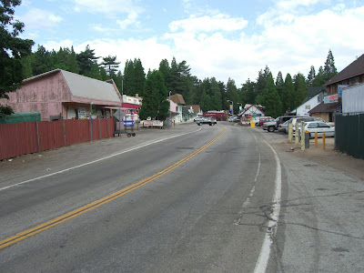
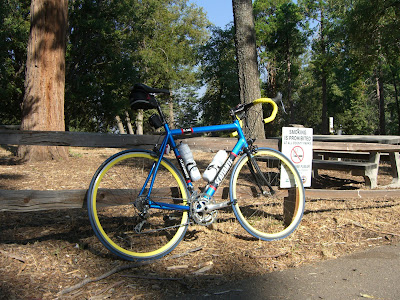
The Harrah’s casino seems to be the popular spot to park, so that was my official starting point. After rubbing my eyes a few times and strapping on my shoes, I headed north along Valley Center Road. My first thought was basically questioning my sanity in waking up so early to simply torture myself with cycling up thousands of feet. Must be a disease. I’ll have to ask my doctor about that.
Anyway, Valley Center Road is mostly forgettable. One cow crossing, a few buildings, a couple of side roads, decent traffic and a touch of climbing. Pretty boring but it quickly led to the turn for 76 (aka Pala Rd). This intersection is home to the Taco Shop, the (un)official start of the climb. Start your timer here!
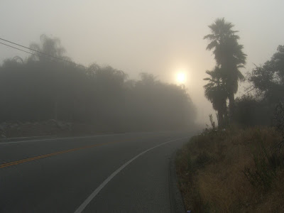
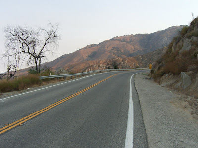
The climbing also kicks up immediately here – nothing all that steep, but some good, consistent climbing. This section was actually a little creepy – heavy fog silhouetting the occasional palm tree with some wickedly thick wisps of fog..
 |
| From 2009-08-14 – Palomar Mountain Cycling |
Another mile or so and I’ve ascended above the fog level. Continuing along 76, the scenery is actually pretty nice:
 |
| From 2009-08-14 – Palomar Mountain Cycling |
Some fog back in the distance, left behind:
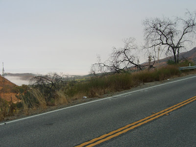 |
| From 2009-08-14 – Palomar Mountain Cycling |
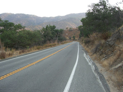
Continuing on:
 |
| From 2009-08-14 – Palomar Mountain Cycling |
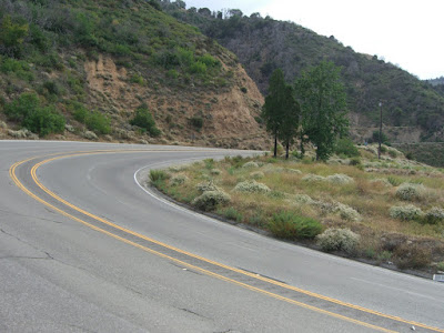
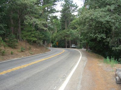
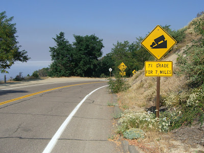
76 passes quickly enough. While decently scenic, I was still glad to hit the the turn for South Grade and shed a bit of the traffic. That said, 76 was actually pretty calm – don’t know if this is always the case or if it was just because it was early enough. On to South Grade! This road is a solid climb. Nothing crazy-steep, but it consistently climbs. Soon enough I hit 3,000 feet:
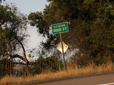 |
| From 2009-08-14 – Palomar Mountain Cycling |
Heading up around one of the many switchbacks:
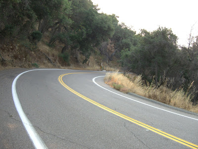 |
| From 2009-08-14 – Palomar Mountain Cycling |
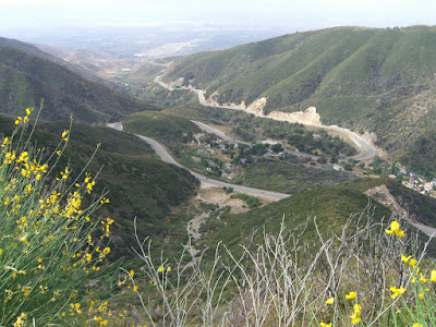
A little farther and a very beautiful switchback:
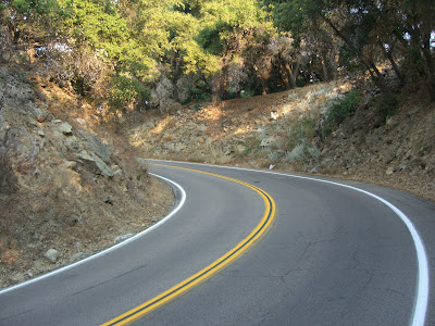 |
| From 2009-08-14 – Palomar Mountain Cycling |
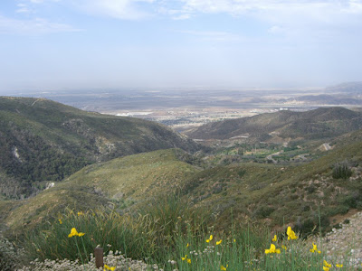
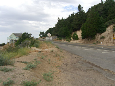
Above 3000 feet the views really start to open up:
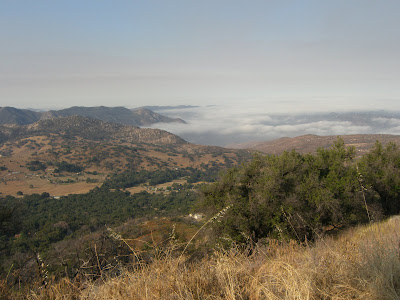 |
| From 2009-08-14 – Palomar Mountain Cycling |
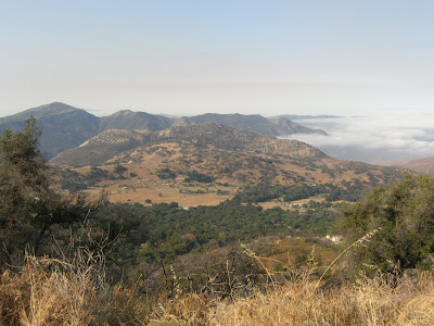 |
| From 2009-08-14 – Palomar Mountain Cycling |
That, right there, is one reason why I torture myself in attempting such climbs.
Another half hour of climbing and I hit the ridge line. Despite being rather tired, I was happy to have maintained a 2600 feet of climbing per hour pace. To finish the climb, I throw in a few hundred more feet along Crestline Rd up to Palomar Mountain County Park. This last bit leaves me with a finishing elevation of 5600 feet. Nice little park:
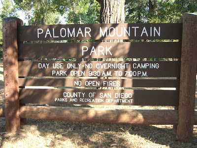 |
| From 2009-08-14 – Palomar Mountain Cycling |
 |
| From 2009-08-14 – Palomar Mountain Cycling |
Sadly, this park affords no expansive views of what you have just conquered. It does, however, offer a bathroom. This more than makes up for the lack of expansive views.
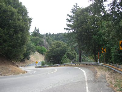
Finally, heading back down:
 |
| From 2009-08-14 – Palomar Mountain Cycling |
A fair warning! This is a very fun descent (minus the 3 or so cattle crossings)! My average speed from Palomar Mountain Park all the way back to my car at Harrah’s was 29mph. 40.0 mph top speed as well. This descent is both fun and challenging – tons of 180+ degree switchbacks to keep you alert! Can’t wait to try it again and see if I can up that number.
The full route map:
Just the South Grade climb portion:
Also, socalvelo has an excellent page on Palomar.
In conclusion, this is an excellent climb. Solidly steep for many miles, nice views and not too much traffic (at least on a Friday morning). Next time, I have two things to add to this ride – a visit to the observatory and a cruise down E Grade to Lake Henshaw. These two attractions alone will keep Palomar high in my to-do-again list. And, next time, a stop at Mother’s is definitely in line as well!
Prost!