Posted: June 30, 2010 at 12:48 am | Tags: 150, Koenigstein Rd, Ojai, Santa Paula, Sulphur Mountain, Sulphur Mountain Rd
Sulphur Mountain is one of those climbs that you really have to hunt for to find. With only a couple of passing mentions on bikeforums and virtually nothing on google (aside from a few pages about mountain biking portions of it), this climb is easily overlooked. Even the road itself is plain looking at its turnoff from route 150 just outside of Ojai – you’d never guess it goes anywhere special. This is a shame. Sulphur Mountain Rd is a great climb. While relatively short (only 1240 ft in elevation gain total), the first couple of miles average 8.8%..and the first mile averages 10%! Needless to say, this is a challenging little climb.
A few important stats:
First 0.7 Miles (the steepest section): 10.5% average
First Mile: 10% average (525 ft elevation gain)
Main Climbing Section (2.05 miles and 945 ft elevation gain): 8.8% average
Overall Climb (3.42 miles and 1240 ft elevation gain): 6.9%
Overall Ride (bottom of climbing section to end of Sulphur Mountain Rd): 4.3 miles
If you only look at the overall climb numbers, 6.9% doesn’t sound too bad. This is deceptive. The first 2 miles climb steeply up to the ridge line while the following 1.5 miles meander gently (with a few steep portions thrown in) along the ridge. Basically, if you can get up those 2 steep miles, you are good to go.
Anyway, on to the pictures!
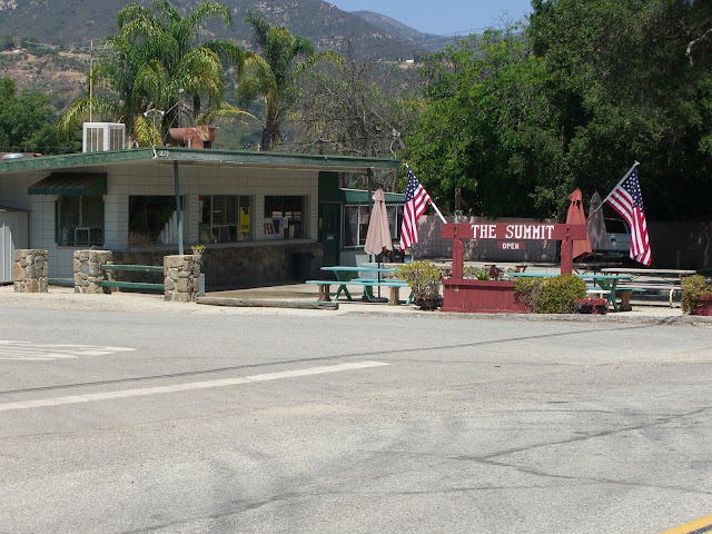
A nice place to start is near The Summit roadside food stand:
The name refers to the fact that this is the summit of route 150 between Ojai and Santa Paula (at just over 1560 ft in elevation). In fact, this is the highest point along all of route 150 (the other high point along the Casitas Pass section tops out at under 1200 ft). 150 itself is a great road to ride on as well, so starting in either Ojai or Santa Paula and riding up 150 to Sulphur Mountain would be great as well. However, if you are pressed for time, as I was, the streets around The Summit provide the best relatively secure, close parking area for this ride. From here, you gradually descend a couple of miles along 150 towards Ojai before turning left on Sulphur Mountain Rd. Watch for this intersection as it is not well marked.
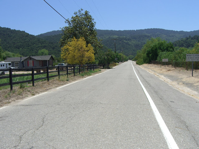
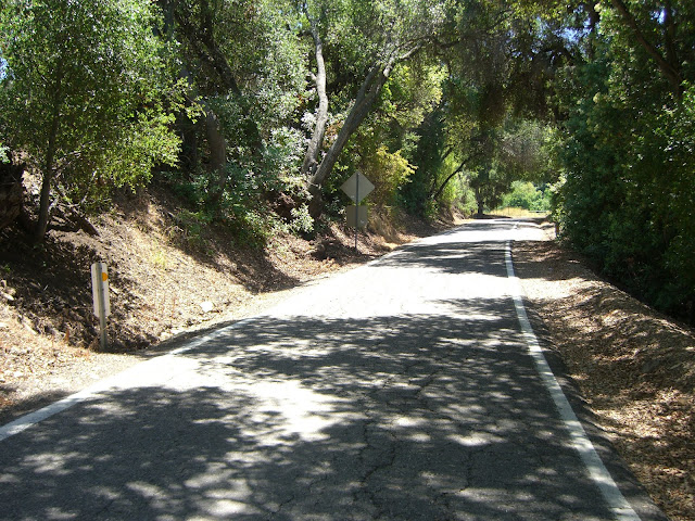
The first part of Sulphur Mountain Rd is relatively flat with some houses along the road:
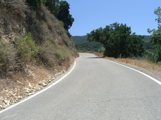
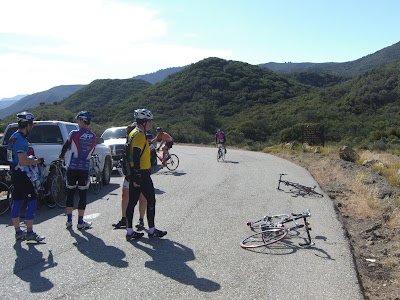
The hill in the background is what you are about to climb up. Very quickly, the climbing starts:
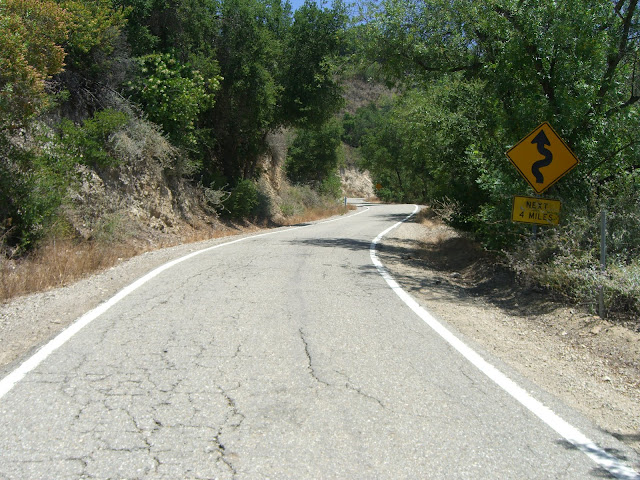
Some of this steep climbing is shaded:
Some is not well shaded:
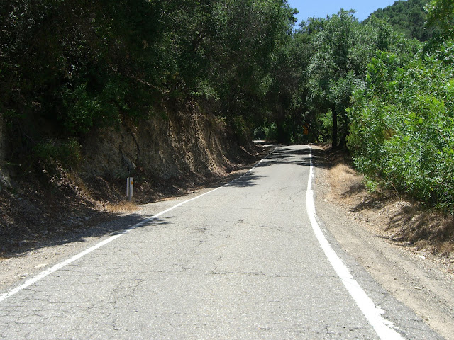
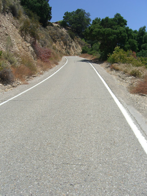
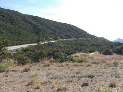
Sections like this will test you:
Steep (10%+), exposed and sun-drenched (the sun just bounces off those rock walls). Luckily, you do get a lot of shaded sections:
Read the Full Ride Report
Posted: June 3, 2009 at 3:28 am | Tags: 33, Double Metric, Ojai, Ojai Valley Century, Organized Rides, Santa Paula, Ventura
So, being a masochist and all, I decided to sign up for the longest, toughest ride in the Ojai Valley last weekend. This ride is organized by a couple of the local Boy Scout Troops..and, they did an excellent job of providing support!
Starting out in Libbey Park in Ojai, I realized it was still too early in the morning. I don’t wake up this early. I don’t enjoy waking up this early. In fact, I didn’t even know 5AM existed. Some more sleep would have been quite welcome. Sad to say, sleep was not on the agenda. Ok, ok..enough whining about sleep. The initial climbing on this ride definitely woke me up.
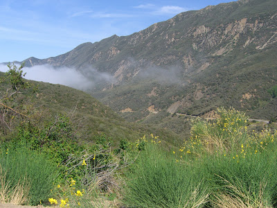
A few miles after departing from the park (and going through some gorgeous residential neighborhoods), we started the ascent up the 33. Initially, we were tormented by heavy fog and general dreariness..but, about halfway up, we broke out of the fog and into sunshine..
What a beautiful climb! Another thousand or fifteen hundred feet and we reached the turnaround point (elevation 3600 ft or so):
Of course, part of me wanted to continue up:
Doesn’t get much better than that for scenic climbing. Oh well, some day I will do the full 33 climb. The descent back down was great – aside from some rock debris in certain sections, this was a fun, high speed, sweeping descent for almost 15 miles. 30-40mph for almost all of it! After finishing the descent, we headed west to tackle Casitas Pass, stopping briefly for some nutrition at a ranger station rest stop. While resting there, I ran into one of the premier riders for this ride:
If only I were so fast :p
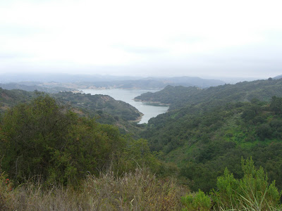
Beyond that, we climbed Casitas Pass and got some nice views of the lake:
Pretty easy ascent after having done the 33. Beautiful though, despite the fog. Completing that, we headed out to Montecito and had some gorgeous riding out there (was getting tired and mostly stopped taking photos at this point..sorry!). After meandering through Montecito, we headed back towards the coast and then back along 192 before hitting 150 and taking it to the 101. The section along the 101 was actually not that bad. 4 or 5 miles for that section, and there seemed to be a tailwind, so I was able to maintain 22-25 mph for that entire stretch. Cars passing at 65+mph is not the most pleasant, but there is a huge shoulder so it isn’t too bad. And the ocean scenery on the right is not so bad either!
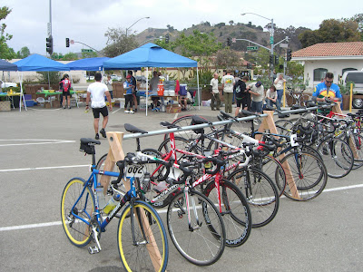
About 77 miles in, you exited at the turnoff for 1 South. This then brought you along some incredibly cute coastal villages (wish I had pictures of them!) before getting into Ventura proper. And, finally, after putting up with a rather bumpy bike path for most of this stretch, we hit the lunch stop. A sandwich loaded with mayo, meat and mustard never tasted so good. As there were few riders doing the full double metric, we were rather late to the lunch stop…but no worries, food was still there. And a few nice bikes as well:
And yes, still foggy here. After experiencing some nice coastal Ventura neighborhoods, then some auto malls (one that was blasting horrible 80s music and doing a tent sale bbq), we started to head inland and finally got some more sun. This section was definitely interesting (it paralleled the 126 basically), and really gave you a feel for the farming roots of the area. Tons of farms and orchards along the way. Mostly flat, but some rolling hills. Again, I was getting tired so I didn’t get to take enough pictures. Sad.
The next rest stop was quite awesome. Set against the beautiful train station in Santa Paula, Boy Scout volunteers handed out never-ending supplies of popsicles (and vitamin water, pretzels, etc) for those hurting (and we were all hurting a bit at this point). Taking a good rest here, I knew 20 more miles were ahead of me (and some climbing too). My legs were begging to retire at this point, but there was no way I could quit now. So, yes, power on I did, up to 1600 ft for the saddle of 150 before the final descent back into Ojai. And there were more popsicles to be had on this ascent. Twice, in fact. And, those popsicles were probably the best popsicles I have ever had. I’m sure it had nothing to do with having ridden 120 miles already. No, definitely not.
126 miles. The final mileage. 10,000+ calories burned according to the Garmin. 9,000 ft climbed. And a huge bowl of McConnell’s ice cream to devour at the finish. Life is good.
Pictures from the ride are here.
Oh, and the official map for the double metric (click View Full for a nice, big version of the map):