Ojai – CA-33 to Rose Valley to Pine Mountain Summit (& Beyond!)
Posted: July 18, 2010 at 11:43 pm | Tags: 33, Meiners Oaks, Ojai, Pine Mountain, Pine Mountain Inn, Pine Mountain Ridge Road, Pine Mountain Summit, Rose Valley, Sespe Creek
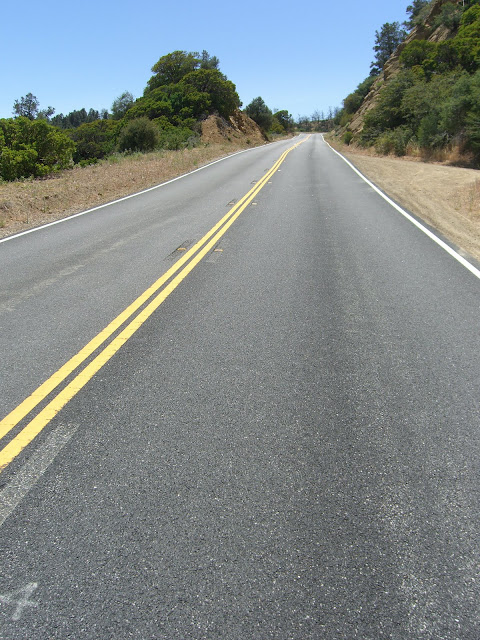
33 North from Ojai is one of the most beautiful cycling hill climbing routes ever created. While never all that steep, the route is incredibly scenic and offers lots of changing scenery if you ride it all the way to Pine Mountain Summit. Going all the way to Pine Mountain Summit along Route 33 means a 30 mile (one-way) ride that takes you up to a max elevation of 5160 ft. With a starting elevation of ~800 ft and some rolling sections, this means an overall elevation gain nearing 5000 ft. Pretty solid. If that is too easy, you can also ride up Pine Mountain Ridge Road to get to the real Pine Mountain itself, another 2000 ft higher (and a very tough and rough 2000 ft!). Also, if you go beyond Rose Valley Summit, bring a Camelback as there were no water sources that we could find.
Stats:
33 to Rose Valley Summit – 11.4 miles at 4.3% (2600 ft gain)
11.7 miles of easy climbing and rollers between Rose Valley Summit and the bottom of the Pine Mountain Summit Climb (1.4% – 850 ft gain)
Climb to Pine Mountain Summit – 3 miles at 5.4% (850 ft gain) – last 2/3 of a mile at 8%
Pine Mountain Ridge Road Climb – 6.1 miles at 6.4% (2050 ft gain), steepest 3.7 miles at 7.8%, steepest 1.75 miles at 9.1%
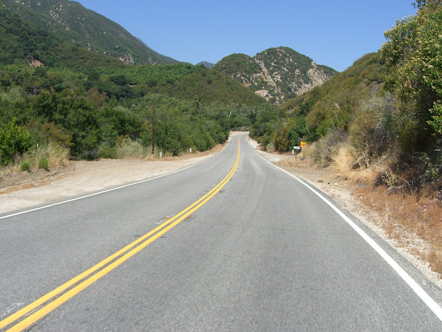
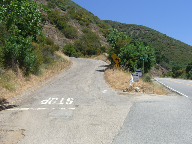
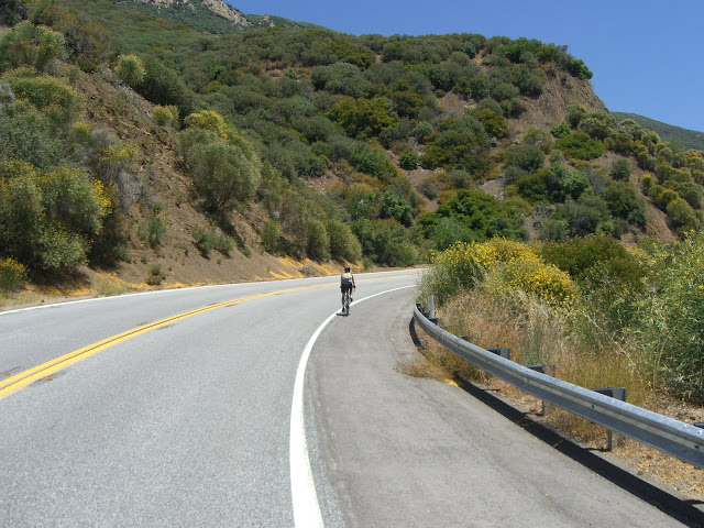
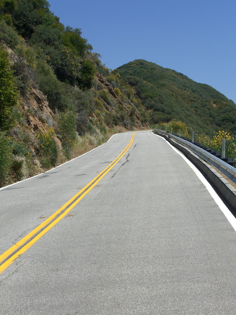
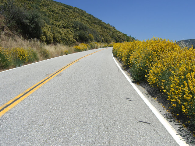
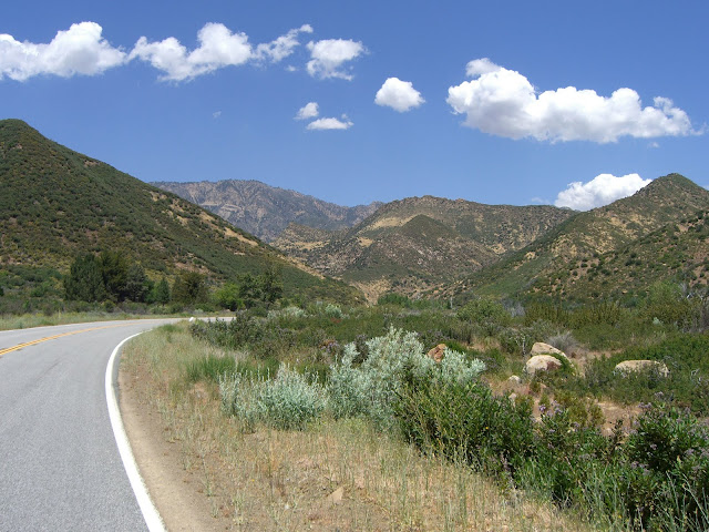
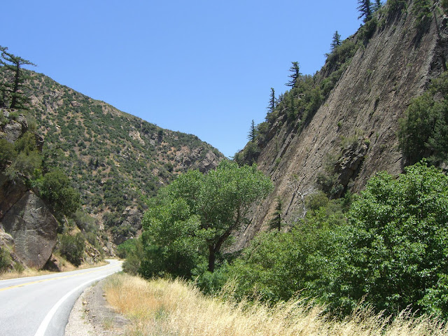
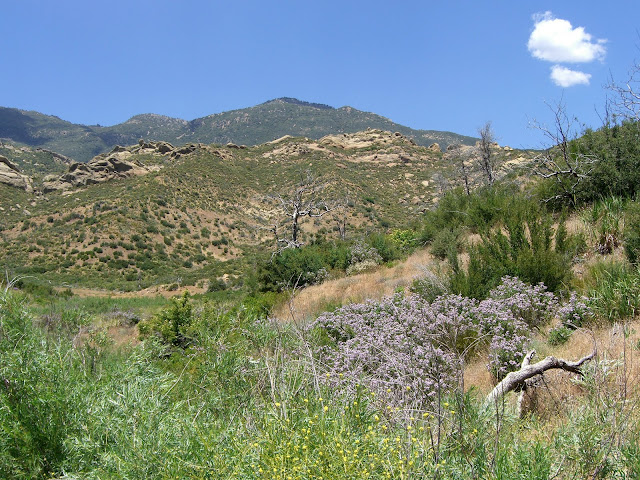
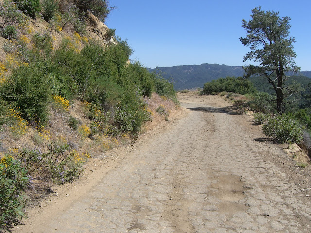
Anyway, the climbing starts just north of Meiners Oaks along Route 33. From Ojai, head west along 150 (Ojai Ave) for about 1 mile before turning right (& heading north) on 33. At about 4.5 miles in, the climbing starts in earnest as you pass by Matilija Lake. This first section, before the real climbing, is quite pleasant:
Nearing Matilija Lake:
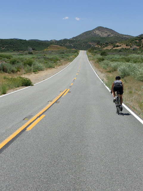
As you approach Matilija Lake, the actual climbing begins:
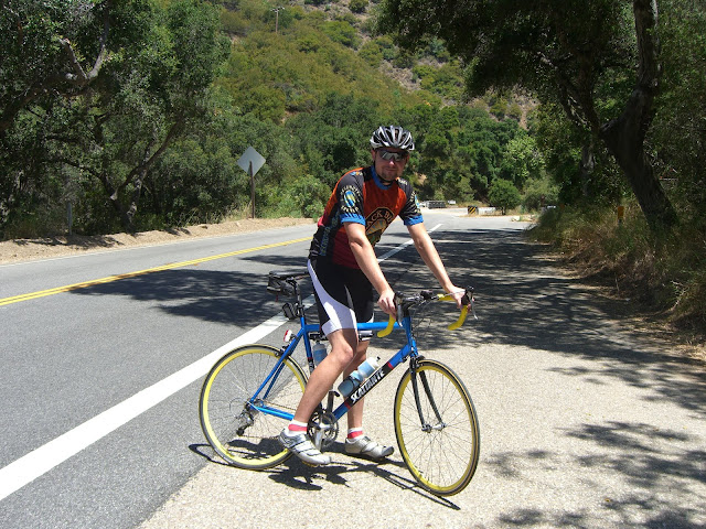
Me..getting ready for a long climb..
Just a bit north of this point, I elected to throw in a touch of brief, steep climbing. Matilija Canyon Road presents an awesomely steep section of road:
Crazy, no?
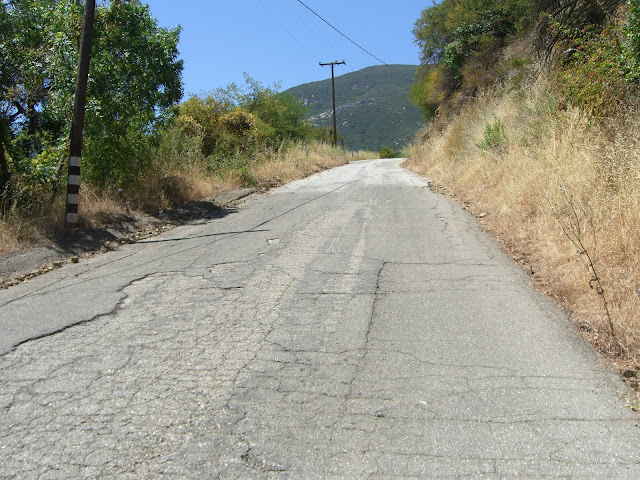
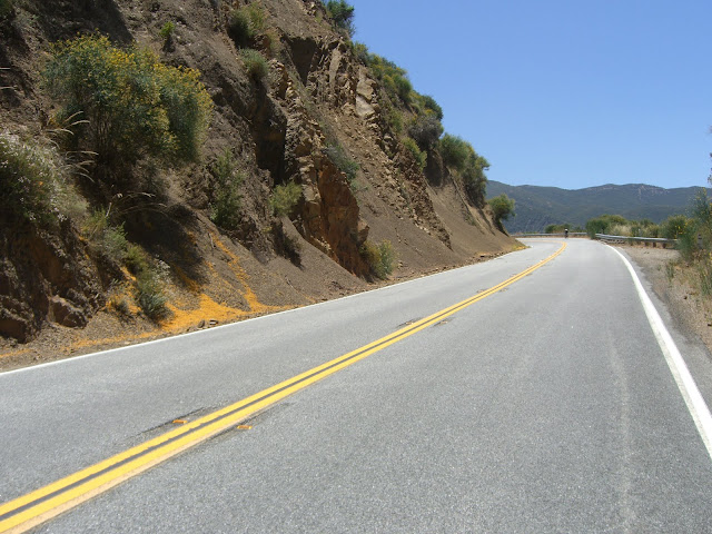
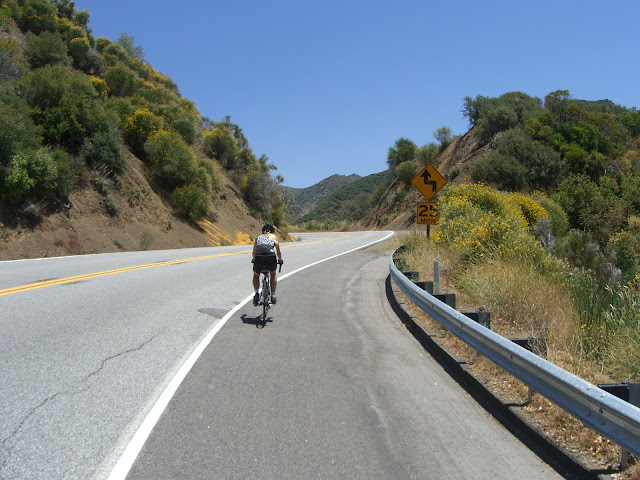
Continuing on up 33:
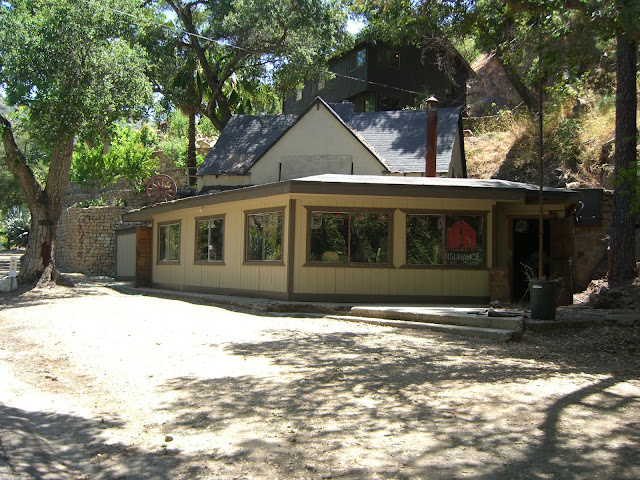
A cool restaurant along the way:
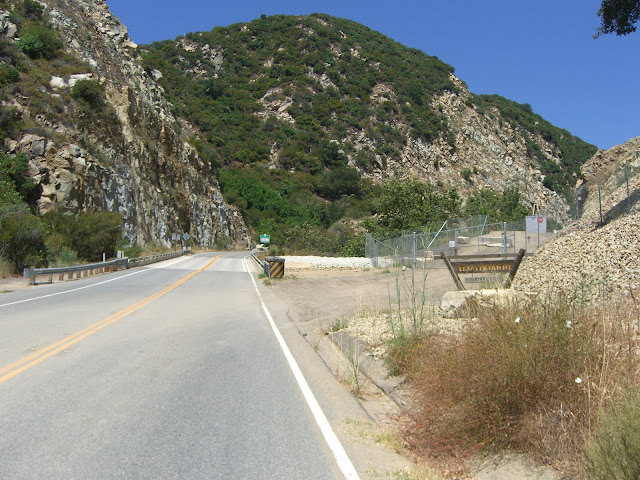
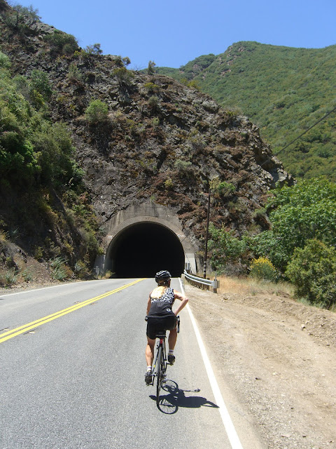
A little bit further and the first tunnel (of three) is encountered:
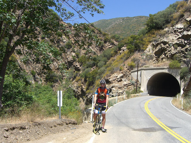
Looking back at the circa 1931 tunnel:
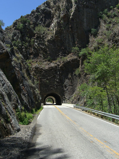
Shortly thereafter, you will pass through two more short tunnels. These tunnels are quite beautiful and are worthy of a picture stop:
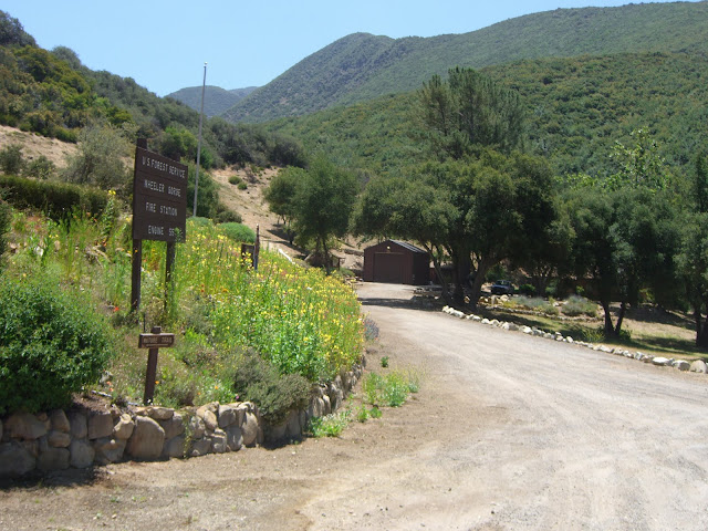
On your right, after the tunnels, there is a nice mini-waterfall. A little further and you hit the Wheeler Gorge Fire Station:
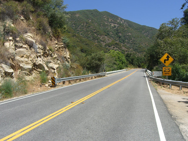
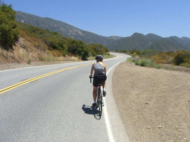
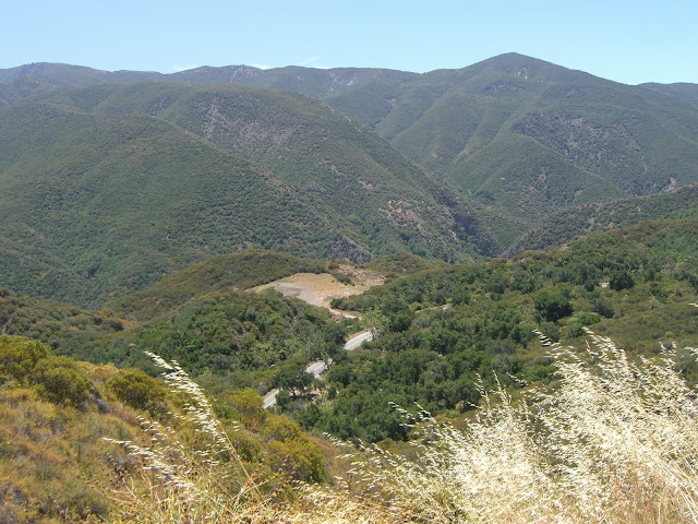
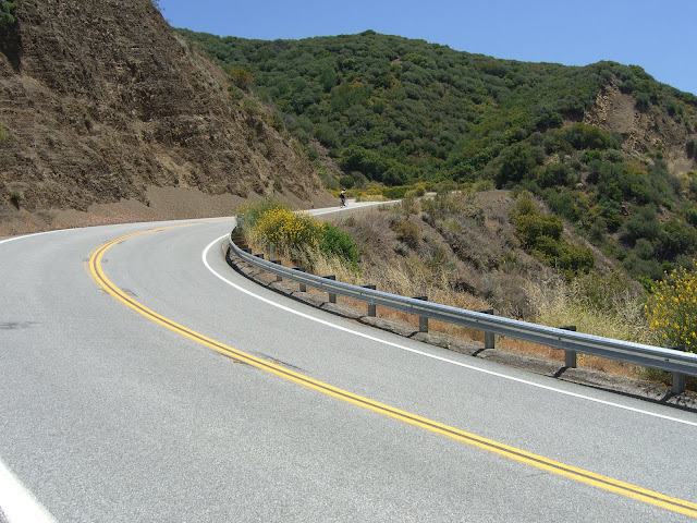
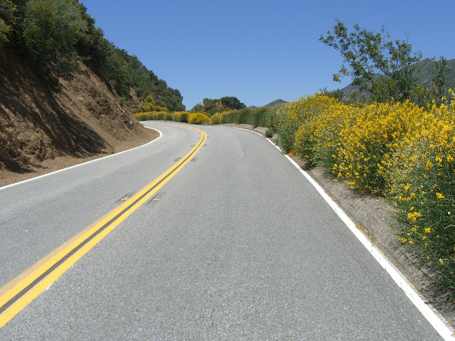
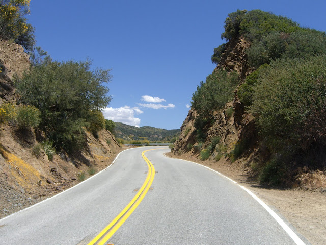
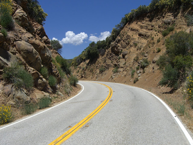
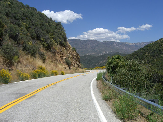
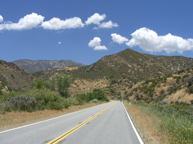
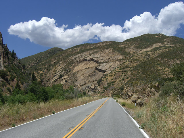
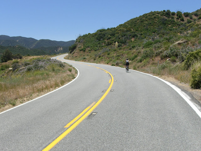
This is when the climbing starts to really get scenic. 2000 ft and climbing up and up:
What a road!
Looking back on the road just climbed:
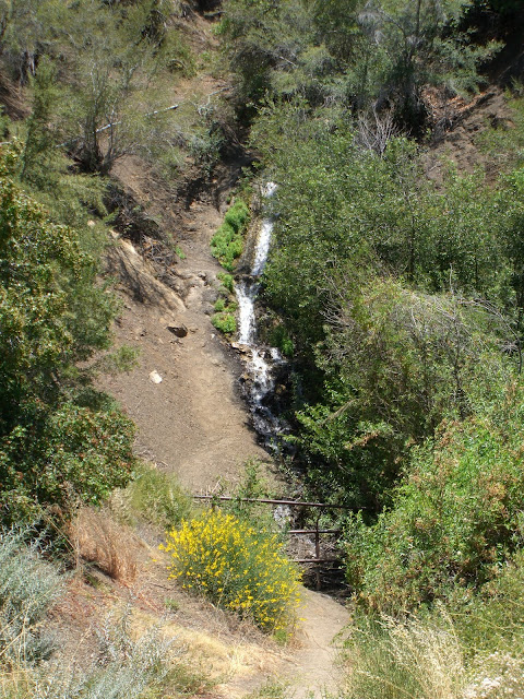
A waterfall along the way:
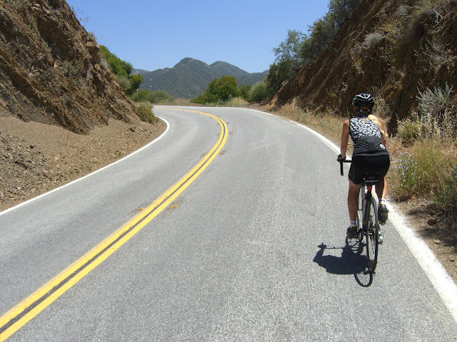
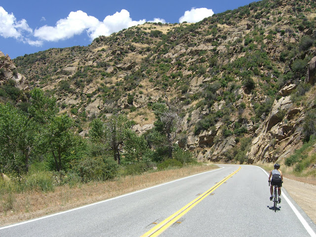
More climbing along one beautiful route:
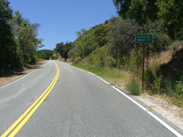
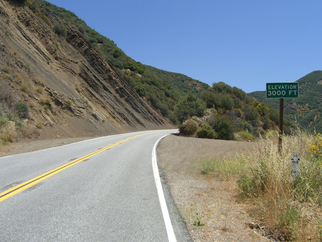
3000 ft elevation:
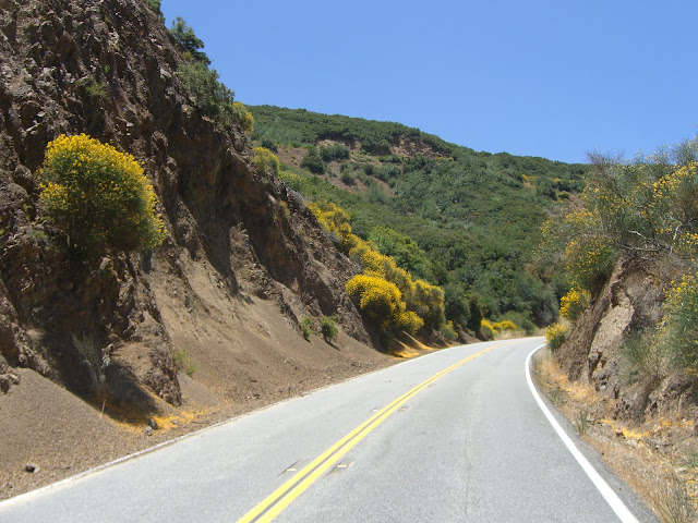
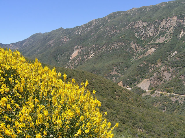
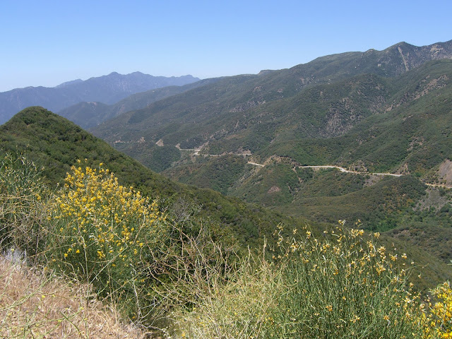
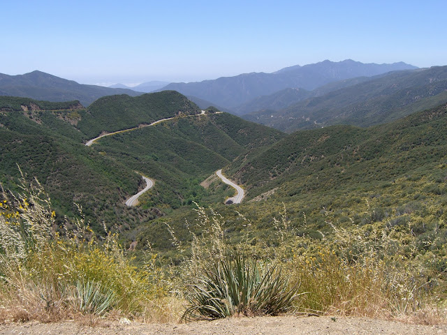
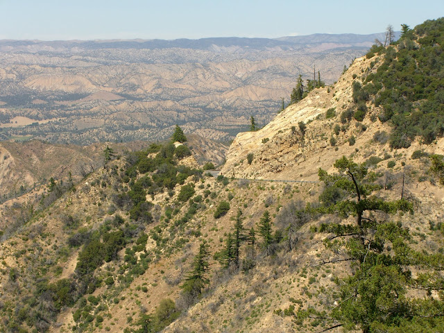
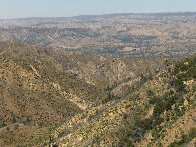
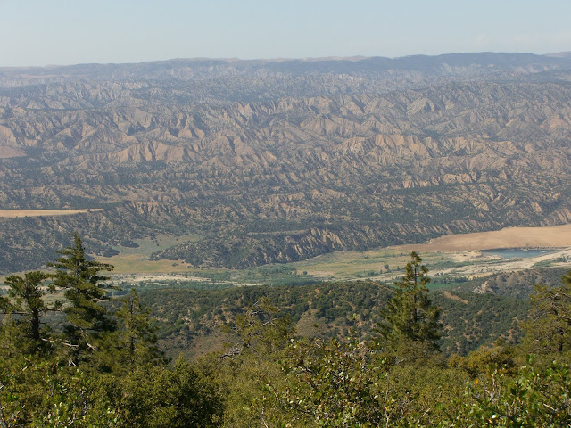
And the scenery really starts getting ridiculous:
You know you want to cycle up that. More..
Looking back on the road just climbed:
The road ahead:
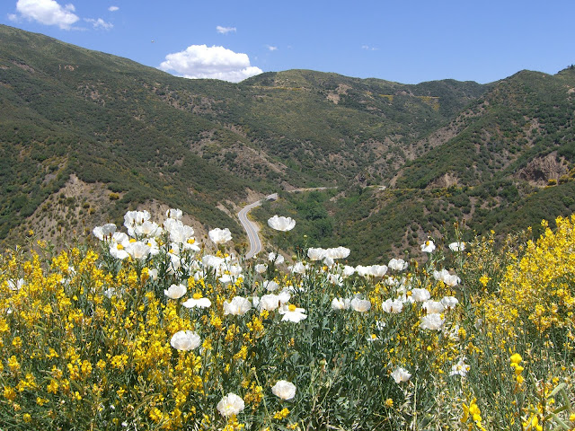
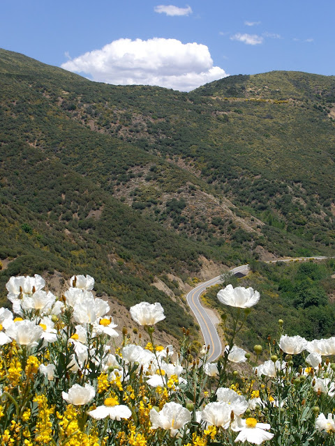
And, a couple more shots looking back with some wildflowers enhancing the view:
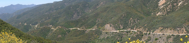
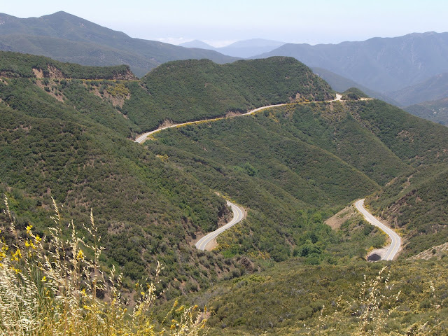
Insane. That is one epic viewpoint. And a look back at all the climbing along 33:
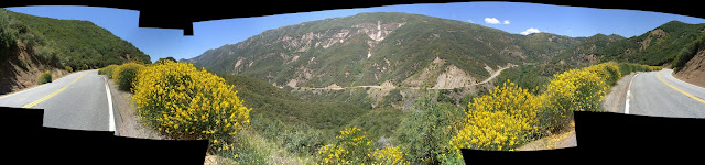
HQ Panorama:
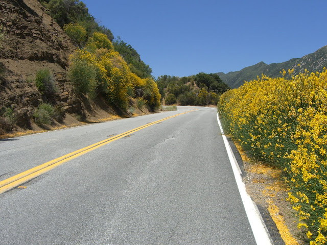
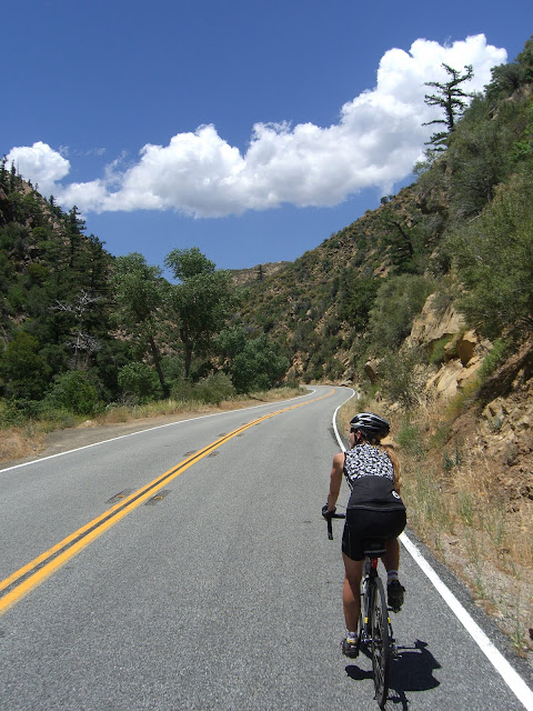
Continuing on:
Too much green and color?
Maybe.
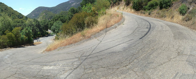
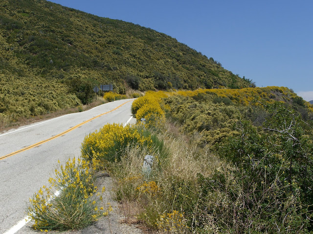
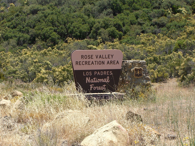
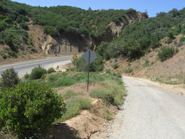
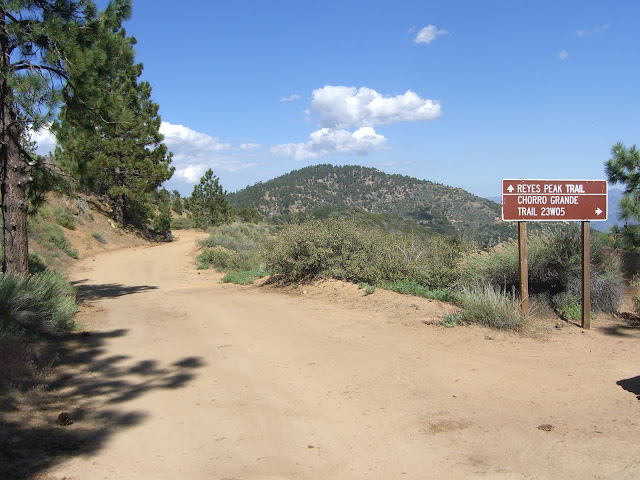
At just over 3400 ft in elevation, you will hit the turnoff for Rose Valley Recreation Area:
This is a brief respite after suffering through a tough 6-7% stretch a mile back. Rose Valley provides you with a very quick descent that is followed by a final, short climb to a summit at just over 3700 ft. This last summit attempt is, not surprisingly, quite beautiful:
Looking back from an excellent vantage point:
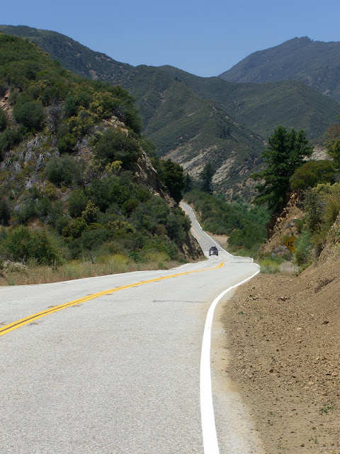
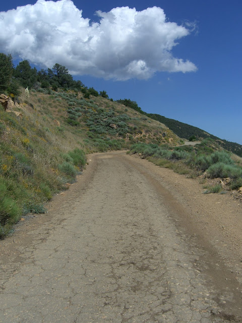
At this point, you have a choice. Since this is the top of the main climb, you can turn around here and enjoy the descent. With about 3,000 feet of climbing completed, this is a very solid ride. The other option, of course, is to continue riding! From Rose Valley to Pine Mountain Summit, you can expect gentle, rolling scenery that slowly climbs upward and finishes with a solid little climb to the summit.
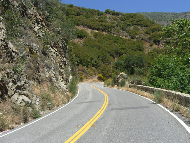
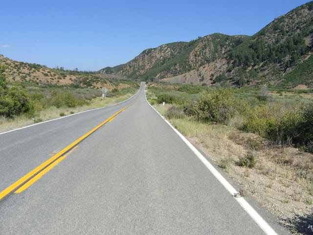
Anyway, if you choose to continue, you are greeted with a pleasant descent after the Rose Valley Summit:
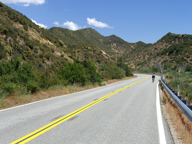
Wow. This, right here, is why I cycle. The scenery along 33 is insane:
Welcome to Sespe Creek and all of its beauty.
A very impressive canyon:
A sheer wall along the canyon:
This impressive wall appeared to be dotted with rock climbing instruments. I can definitely see why..it looked quite spectacular from below!
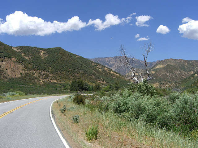
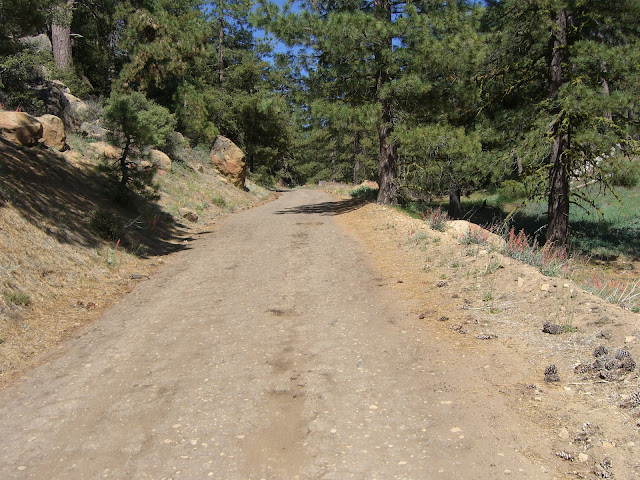
As you leave the canyon:
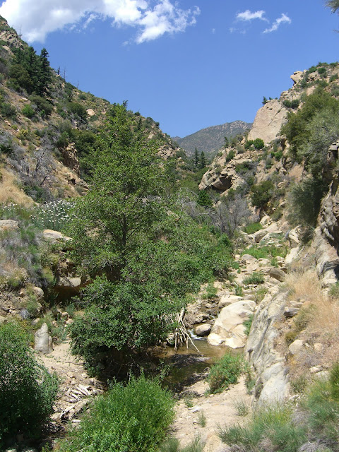
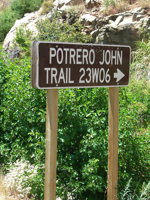
Nice creek and hiking area a bit later:
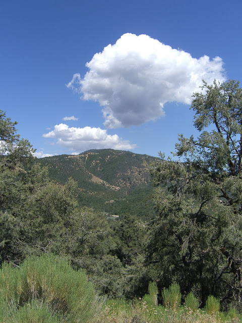
Lovely scenery:
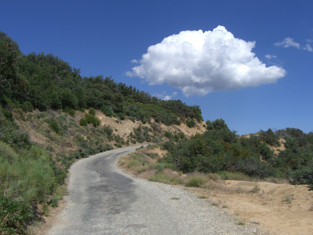
Lovely road:
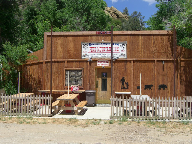
And here’s hoping Wolf’s Pine Mountain Inn reopens sometime in the near future:
It seems that the owner, Tom Wolf, has been trying to reopen the place since having a heart attack a few years ago. The Ventura County Star has a nice set of videos on the place and an article about his quest to reopen. Given that there are no services for basically the whole ride to Pine Mountain Summit, I do really hope the place reopens. That, and it seems like a cool place anyway.
Continuing on, the road starts climbing in earnest again:
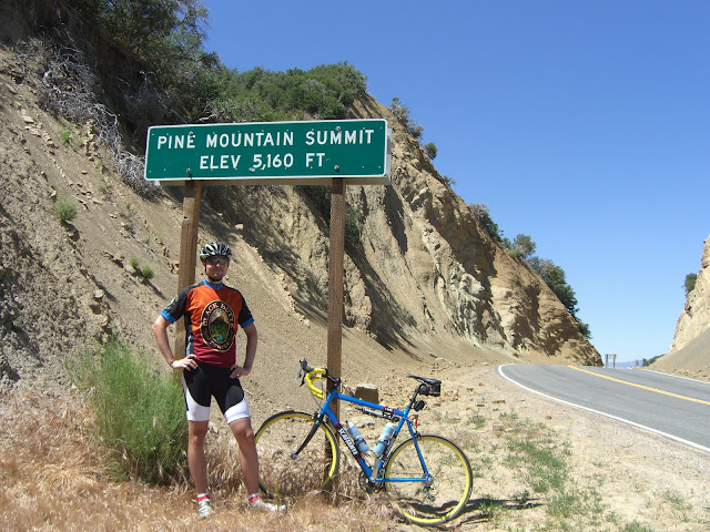
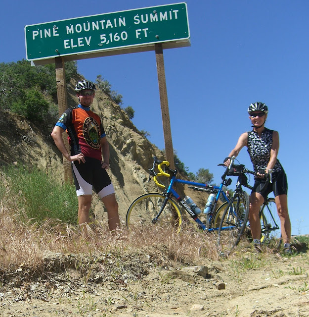
While this last climb only averages about 5%, you will still be climbing for about 3.5 miles and encounter a couple of smaller stretches in the 7% range. At 30 miles in and nearly 5000 feet of climbing, you will relish seeing the summit sign:
Success!
Some day, I would like to cycle the rest of 33. It looks awesome:
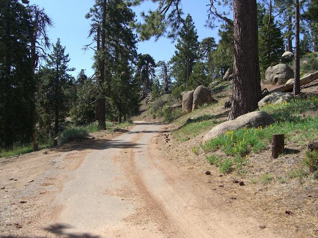
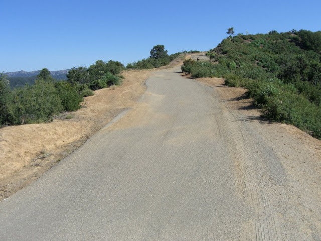
So, just to reiterate, Pine Mountain Summit is 30 miles in and just under 5000 feet of climbing. The round-trip to here equates to a 60 mile, 5000 foot elevation gain suffer-fest. Not too shabby. Not at all. Of course, you still have one way to further punish yourself. This punishment is known as Pine Mountain Ridge Road. This ridiculous road is technically paved. However, the last paving was done sometime in the far, far distant past. The road surface basically varies from rough tarmac to rougher tarmac to gravel to dirt. And those are the good sections. Bring a cross bike or some tough tires along.
The grade itself along Pine Mountain Ridge Road averages 6.4% for 6.1 miles. That doesn’t seem too bad. However, the first 1.2 miles or so are at 3% or less. Additionally, the grade until mile 2 is at or under 6%. This will lull you. The steeper section of the climb (3.7 miles) averages 7.8% and has the worst road quality with the steepest 1.75 miles at 9.1% (850 feet elevation gain in that distance!).
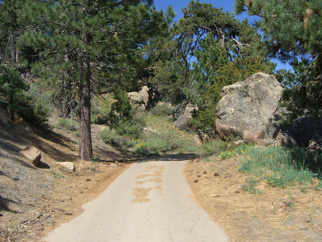
Anyway, the first stretch:
What I am climbing to:
The first stretch is both scenic and fun:
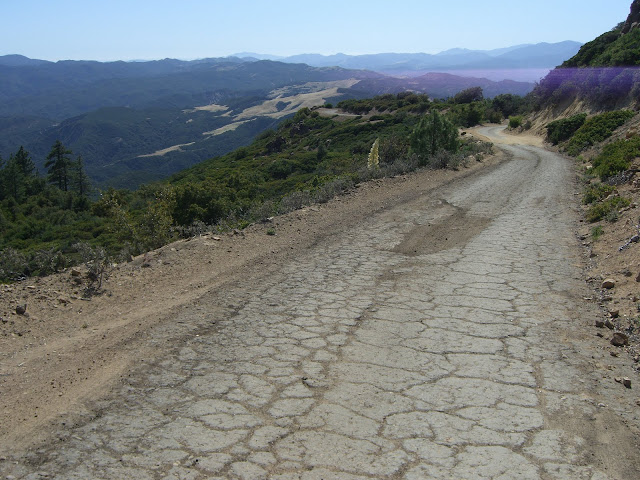
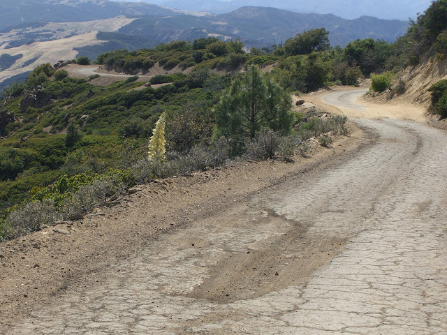
That decent road surface? Yeah, it doesn’t last:
But the views stay nice:
Getting up above 6400 feet (about 3/4 of the way up) and into the camping/hiking/rock climbing areas:
Also, a huge thank you to the great rock climber in the pickup truck who, on your way down the road, replenished my depleted water supplies. Yeah, I did kind of beg you for water..but you were awesome and took pity on me and refilled both of my bottles. Thank you.
And, finally, the top of the paved road at just below 7200 feet in elevation:
Looking back down the road:
And yes, the descent is brutal. The horrible and varying road surface means a very technical descent that is heavy on the brakes and scary at times. At least it is scenic:
After the technical descent along Pine Mountain Ridge Road, the rest of the ride back is quite pleasant. The first stretch is nice and scenic with no pedaling necessary. After dropping almost 1000 feet from Pine Mountain Summit, you will have to pedal on occasion as you roll through the rolling section once again. At least the views stay nice:
After that gorgeous, but long, rolling section, you have a quick climb back up to the Rose Valley Summit. Don’t worry..it is only a few hundred feet in elevation gain. And, once you hit that summit, you get a wonderful, long descent. While never incredibly fast, you do get to descend for basically 14 miles. Not bad!
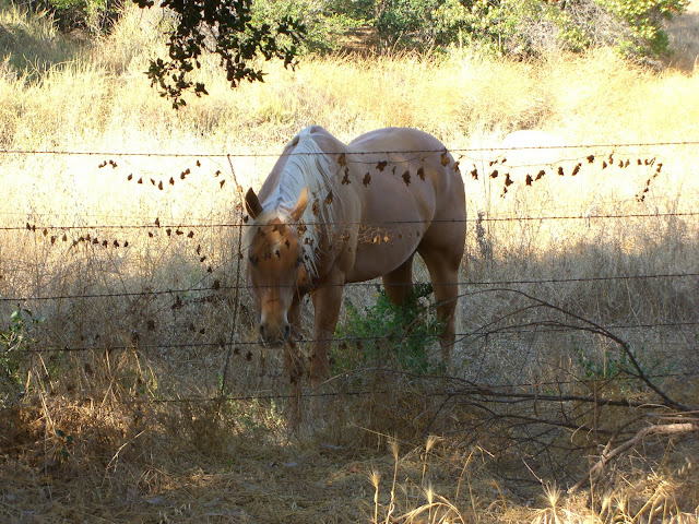
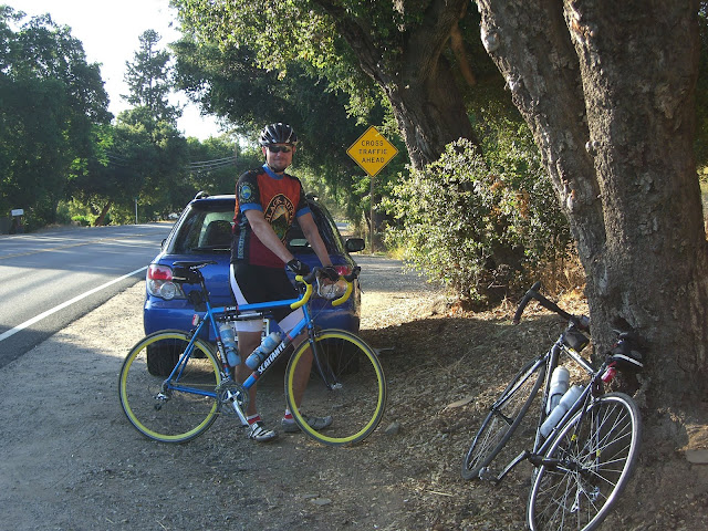
Finally, 72+ miles and 7000+ feet of climbing later, I am back to the car..with a few horses looking on:
Me, happy to have finished this epic ride:
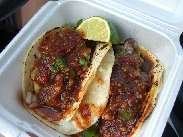
Most importantly, post-ride food:
Tasty and cheap tacos from Productos La Flor de Michoacan in Meiners Oaks (at El Roblar Dr and Amaz St). Those tacos hit the spot.
MapMyRide maps..
The full ride from Meiners Oaks to Pine Mountain proper (at 7k+ ft elevation):
To Pine Mountain Summit at 5160 ft:
The shorter climb to Rose Valley:
The Pine Mountain Ridge Road Section:
The GarminConnect page for the ride:
33 is an epic, beautiful climb. Get out there and ride it.


The Discussion
see what everyone is saying
Awesome route! How is the traffic along Hwy 33? I live in Santa Barbara and have always wanted to do this climb but have been discouraged by what I am guessing might be fairly heavy (and fast moving) traffic.
Hi Dan,
One quick caveat – I have only done 33 on weekends, so I don’t know how weekdays are. With that said, the traffic along 33 I found to be fine. Up to Rose Valley, there is a decent amount of traffic. However, despite a lack of shoulders in most places, the sight-lines are good in most places so drivers will see you well in advance. Additionally, traffic is still light enough that overtaking traffic will usually move well over into the other lane while passing you. Traffic along 33 beyond Rose Valley gets even lighter – it can be 5+ minutes between car sightings at times for that section. 33 is also a fairly popular motorcycling route, so you will occasionally encounter one of them pushing their speed, but they will also generally give you a lot of room. The only sketchy section would be the few tunnels you pass through. While short, drivers will be going in somewhat blind, so a rear light and picking up your pace would be recommended. Basically, coming from even more car-centric Los Angeles, I found 33 rather pleasant with respect to traffic.
I was thinking of just starting the climb at Rose Valley and then heading up from there to Pine Mountain Summit and then up Pine Mountain Ridge Road. Hopefully this will minimize the interaction with traffic. What do you think? Anyhow, I really enjoy your trip reports and if you ever need a climbing partner (albeit a slow one) in the Santa Barbara area, look me up…
While this is not a bad idea, I am also not sure exactly where you could safely park at the Rose Valley turnoff. However, if you could find a safe and secure parking spot, the ride from Rose Valley to Pine Mountain Summit would be a beautiful, low-traffic and rolling climb that I am sure you would enjoy. If not though, the traffic up to Rose Valley really is not that bad. Whatever you decide on, I hope you get the chance to ride these roads – they are awesome.
Also, if you make it all the way to Pine Mountain Ridge Road (and actually decide to climb it), make sure you have extra water and some tough tires (or a mountain/cross bike). I’ll let you know next time I am riding in the area.
Cheers,
Ryan
[…] will be a great route in hot weather where I can get used to both the heat and the altitude.Click here for a description and some lovely pictures of this great route. Thanks to the person who documents […]
Thank you for sharing this.
Great pics! Thanks for the write up!
Pine Mountain ridge road is now butttery smooth asphalt all the way to the reyes peak trail!
This is a topic which is close to my heart… Thank you! Where can I find the contact details for questions?
Not sure if you still monitor this page, but I just drove this road this weekend….basically all the way from Bakersfield, and it is now on my bucket list. The river valley itself is stunning before the big climbs start!
I am too fat right now, but I would still love to try it!
If I could find a way to portage myself, I could see riding from Maricopa (plenty of food and water) all the way into Ojai-or even down to Ventura (there is a full separated bicycle path from Ojai to the city). If I can find a way to get back….that would an amazing day!
It’s an amazing post in support of all the web visitors;
they will obtain benefit from it I am sure.
Thanks very much for this post, and the really fine, well-chosen photos. I did that ride in 1978, starting
in Ventura and finishing in Bakersfield, with a detour to New Cuyama in between. Good memories..
Bring plenty of water!