San Bernardino Mountains – Valley of the Falls – CA-38 (State Route 38) to Forest Falls Hill Climb
Posted: August 6, 2010 at 5:06 am | Tags: CA-38, Forest Falls, Mentone, Redlands, SR-38, Valley of the Falls Dr
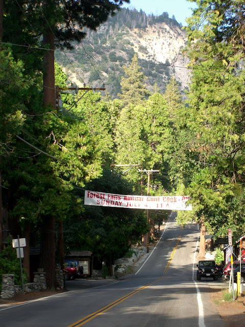
If you start in Mentone, those are the stats. That is definitely a solid climb. You can also cut off a few miles of somewhat boring climbing and start at the intersection of 38 (Mill Creek Rd) and Bryant. If you do this, you will miss almost 900 feet of shallow climbing. With that said, the climbing you will miss is nothing special. So, if you are going for overall climbing, start in Mentone. If you are going for scenic climbing, start at 38/Bryant. Additionally, if you start at 38/Bryant, your average grade will be 6.3% for over 10 miles. Not bad. The rest of this post assumes a starting point at 38/Bryant.
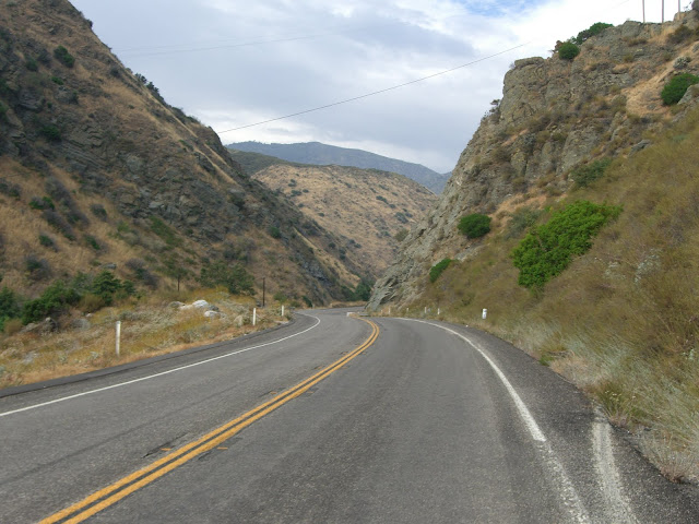
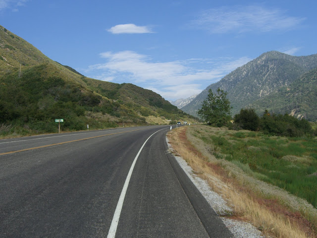
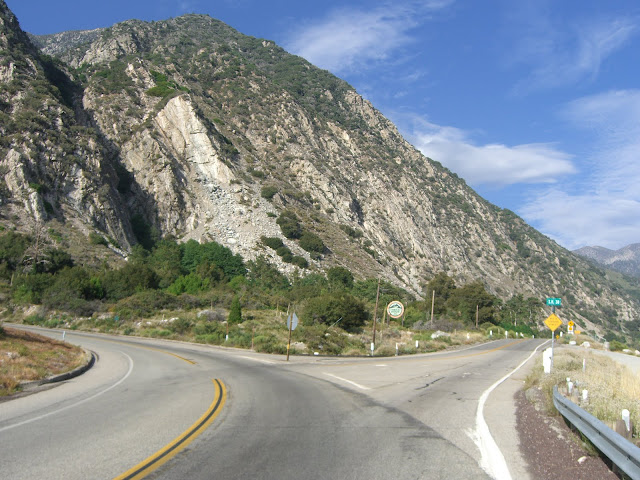
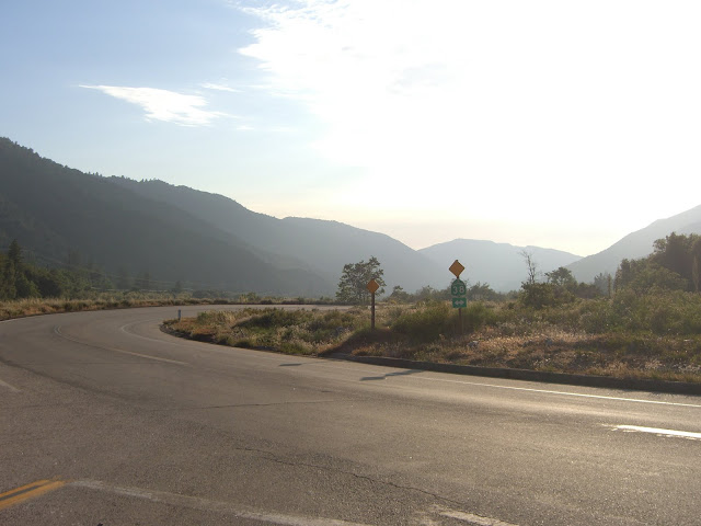
The initial section of 38 (above Bryant) has a minimal shoulder:
 |
| From 2010-07-11 – San Bernardino Mountains Cycling – 38 to Forest Falls |
Given the relatively steady traffic, this is the only somewhat unpleasant section. Luckily, the shoulders open up pretty quickly for the rest of the ride:
 |
| From 2010-07-11 – San Bernardino Mountains Cycling – 38 to Forest Falls |
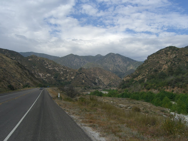
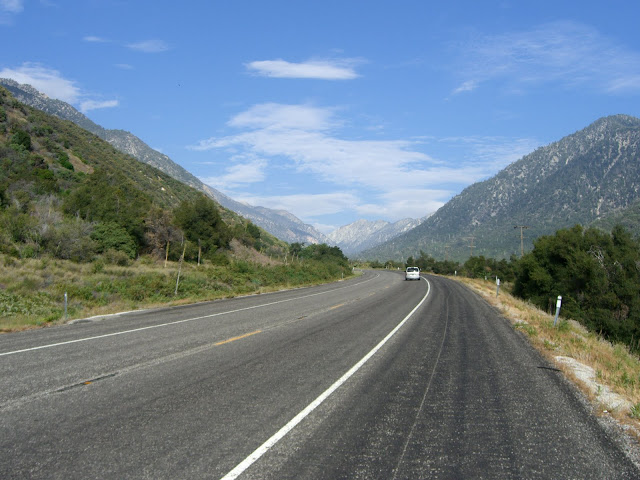
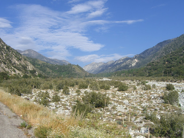
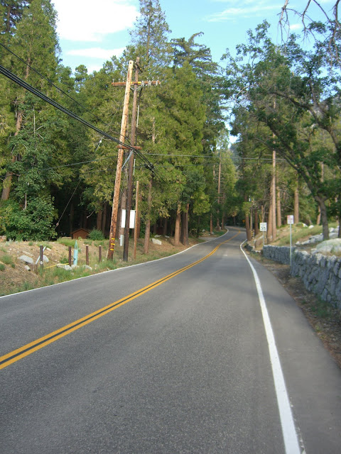
The rest of the ride along 38 is a very scenic ride up a valley with few curves:
 |
| From 2010-07-11 – San Bernardino Mountains Cycling – 38 to Forest Falls |
The traffic, while not heavy, is relatively constant and somewhat fast. The wide shoulder for most of 38, however, makes this section surprisingly pleasant.
 |
| From 2010-07-11 – San Bernardino Mountains Cycling – 38 to Forest Falls |
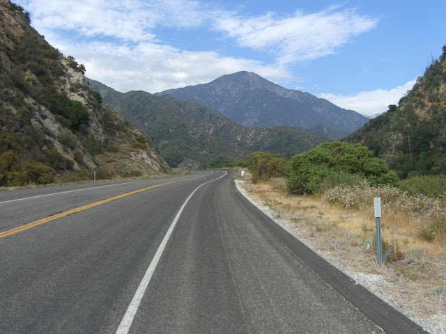
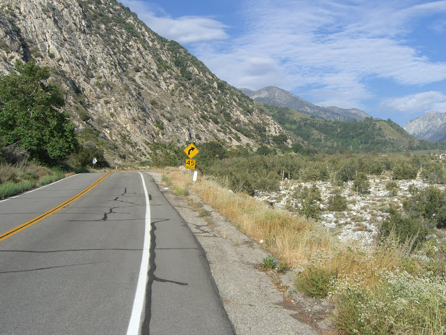
The grade is, for the most part, extremely steady and relatively shallow. While I love steep climbs, it is also nice to be able to shift up a few gears and power on at more than 6 mph at times! And, of course, some pleasant scenery doesn’t hurt.
 |
| From 2010-07-11 – San Bernardino Mountains Cycling – 38 to Forest Falls |
Awesome valley to be riding up!
 |
| From 2010-07-11 – San Bernardino Mountains Cycling – 38 to Forest Falls |
 |
| From 2010-07-11 – San Bernardino Mountains Cycling – 38 to Forest Falls |
4,000 feet in elevation!
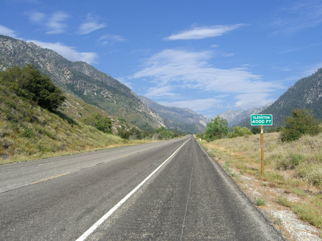 |
| From 2010-07-11 – San Bernardino Mountains Cycling – 38 to Forest Falls |
Beautiful.
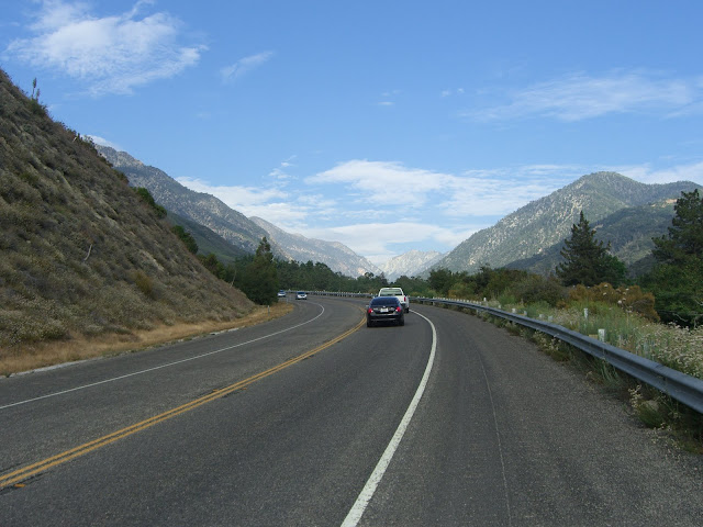
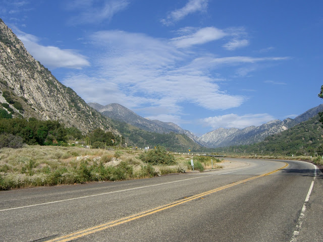
This last stretch along 38 includes a little bump up with regard to the grade…nothing steep, but just enough for you to notice after such a constant grade. Shortly, you come to the only big switchback along 38 that you will encounter:
 |
| From 2010-07-11 – San Bernardino Mountains Cycling – 38 to Forest Falls |
 |
| From 2010-07-11 – San Bernardino Mountains Cycling – 38 to Forest Falls |
 |
| From 2010-07-11 – San Bernardino Mountains Cycling – 38 to Forest Falls |
From this point:
 |
| From 2010-07-11 – San Bernardino Mountains Cycling – 38 to Forest Falls |
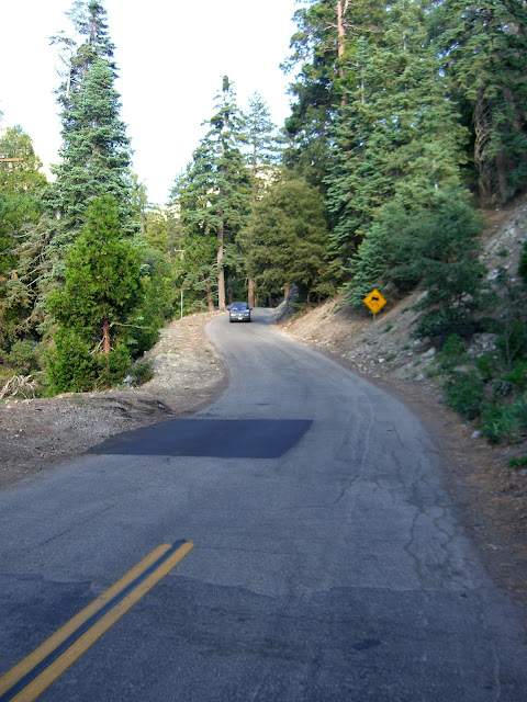
You can stay left to stay on 38 and climb to Angelus Oaks (a solid climb) and even climb all the way to Onyx Summit (8,443 ft elevation!). Or, you can turn right and climb up Valley of the Falls Dr to Forest Falls (as I did). The climb up Valley of the Falls Dr is significantly tougher than the last stretch along 38. Averaging over 6.8% for nearly 4.5 miles (and ~1600 ft of elevation gain), Valley of the Falls is a challenging climb. Thankfully, the climb starts out mellow after the turnoff from 38:
 |
| From 2010-07-11 – San Bernardino Mountains Cycling – 38 to Forest Falls |
 |
| From 2010-07-11 – San Bernardino Mountains Cycling – 38 to Forest Falls |
Of course, maybe that is not so fortunate since that means the rest of the climb has to be steeper..
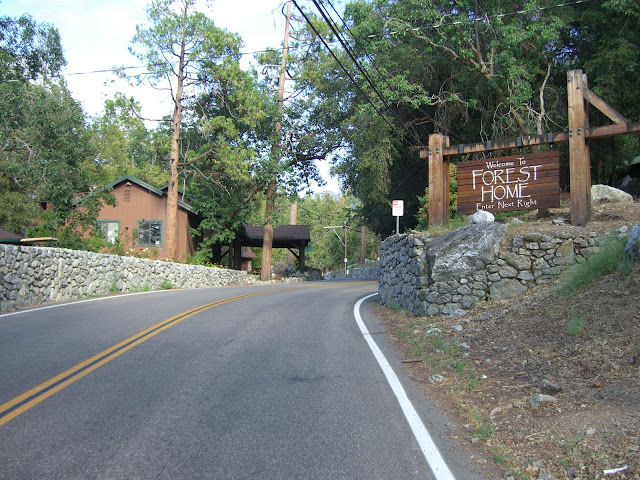
Pretty quickly, you hit the Welcome to Forest Falls sign:
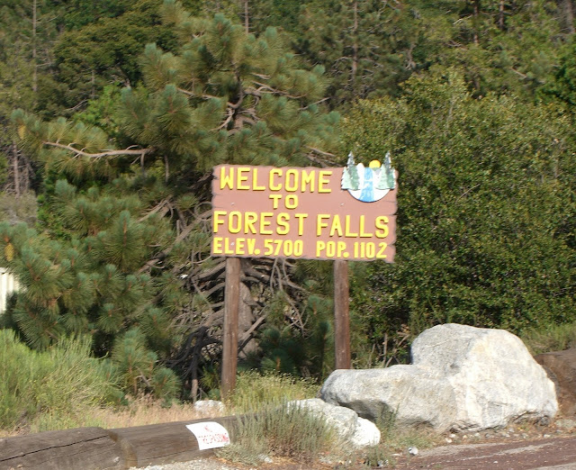 |
| From 2010-07-11 – San Bernardino Mountains Cycling – 38 to Forest Falls |
This is a bit deceptive, as you are far from hitting 5700 feet in elevation. Keep on climbing (now through steeper stuff), and you hit the Forest Home community:
 |
| From 2010-07-11 – San Bernardino Mountains Cycling – 38 to Forest Falls |
 |
| From 2010-07-11 – San Bernardino Mountains Cycling – 38 to Forest Falls |
Note that the trees provide much more shade along this stretch..and for most all of Valley of the Falls Dr. Pleasant on a hot day.
Continue climbing and you finally get to the outskirts of Forest Falls itself. The cute post office:
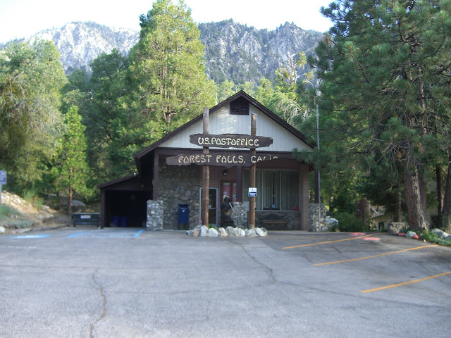 |
| From 2010-07-11 – San Bernardino Mountains Cycling – 38 to Forest Falls |
And Fire Station:
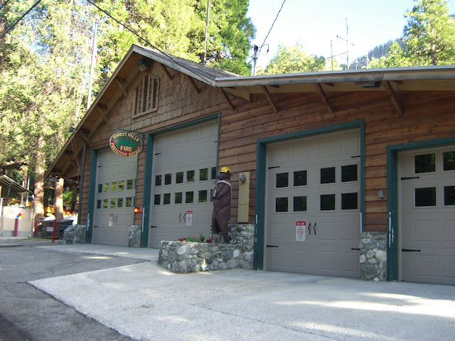 |
| From 2010-07-11 – San Bernardino Mountains Cycling – 38 to Forest Falls |
At this point, after having dealt with some steep sections, you finally get a well-earned descent into the heart of Forest Falls:
 |
| From 2010-07-11 – San Bernardino Mountains Cycling – 38 to Forest Falls |
Brief, but deserved! This heart of Forest Falls will be a welcome oasis to all hill climbing cyclists…there is both a Mexican restaurant and a general store here!
The Mexican restaurant (El Mexicano):
 |
| From 2010-07-11 – San Bernardino Mountains Cycling – 38 to Forest Falls |
The reviews on yelp are decent. The general store should also be able to provide you with nourishment:
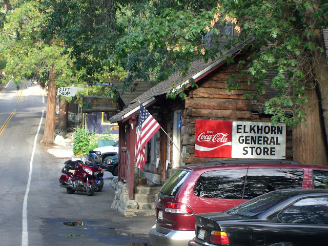 |
| From 2010-07-11 – San Bernardino Mountains Cycling – 38 to Forest Falls |
Continuing on from this point, the road soon turns to a one lane road:
 |
| From 2010-07-11 – San Bernardino Mountains Cycling – 38 to Forest Falls |
And climbs into the Falls Recreation Area:
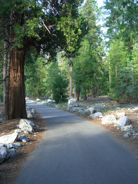 |
| From 2010-07-11 – San Bernardino Mountains Cycling – 38 to Forest Falls |
This area was quite popular:
 |
| From 2010-07-11 – San Bernardino Mountains Cycling – 38 to Forest Falls |
There are also some larger falls upstream a bit if you hike to them (search for Big Falls).
Anyway, the cycling up this last section puts 38 to shame. Some of the ramps along here will definitely get your attention. The middle 2.3 miles of this climb average over 7.4%…definitely not too shabby. And, considering that this grade is not consistent and that there are some steeper sections thrown in, you will work a bit. With all that said, this climb also isn’t ridiculously tough, so hopefully you can enjoy the challenge and the scenery at the same time.
The descent down is pretty nice as well. Initially, you will have have to watch your speed, as there are a lot of side streets. However, about 1.5 miles down, you get to really let it fly – 35-45 mph should be easily doable. Of course, you will all too quickly hit 38 and slow down a bit.
 |
| From 2010-07-11 – San Bernardino Mountains Cycling – 38 to Forest Falls |
Pedal a bit, though, and you can still maintain 30+ for the rest of the descent (and 35+ for much of it). This is definitely a pedal-assisted descent if you want to keep your speeds up.
And, the whole route from the intersection of 38 and Bryant (remember, you can also start 900 feet lower in Mentone if you want some more climbing):
And, just the Valley of the Falls Dr section:
Click View Elevation for the above section. Definitely not a bad climb.
My GarminConnect page for the ride:
Anyway, this is a great climb to tackle if you are near the Redlands area. The section along 38 is consistent and mellow and offers a nice warm-up before tackling the steeper, tougher, but not overly ridiculous climb up to Forest Falls. One solid climb.
The Discussion
see what everyone is saying
Hey Ryan I skated Forest Falls yesterday. It was a lot of fun. I parked up top. Skated down to where it connects with thne 38.Hitchhiked up to the first restaurant skated down, then hitchhiked to the top of Forest falls. Two good skates. I have skated the 38 from Big Bear but it was a lot more fun the second time.
Hey Ian,
Sorry for the extremely late reply. Congrats on skating down Forest Falls! That is not the easiest descent, so well done. I still need to descend one of these roads with you. Keep it up and enjoy the sweet descents.
I really love this road. Going down the 330 and this in a single day was nirvana on a board. I should of contacted you while the 330 was still closed that would of been fun.
Anyhow yeah after the first big left 35 to 45 the rest of the way down. My friend Tim was hitting 50+ easy. Pefect pavement, nice locals, and decent food!
Shoot me a email we’ll ride soon!
Nice day of descending. Man, I haven’t done the mountain roads around LA for a while. Lots of out of town trips (some great climbs in Owens Valley/Sequoia/Tahoe), but it will be fun to get back to the classic climbs and descents around here.
I just got back from Seqoia as well The General is so amazing! What unbelievable road that is. The ascent from Hospital rock to lodgepole must be somehing else. The downill is so challenging. The pavement, well at least after the first 180 is smooth through the turns is smooth. I really wanna check out Owens, as well as Onion Valley and other roads in that area. fun Fun. Lets descend 39 soon!