San Francisco Bay Area Cycling – Santa Cruz Mountains – Hicks Road North/Mt. Umunhum Climbing
Posted: July 28, 2010 at 12:27 am | Tags: Hicks Road, Mount Umunhum, Mt. Umunhum Road, San Francisco, Santa Cruz Mountains4.1 miles. 2,199 ft elevation gain. 10.2% average grade. 17% max grade.
Let that sink in for a minute. Over 4 miles of climbing at over 10%. If that doesn’t scare you just a little bit, I don’t know what will.
Anyway, this is, not surprisingly, another climb listed in Summerson’s The Complete Guide to Climbing (By Bike) in California. In this book, Hicks Road North/Mt Umunhum gets a few noteworthy mentions..
For all of California:
For the San Francisco Bay Area:
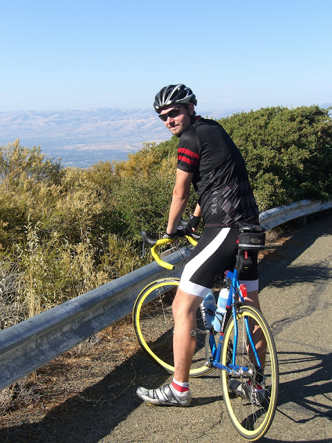
With this many mentions..and an entire mile at 13.9% (!), I had to try this out. Somehow, I actually also convinced my mom to attempt it as well. She is an avid cyclist, but stats like these give her pause. Anyway, despite the ridiculousness of the grade, she was game (after thinking it over for a few minutes). Sweet.
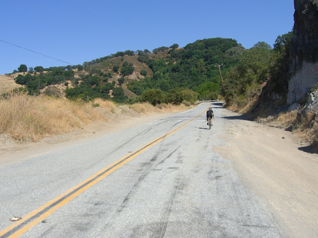
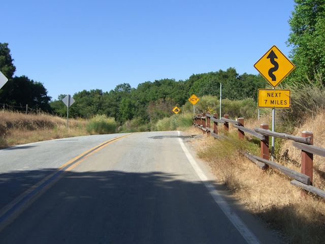
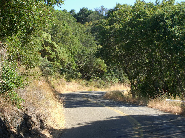
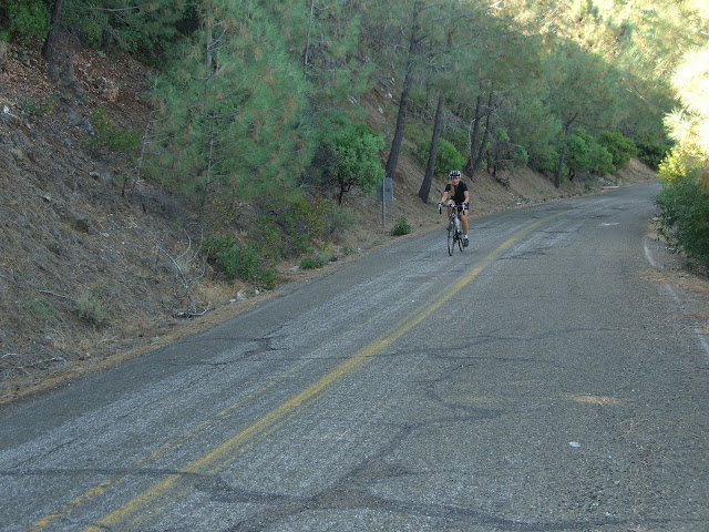
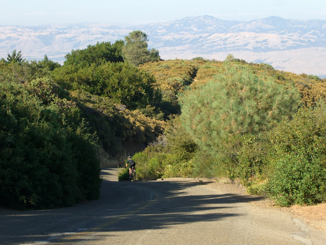
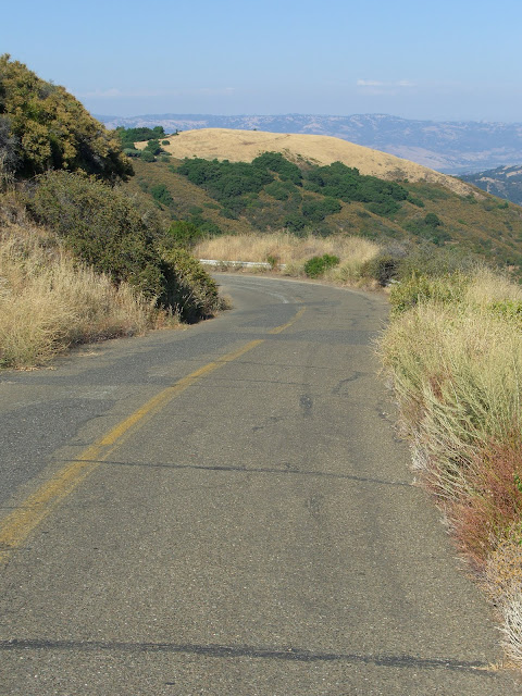
The first part of Hicks Road consists of rolling bumps that gradually bring you upwards (<400 feet gain in 5 miles). This stretch is semi-scenic:
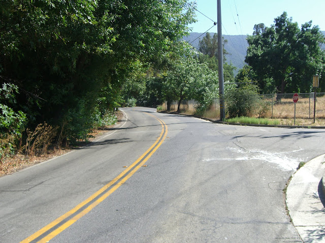 |
| From 2010-07-25 – San Francisco Bay Area Cycling – Hicks Rd & Mt. Umunhum Climb |
 |
| From 2010-07-25 – San Francisco Bay Area Cycling – Hicks Rd & Mt. Umunhum Climb |
 |
| From 2010-07-25 – San Francisco Bay Area Cycling – Hicks Rd & Mt. Umunhum Climb |
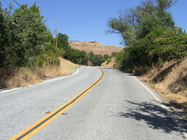
There is a bit of car traffic along here though, so watch your line. The only real climbing in this first stretch is a short, but steep, bump up to Guadalupe Reservoir:
 |
| From 2010-07-25 – San Francisco Bay Area Cycling – Hicks Rd & Mt. Umunhum Climb |
 |
| From 2010-07-25 – San Francisco Bay Area Cycling – Hicks Rd & Mt. Umunhum Climb |
 |
| From 2010-07-25 – San Francisco Bay Area Cycling – Hicks Rd & Mt. Umunhum Climb |
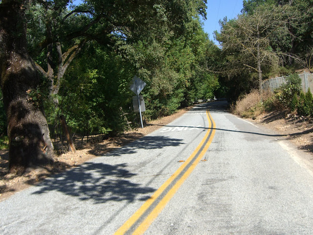
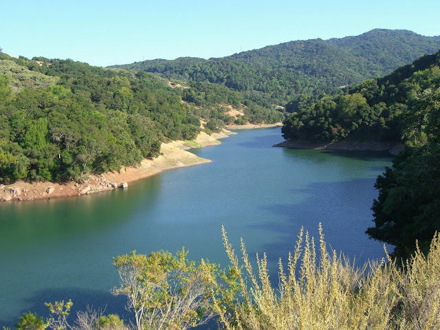
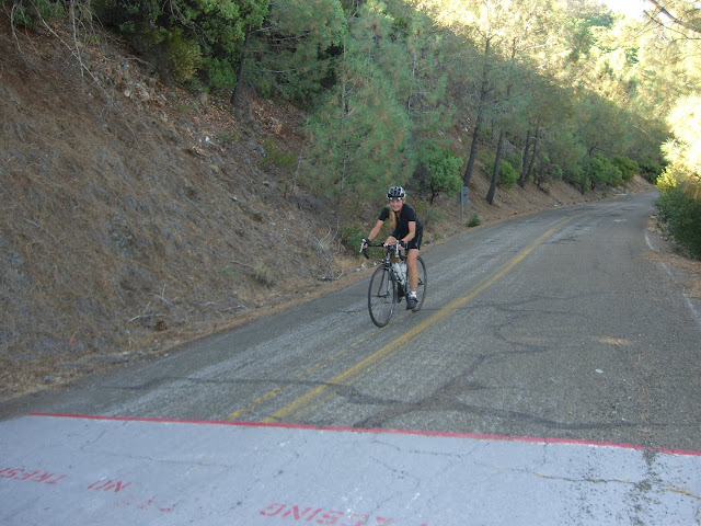
Enjoy the respite along the reservoir. It will not last. After you round a sharp bend (and cross a second small creek crossing), you are suddenly faced with a wall of pain..
 |
| From 2010-07-25 – San Francisco Bay Area Cycling – Hicks Rd & Mt. Umunhum Climb |
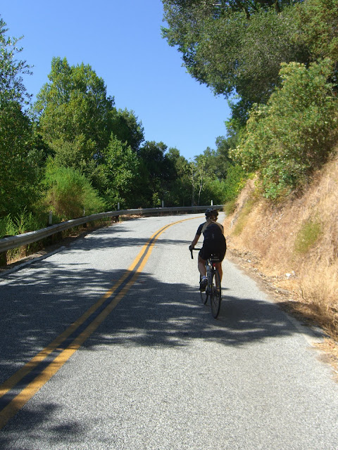
Sadly, I was not able to capture the full extent of the misery/steepness of this portion. There are no real switchbacks that easily show the grade. So, keeping in mind the 14% nature of this part of the climb, here is my mom powering on up:
 |
| From 2010-07-25 – San Francisco Bay Area Cycling – Hicks Rd & Mt. Umunhum Climb |
And looking up from that point:
 |
| From 2010-07-25 – San Francisco Bay Area Cycling – Hicks Rd & Mt. Umunhum Climb |
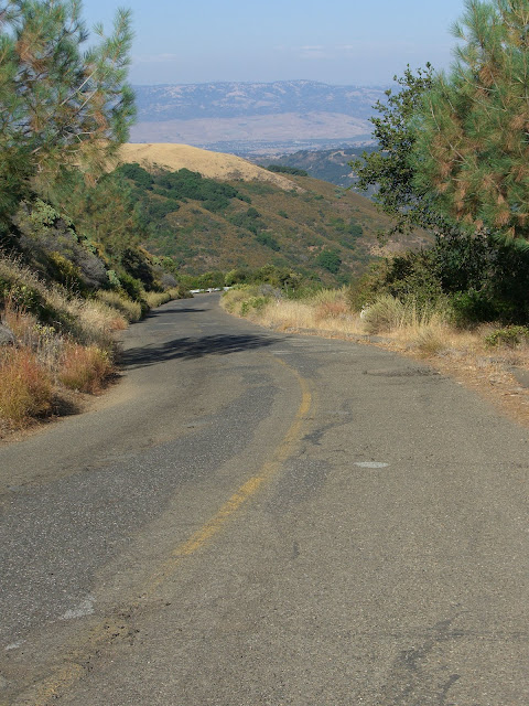
Looking back from the top of Hicks:
 |
| From 2010-07-25 – San Francisco Bay Area Cycling – Hicks Rd & Mt. Umunhum Climb |
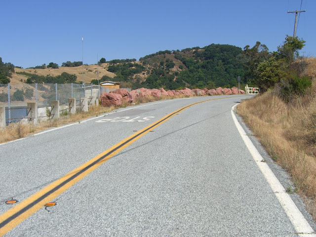
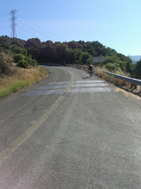
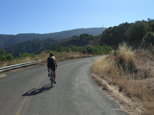
The last section of Hicks is quite mellow compared to the first climbing section. It is still in the 8-10% range, but is a welcome break from 14%. Of course, despite this easier section, the Hicks Road North section still averages about 12.4% for the entire climbing section. So yes, 13.9% for an entire mile and 12.4% overall. Of course, why not make it harder by including Mt. Umunhum? This is just another 2.9 miles at 9.5% (and 1,450 ft ascent). Easy, right?
If you are up for that, turn right on Mt. Umunhum Road to complete the rest of the climb:
 |
| From 2010-07-25 – San Francisco Bay Area Cycling – Hicks Rd & Mt. Umunhum Climb |
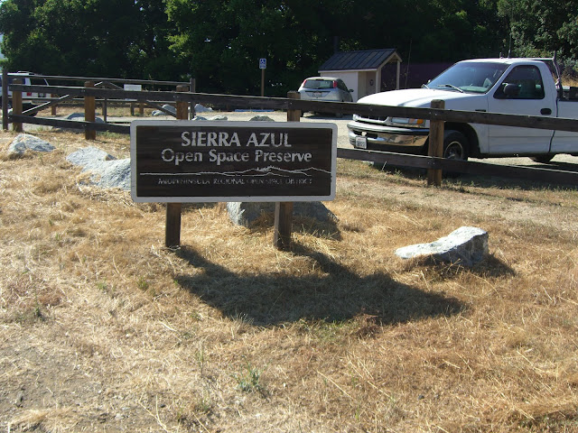
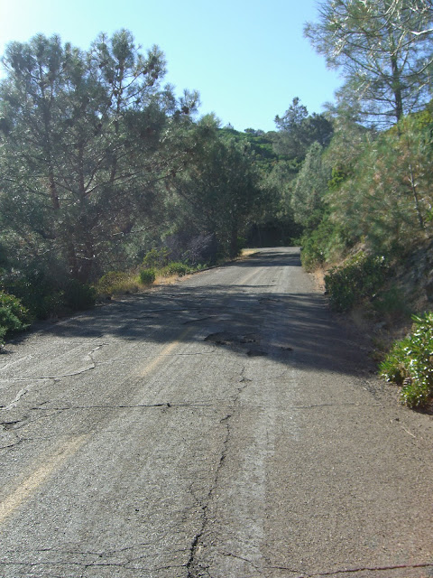
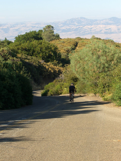
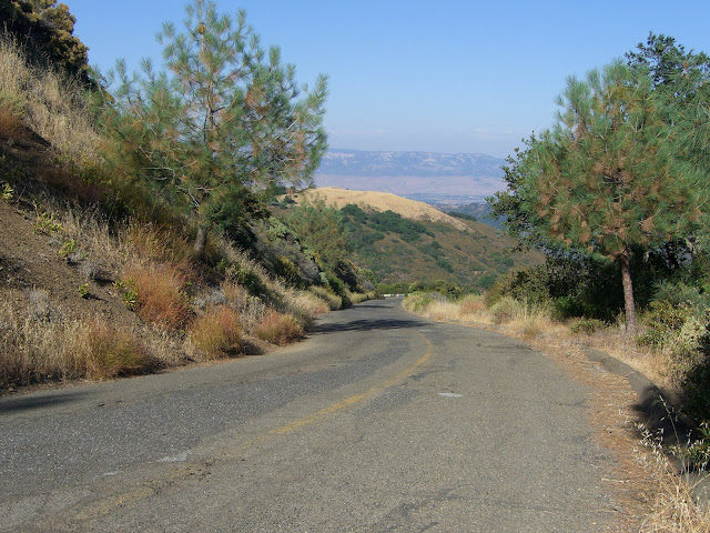
Along here you will be riding through the Sierra Azul Open Space Preserve:
 |
| From 2010-07-25 – San Francisco Bay Area Cycling – Hicks Rd & Mt. Umunhum Climb |
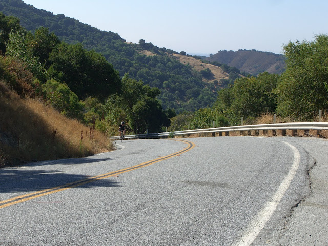
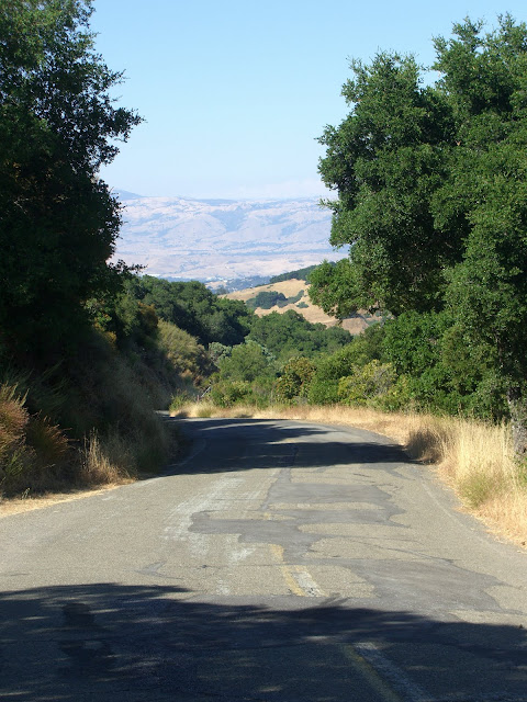
The climbing is initially mellow, but gets tough (once again!) pretty quickly:
 |
| From 2010-07-25 – San Francisco Bay Area Cycling – Hicks Rd & Mt. Umunhum Climb |
Occasional shade along this steep route:
 |
| From 2010-07-25 – San Francisco Bay Area Cycling – Hicks Rd & Mt. Umunhum Climb |
Partway up Mt. Umunhum Road, the road is closed to car traffic (aside from government and resident traffic):
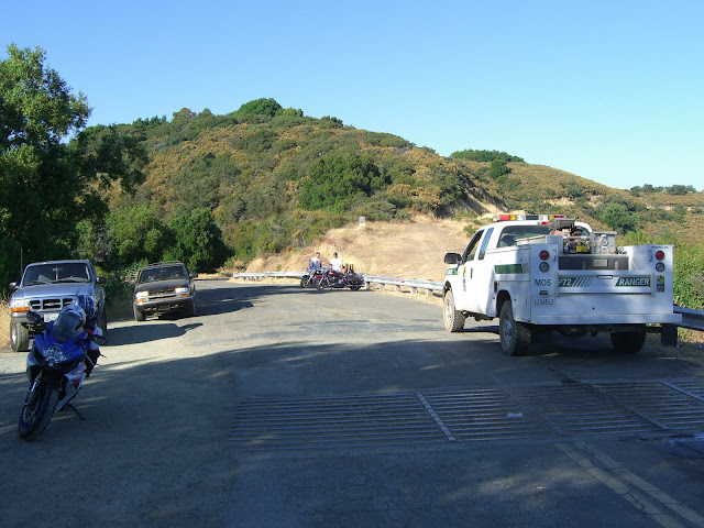 |
| From 2010-07-25 – San Francisco Bay Area Cycling – Hicks Rd & Mt. Umunhum Climb |
The gate at this point means that, basically, you have the road to yourself for the next 1.2 miles.
Climbing higher and higher:
 |
| From 2010-07-25 – San Francisco Bay Area Cycling – Hicks Rd & Mt. Umunhum Climb |
Almost there!
 |
| From 2010-07-25 – San Francisco Bay Area Cycling – Hicks Rd & Mt. Umunhum Climb |
So close..
 |
| From 2010-07-25 – San Francisco Bay Area Cycling – Hicks Rd & Mt. Umunhum Climb |
Success!
 |
| From 2010-07-25 – San Francisco Bay Area Cycling – Hicks Rd & Mt. Umunhum Climb |
 |
| From 2010-07-25 – San Francisco Bay Area Cycling – Hicks Rd & Mt. Umunhum Climb |
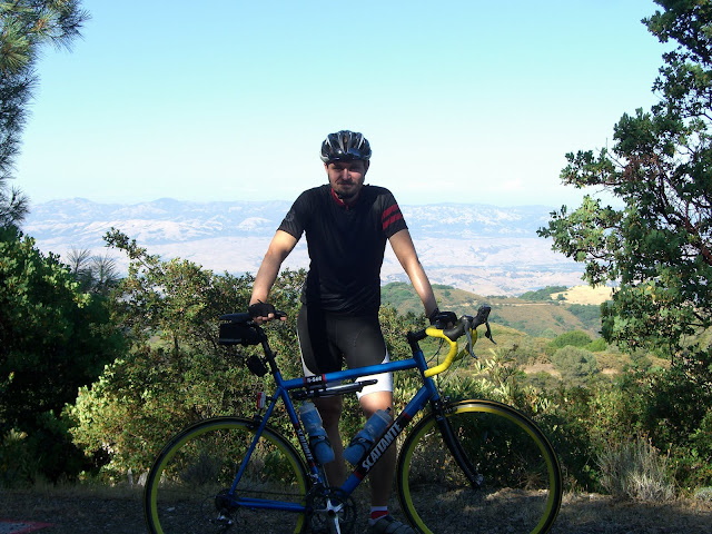
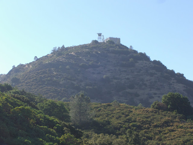
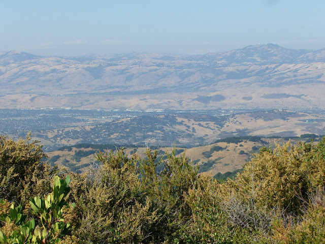
Elevation at the No Trespassing line (beyond here, there are private property issues): 2,846 feet. How I wish I could continue on up.. maybe in 2013 when they finish cleaning up the asbestos and lead that will be a possibility. Until then, this is still an epic climb (I’d say epic is fair wording for 4 miles at over 10%). And, despite not getting to summit Mount Umunhum itself, you do get some rather close views of the infamous summit:
 |
| From 2010-07-25 – San Francisco Bay Area Cycling – Hicks Rd & Mt. Umunhum Climb |
Mt. Umunhum is easily recognized by its five-story box-shaped radar tower (the building seen in the above photo). This tower operated as an early-warning radar station until 1980. While no longer in operation, it is still a landmark in the Bay Area (even 30 years later!). So yeah, while ascending or descending, stop a second and enjoy the view of Umunhum and appreciate the history of this mountain.
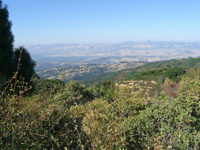
And, appreciate the fact that you will now be descending while taking in epic views:
 |
| From 2010-07-25 – San Francisco Bay Area Cycling – Hicks Rd & Mt. Umunhum Climb |
That would be me appreciating said fact.
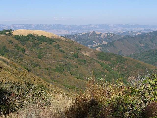
More of those views:
 |
| From 2010-07-25 – San Francisco Bay Area Cycling – Hicks Rd & Mt. Umunhum Climb |
 |
| From 2010-07-25 – San Francisco Bay Area Cycling – Hicks Rd & Mt. Umunhum Climb |
Steep, but beautiful, descending:
 |
| From 2010-07-25 – San Francisco Bay Area Cycling – Hicks Rd & Mt. Umunhum Climb |
 |
| From 2010-07-25 – San Francisco Bay Area Cycling – Hicks Rd & Mt. Umunhum Climb |
And some more descending..
 |
| From 2010-07-25 – San Francisco Bay Area Cycling – Hicks Rd & Mt. Umunhum Climb |
 |
| From 2010-07-25 – San Francisco Bay Area Cycling – Hicks Rd & Mt. Umunhum Climb |
Nice. Those two pictures should be all that is necessary to convince you to try this ride. But, if not, some more scenery..
 |
| From 2010-07-25 – San Francisco Bay Area Cycling – Hicks Rd & Mt. Umunhum Climb |
 |
| From 2010-07-25 – San Francisco Bay Area Cycling – Hicks Rd & Mt. Umunhum Climb |
And one more descending picture:
 |
| From 2010-07-25 – San Francisco Bay Area Cycling – Hicks Rd & Mt. Umunhum Climb |
So yeah…not a bad ride. Extremely demanding and very scenic. This is a must-do for anyone looking for either tough climbs (and this is a tough climb) or scenic climbs (the views along Mt Umunhum Rd are very scenic).
MapMyRide map of the whole climb (including the 5 mile warm-up):
MapMyRide map of the Hicks Road North Climb (click the elevation profile for this climb!):
And the MapMyRide map of the Mt. Umunhum Road Section (also an impressive elevation profile):
Garmin Connect data:
If you are wondering..yes, I did forget to turn the Garmin back on for the descent (of all the times to forget..oh well..).
So, in conclusion, this is an excellent climb. Tough (very tough), scenic and fun. Give it a try.
The Discussion
see what everyone is saying
How does this climb compare with Sierra Road or the back side of Mt. Hamilton?
While I have never climbed Mt Hamilton East or Sierra (they are on my list for some future visit), based on stats, this climb is likely tougher than either of those. Hamilton climbs 1992 ft, but at only 5.5%. Hicks/Umunhum gains even more elevation (2199 ft) at almost double the grade (10.2%). Needless to say, there is no contest there. Sierra, however, is closer. At 9.8% for 1816 ft of elevation gain, the stats are more comparable. Based on stats alone, Hicks/Umunhum is probably still tougher (steeper, more elevation gain…plus that mile stretch at a ridiculous 13.9%). Sierra, though, sounds like a pretty solid climb. I’ll report back when I do climb it (but still, I doubt that it will prove to be as tough or tougher than Hicks/Umunhum).
It sounds like you have climbed Hamilton and Sierra – when you get a chance to conquer Hicks/Umunhum, I’d love to hear what you thought of it in relation to Hamilton and Sierra!
-Ryan
Stopping at the White Line of Death is for wimps! Risk a ticket, continue to the crest, and it is 5 miles, 10% grade, the third steepest 5 miles in America, and this side of Mount Washington.
http://connect.garmin.com/activity/32761653
I was tempted…however, I had heard too many stories of residents threatening those continuing on and park rangers writing tickets that I actually decided to play it safe this once. On this topic, it does sound like the state is looking to clean up the site and fully open it up for public use in the next couple of years.
[…] I took off for Hicks Rd. on a very, very cold morning. I don’t care what some of the East Coast folks have to say about California weather – 30 degrees is still 30 degrees. If I felt strong at the top, I was going to go all the way up to Mt. Umunhum, which is 3000+ ft up. I can go into details of this extremely tough climb, but toughascent.com does a fantastic report of it HERE. […]
[…] I took off for Hicks Rd. on a very, very cold morning. I don’t care what some of the East Coast folks have to say about California weather – 30 degrees is still 30 degrees. If I felt strong at the top, I was going to go all the way up to Mt. Umunhum, which is 3000+ ft up. I can go into details of this extremely tough climb, but toughascent.com does a fantastic report of it HERE. […]
me and a couple friends hiked up this from the start of quicksilver in almaden (so about 26 miles in all). took all day. we wanted to get to the summit and passed the no trespassing signs but some dude who owned private property shut our efforts down while we were almost at the top. bummer.
Umunhum has quite a history and reputation..the property owners up there really seem to dislike those who want to summit. The road itself has a No Trespassing line that is apparently followed up by security cameras and a motion sensor that activates warning lights. Possibly slightly ridiculous.
26 miles hiking only to get shut down at the very top? Ouch.
Hey Ryan,
I cross linked your site because you do a good account of this climb. I live out here in Almaden, and although I’m mostly a Cyclocross/MTB rider, I’ll do this climb every once in awhile just to check myself. I did it the other day with my compact crankset.
Here’s my cross post: http://www.dionridesbikes.com/2011/09/road-riding-is-hard.html
Even though I have a “bail out” cog in the back (34T), the 1:1 gearing was very tough compared to the triple crankset I had on my bike before.
Folks, I’ve done Hamilton, Sierra, Jamison Creek, etc. and Hicks to Umunhum is by far the hardest climb around.
Good write up on this! Advice to all – go out and do this climb… it’s a test of will.
Thank for such a great post. After reading your post, I went to Hicks Rd today. But unfortunately I did not find this climb as difficult as I expected. The grade is definitely impressive but overall not as difficult as I thought. For me the most difficult ride is still the skyline via pagemill (especially the gate 3 to gate 4 segment).
My wife and I just rode up Hicks Rd yesterday. But that was only half the climbing… We continued up on Woods trail to the top of Kennedy trail and down we went. It was a beautiful tough ride!
On Strava:
http://www.strava.com/activities/123470406
On Garmin Connect:
http://connect.garmin.com/activity/466733909
On Kinomap (Video + GPS tracks):
http://www.kinomap.com/watch/sj9c4v
http://www.kinomap.com/watch/eqgkw5
http://www.kinomap.com/watch/46vuhd
http://www.kinomap.com/watch/k7vp7a
http://www.kinomap.com/watch/a98sd6
http://www.kinomap.com/watch/ch688n
Enjoy!
Having traveled to the Bay Area for a few days, I gave this climb a try yesterday morning. Starting near Camden Ave., Hicks Rd was very scenic (with the Guadalupe River flowing near full strength due to the recent rainfall), and that one-mile section was quite steep (it was for the better that I forgot how steep this section is before I did it). Mt. Umunhum Rd did not seem so bad after Hicks Rd for some crazy reason.
Unfortunately, I had to turn around at the first gate (near the parking lot about 1.7 miles up the road). The final 1.2 miles to the red line are closed to the public until (allegedly) the end of Summer 2017. Supposedly, this clean-up effort will finally lead to opening Mt. Umunhum Rd to its summit. If that’s indeed the case (after all of these years), I’ll have to come back out this direction to complete the climb, as it would give the hill climbing lovers out there another tall peak to climb in the Bay Area!
Hello, it’s Philip Flowers here!
I work as a professional an essay writer and have created this content with the intent of changing your life for the better. I started honing my writing talent in high school. I learned that my fellow students needed writing help—and they were willing to pay for it. The money was enough to help pay my tuition for my remaining semesters of college.
Ever since school, I have continued to work as an academic writer. I was hired by a writing service based in the United Kingdom. Since then, the essays that I have created have been sold around Europe and the United States.
In my line of work, I have become familiar with hearing, “Philip Flowers, can you help me meet my writing assignment deadline?” I know that I can save their time.
Professional Writer – Philip – http://www.cleanurbanenergy.comCorp
Hello everyone, it’s Camden Patton here!
I work as a professional an essay writer and have created this content with the intent of changing your life for the better. I started honing my writing skills in high school. I learned that my fellow students needed writing help—and they were willing to pay for it. The money was enough to help pay my tuition for my first semester of college.
Ever since college, I have continued to work as a professional writer. I was hired by a writing service based in the United Kingdom. Since then, the research papers that I have written have been sold around Europe and the United States.
In my line of work, I have become accustomed to hearing, “Camden, can you help me meet my writing assignment deadline?” I know that I can provide this service.
Academic Writer – Camden Patton – http://www.endsmoking.org Corps
Hello guys, my name is Camden Patton!
I`m an academic writer and I`m going to change your lifes on?e and for all
Writing has been my passion since early childhood and now I can`t imagine my life without it.
Most of my works were sold throughout Canada, USA, China and even Russia. Also I`m working with services that help people to save their time.
People ask me “Sir, Camden Patton, I need your professional help” and I always accept the request, `cause I know, that only I can solve all their problems!
Professional Academic Writer – Camden Patton – http://www.endsmoking.org Confederation
Hi Everybody
Thanks for checking out my about page. My name is Nannie Morris.
I have worked a long time in this niche. My interest in writing started at a young age. I wrote poetry as a child and eventually went on to work with my school newspaper.
This early tryst into news reporting eventually led me to academic writing. There is plenty of work for skilled writers. I specialize in dissertations , but have the skills to do all types of academic writing.
Reach out for more information about rates and a price quote. I’m looking forward to helping you.
Academic Writer – Nannie – stpaulsafterschool.org Band
Welcome to my blog ,
I’m Reema.
If you’ve ever been overscheduled and couldn’t finish a academic paper, then you’ve come to the right place. I assist students in all areas of the writing technique. I can also write the paper from start to finish.
My career as a professional writer started during high school. After learning that I was very capable in the field of academic writing, I decided to take it up as a profession.
Talented Academic Writer- Reema Bright- http://www.daily-pakistan-news.comCompany
I’m an expert writer who loves to bring smiles to people’s face.
Writing is what I do for a living and I am so passionate about this. I have worked with several associations whose goal is to help people solve writing problems.
I love traveling and have visited several places in the past few years.
I’m happy to have written several books that have contributed positively to the lives of many. My books are available in several parts of the world. And I’m currently working with companies that help people save time. Being a part of this team has open more opportunities for me to excel as a writer. I have worked with different people and met many clients as a writer.
I can handle any kind of writing project and provide nothing but the best. People come to me all the time to ask if I can solve their writing problems and I accept. I find pleasure in assisting them to solve their problems as a writer.
Professional Writer – Kyran Mckinney – Buy Essay Online – Top 4 Websites To Do It By WriteMyEssay Company
Hello All
Thanks for checking out my about page. My name is Penelope Sims.
I have worked several years in this niche. My passion for writing started at a young age. I wrote short stories as a child and eventually went on to work with my school newspaper.
This early tryst into news reporting eventually led me to academic writing. There is plenty of work for qualified writers. I specialize in dissertations , but have the skills to do all types of academic writing.
Reach out for more information about rates and a price quote. I’m looking forward to helping you.
Academic Writer – Penelope Sims – http://www.smartmediaschool.com Band
Hi guys, I am Aubree Archer a professional in academic writing.
I enjoy solving people’s problems and make them happy. That is what I have been doing for decades now.
I have been writing since I was 12 years old and never knew it would turn out to be a full-time career. I have also been able to handle several assignments that involves writing. And I worked in three organizations as a volunteer to assist people.My interest has always been to help people succeed. And I go the extra mile to make that happen.
I enjoy writing books and have helped people from countries like Canada.
I work with a service provider whose mission is to provide quality writing and make people happy. In fact, many people come to me for help on a daily basis because they know I always deliver. And I will continue to provide nothing but the best to build trust like I have been doing for the past few years.
Expert writer – Aubree – blavatskybooks.netTeam
Hi and welcome to my website . I’m Penelope Sims.
I have always dreamed of being a book writer but never dreamed I’d make a career of it. In college, though, I assisted a fellow student who needed help. She could not stop complimenting me . Word got around and someone asked me for to write their paper just a week later. This time they would compensate me for my work.
During the summer, I started doing research paper writing for students at the local college. It helped me have fun that summer and even funded some of my college tuition. Today, I still offer my writing skills to students.
Writing Specialist – Penelope Sims – http://www.elizabethbuckleyschool.com Band
Hi guys, I am Idrees a professional in academic writing.
I love solving people’s problems and make them happy. That is what I have been doing for decades now.
I have been writing since I was 12 years old and never knew it would turn out to be a full-time career. I have also been able to handle several assignments that involves writing. And I worked in three organizations as a volunteer to assist people.My hobbie has always been to help people succeed. And I go the extra mile to make that happen.
I enjoy writing books and have helped people from countries like USA.
I work with a service provider whose mission is to provide quality papers and make people happy. In fact, many clients come to me for help on a daily basis because they know I always deliver. And I will continue to provide nothing but quality to build trust like I have been doing for the past few years.
Expert writer – Idrees Leech – http://www.schoolsofminneapolis.comCorp
Hi guys, it’s Raiden here!
I work as a professional an essay writer and have created this content with the intent of changing your life for the better. I started honing my writing talent in high school. I learned that my fellow students needed writing help—and they were willing to pay for it. The money was enough to help pay my tuition for my first semester of college.
Ever since high school, I have continued to work as an academic writer. I was hired by a writing company based in the United Kingdom. Since then, the research papers that I have created have been sold around Europe and the United States.
In my line of work, I have become accustomed to hearing, “Raiden, can you help me meet my writing assignment deadline?” I know that I can provide this service.
Professional Writer – Raiden – studentenkamerbrugge.com Corps
Good day and welcome to my blog . I’m Preston Singh.
I have always dreamed of being a book writer but never dreamed I’d make a career of it. In college, though, I aided a fellow student who needed help. She could not stop telling me how well I had done. Word got around and someone asked me for to help them just a week later. This time they would pay me for my work.
During the summer, I started doing research paper writing for students at the local college. It helped me have fun that summer and even funded some of my college tuition. Today, I still offer my writing skills to students.
Professional Writer – Preston Singh – nametheschool.comConfederation
I had to Google Hicks Road after I climbed all of Umunhum to the “Cube” today. It was ridiculously hard! We started from Los Gatos and went on Shannon Rd first. I trained so much on the hills in San Jose and other areas in the South Bay, such as Sierra, Redwood Gulch, Aborn, Clayton, Regnart; I even ascended Mt Diablo yesterday. Nevertheless, those climbs did not compare to Hicks and Umunhum together. I can’t even believe I made it all the way up. I was so slow the entire time xD
I might try again whenever I get better gears. My entry level Giant Contend has been all over the place…