Posted: July 1, 2012 at 8:42 pm | Tags: Onion Valley, Owens Valley
Onion Valley. The 5169 ft, 7.8% monster of Owens Valley. The #1 toughest single climb in California, according to John Summerson’s The Complete Guide to Climbing (By Bike) In California.
A few stats from Summerson’s book:
- Elevation Gain: 5169 ft
- Length: 12.5 miles
- Average Grade: 7.8%
- Steepest Mile: 9.2%
- Steepest 3 Miles: 8.5%
- #1 Most Difficult Road Bike Climb in California
- #3 Most Difficult Road Bike Climb in the US
- Steepest 10 Mile Climbing Section in California (8.3%)
- #5 Steepest 5 Mile Climbing Section in California (8.5%)
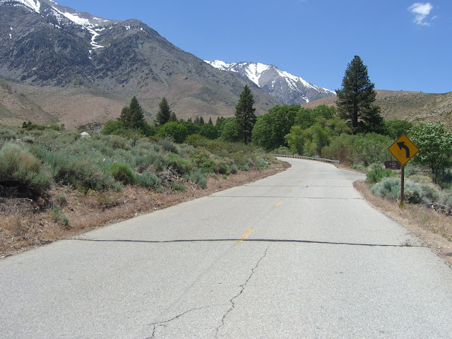
Onion in all its glory:
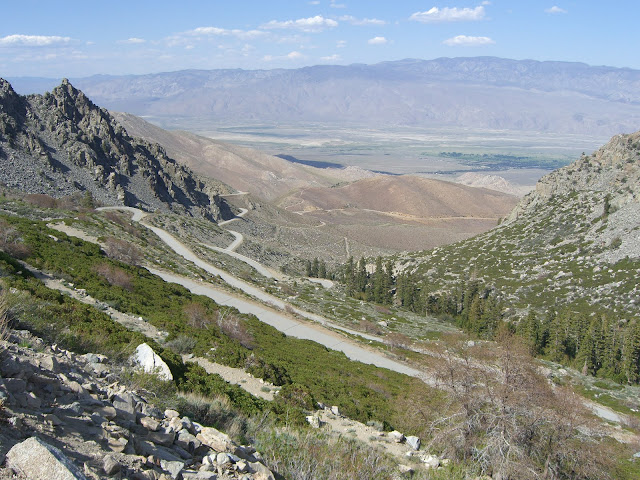
I’ve now ridden Onion twice – once from 395 and once from Gray’s Meadow – and truly enjoyed both ascents. Of course, this is Owens Valley – just about all of the climbs are incredible. This last trip, I took a long weekend and enjoyed some fun cycling, hiking and camping. This was my schedule:
- Camp at Horseshoe Meadows Thursday night (just over 10,000ft)
- Friday, descend down Horseshoe Meadows Road, then climb back up to camp (reverse climb!)
- Camp at Onion Valley Friday & Saturday nights (just over 9,000ft)
- Saturday, hike Kearsarge Pass
- Sunday, descend down Onion Valley Road, then climb back up to camp (one more reverse climb!)
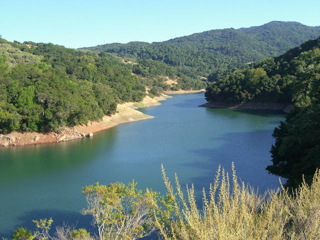
Horseshoe Meadows, needless to say, deserves its own entry. If you’ve ever driven 395 through Lone Pine, you’ve probably seen the massive switchbacks carved into the mountains above Lone Pine. An impressive sight, and an impressive climb.
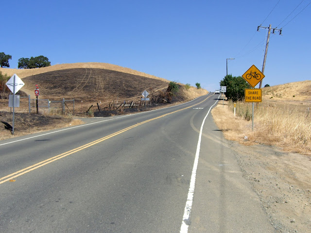
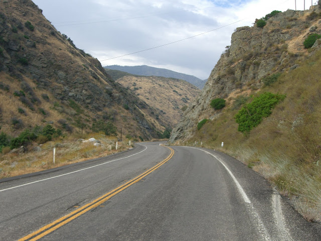
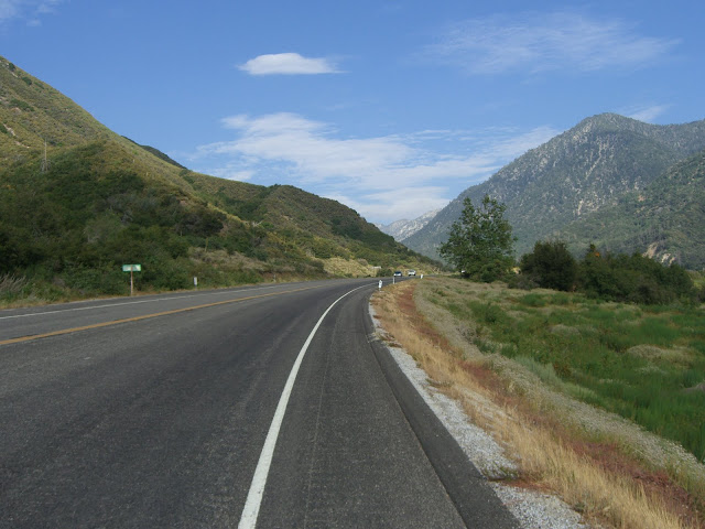
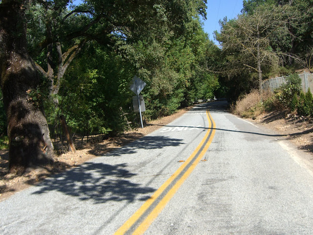
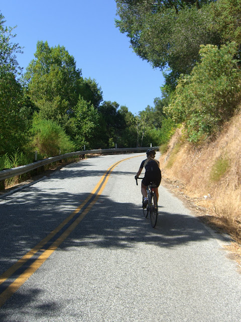
This ride, however, is all about Onion Valley. This time, since I was camped at the Onion Valley Campground (the top of Onion Valley Road), my plan was to descend down to Gray’s Meadow Campground (situated right where the road finishes climbing the valley floor and starts climbing the mountain itself), then climb back up. However, if you want credit for conquering Onion Valley, you’ll have to start at the bottom at 395 (which I did on my first ascent of Onion Valley).
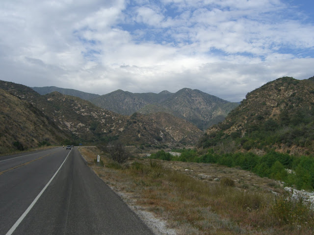
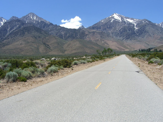
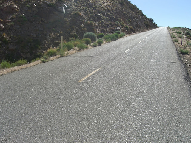
Starting from 395 is mentally challenging, as you climb up a (nearly) unchanging desert floor for nearly 2,000 ft of elevation gain. A few shots from my 2011 climb of this stretch:
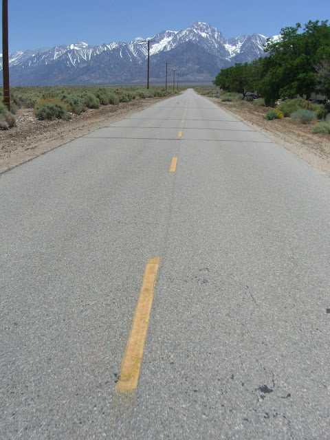
Looking back:

The one cool oasis you pass on this grueling stretch:

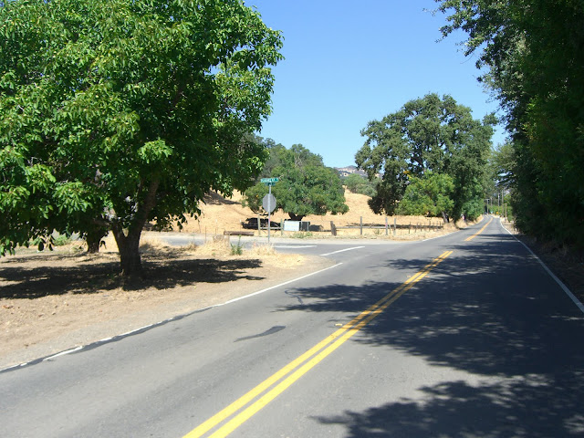
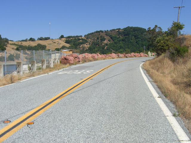
Finally, Gray’s Meadow!
If you made it this far, you’ve already climbed 2,000 ft. And, if you climbed Onion like I did in 2011 during midday temperatures, you climbed it in 90 degree heat. Not that fun (hint: in summer, wake up early and start climbing as soon as you wake up).
This time, I made sure to start climbing at a saner time. After a leisurely breakfast of oatmeal at Onion Valley, and packing everything up at camp, I started the descent from the OV campground at 8:04AM to start climbing from Gray’s (3,000 ft lower) at 8:15AM (yes, this is one fast descent). A quick note about this descent – ridiculous. I averaged over 37mph descending, hit over 50mph – all while taking the curves cautiously and never pedaling to gain speed. This is one quick descent. Just watch the expansion joints in the asphalt, especially up higher, and the occasional rock debris.
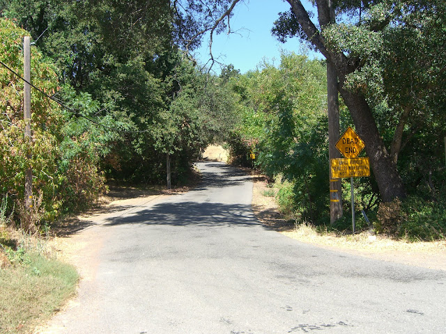
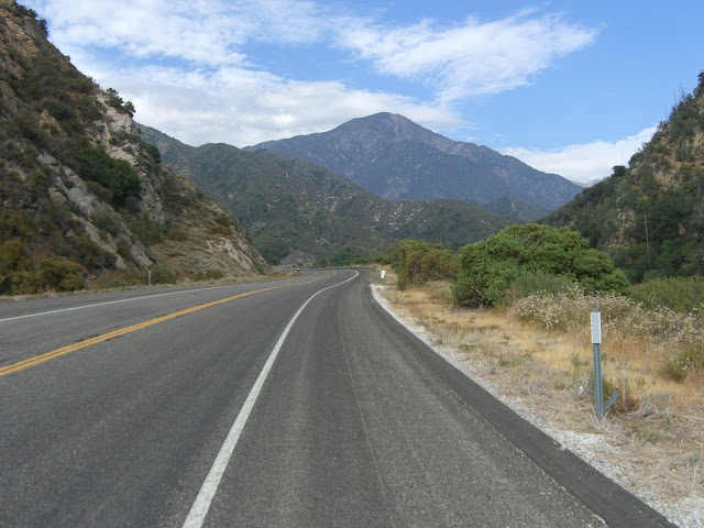
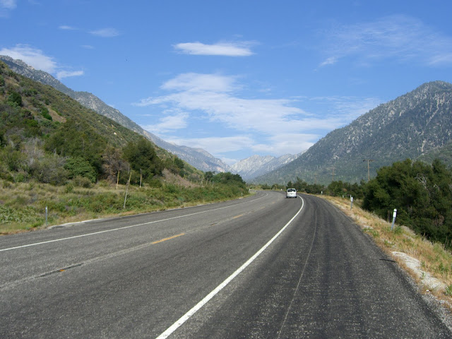
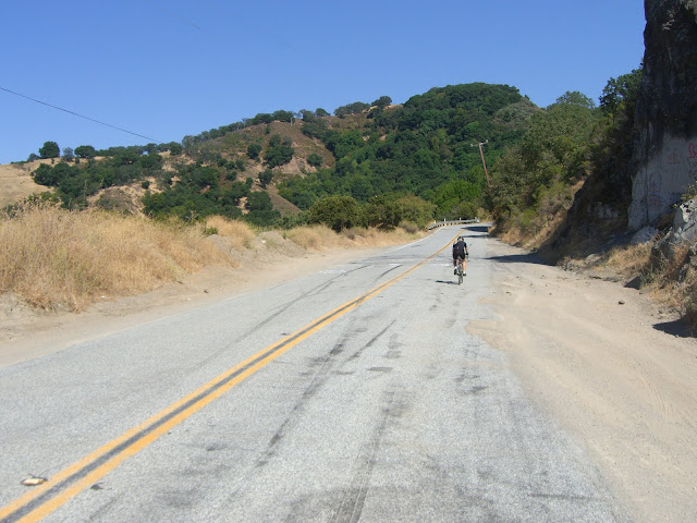
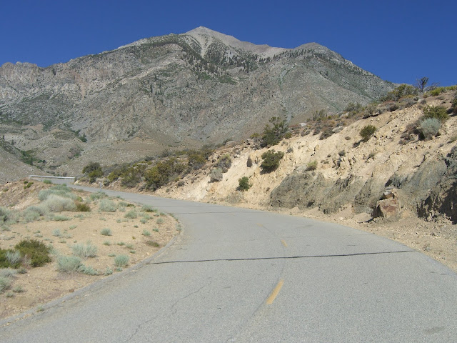
Back to Gray’s.. the very first part of climbing from Gray’s is a fun little traverse up a hill that goes straight to the sky:
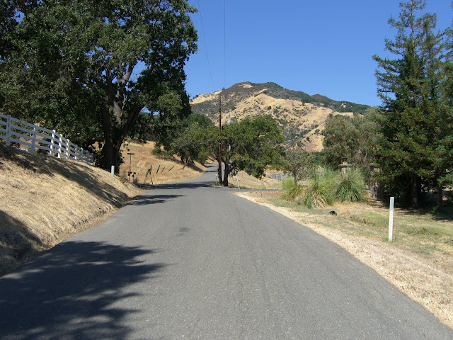
.. before throwing you towards the mountains themselves:
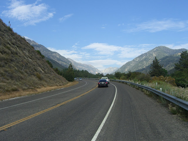
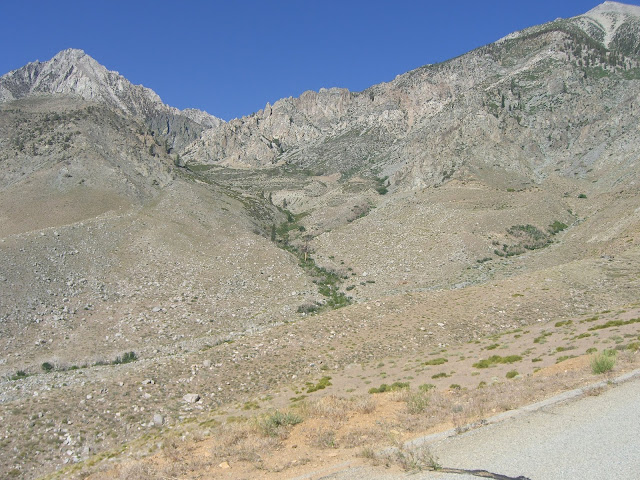
The drainage you will (eventually) be climbing up (if you look closely, you might just see the road carved into the terrain):
Read the Full Ride Report
Posted: August 23, 2010 at 2:26 am | Tags: Gates Canyon, Mix Canyon, Vacaville
Mix Canyon and Gates Canyon. Two truly insane climbs. The two toughest medium-length climbs I have ever ridden (and I have ridden a lot of steep climbs!). You would have to be slightly demented to attempt them.
Mix Canyon
Stats from John Summerson’s Climbing (By Bike) In California book for Mix Canyon:
Elevation Gain: 2178 ft
Length: 4.0 miles
Average Grade: 10.3%
Steepest Mile: 15.8%
Steepest 3 Miles: 11.8%
Steepest Mile in California at 15.8%. Second place goes to Old Priest Grade at 15.0%.
3rd Steepest 1/2 Mile in California at 16.2%. First place goes to Marin Avenue (18.1%) and second place goes to Mattole Road South 2 (17.5%).
Additionally, a separate half mile stretch of Mix Canyon appears at the #6 spot in the toughest 1/2 mile climbing section category (15.4%)
Most Technical Descent in Northern California
Needless to say, Mix Canyon, by the stats, is an epic climb. Gates Canyon is no easier.
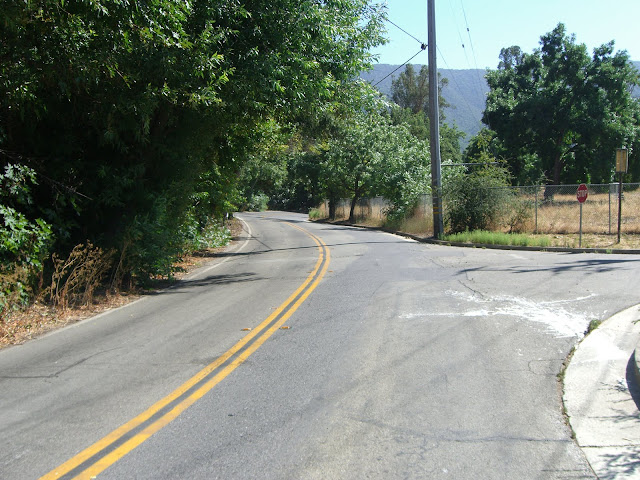
Anyway, I started out at Alamo Creek Park Park in Vacaville. From here, I headed north on Alamo Dr, quickly turned left on Foothill Dr, then turned right right on Pleasants Valley Rd. Pleasants Valley is a pleasant, scenic road:
After about 4 miles of rolling terrain along Pleasants Valley Rd, I hit the infamous Mix Canyon:
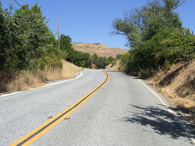
Initially, Mix is an easy, scenic ride through pleasant farms:
Read the Full Ride Report
Posted: August 6, 2010 at 5:06 am | Tags: CA-38, Forest Falls, Mentone, Redlands, SR-38, Valley of the Falls Dr
4,279 ft elevation gain
14.5 miles in length
5.6% average grade
If you start in Mentone, those are the stats. That is definitely a solid climb. You can also cut off a few miles of somewhat boring climbing and start at the intersection of 38 (Mill Creek Rd) and Bryant. If you do this, you will miss almost 900 feet of shallow climbing. With that said, the climbing you will miss is nothing special. So, if you are going for overall climbing, start in Mentone. If you are going for scenic climbing, start at 38/Bryant. Additionally, if you start at 38/Bryant, your average grade will be 6.3% for over 10 miles. Not bad. The rest of this post assumes a starting point at 38/Bryant.
The initial section of 38 (above Bryant) has a minimal shoulder:
Given the relatively steady traffic, this is the only somewhat unpleasant section. Luckily, the shoulders open up pretty quickly for the rest of the ride:
The rest of the ride along 38 is a very scenic ride up a valley with few curves:
The traffic, while not heavy, is relatively constant and somewhat fast. The wide shoulder for most of 38, however, makes this section surprisingly pleasant.
The grade is, for the most part, extremely steady and relatively shallow. While I love steep climbs, it is also nice to be able to shift up a few gears and power on at more than 6 mph at times! And, of course, some pleasant scenery doesn’t hurt.
Awesome valley to be riding up!
Read the Full Ride Report
Posted: July 28, 2010 at 12:27 am | Tags: Hicks Road, Mount Umunhum, Mt. Umunhum Road, San Francisco, Santa Cruz Mountains
4.1 miles. 2,199 ft elevation gain. 10.2% average grade. 17% max grade.
Let that sink in for a minute. Over 4 miles of climbing at over 10%. If that doesn’t scare you just a little bit, I don’t know what will.
Anyway, this is, not surprisingly, another climb listed in Summerson’s The Complete Guide to Climbing (By Bike) in California. In this book, Hicks Road North/Mt Umunhum gets a few noteworthy mentions..
For all of California:
#7 Most Difficult Half Mile: 14.3% (mile 0.3-0.8)
#5 Most Difficult Mile: 13.9% (mile 0.1-1.1)
For the San Francisco Bay Area:
#1 Most Difficult Climb
#5 Steepest Climb (10.2%)
#5 Most Technical Descent
#4 Highest Elevation Attained Climb (2,846 ft)
#5 Greatest Length of >10% Grade Climb (1.6 miles)
With this many mentions..and an entire mile at 13.9% (!), I had to try this out. Somehow, I actually also convinced my mom to attempt it as well. She is an avid cyclist, but stats like these give her pause. Anyway, despite the ridiculousness of the grade, she was game (after thinking it over for a few minutes). Sweet.
The first part of Hicks Road consists of rolling bumps that gradually bring you upwards (<400 feet gain in 5 miles). This stretch is semi-scenic:
There is a bit of car traffic along here though, so watch your line. The only real climbing in this first stretch is a short, but steep, bump up to Guadalupe Reservoir:
Enjoy the respite along the reservoir. It will not last. After you round a sharp bend (and cross a second small creek crossing), you are suddenly faced with a wall of pain..
Read the Full Ride Report