Posted: July 18, 2010 at 11:43 pm | Tags: 33, Meiners Oaks, Ojai, Pine Mountain, Pine Mountain Inn, Pine Mountain Ridge Road, Pine Mountain Summit, Rose Valley, Sespe Creek
33 North from Ojai is one of the most beautiful cycling hill climbing routes ever created. While never all that steep, the route is incredibly scenic and offers lots of changing scenery if you ride it all the way to Pine Mountain Summit. Going all the way to Pine Mountain Summit along Route 33 means a 30 mile (one-way) ride that takes you up to a max elevation of 5160 ft. With a starting elevation of ~800 ft and some rolling sections, this means an overall elevation gain nearing 5000 ft. Pretty solid. If that is too easy, you can also ride up Pine Mountain Ridge Road to get to the real Pine Mountain itself, another 2000 ft higher (and a very tough and rough 2000 ft!). Also, if you go beyond Rose Valley Summit, bring a Camelback as there were no water sources that we could find.
Stats:
33 to Rose Valley Summit – 11.4 miles at 4.3% (2600 ft gain)
11.7 miles of easy climbing and rollers between Rose Valley Summit and the bottom of the Pine Mountain Summit Climb (1.4% – 850 ft gain)
Climb to Pine Mountain Summit – 3 miles at 5.4% (850 ft gain) – last 2/3 of a mile at 8%
Pine Mountain Ridge Road Climb – 6.1 miles at 6.4% (2050 ft gain), steepest 3.7 miles at 7.8%, steepest 1.75 miles at 9.1%
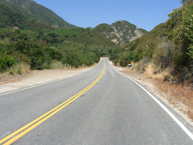
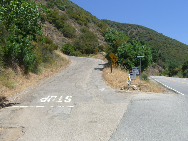
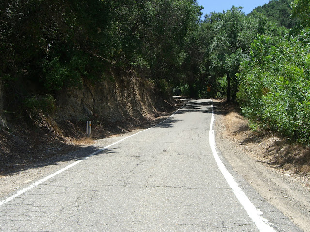
Anyway, the climbing starts just north of Meiners Oaks along Route 33. From Ojai, head west along 150 (Ojai Ave) for about 1 mile before turning right (& heading north) on 33. At about 4.5 miles in, the climbing starts in earnest as you pass by Matilija Lake. This first section, before the real climbing, is quite pleasant:
Nearing Matilija Lake:
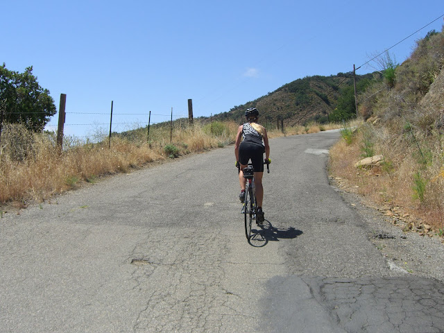
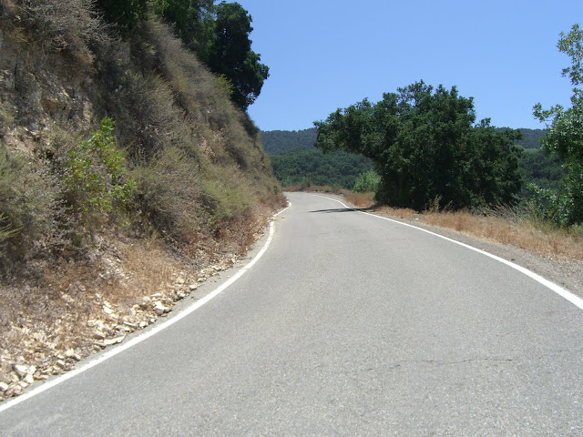
As you approach Matilija Lake, the actual climbing begins:
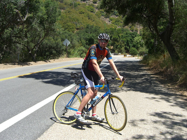
Me..getting ready for a long climb..
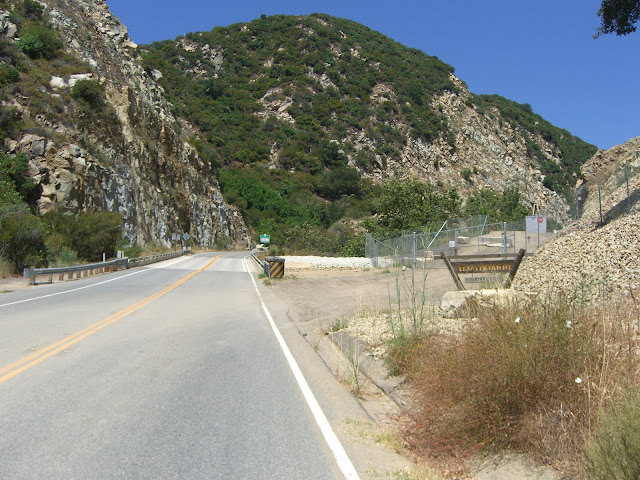
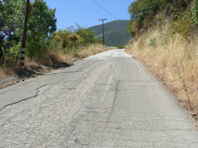
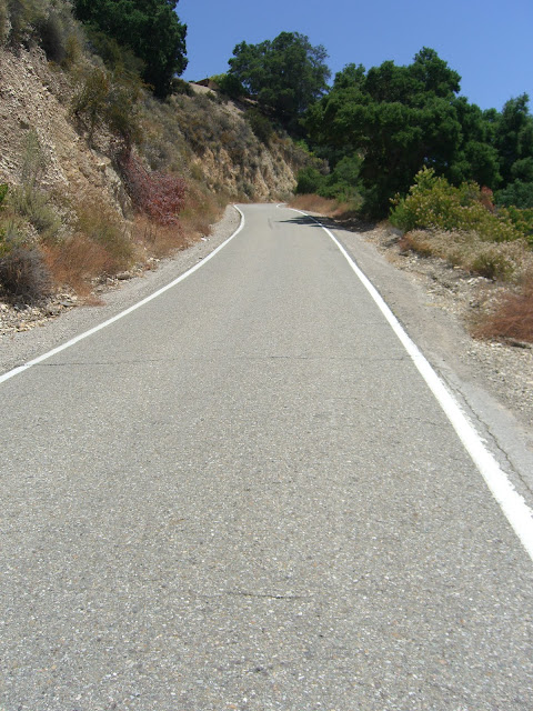
Just a bit north of this point, I elected to throw in a touch of brief, steep climbing. Matilija Canyon Road presents an awesomely steep section of road:
Crazy, no?
Read the Full Ride Report
Posted: July 17, 2010 at 2:16 am | Tags: Palm Springs, Palm Springs Aerial Tramway, San Bernardino Mountains, San Rafael Dr, Tramway Road
Palm Springs. Yes, you read that right. Absolutely not a city known for cycling. Between the abundance of elderly drivers, excessively high temperatures and strong winds, this is one area that will test you. And yet, this wasteland for cycling has one of the best climbs in southern California – Tramway Road. This awesome road basically heads straight up from Palm Springs to the bottom of the Palm Springs Aerial Tramway.
I found this climb in The Complete Guide to Climbing (By Bike) in California (full disclosure: if you purchase the book from the link above I do earn a commission – with that said, I highly recommend the book as it is the most complete resource for climbs in California).
So, a couple of stats on this climb.. First, from the above book:
2nd steepest climb in southern California at a 9.5% average grade
#1 fastest descent in southern California
#1 climb with the greatest length of > 10% grade in southern California (1.6 miles long)
#5 most scenic/spectacular climb in southern California
Additionally, a few more stats:
Length: 3.8 miles
Elevation Gain: 1910 ft
Average Grade: 9.5%
Last 1.2 miles: 12%
Last 1/2 mile: 14.3%
Needless to say, this is a stout climb. To put it simply, this is a road that does not believe in switchbacks. In 2k feet of climbing, you get some slight curves and one 90 degree bend…and nothing more. Up, up and up some more is an accurate description of the climb. During summer (and late spring, and fall…), the temperatures are generally unbearable. In the afternoon, the winds are strong. This climb has a small window of opportunity. If you hit that window, however, you will be rewarded with a challenging, beautiful climb. This last week, I enjoyed an altogether too hot week in Palm Springs (temperatures hit 115-118 degrees). Given these excessively hot temperatures, I headed out to climb Tramway as early as possible. While I left my hotel before 7AM, I didn’t actually get to start climbing until about 7:20AM (the drive from La Quinta to Palm Springs takes a while). At this time, temperatures were already hovering around 90 degrees. Hot? Yes. Bearable? Just barely.
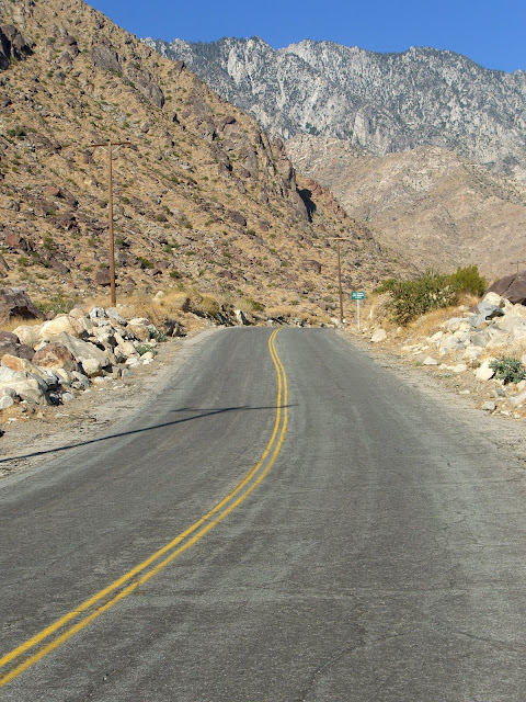
Anyway, I started climbing Tramway Road from the intersection with 111 (aka Palm Canyon Dr) and enjoyed the views from the start:
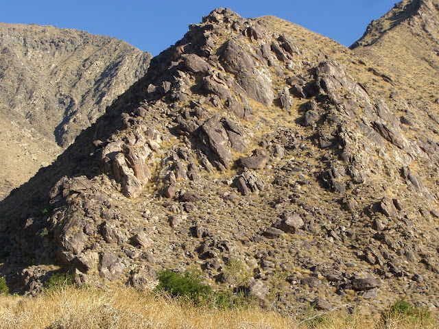
Such incredible mountains that you climb into:
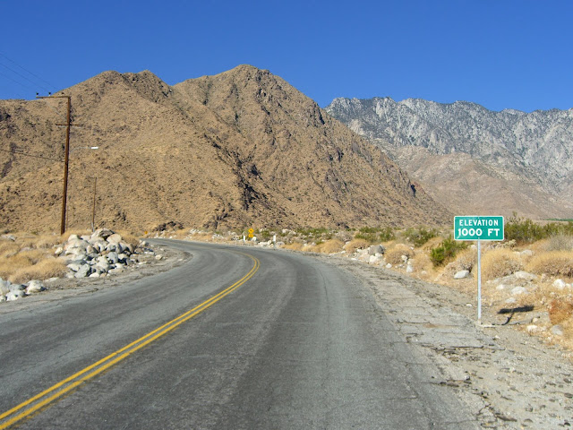
Starting at just below 700ft in elevation, you will quickly hit the 1k marker:
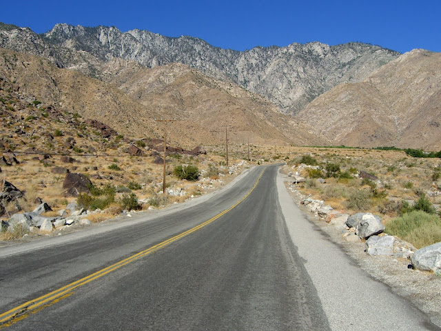
As you continue to climb, the views just get more spectacular:
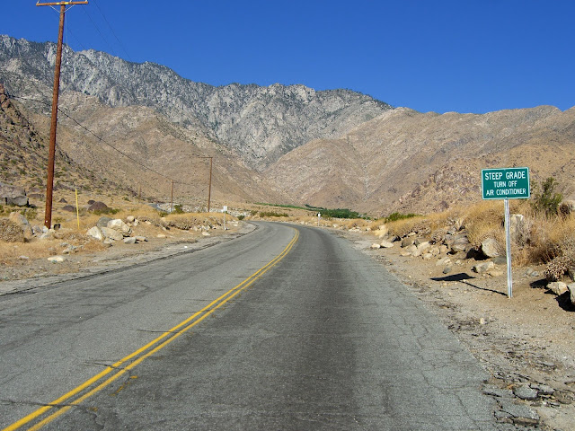
Turn off your air conditioner:
Given the 10%+ nature of this road and the summertime temperatures of 110+…that sign is probably necessary. If you (or your car) can make it beyond that sign, the scenery just gets better:
Read the Full Ride Report
Posted: July 1, 2010 at 5:10 am | Tags: Camino Cielo, El Capitan, Refugio, Refugio Rd, Santa Ynez Peak
Santa Barbara – the epicenter of tough hill climbing in southern California? Quite possibly. While the mountain roads ringing Santa Barbara do not climb as high as those in the LA area (6-8k+ for some), they do provide for some very stout climbing. Old San Marcos/Painted Cave, Gibraltar and Figueroa Mountain are three of the toughest, most scenic climbs around. Refugio Road ranks right up there with these climbs. This is a steep and scenic climb about 20 miles north of Santa Barbara just off the 101. Given the slightly more remote location and the fact that it is not a through road (unless you are willing to descend down a rough dirt road on the other side), Refugio gets very little car traffic. It gets significantly less traffic than Old San Marcos or Gibraltar – and those climbs don’t get all that much traffic.
Refugio has one more thing going for it that rarely gets mentioned – you can (and should) connect with West Camino Cielo at the top of the Refugio climb. The Camino Cielo section is much more mellow (aside from the last mile or so), but offers one of the most beautiful and scenic stretches of climbing in southern California. Taken together, this ride has it all – super steep stretches, great scenery and sustained climbing (you start at almost sea level and hit ~4000 ft in elevation).
Important Stats:
Refugio Rd Section:
Main climb: 8.6% for 3.7 miles
Steepest section: 10.0% for 2.4 miles
First ~0.5 miles of climbing: Just under 15%!
W Camino Cielo Section:
5.8% for 5.7 miles (1740 ft gained)
4,000 ft elevation summit point
~9% for last mile steep push
8%+ steeper mile-long section early on
Aside from the two steep sections above, Camino Cielo is very mellow
Small descent just past the 3 mile point
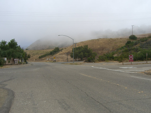
Anyway, this last weekend I got to ride this with my mom. Since it has been about a year since I last rode this, I was definitely looking forward to it. We parked just off the 101 along Refugio Rd – one of the few spots you can park for free in the area. Being right near the ocean, this spot was covered in fog:
The fog was actually welcome – on a climbing ride fog is very pleasant to have. Unfortunately, the fog quickly disappeared:
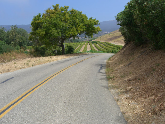
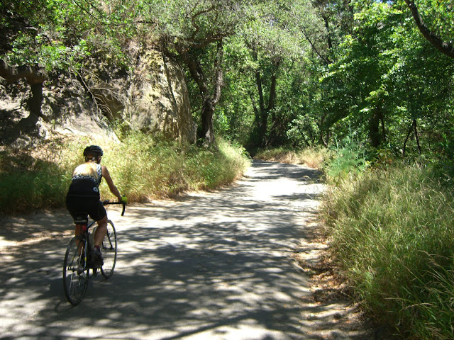
On the other hand, this meant the views would be nice. After a couple of miles of cycling through orchards, we start hitting some more forested sections:
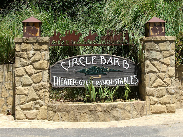
Soon, we hit the gorgeous Circle Bar B Guest Ranch:
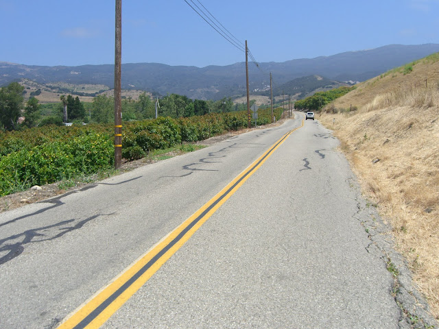
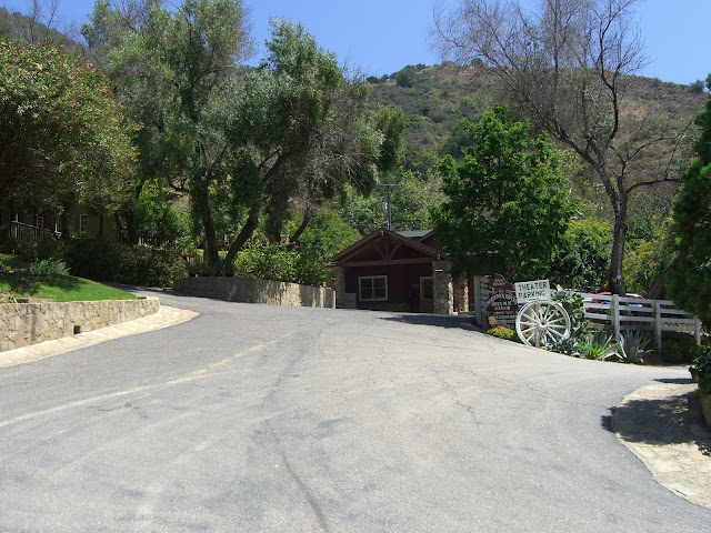
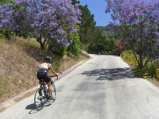
Most traffic you encounter will be going no further than here. After passing by Circle Bar B, the climbing starts in earnest (and with some great color!):
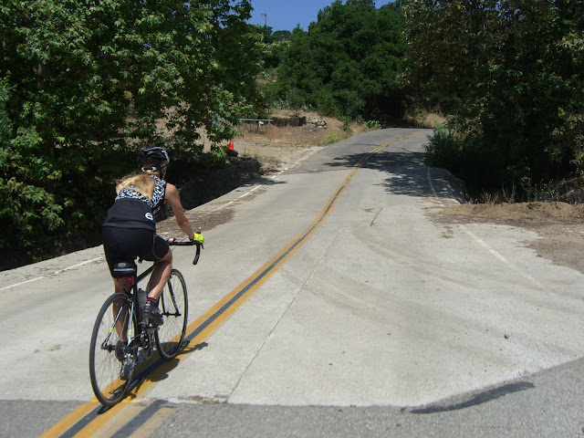
Of course, the shade disappears just as you really start climbing:
Read the Full Ride Report
Posted: June 30, 2010 at 12:48 am | Tags: 150, Koenigstein Rd, Ojai, Santa Paula, Sulphur Mountain, Sulphur Mountain Rd
Sulphur Mountain is one of those climbs that you really have to hunt for to find. With only a couple of passing mentions on bikeforums and virtually nothing on google (aside from a few pages about mountain biking portions of it), this climb is easily overlooked. Even the road itself is plain looking at its turnoff from route 150 just outside of Ojai – you’d never guess it goes anywhere special. This is a shame. Sulphur Mountain Rd is a great climb. While relatively short (only 1240 ft in elevation gain total), the first couple of miles average 8.8%..and the first mile averages 10%! Needless to say, this is a challenging little climb.
A few important stats:
First 0.7 Miles (the steepest section): 10.5% average
First Mile: 10% average (525 ft elevation gain)
Main Climbing Section (2.05 miles and 945 ft elevation gain): 8.8% average
Overall Climb (3.42 miles and 1240 ft elevation gain): 6.9%
Overall Ride (bottom of climbing section to end of Sulphur Mountain Rd): 4.3 miles
If you only look at the overall climb numbers, 6.9% doesn’t sound too bad. This is deceptive. The first 2 miles climb steeply up to the ridge line while the following 1.5 miles meander gently (with a few steep portions thrown in) along the ridge. Basically, if you can get up those 2 steep miles, you are good to go.
Anyway, on to the pictures!
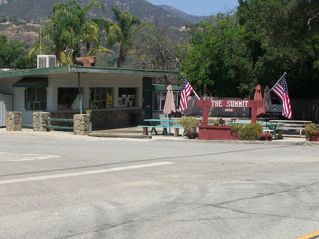
A nice place to start is near The Summit roadside food stand:
The name refers to the fact that this is the summit of route 150 between Ojai and Santa Paula (at just over 1560 ft in elevation). In fact, this is the highest point along all of route 150 (the other high point along the Casitas Pass section tops out at under 1200 ft). 150 itself is a great road to ride on as well, so starting in either Ojai or Santa Paula and riding up 150 to Sulphur Mountain would be great as well. However, if you are pressed for time, as I was, the streets around The Summit provide the best relatively secure, close parking area for this ride. From here, you gradually descend a couple of miles along 150 towards Ojai before turning left on Sulphur Mountain Rd. Watch for this intersection as it is not well marked.
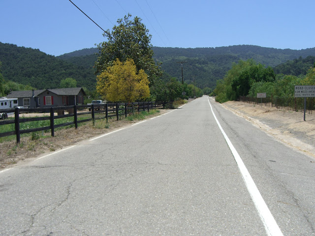
The first part of Sulphur Mountain Rd is relatively flat with some houses along the road:
The hill in the background is what you are about to climb up. Very quickly, the climbing starts:
Some of this steep climbing is shaded:
Some is not well shaded:
Sections like this will test you:
Steep (10%+), exposed and sun-drenched (the sun just bounces off those rock walls). Luckily, you do get a lot of shaded sections:
Read the Full Ride Report