Santa Barbara – Gibraltar Road Climb
Posted: June 5, 2010 at 2:39 am | Tags: Camino Cielo, Gibraltar Road, Old San Marcos Pass, Painted Cave, Santa BarbaraIf you like to climb, you need to find your way to Santa Barbara. Santa Barbara arguably has the most easily accessible, tough and scenic climbs in southern California. I’ve already written about the Old San Marcos/Painted Cave climb – one of the toughest around – so now it is time to tackle Gibraltar Road.
To start, you have a couple of options. You can start at Tuckers Grove Park and give yourself a few miles of warm up. You can also start at the Santa Barbara Mission and give yourself no warm up. Either works for a starting location, but I would recommend Tuckers Grove – this gives you some rolling hills to warm up with and lets you finish with a great descent. If you start at the Mission you will climb immediately and finish with rolling hills. Anyway, the rest of this assumes you start at Tuckers Grove.
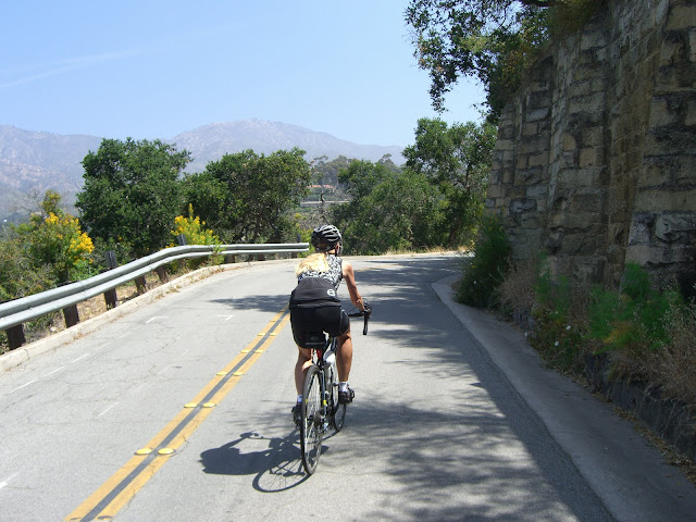
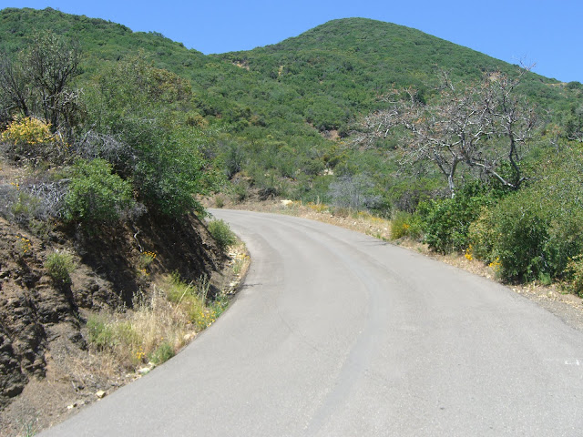
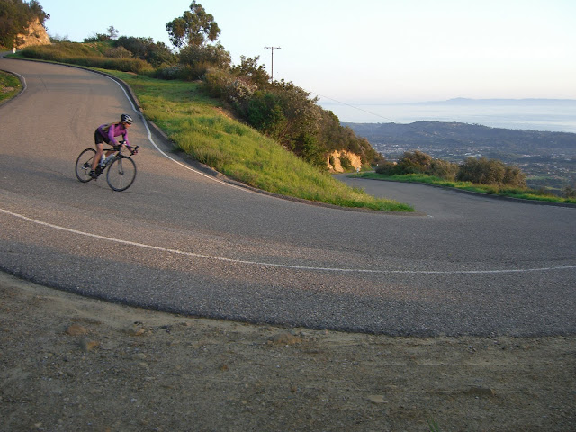
From Tuckers Grove, you head east on Cathedral Oaks. After passing 154/San Marcos Pass Road, Cathedral Oaks turns into Foothill Road/192. This whole time you will be climbing and descending – this is some rather rolling terrain. A couple of miles further and you turn right onto Mission Canyon Road. Pass by Rocky Nook Park on your left. Right after, turn left onto Mountain Drive. If you were to ride a bit farther on Mission Canyon you would see Mission Santa Barbara (definitely worth visiting – it is one of the most beautiful California missions). As soon as you turn onto Mountain, the real climbing begins:
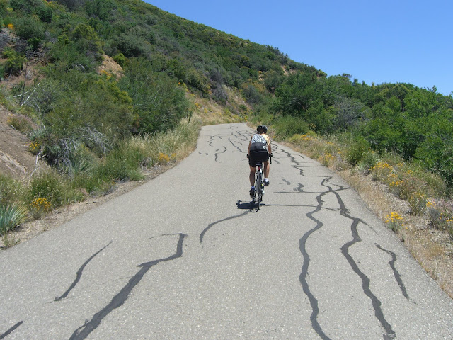
 |
| From 2010-05-31 – Santa Barbara – Gibraltar Road & E Camino Cielo Cycling |
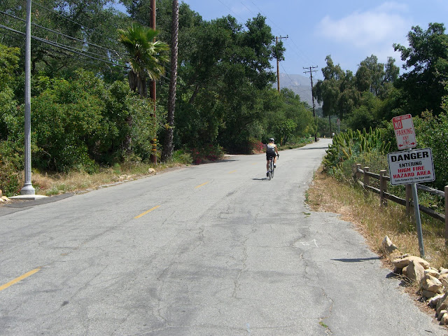
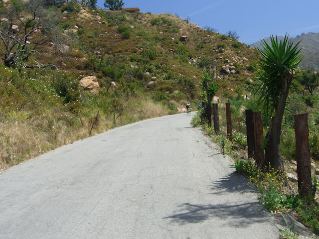
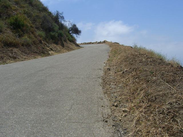
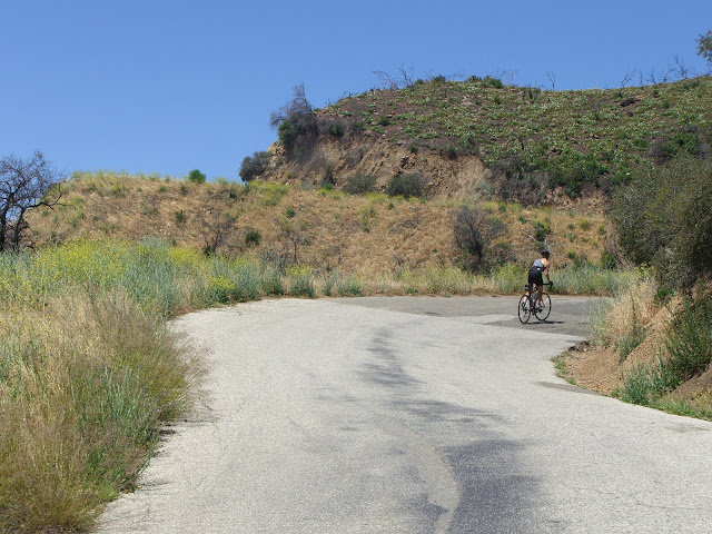
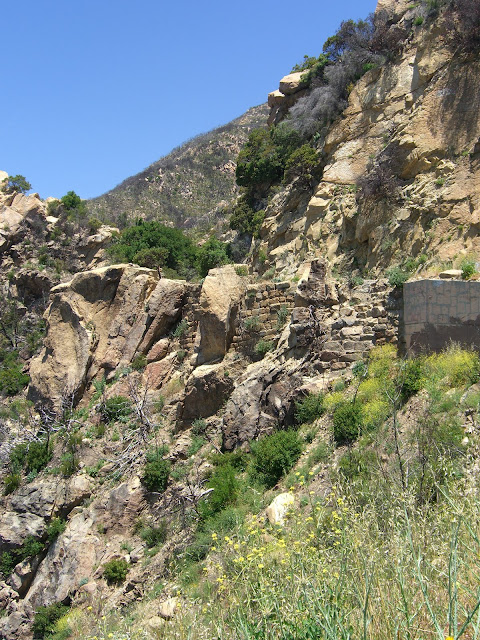
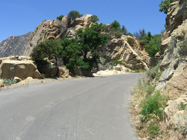
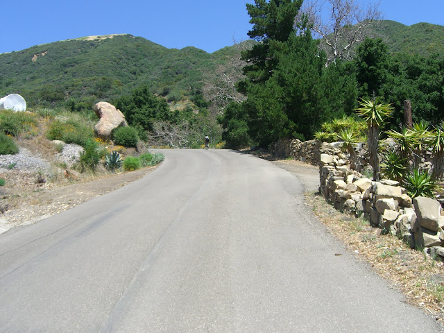
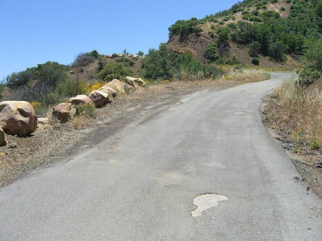
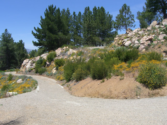
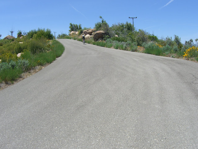
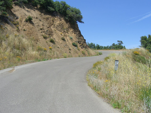
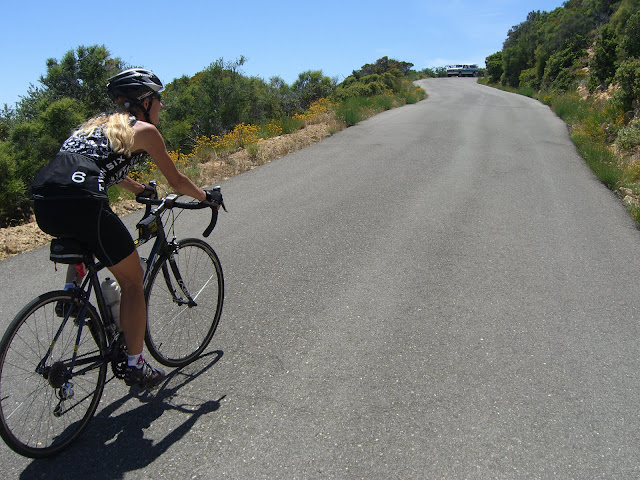
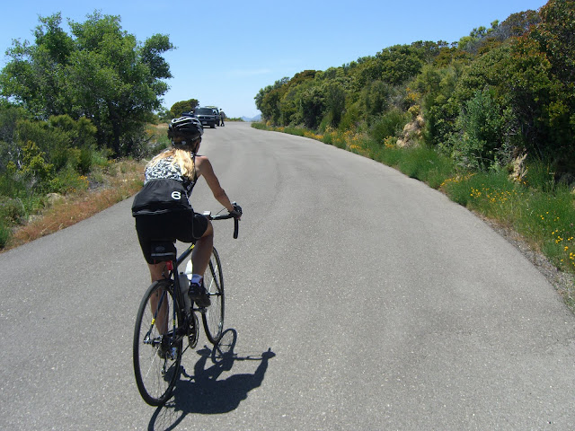
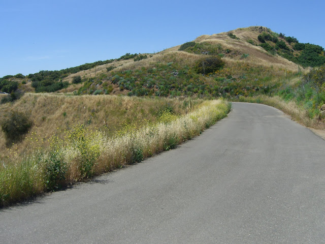
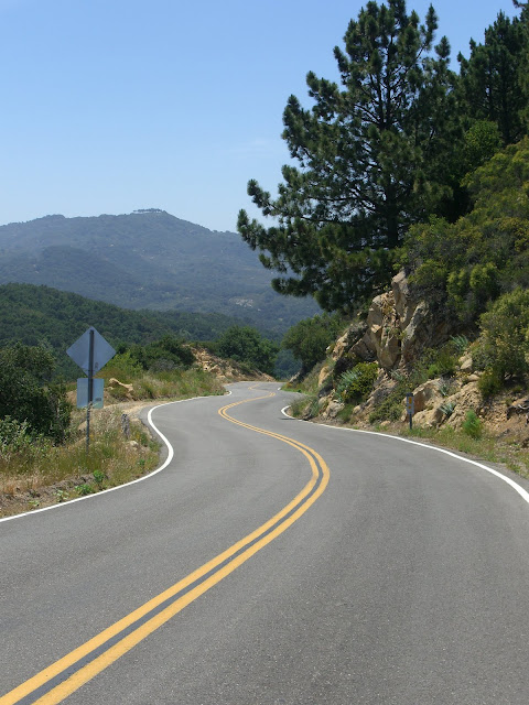
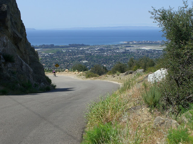
This section of Mountain is pretty cool with an impressive rock wall spanning much of the length on the right side. After about a mile you will join up with Foothill/192. About 3/10s of a mile later you will turn left to stay on Mountain while 192 continues on to the right. This left turn is right before/at Sheffield Reservoir. Take a breather here and rehydrate as the climbing is unforgiving from this point forward. From here, ride a few hundred feet up before coming to a 4 way intersection. The left will take you along Las Canoas – a wonderful, albeit short, road to ride. To the right Mountain Drive continues along – also quite worthy of riding – lots of rolling hills with some decent climbs and amazing scenery along the way (if you have some extra time I would highly recommend exploring it). The middle choice, however, is your choice for today. This is the start of Gibraltar Road. The next 6.5 miles will give you almost 2600 feet of climbing with few breaks (your breaks will basically be sections that are not quite as steep as the surrounding sections). Anyway, the very start of Gibraltar:
 |
| From 2010-05-31 – Santa Barbara – Gibraltar Road & E Camino Cielo Cycling |
 |
| From 2010-05-31 – Santa Barbara – Gibraltar Road & E Camino Cielo Cycling |
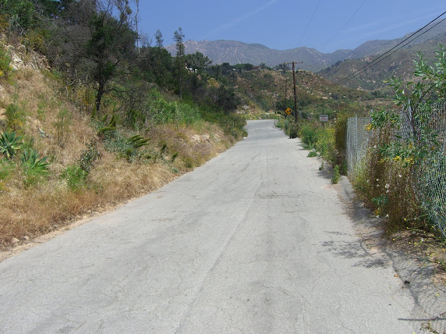
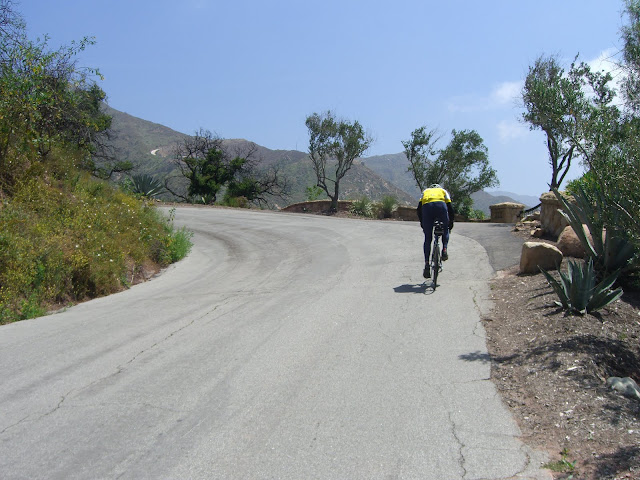
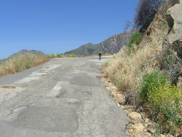
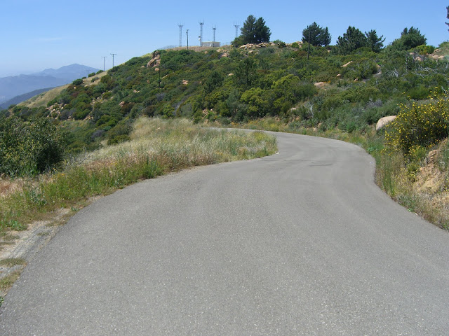
Shortly after this section you pass by El Cielito Road – from this point on you do not pass another intersection until finishing the climb at Camino Cielo Road. Right after El Cielito:
 |
| From 2010-05-31 – Santa Barbara – Gibraltar Road & E Camino Cielo Cycling |
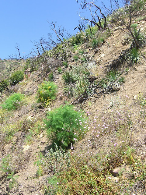
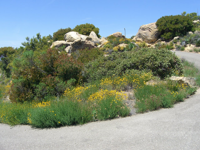
Still some green on the hills from all the rains last season:
 |
| From 2010-05-31 – Santa Barbara – Gibraltar Road & E Camino Cielo Cycling |
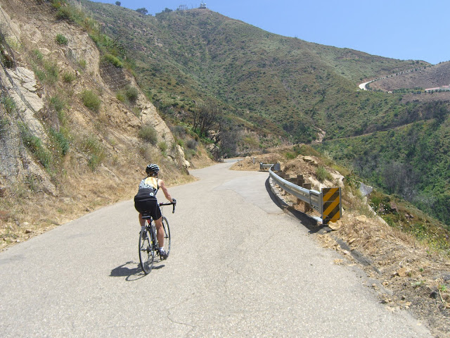
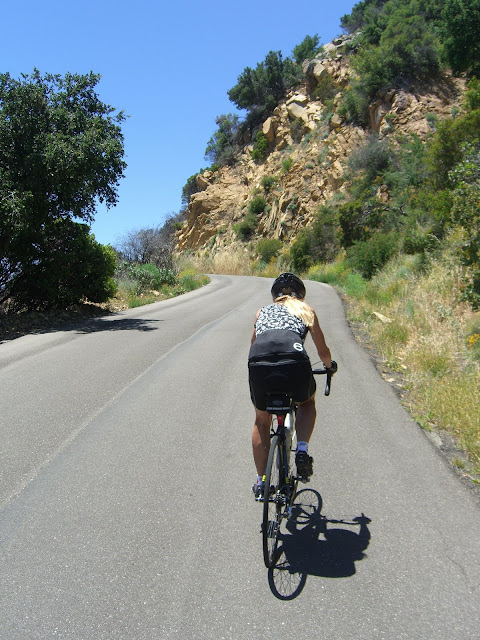
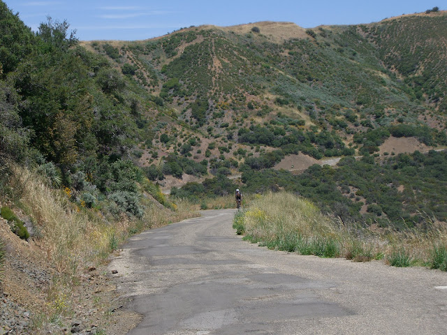
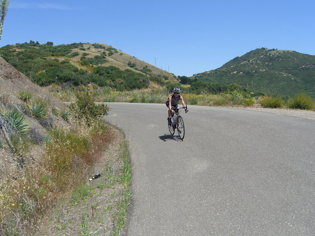
Lots of other cyclists on the road today:
 |
| From 2010-05-31 – Santa Barbara – Gibraltar Road & E Camino Cielo Cycling |
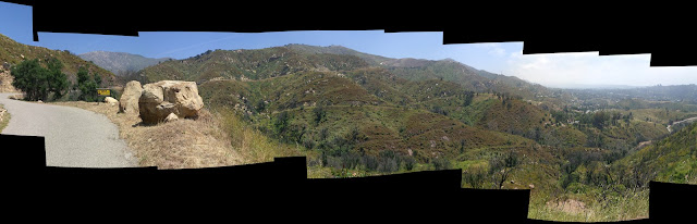
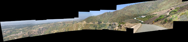
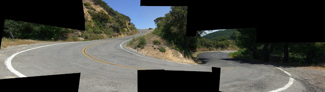
A panorama from this section:
 |
| From HQ Panoramas |
Make sure to click on the link to see the higher resolution version. From there you can click the Download tab and choose Download Photo if you would like to download the full size, original version of the panorama (8271×2670 pixels in size…so yeah, pretty large).
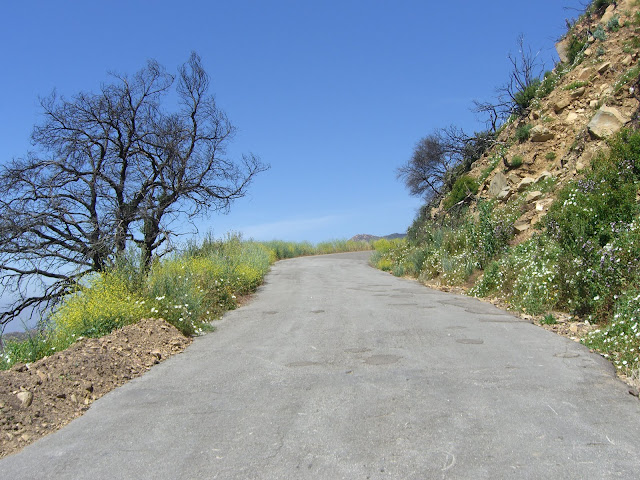
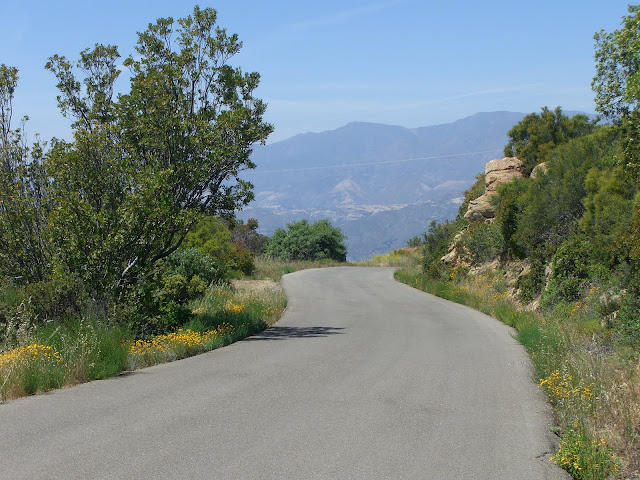
Some more of the scenery you pass:
 |
| From 2010-05-31 – Santa Barbara – Gibraltar Road & E Camino Cielo Cycling |
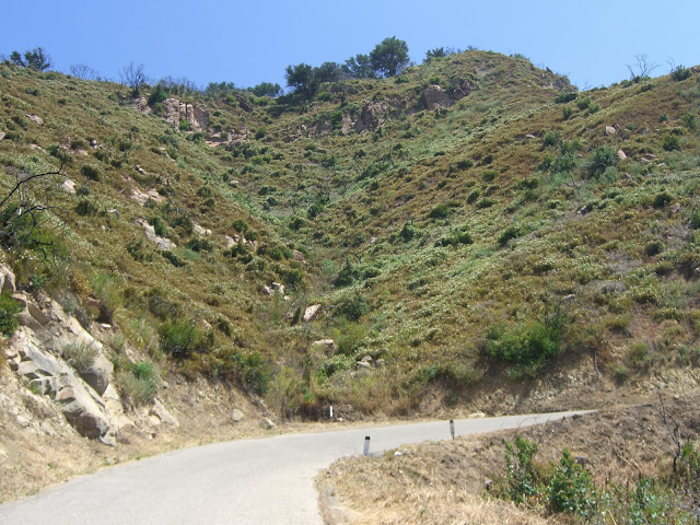
Riding straight up into the sky:
 |
| From 2010-05-31 – Santa Barbara – Gibraltar Road & E Camino Cielo Cycling |
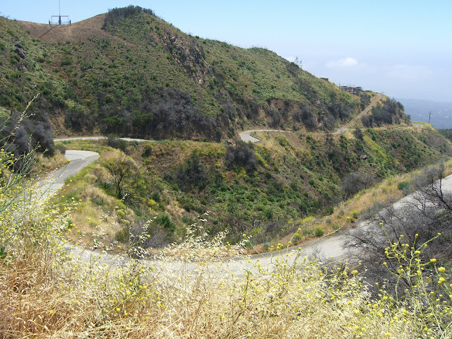
Twisting, curving asphalt winding its way up some rugged hills:
 |
| From 2010-05-31 – Santa Barbara – Gibraltar Road & E Camino Cielo Cycling |
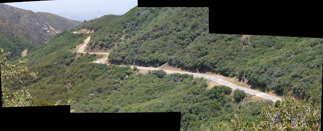
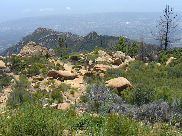
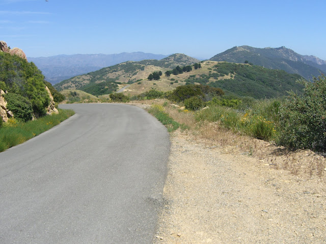
A bit farther up and you get a nice panorama of what has just been climbed:
 |
| From HQ Panoramas |
Again, click on the image for a larger version and the option of downloading the original image (11,038×2493 pixels in this case).
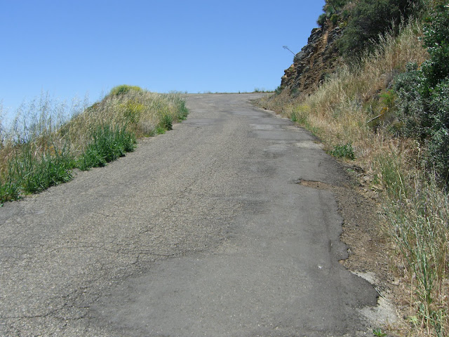
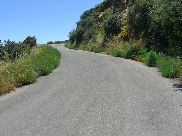
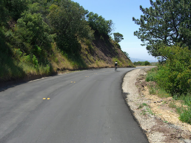
This bottom half or so is the easier section of Gibraltar, I should mention. By easier, I simply mean that it isn’t as brutal as the second half. Here, you might just be able to stay out of your granny gear and push it a bit. Just don’t kill yourself pushing on the bottom half as you will need some reserve energy for the top half.
Nearing the bend that divides the easier bottom section and the tougher top section:
 |
| From 2010-05-31 – Santa Barbara – Gibraltar Road & E Camino Cielo Cycling |
Panorama at the bend:
 |
| From HQ Panoramas |
(Again, click for larger image).
Take a break here if you want as the climbing only gets tougher from here. Continuing up, you again head straight into the sky:
 |
| From 2010-05-31 – Santa Barbara – Gibraltar Road & E Camino Cielo Cycling |
Having been burned by fire relatively recently, you still have a stark contrast between the older, completely burnt plants and the newer, healthy, green growth:
 |
| From 2010-05-31 – Santa Barbara – Gibraltar Road & E Camino Cielo Cycling |
Steep, but fun and scenic:
 |
| From 2010-05-31 – Santa Barbara – Gibraltar Road & E Camino Cielo Cycling |
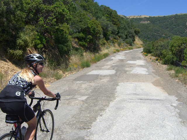
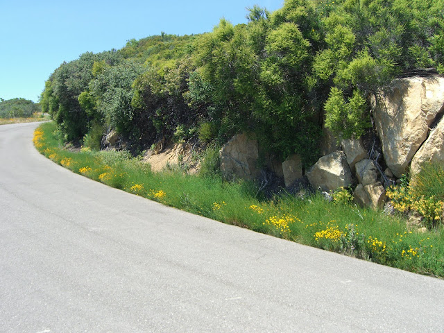
The road surface starts getting a bit funky – but, what a scene to ride through:
 |
| From 2010-05-31 – Santa Barbara – Gibraltar Road & E Camino Cielo Cycling |
 |
| From 2010-05-31 – Santa Barbara – Gibraltar Road & E Camino Cielo Cycling |
Looking back on the twisty section just climbed:
 |
| From 2010-05-31 – Santa Barbara – Gibraltar Road & E Camino Cielo Cycling |
And yes, that twisty section is pretty steep. You’ll likely be breathing somewhat hard by this point.
Such scenery:
 |
| From 2010-05-31 – Santa Barbara – Gibraltar Road & E Camino Cielo Cycling |
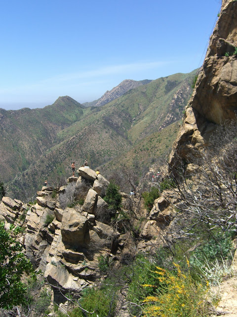
A bit later and you encounter one of the most visually impressive sections:
 |
| From 2010-05-31 – Santa Barbara – Gibraltar Road & E Camino Cielo Cycling |
 |
| From 2010-05-31 – Santa Barbara – Gibraltar Road & E Camino Cielo Cycling |
This massive rock section is also home to some sweet rock climbing. The climbers were out in force today:
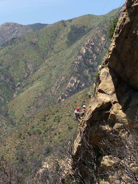 |
| From 2010-05-31 – Santa Barbara – Gibraltar Road & E Camino Cielo Cycling |
 |
| From 2010-05-31 – Santa Barbara – Gibraltar Road & E Camino Cielo Cycling |
Not a bad backdrop for climbing either! Requisite shot of the bike leaning against the ever-present (in Santa Barbara) and beautiful Manzanita trees:
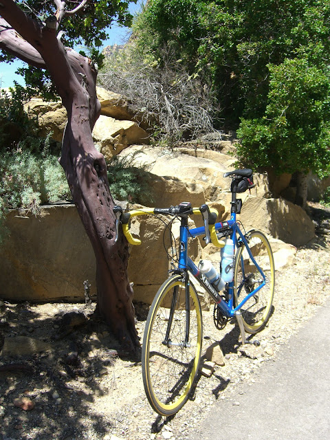 |
| From 2010-05-31 – Santa Barbara – Gibraltar Road & E Camino Cielo Cycling |
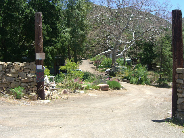
After passing by the climbing rock, you will encounter a brief respite leading to Flores Flat. Enjoy this easy section as it doesn’t last long. Just as you catch your breath you hit Flores Flat and start climbing once again:
 |
| From 2010-05-31 – Santa Barbara – Gibraltar Road & E Camino Cielo Cycling |
 |
| From 2010-05-31 – Santa Barbara – Gibraltar Road & E Camino Cielo Cycling |
 |
| From 2010-05-31 – Santa Barbara – Gibraltar Road & E Camino Cielo Cycling |
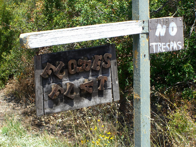
This is a rather interesting community – one of only two communities in the Santa Ynez Mountains that overlooks Santa Barbara (Painted Cave being the more famous and populous community). Flores Flat barely escaped destruction in the 2009 Jesusita Fire. Anyway, it is home to a small number of residences and a few businesses (a pottery business at the very least if I remember correctly). Right after the inhabited area, you get to climb one of the steepest sections along Gibraltar:
 |
| From 2010-05-31 – Santa Barbara – Gibraltar Road & E Camino Cielo Cycling |
Heading up the steep stuff:
 |
| From 2010-05-31 – Santa Barbara – Gibraltar Road & E Camino Cielo Cycling |
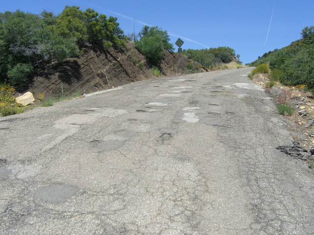
As you finish this torturous section, you get a brief respite in this patchwork of asphalt:
 |
| From 2010-05-31 – Santa Barbara – Gibraltar Road & E Camino Cielo Cycling |
See, you will smile when you hit this brief easy section. Unfortunately for you, the grade kicks up quite a bit after the next bend and taunts you endlessly until you hit East Camino Cielo (luckily, not too much further).
Steep…and sucky asphalt to boot!
 |
| From 2010-05-31 – Santa Barbara – Gibraltar Road & E Camino Cielo Cycling |
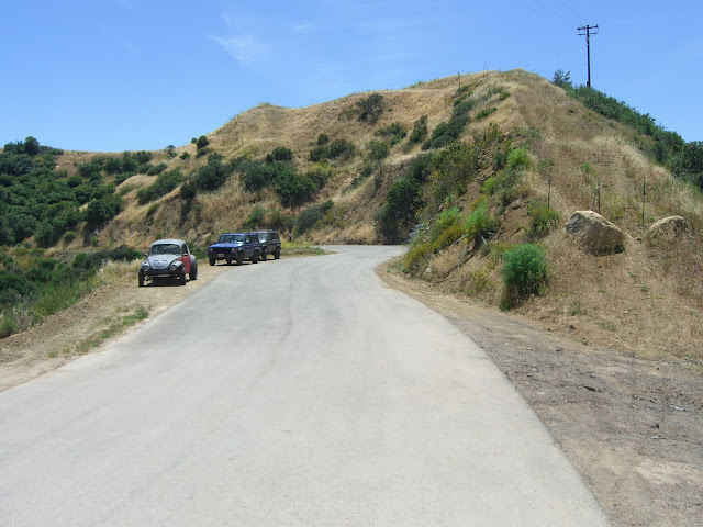
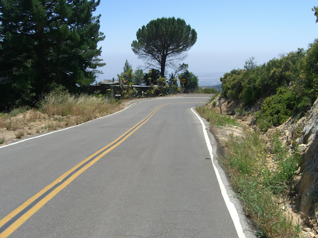
If you make it this far and hit the intersection with E Camino Cielo, congratulations! Gibraltar is by no means an easy climb and you should pat yourself on the back for having completed it. Or, if patting yourself on the back feeds your ego too much, you can go and reward yourself with a beer at Hollister Brewing Company. You have, at the very least, earned yourself that. By the way, Hollister makes some astounding IPAs if you like your beers bitter. I jump ahead of myself though. You do still have some more riding to do. Thankfully, this is easy compared to what was just completed.
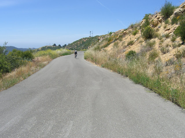
This next section is optional, but highly recommended. Turn sharp right onto East Camino Cielo and climb (at a much easier grade) for less than 1 mile through some gorgeous scenery:
 |
| From 2010-05-31 – Santa Barbara – Gibraltar Road & E Camino Cielo Cycling |
Nice views of the section of Gibraltar that you just suffered through:
 |
| From HQ Panoramas |
Again, click on image for larger size.
As you approach the final eastern viewpoint on this ride you are greeted by a seriously beautiful section of road:
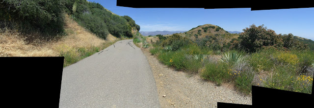 |
| From HQ Panoramas |
This one is definitely worth clicking on for the higher res version. Downloading it will get you the 7122×2466 pixel original – quite nice if I do say so myself.
This quickly leads to your inland vantage point:
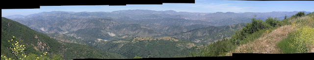 |
| From HQ Panoramas |
Such incredible mountains! And yes, again, click on that for the bigger version. At this point you can continue along Camino Cielo. This will give you about 6 miles of rolling hills that generally tilt downwards. To be honest, I haven’t ridden most of this section, but I plan to at some point. It is supposed to be nice. Up to you if you want to add this on to your ride!
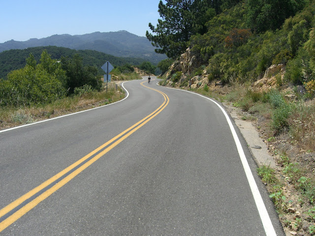
Anyway, head back west and you quickly come back down to the intersection of Camino Cielo and Gibraltar. Continue descending west along Camino Cielo and enjoy the fact that you are descending. Sadly, this doesn’t last all that long and you climb again:
 |
| From 2010-05-31 – Santa Barbara – Gibraltar Road & E Camino Cielo Cycling |
 |
| From 2010-05-31 – Santa Barbara – Gibraltar Road & E Camino Cielo Cycling |
 |
| From 2010-05-31 – Santa Barbara – Gibraltar Road & E Camino Cielo Cycling |
Fighting their way up the last section to La Cumbre Peak:
 |
| From 2010-05-31 – Santa Barbara – Gibraltar Road & E Camino Cielo Cycling |
Almost there:
 |
| From 2010-05-31 – Santa Barbara – Gibraltar Road & E Camino Cielo Cycling |
La Cumbre Peak:
 |
| From 2010-05-31 – Santa Barbara – Gibraltar Road & E Camino Cielo Cycling |
La Cumbre Peak tops out at 3,995 feet and offers some nice views:
 |
| From 2010-05-31 – Santa Barbara – Gibraltar Road & E Camino Cielo Cycling |
And one happy cyclist for having completed the climb:
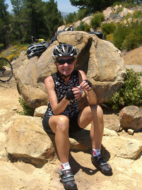 |
| From 2010-05-31 – Santa Barbara – Gibraltar Road & E Camino Cielo Cycling |
Leaving La Cumbre, a quick descent followed by a quick ascent:
 |
| From 2010-05-31 – Santa Barbara – Gibraltar Road & E Camino Cielo Cycling |
Top of this ascent:
 |
| From 2010-05-31 – Santa Barbara – Gibraltar Road & E Camino Cielo Cycling |
Finally, time to really start descending:
 |
| From 2010-05-31 – Santa Barbara – Gibraltar Road & E Camino Cielo Cycling |
 |
| From 2010-05-31 – Santa Barbara – Gibraltar Road & E Camino Cielo Cycling |
You’ll pass a shooting range after a little while:
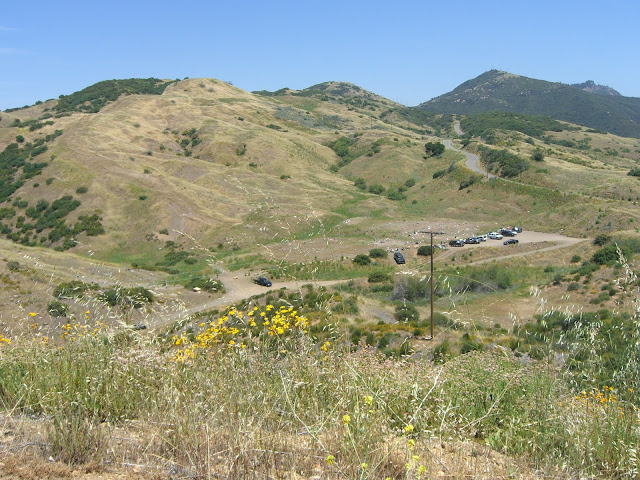 |
| From 2010-05-31 – Santa Barbara – Gibraltar Road & E Camino Cielo Cycling |
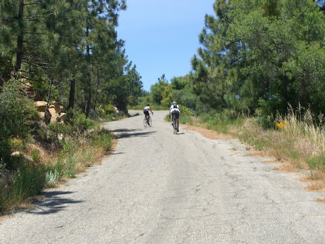
And you’ll also get your last climb here:
 |
| From 2010-05-31 – Santa Barbara – Gibraltar Road & E Camino Cielo Cycling |
 |
| From 2010-05-31 – Santa Barbara – Gibraltar Road & E Camino Cielo Cycling |
Of course, when you are climbing through scenery like that, the climbing suddenly doesn’t seem so bad.
 |
| From 2010-05-31 – Santa Barbara – Gibraltar Road & E Camino Cielo Cycling |
It would seem someone landscaped this section:
 |
| From 2010-05-31 – Santa Barbara – Gibraltar Road & E Camino Cielo Cycling |
Nature can be pretty cool.
Almost to the top of this climb:
 |
| From 2010-05-31 – Santa Barbara – Gibraltar Road & E Camino Cielo Cycling |
 |
| From 2010-05-31 – Santa Barbara – Gibraltar Road & E Camino Cielo Cycling |
Just after starting the descent:
 |
| From 2010-05-31 – Santa Barbara – Gibraltar Road & E Camino Cielo Cycling |
Seriously. Could this be a nicer descent?
 |
| From 2010-05-31 – Santa Barbara – Gibraltar Road & E Camino Cielo Cycling |
Maybe, but this is pretty tough to beat. A flat section along the descent:
 |
| From 2010-05-31 – Santa Barbara – Gibraltar Road & E Camino Cielo Cycling |
People parked for Knapp’s Castle:
 |
| From 2010-05-31 – Santa Barbara – Gibraltar Road & E Camino Cielo Cycling |
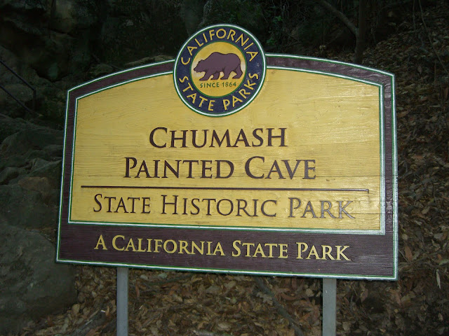
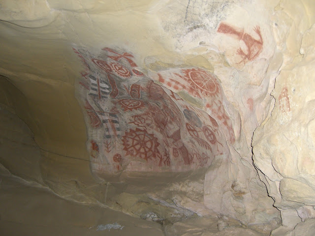
Knapp’s Castle is definitely worth checking out. From this parking area it is a very short hike to the remains of the residence. Knapp’s Castle was built in the early 1900s but was destroyed by wildfire in 1940. See the wikipedia page for more information and some pictures. A few miles more and you will come to the junction of E Camino Cielo and Painted Cave Road. The most common route is to descend down Painted Cave and connect directly to Old San Marcos. While this is an interesting descent as you can stop by at Painted Cave State Historic Park:
 |
| From 2009-12-25 – Goleta – Christmas – Old San Marcos & Painted Cave Cycling |
 |
| From 2009-12-25 – Goleta – Christmas – Old San Marcos & Painted Cave Cycling |
and you can get a few fun turns in:
 |
| From 2010-02-12 – Santa Barbara – Gibraltar Road Cycling |
I would recommend considering skipping Painted Cave (although I highly recommend it for ascending as it is a very tough climb). Skipping it is as easy as continuing on E Camino Cielo at the intersection with Painted Cave. This is actually a really fun descent – while Painted Cave is mostly in poor condition with regards to paving, most of Camino Cielo from here to 154 is either very freshly paved or semi-recently paved. This makes for a wonderful descent:
 |
| From 2010-05-31 – Santa Barbara – Gibraltar Road & E Camino Cielo Cycling |
 |
| From 2010-05-31 – Santa Barbara – Gibraltar Road & E Camino Cielo Cycling |
Nice:
 |
| From 2010-05-31 – Santa Barbara – Gibraltar Road & E Camino Cielo Cycling |
 |
| From 2010-05-31 – Santa Barbara – Gibraltar Road & E Camino Cielo Cycling |
Seriously. That is beautiful.
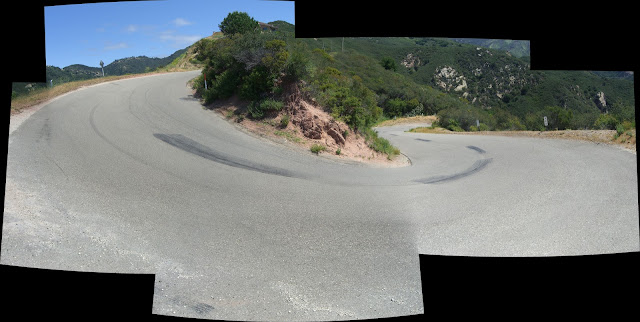
The one tight switchback on this descent:
 |
| From HQ Panoramas |
(Again, click for a bigger version). Aside from this switchback and 1 or 2 other turns, you don’t even need to hit your brakes on this descent. Great pavement, sweeping turns, pleasant grade – perfect recipe for a great descent. Honestly, this was way more fun than descending down Painted Cave. While I don’t mind Painted Cave, it does involve lots of horrible paving (tons of bumps and potholes) and lots of braking (super steep and tight curves). If you do Painted Cave, be careful – brake fade is an issue. Otherwise, enjoy the rest of the descent to 154:
 |
| From 2010-05-31 – Santa Barbara – Gibraltar Road & E Camino Cielo Cycling |
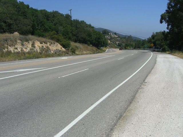
Turn left and descend for a couple of miles until turning right onto Old San Marcos Pass Road. This section along 154 will be filled with high speed traffic (50+ mph) but can be fun as it is not hard to break 40mph. Once you turn onto Old San Marcos you will have a most excellent descent. The first part is rather steep and will require some braking for the switchbacks:
 |
| From HQ Panoramas |
But is quite beautiful:
 |
| From 2010-05-09 – 1 – Old San Marcos Pass Cycling |
After descending the two tight switchbacks, the rest of the descent is fast, fun and scenic…and requires very little braking once you get to know the curves. Averaging 30mph down (even with the slower top section) is definitely doable – and really, really fun. Also, near the bottom, pedal a bit and you will break 40mph. This is one awesome descent with a road surface in almost perfect condition (the biggest problem is the occasional spot of road debris – small pebbles/rocks and the like – just keep an eye out for those rare sections). By the way, the last mile can absolutely be done at a minimum speed of 35mph. Enjoy.
Once you run out your awesome descent, turn left onto Cathedral Oaks and pedal a quarter of mile back to Tuckers Grove Park and complete your ride. And yeah, go and treat yourself to a burger, fries and beer at Hollister as you have earned it. If you don’t care about the beer, The Habit in old town Goleta makes some awesome chili burgers (and is much cheaper than Hollister).
Here is the full route map for this ride:
And here is the route map for the Gibraltar climb section:
Check out the elevation profile on that one – the Gibraltar section averages about 7.5%. Not bad considering it only gets progressively harder the further you go up!
Cheers!
The Discussion
see what everyone is saying
[…] area (6-8k+ for some), they do provide for some very stout climbing. Old San Marcos/Painted Cave, Gibraltar and Figueroa Mountain are three of the toughest, most scenic climbs around. Refugio Road ranks […]
I haven’t done Gibraltar yet. I’ve done Old San Marcos and Painted Cave. I met a bicyclist yesterday on the Pass, her name is Madeline. SHe called me The Turtle ‘cuz I am slow but steady.
Hi turtle and welcome to Tough Ascent! Slow and steady is better than blowing up before you get to the top of the climb, so no shame in going slow. For me, sometimes I like to hammer up a climb. Other times, it is nice to take it slow and just enjoy the scenery as the elevation numbers tick upwards. Anyway, I hope you get a chance to try Gibraltar soon before it gets really hot and before all the green disappears.
Absolutely nothing wrong with slow and steady. Not only do you get there, but you get to enjoy the scenery along the way!
One day maybe I too can do that ride….very impressive Carmen!
Love your photos. When I lived in Santa Barbara, Gibraltar was absolutely my favorite ride. I now live in Ojai and climb to Rose Valley or Lake Casitas. Yesterday, I stumbled upon Sulphur Mountain Road! I had no idea what I had gotten myself into, but managed to claw my way up. I was going slow enough that a cloud of gnats tormented me the entire climb. I found your site looking up that ride today. What a great site with excellent information, photos, maps, etc. Thanks for collecting the info for these rides. See you on the road!
Gibraltar is an amazing climb. Sulphur Mountain is quite the unknown climb it would seem. And, given the grade, it is a rather slow climb. Great climb though. Glad you enjoyed reading through my ride reports. Happy riding!
Given what Carmen has said about you, I’m sure you could get up to that level in no time.
Just did this one. Much better than going down Gibraltar! Nice ride and thanks again for the info.
Just rode this today and linked our blog viewers to you as you can see here
http://cycleitalia.blogspot.com/2013/01/still-in-southern-california.html
Nice blog by the way!
Snow on La Cumbre! Nice. Glad you enjoy the blog!
[…] as well. A day such as this happened last week when I set out to ride to Santa Barbara and climb Gibraltar – a popular climb in the area at an average of 8% over […]
[…] as well. A day such as this happened last week when I set out to ride to Santa Barbara and climb Gibraltar – a popular climb in the area with an average of 8% over […]
It is still an awesome climb!
Hi! Thanks for the great description. We have heard about this climb and eager to do it. We are on a road trip with our road bikes. Any idea where we might find a camping spot or even just an overnight parking spot near this climb? (We are in a small 19foot 4×4 camper and do not require any amenities. Just a spot to park so that we can relax for the night after doing the climb.)
Thanks!
Lesley
If you are coming from the north there is camping at state beaches along the coast-Gaviota, Refugio and El Capitan. South of SB is Emma Wood State Beach in Ventura and Carpinteria state beach. Enjoy the ride!
Whilst over in the States for a couple of weeks on business I Rode up Gibraltar Rd yesterday after reading this informative post. Thought you might like to know that 3/4 of the climb has been resurfaced. It’s like a carpet now In comparison to what was there before from what I understand. The locals told me this was completed a couple of months back. I really enjoyed enjoyed the ride and my coffee in the Handlebar Cafe in down town Santa Barbara afterwards.
I am considering doing the Santa Barbara Century this year which includes this climb I think (?). I did the Temecula century last year, which was a little more overall elevation gain but nothing like Gibraltar road. I am looking for opinions on whether or not I have enough time to train to finish this climb. I’m not looking to break any records, but I haven’t been on the bike more than 2 days per week lately. If I stepped it up in the next few weeks, would I be ready?
Great write up, I’m looking forward to doing this climb.
Are there any places I can stop along, or before, the climb to refill my water bottles? I’ve been trying to find water stations along popular cycling routes using Google, but have had absolutely no luck so far. Maybe I’m using the wrong keywords. Thanks in advance!
For T-Bird:
Gibraltar Rd (and Camino Cielo for that matter) does not have any water fountains/spigots.
However, if you descend Painted Cave Road, then before you descend through some switchbacks, you should be able to find a water spigot at the corner with a little Painted Cave residential road on the right (Manzanita Dr, I believe) where you can refill your bottle.
Otherwise, you will not find any water anywhere along the ridge. (Bring at least two bottles on a hot day.) Good luck!
I am driving to LA this weekend from the Bay Area and looking at stopping in SB for a workout and want to do this climb. Are there any road changes after this winter that I should know?
Awesome to find this page so rich of information since Im planning to ride Gibraltar next week! I was wondering if anyone could post the strava route here.
Thanks folks!