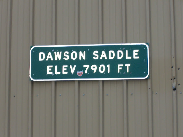
CA-39 (aka Hwy 39 or San Gabriel Canyon Rd or CA State Route 39) Climb to Angeles Crest and Dawson Saddle (at 7901 ft!)
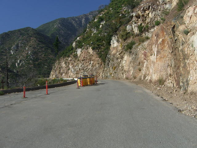
Posted: June 14, 2010 at 5:27 am | Tags: Angeles Crest Hwy, CA-39, Dawson Saddle, Hwy 39, Islip Saddle, San Gabriel Canyon Rd, SR-39Note: As of March 2014 a rock and mud debris field is covering 39 a few miles south of Angeles Crest at Snow Spring:
The above is a 360 degree photo sphere – drag it around to see all of the scene. If anyone rides 39 and finds that this debris field has been cleared, please do leave a comment!
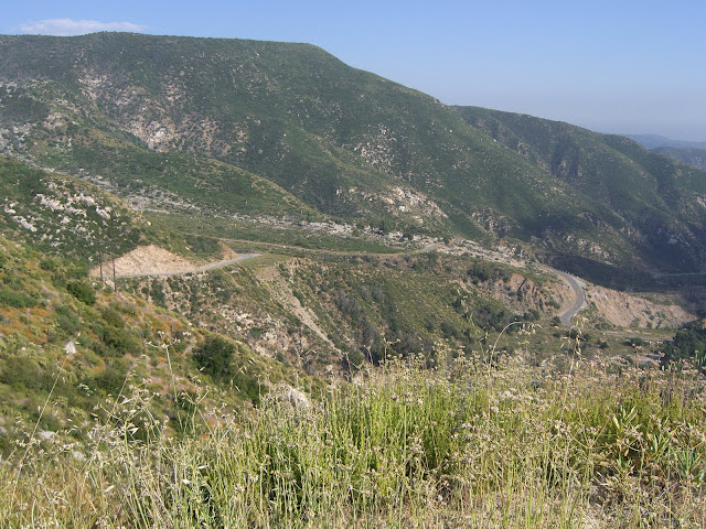
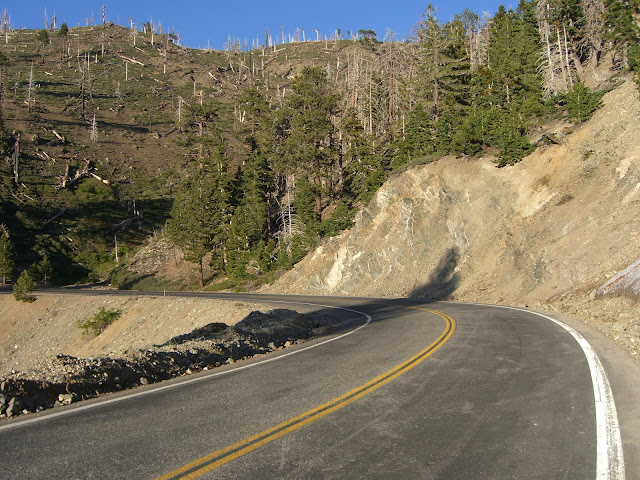
This climb is one of the best sustained climbs in southern California. Starting from 1600 feet elevation, 39 climbs continuously to its high point where it intersects with Angeles Crest Highway at an elevation of 6800 feet. From here, the climb continues up Angeles Crest to its high point at Dawson Saddle – elevation 7901 feet! Yes, that’s right – about 6300 feet of climbing without a single descent. In southern California, no less.
Actually, in the interest of technical accuracy, there are a couple of descents tilting just barely down that do last for a couple dozen feet. For all intents and purposes though, there are no descents for this 22.5 mile long climb. The whole climb averages just over 5.3%, with the majority section along 39 averaging about 5.6%. There is nothing here that is tough with respect to grade – it is only tough because of the rather large amount of climbing involved.
This alone should be enough to entice those riders who enjoy long, sustained climbs. If not though, there are two other good reasons to try this out. First, it is very scenic – especially late spring/early summer when the mountains are nice and green (this year was probably particularly good since we had a fair amount of precipitation). Second, most of this climb is free from traffic. Yes, all traffic. Due to road damage higher up, most of the road is completely closed to vehicles. Of course, this means, for most of the climb, you are entirely isolated from civilization. Bring more water/nutrition than usual to be safe (a camelback is not a bad idea for this ride). A riding partner would also be a good idea. This situation may change relatively soon though. Word is the road to Crystal Lake, at the very least, is hoped to be opened sometime later this summer. When that happens, there will likely be a snack bar open at Crystal Lake itself, so you will have access to water and food there. For now though, err on the side of caution and pack extras.
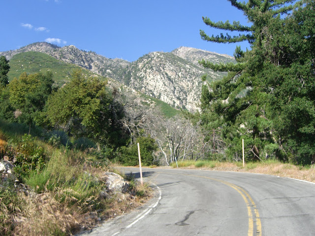
This time, I parked just above the OHV area along 39 – about 10 miles north of Azusa. You can also park in Azusa and add those 10 miles to your ride. The 10 mile stretch is scenic, rolling hills that gradually climb upwards (starting elevation ~800ft, finishing elevation ~1600ft). You get nice views of Morris Reservoir and San Gabriel Reservoir along the way, including ~1 mile long descents next to each one. However, traffic is heavy (especially on weekends) along these sections and the shoulder is often narrow, so I find it to be not so pleasant. I rode this section the first time I did this climb, and would still semi-recommend it as the scenery is pretty cool. However, if you want to skip this warm-up and start right at the point that the traffic dies down and the climb actually starts in earnest, park where I parked. There are a couple of large parking areas right after the OHV area. They are easy to spot – right after the OHV area and the first true parking lots that you see. There are a few lots – all right below and above West Fork (West Fork, by the way, is a paved road that is also closed to vehicles and is a popular hiking and cycling road…about 15 miles round trip for that section…I haven’t tried it but plan on adding it in next time). On this Sunday, there were probably a hundred or so cars parked around this area – quite popular! Note that you will need a Forest Service Adventure Pass to park anywhere around here – $5 for a day pass and $30 for an annual pass. Worth the money, in my opinion, to support areas like this.
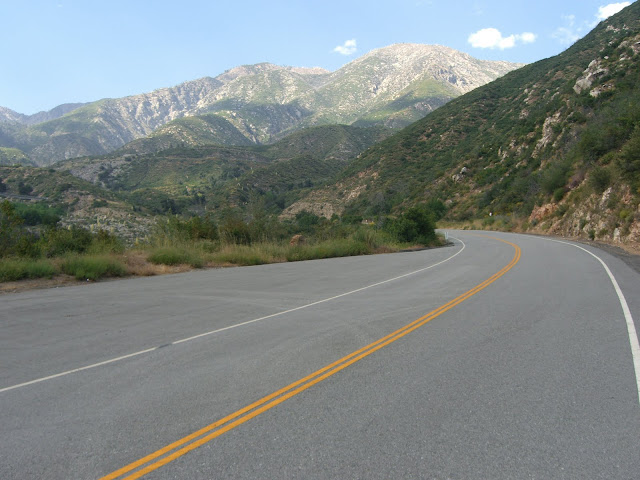
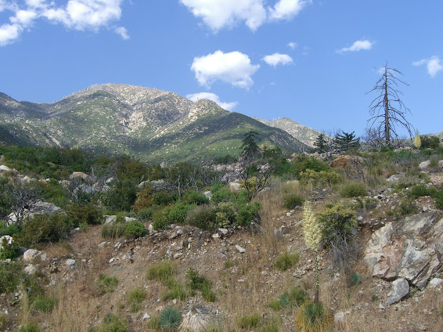
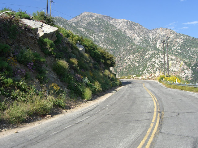
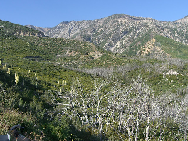
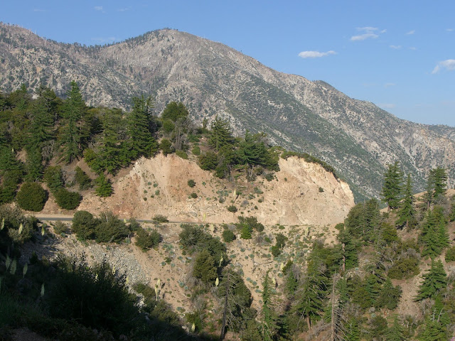
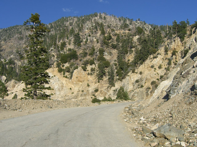
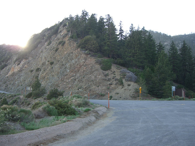
Starting from this parking area, the scenery is immediately beautiful:
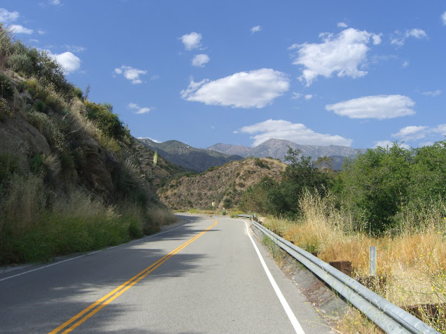 |
| From 2010-06-13 – San Gabriel Mountains Cycling – CA-39 to Dawson Saddle |
Cloud cover provided shade for much of the first part of the climb (nice to have given an 80 degree starting temperature):
 |
| From 2010-06-13 – San Gabriel Mountains Cycling – CA-39 to Dawson Saddle |
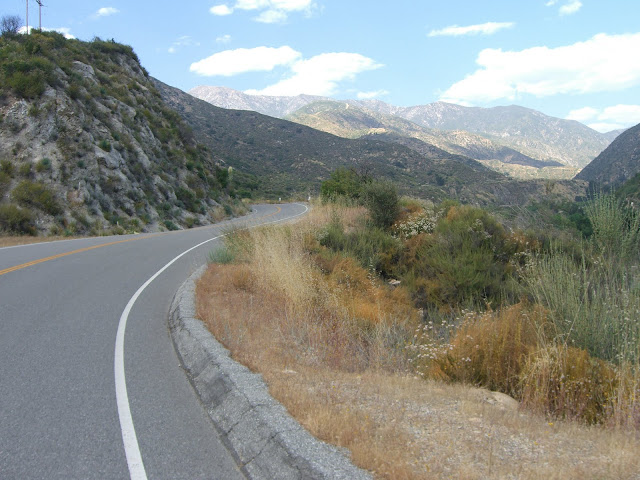
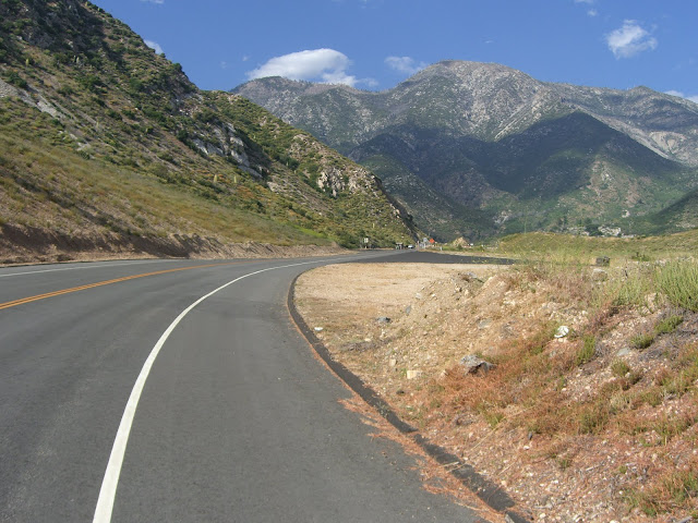
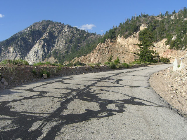
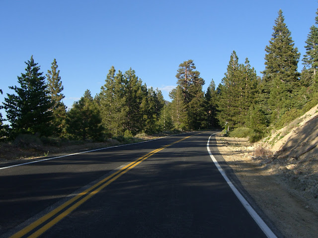
There are a few stretches that stay straight as an arrow for longer than expected given the ruggedness of the mountains:
 |
| From 2010-06-13 – San Gabriel Mountains Cycling – CA-39 to Dawson Saddle |
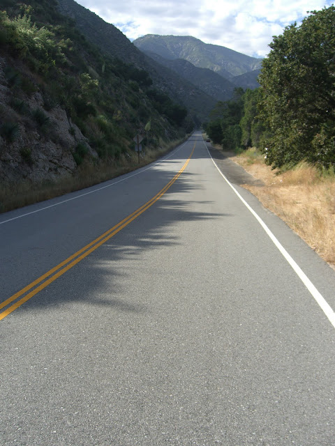
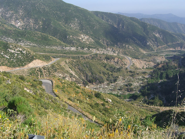
Looking up the canyon:
 |
| From 2010-06-13 – San Gabriel Mountains Cycling – CA-39 to Dawson Saddle |
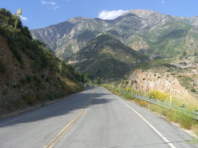
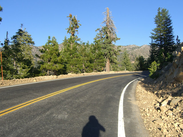
Beautiful pavement here:
 |
| From 2010-06-13 – San Gabriel Mountains Cycling – CA-39 to Dawson Saddle |
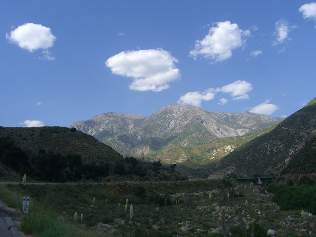
Truly a beautiful valley:
 |
| From 2010-06-13 – San Gabriel Mountains Cycling – CA-39 to Dawson Saddle |
Right after the last shot:
 |
| From 2010-06-13 – San Gabriel Mountains Cycling – CA-39 to Dawson Saddle |
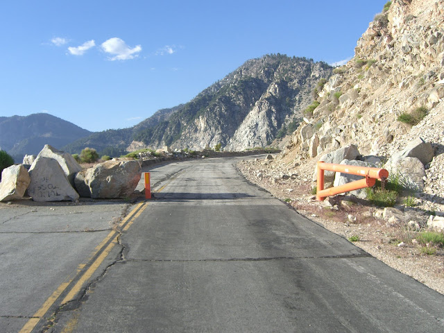
Talk about a scenic backdrop for this road! Even better, the permanent closure for cars is just slightly ahead. The previous section is also often closed to cars – but, at least on this June Sunday, was open to cars (although the traffic level was very light). Just after the gate that closes the road to vehicles (duck under or around with your bike):
 |
| From 2010-06-13 – San Gabriel Mountains Cycling – CA-39 to Dawson Saddle |
Amazing. A road like this, in scenery like this, all to your self.
 |
| From 2010-06-13 – San Gabriel Mountains Cycling – CA-39 to Dawson Saddle |
 |
| From 2010-06-13 – San Gabriel Mountains Cycling – CA-39 to Dawson Saddle |
What a road!
 |
| From 2010-06-13 – San Gabriel Mountains Cycling – CA-39 to Dawson Saddle |
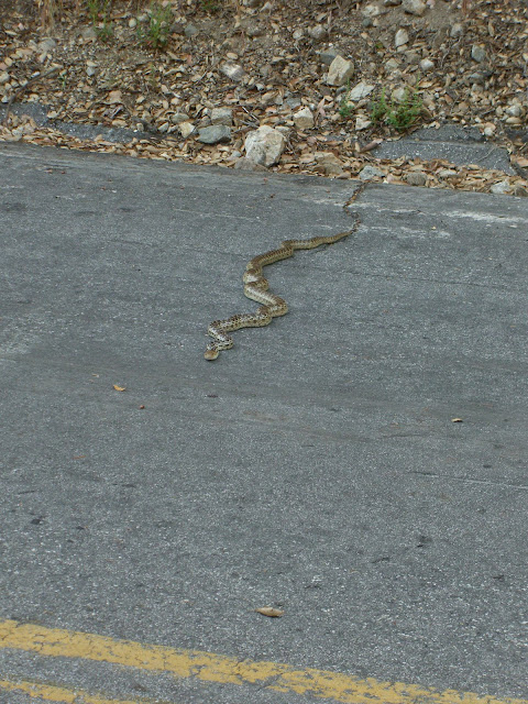
Oh, I should mention my rattlesnake encounter. Just a bit before the above shot, I was merrily enjoying the scenery while slowly climbing when, somehow, I entirely missed noticing a snake on the side of the road. I’d like to note that, normally, I have a good eye for noticing most anything on a road. Distraction? Blending into the side of the road? Probably a combination of the two. Anyway, I finally did notice the snake. A scary hissing sound right next to you will make you notice a snake really, really quickly. In this next second, I realized three things. One, this snake was no more than two feet from me. Two, this snake had raised its head about 6 inches above the ground while hissing (apparently getting ready for an offensive attack to defend itself). Three, this snake was a rattlesnake (!). This combination is a really effective way to get your adrenaline pumping. From reading about 39 some more, it would seem that rattlesnakes are pretty common to the area. Keep your eyes open. Also, if near Crystal Lake, watch out for bears. Bears, apparently, like the Crystal Lake area and a few cyclists have spotted them around there. The bears are timid, generally speaking, and run away. However, you should still keep an eye out and keep your distance if you happen to spot one (and, of the couple times I have been up, I have not seen any).
Anyway, a bit farther:
 |
| From 2010-06-13 – San Gabriel Mountains Cycling – CA-39 to Dawson Saddle |
Love the green on the mountains:
 |
| From 2010-06-13 – San Gabriel Mountains Cycling – CA-39 to Dawson Saddle |
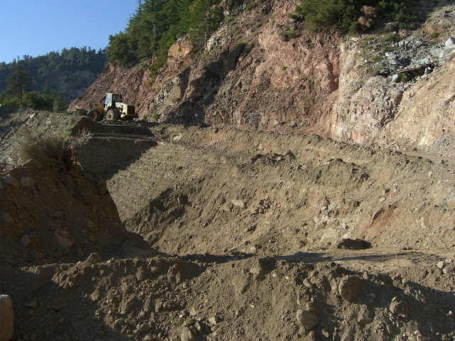
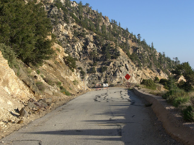
Just above 3600 ft elevation, some road construction to fix washed out sections:
 |
| From 2010-06-13 – San Gabriel Mountains Cycling – CA-39 to Dawson Saddle |
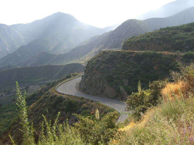
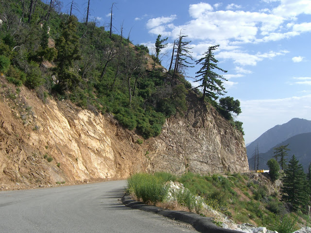
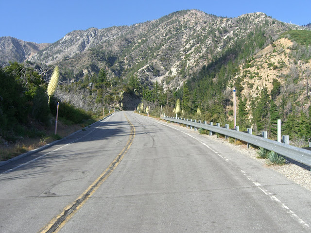
This is the point at which the road really starts getting incredible as it starts cutting directly into the rocky hillside:
 |
| From 2010-06-13 – San Gabriel Mountains Cycling – CA-39 to Dawson Saddle |
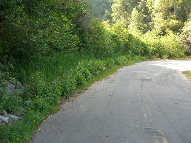
One beautifully green section:
 |
| From 2010-06-13 – San Gabriel Mountains Cycling – CA-39 to Dawson Saddle |
 |
| From 2010-06-13 – San Gabriel Mountains Cycling – CA-39 to Dawson Saddle |
Why so green? A stream flows through here. Lots of wildlife as well, including this squirrel:
And this awesome, long, fat snake:
 |
| From 2010-06-13 – San Gabriel Mountains Cycling – CA-39 to Dawson Saddle |
Click for a larger version of that already large snake.
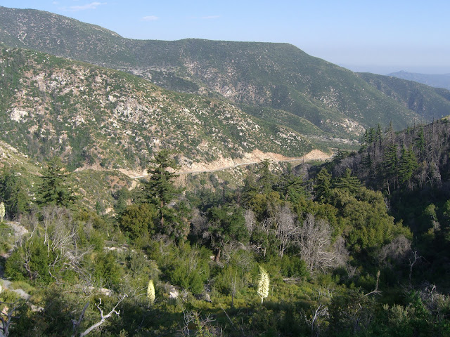
A little bit farther and the views back down the canyon open up:
 |
| From 2010-06-13 – San Gabriel Mountains Cycling – CA-39 to Dawson Saddle |
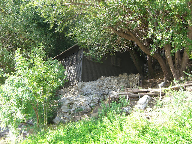
There are even a few houses along this road (they get a key that unlocks the gate lower down the road):
 |
| From 2010-06-13 – San Gabriel Mountains Cycling – CA-39 to Dawson Saddle |
 |
| From 2010-06-13 – San Gabriel Mountains Cycling – CA-39 to Dawson Saddle |
That would be quite a different place to live. Just up from that house, you get an incredible view of the road you just climbed:
 |
| From 2010-06-13 – San Gabriel Mountains Cycling – CA-39 to Dawson Saddle |
The shot above deserves a full-size view. Click it on it for said full-size view.
Nice greenery and color along the road:
 |
| From 2010-06-13 – San Gabriel Mountains Cycling – CA-39 to Dawson Saddle |
And a spectacular view of much of what you just climbed:
 |
| From 2010-06-13 – San Gabriel Mountains Cycling – CA-39 to Dawson Saddle |
That one is worthy of clicking on for a larger view.
Continuing on up (and up, up and up…), the mountains are still rather green:
 |
| From 2010-06-13 – San Gabriel Mountains Cycling – CA-39 to Dawson Saddle |
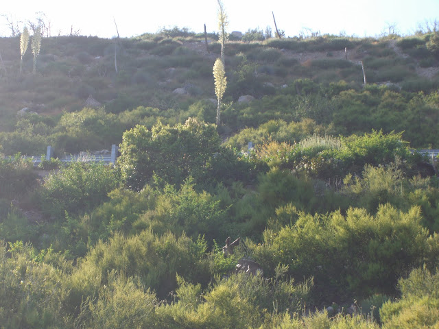
Again, lots of wildlife along the ride:
 |
| From 2010-06-13 – San Gabriel Mountains Cycling – CA-39 to Dawson Saddle |
Look down in that shot for the deer. That cute deer followed my route for a little while. Cool to have for climbing. Scary for descending.
Some larger trees start presenting themselves:
 |
| From 2010-06-13 – San Gabriel Mountains Cycling – CA-39 to Dawson Saddle |
Another incredible view back along 39:
 |
| From 2010-06-13 – San Gabriel Mountains Cycling – CA-39 to Dawson Saddle |
Seriously?
 |
| From 2010-06-13 – San Gabriel Mountains Cycling – CA-39 to Dawson Saddle |
 |
| From 2010-06-13 – San Gabriel Mountains Cycling – CA-39 to Dawson Saddle |
 |
| From 2010-06-13 – San Gabriel Mountains Cycling – CA-39 to Dawson Saddle |
 |
| From 2010-06-13 – San Gabriel Mountains Cycling – CA-39 to Dawson Saddle |
Southern California, not a single car and scenery like that? Wow.
Yay, 5000 feet!
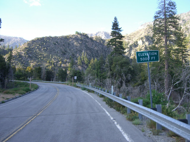 |
| From 2010-06-13 – San Gabriel Mountains Cycling – CA-39 to Dawson Saddle |
And right after, the turnoff for Crystal Lake itself:
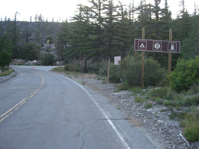 |
| From 2010-06-13 – San Gabriel Mountains Cycling – CA-39 to Dawson Saddle |
You can add to your climbing and climb to Crystal Lake itself. It appears to be about 1 mile of riding to the lake from the junction at 39 at just under a 7% grade. This road that takes you to the lake also appears to continue on for almost 2 miles beyond the lake – at a similar grade. I’ve yet to do this offshoot climb, but plan on trying it next time out. And, of course, if the state opens the road to Crystal Lake later this summer..and if the snack shop opens at Crystal Lake.. this would be a highly recommended add-on for the simple fact that you will be able refuel and rehydrate at this point. Anyway, we’ll see if these plans actually come to fruition. In the meantime, this is a nice way to add a bit of climbing to your ride.
A little farther on, looking back on the great climbing:
 |
| From 2010-06-13 – San Gabriel Mountains Cycling – CA-39 to Dawson Saddle |
Some beautiful color on the hills:
 |
| From 2010-06-13 – San Gabriel Mountains Cycling – CA-39 to Dawson Saddle |
Click for a larger image to appreciate the color.
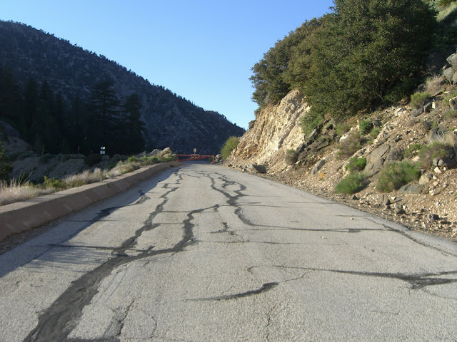
And…(drum-roll please)…the start of the truly sucky section:
 |
| From 2010-06-13 – San Gabriel Mountains Cycling – CA-39 to Dawson Saddle |
And by sucky, I am referring to the road quality. The grade is no worse (and actually lessens up near the end), but the asphalt from here to the intersection with Angeles Crest Hwy (CA State Route 2) is riddled with rough tarmac thanks to the constantly eroding hillside. Despite the valiant efforts of CalTrans and contractors, the sheer hillsides along the road keep dropping rocks and boulders onto this incredible stretch of roadway. As a result, you can expect lots of small rocks and gravel to be present on the road itself, along with some larger rocks and some impressive divots from massive boulders. Ascending, this is not too much of a problem. Descending, however, requires that you pay a lot of attention to the road.
Despite the road conditions, the beauty is still hard to beat:
 |
| From 2010-06-13 – San Gabriel Mountains Cycling – CA-39 to Dawson Saddle |
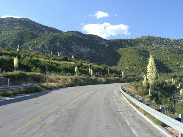
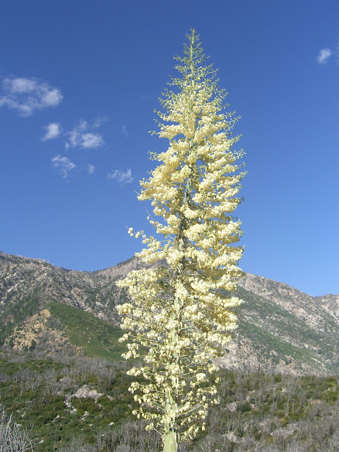
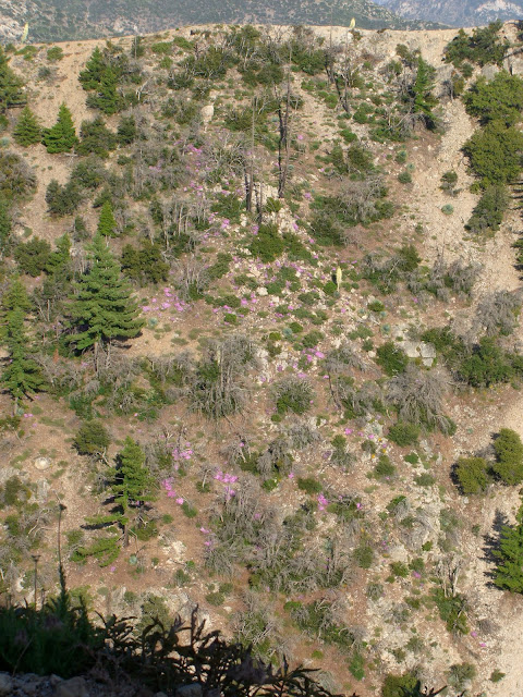
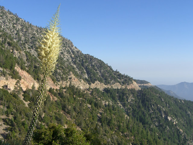
Flowers sprouting from the boulders:
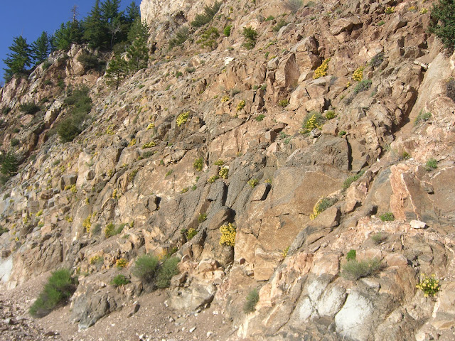 |
| From 2010-06-13 – San Gabriel Mountains Cycling – CA-39 to Dawson Saddle |
As though this would stop me (especially this far up!):
 |
| From 2010-06-13 – San Gabriel Mountains Cycling – CA-39 to Dawson Saddle |
Of course, with scenery like this:
 |
| From 2010-06-13 – San Gabriel Mountains Cycling – CA-39 to Dawson Saddle |
Can you blame me?
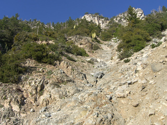
This next section is even more rugged. The rock walls you pass are breathtaking and intimidating:
 |
| From 2010-06-13 – San Gabriel Mountains Cycling – CA-39 to Dawson Saddle |
Yes, that is a massive boulder that ended up to the left of the road. So yeah, don’t climb this road during or right after storms. Thanks.
There is some serious construction going on to shore up this section of the road (many sections were washed out by storms in the last few years). As such, you will see some heavy equipment along here:
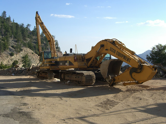 |
| From 2010-06-13 – San Gabriel Mountains Cycling – CA-39 to Dawson Saddle |
Seems to be a piece of the road missing…
 |
| From 2010-06-13 – San Gabriel Mountains Cycling – CA-39 to Dawson Saddle |
Looking up right at this point:
 |
| From 2010-06-13 – San Gabriel Mountains Cycling – CA-39 to Dawson Saddle |
Ok, I can see how water draining down here during storms might just undermine the road. Anyway, yes, you can still go beyond here. It is dirt for about 20 feet, but it is actually ridable..and absolutely passable if you decide to walk it.
After this questionable segment, you are greeted with a most impressive view back:
 |
| From 2010-06-13 – San Gabriel Mountains Cycling – CA-39 to Dawson Saddle |
Nice.
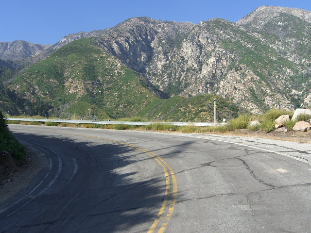
Again, what a seriously impressive road..
 |
| From 2010-06-13 – San Gabriel Mountains Cycling – CA-39 to Dawson Saddle |
A beautiful mini-waterfall along the way:
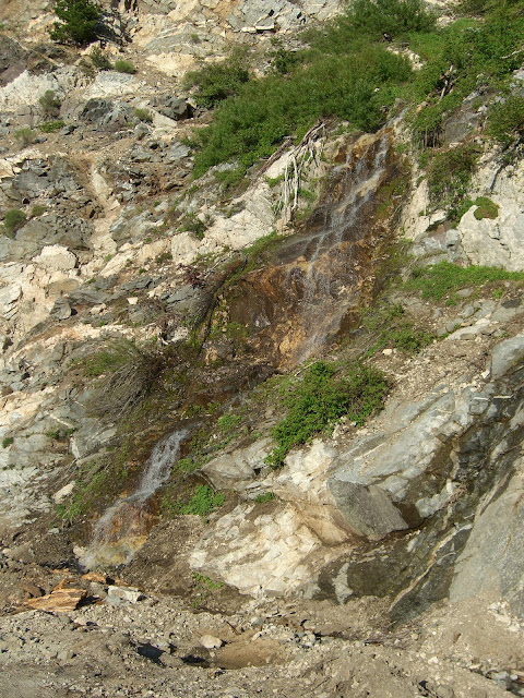 |
| From 2010-06-13 – San Gabriel Mountains Cycling – CA-39 to Dawson Saddle |
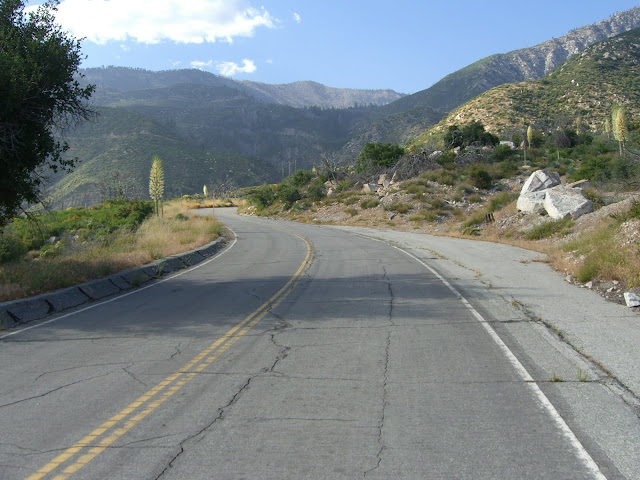
The final stretch to the junction with Angeles Crest Highway:
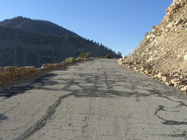 |
| From 2010-06-13 – San Gabriel Mountains Cycling – CA-39 to Dawson Saddle |
Thankfully, you get a break in the last mile or so with a very gentle grade. With the horrible road surface of the last few miles, the climbing you have done already and the miles already ridden, this is a thankful break (despite the fact that, technically, you are still going uphill!).
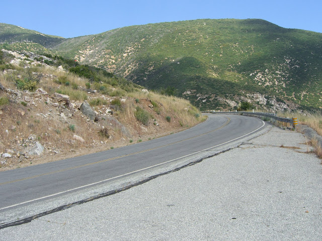
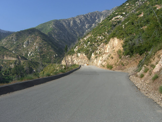
One of the last curves:
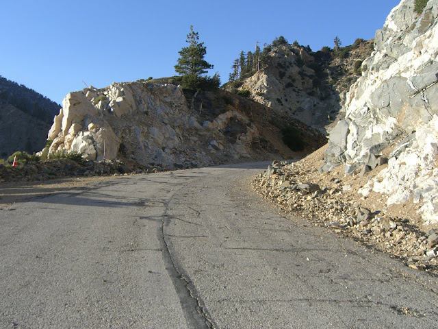 |
| From 2010-06-13 – San Gabriel Mountains Cycling – CA-39 to Dawson Saddle |
Finally!! The last sprint to Angeles Crest!
 |
| From 2010-06-13 – San Gabriel Mountains Cycling – CA-39 to Dawson Saddle |
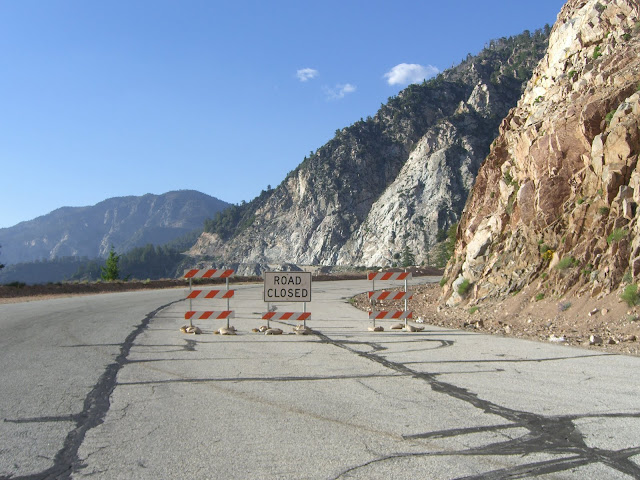
It feels really good to get here. Really good. Last time I rode this (over a year ago), I was thwarted by this:
 |
| From 2009-03-11 – CA-39 (San Gabriel Canyon Rd) North of Azusa Bike Ride |
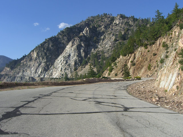
Three months makes a lot of difference:
 |
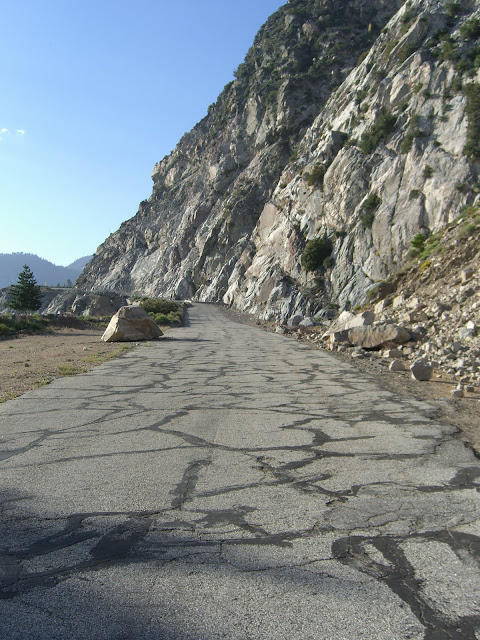
| From 2009-03-11 – CA-39 (San Gabriel Canyon Rd) North of Azusa Bike Ride |
 |
| From 2009-03-11 – CA-39 (San Gabriel Canyon Rd) North of Azusa Bike Ride |
So yeah, don’t expect to make it Angeles Crest in March. June, however, and you should be fine.
Success! Looking back on the road just conquered:
 |
| From 2010-06-13 – San Gabriel Mountains Cycling – CA-39 to Dawson Saddle |
The junction with Angeles Crest:
 |
| From 2010-06-13 – San Gabriel Mountains Cycling – CA-39 to Dawson Saddle |
At this point, I am at about 6800 feet elevation. Starting from 1600 feet, that is not too shabby! However, this time, I was set on doing the full climb (being thwarted by snow and all last time!). Turning right onto Angeles Crest from 39 and I continue climbing immediately:
 |
| From 2010-06-13 – San Gabriel Mountains Cycling – CA-39 to Dawson Saddle |
Thankfully, the scenery is still quite beautiful. Additionally, vehicle traffic is virtually nil. This is at least partially due to the fact that the bottom portion of Angeles Crest above La Cañada Flintridge is still closed due to damage from the last storm season. The minimal traffic that did exist (a number of motorcycles, a couple of performance cars and a few scenery-chasing cars) gave me tons and tons of room – thank you.
More full size trees along this last climb:
 |
| From 2010-06-13 – San Gabriel Mountains Cycling – CA-39 to Dawson Saddle |
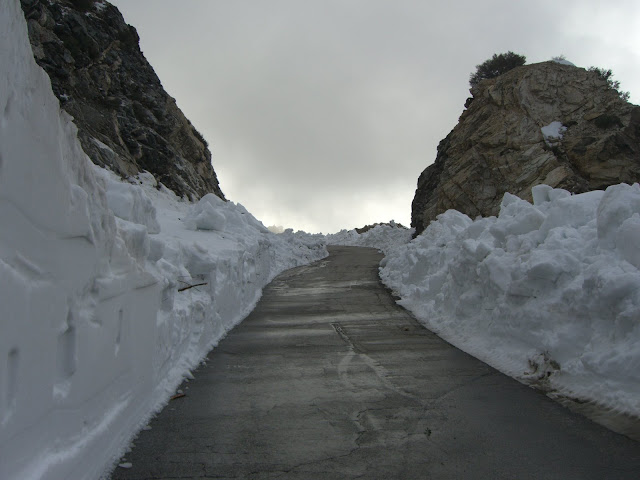
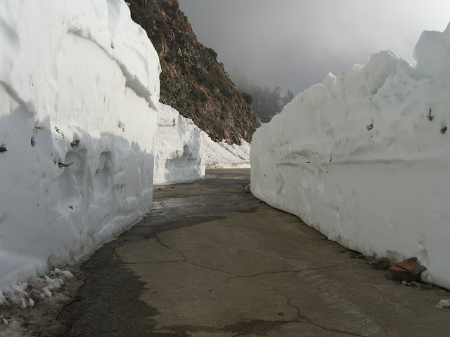
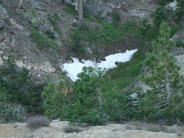
And, finally, the first snow encounter!
 |
| From 2010-06-13 – San Gabriel Mountains Cycling – CA-39 to Dawson Saddle |
Just over 7000 feet in elevation. This is why I love southern California. I can start climbing in 80 degree weather in June, climb 5500 feet without a break, and still find patches of snow. Yeah, in the Sierras, I’m sure this would be a common sight as well. But, seriously, this is right outside of Los Angeles. Pretty cool, in my opinion.
Leading up to the last push to Dawson Saddle:
 |
| From 2010-06-13 – San Gabriel Mountains Cycling – CA-39 to Dawson Saddle |
Success!!
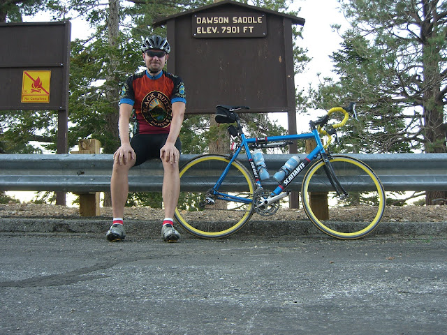 |
| From 2010-06-13 – San Gabriel Mountains Cycling – CA-39 to Dawson Saddle |
 |
| From 2010-06-13 – San Gabriel Mountains Cycling – CA-39 to Dawson Saddle |
I have to say, this ride is incredible. Glendora Mountain Road/Glendora Ridge Road/Mt. Baldy Rd is still my absolute favorite climbing ride in the LA area…but 39 is a close second. 39 is one beautiful ride. If you live around here and haven’t ridden it…go, ride it. Right now. It is an epic ride.
A few mapmyride maps/routes:
From the start of the true climb to Dawson Saddle:
From Azusa, proper:
And the climb from my parking spot to the intersection with Angeles Crest Highway:
Here is the GarminConnect data from the ride:
I will personally certify this as an incredible ride. This is one of the most scenic rides around and probably has the most sustained climbing of any ride in southern California. Glendora Mountain/Glendora Ridge is, in my opinion, a little more scenic. 39, however, is still very scenic – and is free from cars (for most of it) and hits higher elevations. Anyway, both are incredible rides – and both are absolutely worth doing.
Also, much of the descent is great. The stretch along Angeles Crest is smooth and fast. You will be doing 30-40mph here. The top of 39 will suck (lots of small rocks and scarred roadway) – you will have to slow down quite a bit for a number of sections. The middle section of 39 is mostly free of rock debris (but there are a couple of sections to keep your eye on) and is quite fast. Despite the constant creases in the pavement, it is not hard to hit 40 mph in this section. Watch out for a few tighter turns. Finally, the bottom section…perfect pavement. This last section has been recently repaved and is a dream to ride down. You will have no problem maintaining 35+ mph for basically this whole stretch. This stretch is fun. Very fun.
The only word of caution – watch out for wildlife. Deer are common in the area, and you do not want to run into one. Coming down Angeles Crest, sprinting to 40 mph on one section, a lone deer darted across the road ahead of me. While this deer happened to be a few seconds ahead of me, things could have worked out differently (and very damaging) given a slightly different timing. Anyway, watch for deer (and all other wildlife) on your descent. That said, much of this descent is fun, fast and excellent.
Na Zdravi!
-Ryan
The Discussion
see what everyone is saying
great report, on an awesome ride. Definitely on my “to do” list before it gets too hot. thanks for all the info!
Great report! I went up the nice sections of CA 39 with a group of friends about a month ago, but turned around right where the road became crummy.
Your detailed report inspired me to do the entire climb (though starting from Encanto Park) to Dawson Saddle today. It truly is a great and beautiful climb. Coming from the Ventura area, it’s a nice change of pace from the more ‘local’ (Santa Barbara to Santa Monica Mountain climbs. Thank you!
Great story! Thanks to Annette at GMR for pointing this story out.
Hi Rallison
Fantastic pictures with a rich detail of story. I enjoyed reading and admiring the beauty of the San Gabriel mountains. I rode to Islip Saddle in May and I appreciate the detail and rich perspective your report brings.
What camera did you use to take your pictures? Make, model, manufacturer?
Which gates were open/closed? I am wondering if the gate at mile marker 28 a mile or so from West Fork was open?
Thanks for the info!
Email GMR
You better get down here soon and ride this with me!
Hey Brian,
Comments like yours are a big part of the reason I write up these ride reports. These are climbs and roads I love so it is always my hope that my reports will get more people to try some of these adventures.
It really is an amazing climb going all the way up to Dawson Saddle. The top section is rather poor pavement, but the scenery is pretty tough to beat. And, with access to Angeles Crest, there are opportunities for some even more epic rides (say, down Angeles Crest to Red Box, then up Mt. Wilson, then back to 39, for example).
I’m especially glad to hear this inspired you to come out from Ventura as you’ve got some great climbing out there – 33 and 150 right near you, then all the famous Santa Barbara climbs just a short drive/ride up the coast (Gibraltar, Old San Marcos, Painted Cave, Refugio). My parents live up in the Santa Barbara area, so I get the best of both worlds when it comes to cycling. Anyway, glad you enjoyed the ride report!
-Ryan
Thanks for reading the ride report Joe! Speaking of GMR, I also have a ride report on Glendora Mountain Road (including Glendora Ridge Road and Mt. Baldy road) that you can view here. Of course, coming from the GMR blog, that ride report probably won’t provide you with any new information :p
Thanks for reading and thanks for the compliments on the story and pictures! The San Gabriels are incredibly beautiful – rides like 39, Glendora Mountain Road, Glendora Ridge Road and Mt. Baldy Road never cease to amaze. And the hikes can be out of this world – the climb from Mt. Baldy Ski Area Notch to the top of Mt. Baldy has some of the most incredible scenery I’ve seen anywhere. Needless to say, I love the area – and wish I lived closer!
The camera I use is a Casio EX-Z850. Here is an image of the camera:
It is a very slim (fits very easily in a jersey pocket and easily in the front pockets of my jeans, shorts, etc) and durable camera. As you can see from the above image, the casing is very solid and can take some abuse. I’ve shot tens of thousands of photos with it and it has been on many trips to different countries. I’ve abused it a ton and it stills works like a champ. It is now about 4 years old and cost me about $300 when new. Of course, at 4 years old, I am sure there are now better, newer, cheaper options available (on the other hand, the ex-z850 could also probably be picked up cheap if shopping used). Let me know if you have any more camera questions.
On to the gate question. On the Sunday that I did this ride, the gate about a mile above West Fork was open. There was some traffic along here (maybe a vehicle every minute or so). The next gate, a few miles beyond with the restrooms on the left and the large turnaround area was, of course, closed. This is the one with the cement blocks right behind the gate. All gates beyond here were open (as you would expect), except for the final gate at the intersection with Angeles Crest. Hope that answers your questions!
Thanks again for reading!
-Ryan
Glad to have found your blog. I ride Crystal Lake around once a week, to switch it up between GMR and Baldy rides the rest of each week. I ride from Sierra Madre each ride.
Would love to chat up there (I ride a white TIME and have long blonde hair.), so please stop me if you see me. Keep up the blogs, nice to see u and ‘GMR’ updating the ride info. Thanks
I’ll definitely keep an eye out for you when I ride up there. Thanks for reading my blog – glad you enjoy it!
Hi,
I don’t know if you got the note I dropped on this website few days ago — I didn’t hear back so I thought leave a comment here instead.
Just to let you know, I just tried that route you described above yesterday (started at Azusa and tried to travel up to Dawson). Opposite to my expectation, the road is now open and cars are allowed to travel here (and they are travelling fast). Plus, there is a big fat sign at the gate (which is saying that bicycles are prohibited here). I probably would have just ignored the sign if I had the entire road by myself, but with traffic …?
Would be interested in your thoughts… Thanks.
This page encouraged me to skate down the 2 from the Wrightwood direction and down 39! Thank you so much! And thank you Annette as I would not of found this page w.o. your blog!
You must be talking about where the road is open. On 39 from the Ranger station it closes in 15 miles. Or from Eastfork and 39 it closes after 6 miles!
Sweet. Did you really skate all the way down from the 2? That is awesome! A great descent aside from the top section and the creases in the road every 20-30 ft or so.
Sorry Choon, somehow I missed your comment earlier. Anyway, as was mentioned, it is only the first gate that is open (and has been open for a number of months actually). The second gate, a few miles up, is still closed as of at least a couple of weeks ago. This still could change soon as it looks like the Crystal Lake store is getting close to opening, so everybody enjoy this ride while you can still do it without traffic. Although bring some winter clothing as the weather is getting cold up there!
Thanks for this great post, Ryan! I particularly like the pictures with snow.
We will ride Mt. Baldy and Dawson Saddle tomorrow, if the road is passable. We might have to turn around like you had to.
Best,
Bernd
How was the climb today? I want to get up and do 39 again sometime soon, so I’m wondering how far up you can go given the current conditions.
Also, nice blog. Noticed the entry on Mt Lemmon – I want to do that climb eventually – it seems like a great one.
The ride was spectacular! We ended up turning around at Angeles Crest, because we ran out of daylight and it was getting very cold. Here is our route, I will add a post with some pictures in the next week or two: http://maps.google.com/maps?q=http://map.tourofcalifornia.org/gps/san-gabriel-mountains.kmz. 106 miles with 13,800 feet of climbing, according to my Garmin.
39 is still closed and it does not look like it will be opened anytime soon. The road is rideable, if you don’t mind a few short gravel sections. We encountered one icy area where we had to walk our bikes, but there was no snow.
Mt. Lemmon is an awesome climb, you will like it.
Awesome! And nearly 14,000 feet of climbing is a pretty epic day.
Tomorrow looks like it should be a nice day, so I may have to get back out to 39 for another ride up.
A dangerous rockslide on the road towards the heliport today.
Just to let you know that after 9 long years the road to Crystal Lake is repaired and is now open. Cal Trans had a soft opening on 3-21-2011. Snow still on the ground at 6000 and above (roads clear) and the Snack Bar at Crystal Lake is up and going! Spread the word – it is AWESOME.
And yes, it is awesome! Getting a chili dog and fries at the top of this climb is a beautiful thing.
a nice stretch of old road, best left ending at crystal lake if not sooner. if it continues itll cost more stimulus gov, work, no real secluded bike or walking trail, and a whole big mess of more hoodlums, driving and riding and terrorizing the new loops 39 was never meant to create. other than promoting discovery sometimes its best to let others find nature on their own. just another perspective,not so much anti social, just more natural. how you all like me now? hey great a chili dog and fries too.
The very good news is that there can be a remedy – wildcard certificates. You’ll be able to obtain SSL on as many subdomains as you want.
The thing about leaving it closed at Crystal Lake is that it gives Cal Trans the ability to abandon it. Cal Trans does not maintain dead end roads.
Really good post. Really thank you! Excellent.
In 1970 when I was 16 I bought a 10speed bike from the Pep Boys automotive parts store in Pasadena for $50 (the brand was “Sturdee”). I made some sandwiches and got a jug of lemonade and rode to Azusa to pedal up that intriguing twisty road I saw on the map, San Gabriel canyon road. It was awesome and beautiful and eventually I found myself at the junction of the Angeles Crest highway. I went left and rode home to Pasadena, arriving utterly exhausted but inspired about bicycling and slept for 13 hours straight.
I got a better bike (Mondia) and just started pedaling everywhere and rode across the US and back in 73. In 78 I rode up Hwy 39 at night and passed road closure signs which I ignored. Around midnight, I was looking into an abyss where the road used to be; there was no way around that- the mountainside had just fallen away and taken a few hundred yards of roadway with it!
Now I live in Oregon but will be visiting this summer and will bring my folding bike. My plan is to ride up the road from Azusa, then to Mt Wilson via Angeles Crest, and down the Mt Wilson toll road to Altadena. I rode the toll road downhill on a road bike in the 70s with friends and walked it many times. Its a rough dirt track part of the way but mostly rideable.
Looks like Hwy 39 is still officially closed past Crystal lake, although passable on a bike? Thanks for the well written and illustrated report, it brings back lots of good memories.
I’m planning to cycle 39 to Angeles Crest. Is the road passable?
Please post this again, this time using SI units exclusively.
As of March 2014 there is a new rockslide in the uppermost stretch of CA-39 (past the gate blocking the road to car traffic at Crystal Lake), about a mile below the junction with Angeles Crest. It’s 15.0 miles from the West Branch picnic area to the rockslide. The slide is quite large, although I did see an athletic and nimble rider clamber over it with his bike on his shoulder. For ordinary folk it’s the current end of the climb.
Edward, oddly enough, I finally got back out to 39 and cycled it for the first time in months on Saturday and ran into the impressive obstacle. I took a 360 degree photo sphere of the mess and posted it on Google Views: https://www.google.com/maps/views/view/111004183840840391992/photo/UT1oRbyCT94AAAGuwlWL6A
For anyone considering walking through this section, bring your cleat covers!
The debris fields are cleared. The upper portion is the best I’ve seen it in years.
there are new white and black signs posted on the orange gates at tbe road closures which read, “pedestrians, bicycles, and motorized vehicles are prohibited”. The CHP standing in front of the gate today said riding beyond the orange gate is prohibited and violators will receive a 300 dollar fine and a “point on your driving record”. nevertheless, the message was clear they are cracking down and trying to enforce the closure now.
sorry for not clarifying…the two gates I was referring to in my message are 1) at about 1/2 from the crystal lake turn off and 2) at the intersection of the 39 and 2 highways.
Terrific article and pictures. I did the ride from Encanto Park to Crystal Lake last weekend, after reading this article. Fantastic route. Am cursing myself for not doing this route years ago. Am anxious to go all the way to Dawson Saddle on my next outing.
I’m wondering if anyone has an update on the closures and signs as noted back in Sept 2014 by ‘cyclist’.
It’s been 5-6 years since I did this ride from Encanto Park all the way to Dawson Saddle; An amazing ride. I want to do it again this Spring/Summer if possible.
I rode this yesterday (May 30th, 2015). Route was fine. There was one small section (like 20-30 feet) where I had to ride over a bit of gravel but otherwise nothing else other than the typical shitty road conditions from Crystal Lake to ACH. I stopped off at Crystal Lake on the way up and back for refueling. Makes the whole ride doable in 80-90F temperatures. Great pics!
Following up on Shot999’s question:
Loren, or anyone else who’s recently ridden all the way up 39 to Angeles Crest and Dawson – are there still road closure signs and are they enforcing them? I’d like to do this route in a few days. Also curious how much vehicular traffic there is now that the Crystal Lake shop is open. Thanks!
Well I guess it’s open according to this page: http://www.dot.ca.gov/hq/roadinfo/display.php?page=sr39
“Current State Route 39 Conditions
Before driving, check with the Caltrans Highway Information Network (CHIN) 800.427.7623
SR 39
[IN THE SOUTHERN CALIFORNIA AREA]
NO TRAFFIC RESTRICTIONS ARE REPORTED FOR THIS AREA.”
Great write up. Found it while researching the viability of heading up the crest from La Canada/Flintridge then descending down 39. Wondering how the road condition is especially with the heavy rains over the weekend. Might give it a shot this week!
Hi.
Thanks by your pictures, are really great.
I will be in Irvine next week. I bought a road bike there, and want to use it on 39 on september 14 or 15. I hope i can get there early morning and do the ride all over the day, then head to the south to get closer to a friends house.
Do you recommend to a lone rider to carry a back pack with water and food? Its the doubt i have, dont know if i can find convenience stores so i can buy that kind of stuff. I did a google search and nothing appears, only some hotels at the east part of 39.
Update on the signage (having just ridden to Dawson Saddle again today):
The “pedestrians, bicycles, and motorized vehicles are prohibited” sign is on Hwy 39 just above the Crystal Lake turnoff. However, there is no such sign at Hwy 2 (Islip Saddle); just the usual “Road Closed” sign there. I did not see any CHP officers guarding the gates or riding on the gated portion of the road today. However, I may have been lucky today. Any other thoughts?
You are so cool! I do not think I’ve truly read through something like this before.
So nice to discover another person with a few genuine
thoughts on this issue. Really.. thank you for starting
this up. This site is one thing that is required on the web,
someone with a little originality!
What a great ride and what a great description. The pictures are fantastic and together the package is inspirational.
I often visit S.CA. from the Bay Area and spend time on Mt Baldy, Glendora Ridge, Glendora Mountain, East Fork and Hwy 39, but have never been to the end of Hwy 39. Like you, I think the Baldy, GRR, GMR loop is awesome and now I am motivated to explore the upper reaches of Hwy 39. Thank you for sharing.
Tomorrow I will not get to the top of 39 in my 39, East Fork, GMR loop, but now have this extra incentive for a future visit.
Jeff.
Brian, then I think you were lucky. I’m the cyclist that was stopped/warned by the CHP. I’m just stopping in to see if anyone posted any more encounter stories. It seems the white sign near the ACH has been removed. I know for a fact there were two white signs posted one at each gate. Not sure what the removal of one sign means. Road closed means road closed to… All? Cars only?
Took this route today from Escanto park to Dawson Saddle, the road closure between crystal Lake and the other hwy is still there, but there are no bikes prohibited signs on either side. We took this stretch each way no problem, also saw a few other riders. There was actually a helicopter hovering over us for a bit but think it was looking for fires. So that road appears to be closed to cars only.
Went again, no problem crossing, saw 10 cyclists doins so also. Debris field is clear. Make sure you bring enough water! like 3 bottles minimum. Noone does.
What’s up, its nice paragraph concerning media print,
we all be familiar with media is a enormous source of facts.
Hi there I am so thrilled I found your web site, I really found you by error, while I
was browsing on Askjeeve for something else, Anyhow I am here now and would just like to say many thanks for a fantastic post and a all round thrilling
blog (I also love the theme/design), I don’t have time to
browse it all at the minute but I have bookmarked it and also added in your RSS feeds, so when I have time I will be back to read
a great deal more, Please do keep up the excellent b.
This design is wicked! You definitely know how to keep
a reader entertained. Between your wit and your videos,
I was almost moved to start my own blog (well, almost…HaHa!) Fantastic job.
I really loved what you had to say, and more than that,
how you presented it. Too cool!
I gotta favorite this internet site it seems handy very useful cbeecdkfgeeb
Hmm it looks like your website ate my first comment (it
was super long) so I guess I’ll just sum it up what I
submitted and say, I’m thoroughly enjoying your blog.
I as well am an aspiring blog writer but I’m still new to the whole thing.
Do you have any tips and hints for inexperienced blog writers?
I’d really appreciate it.
If you want to grow your experience simply keep visiting this web site and be updated with the most recent gossip posted here.
Hi blogger, do you monetize your site ? There is easy way to earn extra
money every day, just search on youtube : How to earn $25/hour selling articles
I see you don’t monetize your page, don’t waste your traffic, you can earn extra bucks every month because
you’ve got hi quality content. If you want to know how to make extra $$$, search
for: Mrdalekjd methods for $$$
Wonderful items from you, man. I’ve have in mind your stuff previous to
and you are simply extremely great. I really like what you’ve
got right here, certainly like what you are stating and the way during
which you are saying it. You are making it enjoyable and you still take care of
to keep it sensible. I cant wait to learn far more from you.
That is really a wonderful site.
??????SUPREME???????????????????? ?????? iphone6 ??? ??? ??????????? ??? ???? ?? ???????????? iphone6?????????
I like the helpful information you provide
on your articles. I will bookmark your blog and check
again here frequently. I am rather certain I
will be told lots of new stuff right right here! Best of luck
for the following!
Thanks for sharing your thoughts about maquillaje. Regards
I have read so many articles concerning the blogger lovers but
this piece of writing is actually a pleasant piece of writing, keep it up.
If you are writing on a newspaper’s website on a specific issue are you considered a website columnist or a blogger? What separates the two?.
Awesome website you have here but I was curious about if you knew of any message boards that cover the same topics discussed here?
I’d really love to be a part of group where I
can get feedback from other experienced individuals that share the same interest.
If you have any recommendations, please let me know. Kudos!
Hello.
I want to tell you that I’m using this site
for som time and yyou share very good content.
I shared your last article on tumblr and got a lot of good
feedbacks.
Hope you put new content soon.
A design & marketing agency trusted by top brands.
Expert cleaning and sealing exposed aggregate paving.
At low doses, kratom has stimulant-like effects.
Supports the OpenVPN protocol and strong encryption.
I climbed this road from azusa to dawson saddle yesterday . All the debris were totally cleared. Just a pavement surprisingly good for abandonned since 40 years
Rake is collected from most real money ring game pots.
An impressive share! I have just forwarded this onto
a co-worker who was doing a little research on this.
And he actually ordered me lunch due to the fact
that I found it for him… lol. So let me reword this….
Thanks for the meal!! But yeah, thanks for spending the time to discuss this
matter here on your blog.