CA-39 (aka Hwy 39 or San Gabriel Canyon Rd or CA State Route 39) Climb to Angeles Crest and Dawson Saddle (at 7901 ft!)
Posted: June 14, 2010 at 5:27 am | Tags: Angeles Crest Hwy, CA-39, Dawson Saddle, Hwy 39, Islip Saddle, San Gabriel Canyon Rd, SR-39Note: As of March 2014 a rock and mud debris field is covering 39 a few miles south of Angeles Crest at Snow Spring:
The above is a 360 degree photo sphere – drag it around to see all of the scene. If anyone rides 39 and finds that this debris field has been cleared, please do leave a comment!
This climb is one of the best sustained climbs in southern California. Starting from 1600 feet elevation, 39 climbs continuously to its high point where it intersects with Angeles Crest Highway at an elevation of 6800 feet. From here, the climb continues up Angeles Crest to its high point at Dawson Saddle – elevation 7901 feet! Yes, that’s right – about 6300 feet of climbing without a single descent. In southern California, no less.
Actually, in the interest of technical accuracy, there are a couple of descents tilting just barely down that do last for a couple dozen feet. For all intents and purposes though, there are no descents for this 22.5 mile long climb. The whole climb averages just over 5.3%, with the majority section along 39 averaging about 5.6%. There is nothing here that is tough with respect to grade – it is only tough because of the rather large amount of climbing involved.
This alone should be enough to entice those riders who enjoy long, sustained climbs. If not though, there are two other good reasons to try this out. First, it is very scenic – especially late spring/early summer when the mountains are nice and green (this year was probably particularly good since we had a fair amount of precipitation). Second, most of this climb is free from traffic. Yes, all traffic. Due to road damage higher up, most of the road is completely closed to vehicles. Of course, this means, for most of the climb, you are entirely isolated from civilization. Bring more water/nutrition than usual to be safe (a camelback is not a bad idea for this ride). A riding partner would also be a good idea. This situation may change relatively soon though. Word is the road to Crystal Lake, at the very least, is hoped to be opened sometime later this summer. When that happens, there will likely be a snack bar open at Crystal Lake itself, so you will have access to water and food there. For now though, err on the side of caution and pack extras.
This time, I parked just above the OHV area along 39 – about 10 miles north of Azusa. You can also park in Azusa and add those 10 miles to your ride. The 10 mile stretch is scenic, rolling hills that gradually climb upwards (starting elevation ~800ft, finishing elevation ~1600ft). You get nice views of Morris Reservoir and San Gabriel Reservoir along the way, including ~1 mile long descents next to each one. However, traffic is heavy (especially on weekends) along these sections and the shoulder is often narrow, so I find it to be not so pleasant. I rode this section the first time I did this climb, and would still semi-recommend it as the scenery is pretty cool. However, if you want to skip this warm-up and start right at the point that the traffic dies down and the climb actually starts in earnest, park where I parked. There are a couple of large parking areas right after the OHV area. They are easy to spot – right after the OHV area and the first true parking lots that you see. There are a few lots – all right below and above West Fork (West Fork, by the way, is a paved road that is also closed to vehicles and is a popular hiking and cycling road…about 15 miles round trip for that section…I haven’t tried it but plan on adding it in next time). On this Sunday, there were probably a hundred or so cars parked around this area – quite popular! Note that you will need a Forest Service Adventure Pass to park anywhere around here – $5 for a day pass and $30 for an annual pass. Worth the money, in my opinion, to support areas like this.
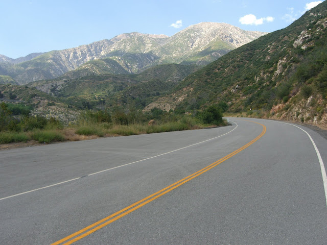
Starting from this parking area, the scenery is immediately beautiful:
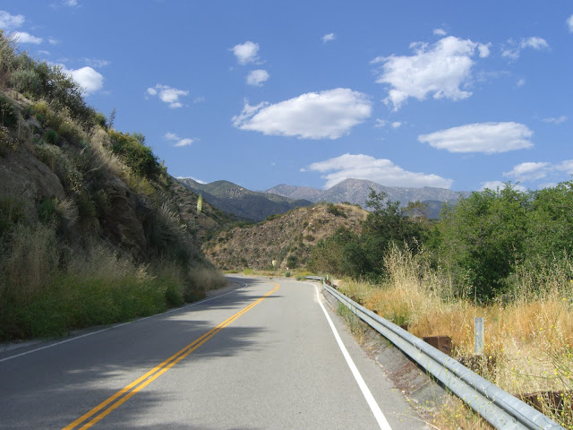 |
| From 2010-06-13 – San Gabriel Mountains Cycling – CA-39 to Dawson Saddle |
Cloud cover provided shade for much of the first part of the climb (nice to have given an 80 degree starting temperature):
 |
| From 2010-06-13 – San Gabriel Mountains Cycling – CA-39 to Dawson Saddle |
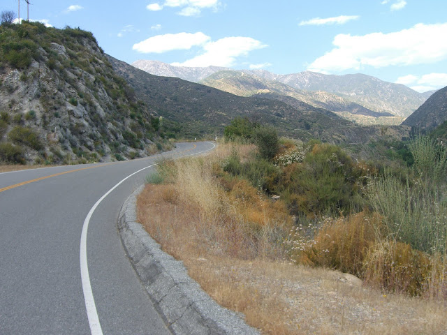
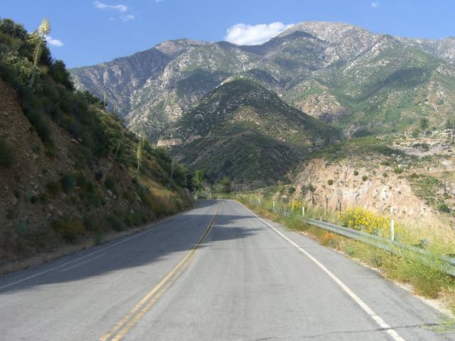
There are a few stretches that stay straight as an arrow for longer than expected given the ruggedness of the mountains:
 |
| From 2010-06-13 – San Gabriel Mountains Cycling – CA-39 to Dawson Saddle |
Looking up the canyon:
 |
| From 2010-06-13 – San Gabriel Mountains Cycling – CA-39 to Dawson Saddle |
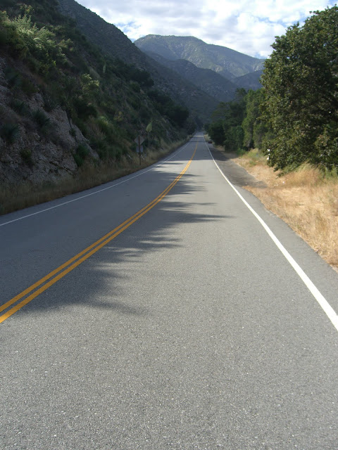
Beautiful pavement here:
 |
| From 2010-06-13 – San Gabriel Mountains Cycling – CA-39 to Dawson Saddle |
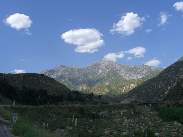
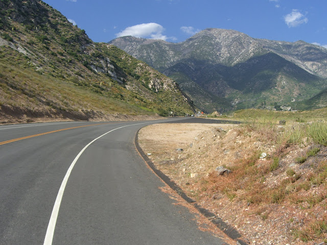
Truly a beautiful valley:
 |
| From 2010-06-13 – San Gabriel Mountains Cycling – CA-39 to Dawson Saddle |
Right after the last shot:
 |
| From 2010-06-13 – San Gabriel Mountains Cycling – CA-39 to Dawson Saddle |
Talk about a scenic backdrop for this road! Even better, the permanent closure for cars is just slightly ahead. The previous section is also often closed to cars – but, at least on this June Sunday, was open to cars (although the traffic level was very light). Just after the gate that closes the road to vehicles (duck under or around with your bike):
 |
| From 2010-06-13 – San Gabriel Mountains Cycling – CA-39 to Dawson Saddle |
Amazing. A road like this, in scenery like this, all to your self.