Posted: June 27, 2009 at 11:36 pm | Tags: Balboa Island, Corona del Mar, Kéan Coffee, Newport Bay Ecological Preserve, Newport Beach, San Joaquin Hills
Low 70s and sunny today..perfect day for a ride around Newport. Decided to plot out a route that would give some flat scenery for a few miles of warm up before hitting the climbing for about a thousand feet of gain followed by dropping back down to the coast for some more scenic riding. While a relatively short loop at 23 miles, the thousand feet of climbing ensures a decent workout. I would especially recommend this loop to those unfamiliar with Newport/Corona del Mar – it will give you a nice introduction to the area.
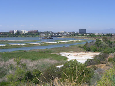
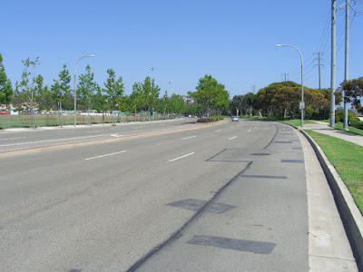
This ride starts at the intersection of Eastbluff Dr & Back Bay Dr, right off of Jamboree. There is ample street parking here, so it makes for a good starting point. Also, the starting point qualifies as rather scenic:
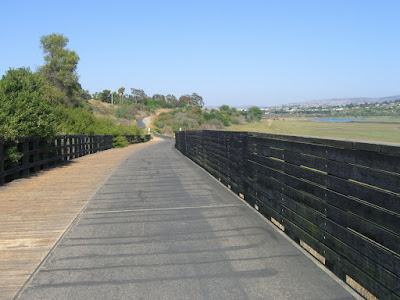
Back Bay Dr borders the Newport Bay Ecological Preserve and is quite popular with runners and cyclists due to minimal traffic…and chances are, you will be passing cars versus cars passing you:
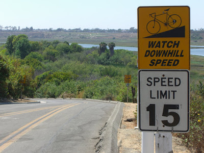
If any officer is reading this, I never cycle above 15mph on this road (this is where I insert the “angel with a halo” smiley). With that disclaimer out of the way…
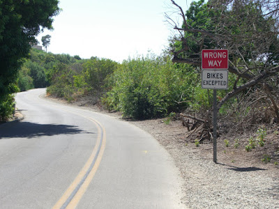
So, this road is also rather unique in another regard:
Don’t see too many roads marked that way! After a few miles of very scenic riding, you will hit San Joaquin Hills Rd on your left. You may want to choose to keep going straight along Back Bay to the end of that road (a few miles later)…you’ll get to see the rest of the bay and get some more flat warm up miles in…then double back to the intersection. Once you do turn onto San Joaquin, you immediately start climbing:
San Joaquin only gains about 550 feet in 4 miles, so it is not that hard. The only tough section is about 2 miles in where you hit a 7-9% section…but that lasts for less than a mile. The first stretch is not all that scenic, passing near to Fashion Island (a semi-upscale, outdoor mall), but the shoulders are wide so it’s no big deal. After passing MacArthur (practically a freeway), it starts getting a bit more scenic. You pass a lawn bowling club on your right:
Can’t say I’ve seen a lawn bowling club before on any ride. This is Newport Beach though, so I suppose it shouldn’t surprise me :p Looking up the road from this point:
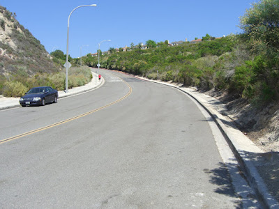
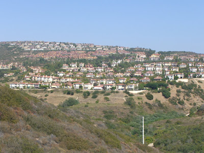
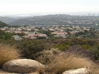
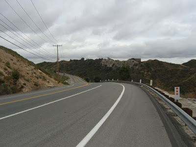
Still a well-traveled, somewhat high speed road, but the shoulder is huge (and you get a painted bike lane shortly ahead). Finish that tougher part of the climb and you are rewarded with views of all the expensive hillside houses:
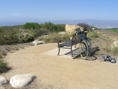
Just before hitting the 4 mile mark, turn right onto Ridge Park Rd and cross Newport Coast Dr. Now the fun starts! While only about a mile long, this climb nets you almost 500 feet of elevation gain with an average grade of about 9%. Additionally, the first fifth is about 12%. No wonder I had to shift down so far. Just after passing Vista Ridge Rd on the right, you will see a small park on your left. This is a nice place to stop for a little refueling while taking in a view of the surroundings. Cute park:
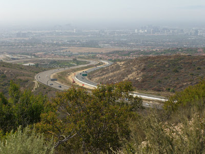
Free views of the 73 freeway included:
And towards the coast (was a bit hazy out that way today):
Continuing on, time for descending! Vista Ridge makes for a nice descent with lots of greenery and some views along to your left:
Found myself hitting 43mph on the part right after that photo..but be warned that this is a pretty short descent and you will have to scrub all that speed before arriving at Newport Coast Dr. Newport Coast is also not a bad descent. Sweeping curves, but more traffic. Nice at about 30mph.
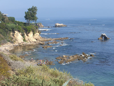
Finally getting out to the coast in Corona del Mar, this was a perfect beach day:
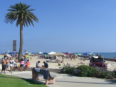
There were a few people out:
And a little detour over to the bay front walking path on Balboa Island:
This little island is a worthwhile detour if you’ve never been. If you have been, you may just want to skip this part as the crowds and traffic can be insane.
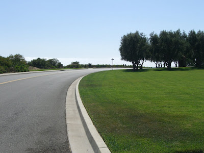
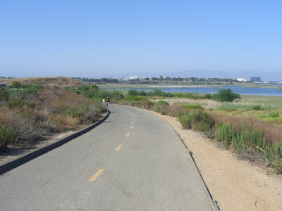
Finally, heading back inland and you hop on the bike path that skirts the other side of the bay:
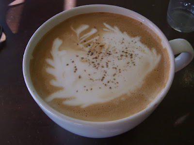
23 miles and I am back to the car. Headed over to Kéan Coffee and got a very tasty Turkish latte:
That is cardamom you see sprinkled on the top. It adds a very nice smell without impacting the flavor. Very tasty! Also, this place is right along the route, and has outdoor seating, so you could easily stop by on the ride versus after the ride…either way it makes for a great stop.
The route map:
Posted: June 16, 2009 at 4:02 am | Tags: Cleveland National Forest, Maple Spring Road, Santiago Canyon, Silverado Canyon
A long, long while ago (about a year ago), when a flat, 40 mile ride was my idea of an epic ride, I rode a great loop in the Irvine area that included the length of Santiago Canyon Road. At the time, this was also one of the most scenic rides I’d done. A year passes, things happen, and you forget about some of your old, but great, rides. Santiago Canyon ended up being one of those forgotten rides for me, sadly. That is, until my mom (visiting for my brother’s graduation from college) ended up flipping through a book of rides in Orange County and asking me about Santiago Canyon. Memory sparked! So, going to mapmyride to show her the loop and the profile of the ride, I stumbled upon a ride that included Santiago Canyon and an interesting out-and-back on Silverado Canyon Road. An out-and-back that added a good 2,000+ feet of climbing. Now I was getting interested… A little more research (thank you bikeforums.net), and I was sold. Without further adieu, the actual ride report!
Given time constraints, I opted not to do a full loop. Portola Hills proved to be a nice place to park that would give me 6 miles along Santiago Canyon before heading up Silverado Canyon. Nice little area:
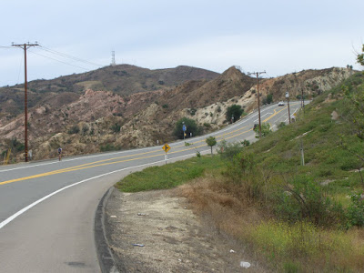
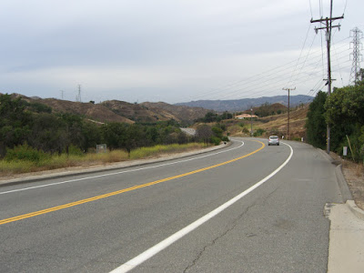
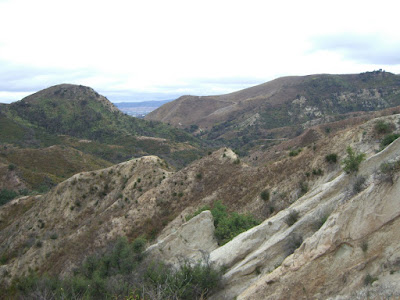
After a quick, steep descent down Ridgeline Rd to Santiago Canyon Road, the climbing starts immediately. I suppose finding a few miles of flats beforehand would be nice, but at least this climbing is rather tame. Anyway, starting around here does keep the entire route along scenic roads. The roads southwest of Santiago Canyon Road are just nowhere near as scenic (not bad roads, just not as sweet). The nice thing about Santiago Canyon Road is that, to the west and south, you butt up against Whiting Ranch Wilderness Park and Limestone Canyon Regional Park, providing you with some spectacular scenes:
Even the less striking sections of Santiago Canyon are still rather scenic (and note the generous shoulders as well):
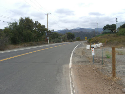
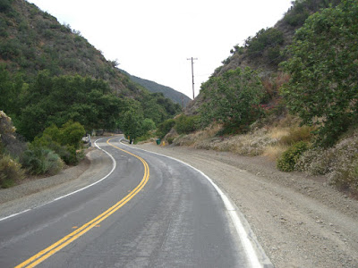
So after lots of rolling hills and 6.4 miles on the Garmin, the turnoff for Silverado Canyon appears (and does not seem to be marked all that well, so keep an eye out when you get near). A couple of hundred feet later, and Silverado Canyon intersects Black Star Canyon. Why the mention? Native American massacres. Ghost and haunting stories. Crazy residents and squatters along the road. Homemade “Private Road” signs to ward off the public. And also, apparently, a good mountain bike ride. A good page about the road can be found here. When I get a mountain bike, I will be riding that road. Anyway, back to the ride at hand. Initially, the road is decent with a gentle gradient. No real shoulder, relatively low traffic but slightly higher speed than I would prefer. That is nitpicking though. Here is the beginning of Silverado Canyon:
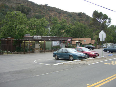
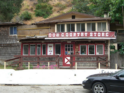
After almost no time, you hit the beginning of the town of Silverado:
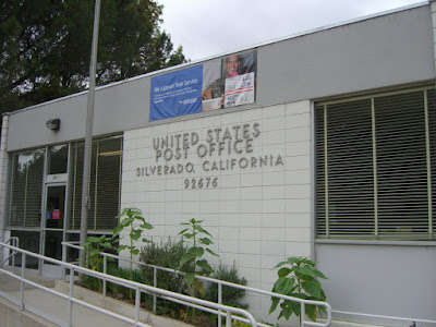
Just big enough to have its own post office:
A sad note as you climb. This is what remains of the Shady Brook County Market:
In 2004, heavy rains loosened a huge boulder above the store and sent it through the residential portion of the building, killing a teenage girl.
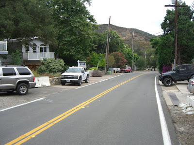
As you wind along and up the road, the traffic speed decreases (25mph limit for much of it…nice!), and there are pleasant looking residences scattered about:
While concentrated a bit around the main part of town, the density of the housing decreases pretty quickly. Continuing up, you get a mix of completely undeveloped sections mixed in with some very lightly developed sections (most of which seem to embrace the natural setting of their lot, thankfully).
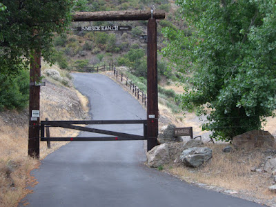
A ranch or two can even be seen along the way (well, the entrances at least):
Looks like a nice, steep road up to the ranch. I wish I could ride up it…
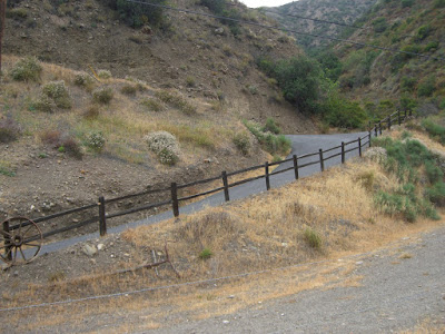
And one of the less developed sections along the road (looking back down on it):
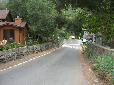
And, finally, we hit the end of the developed section (rather pleasant, no?):
This last section was, most definitely, a pleasant climb through a rural, semi-residential canyon. And, an easy climb as well. The entire stretch averages just under 3%. Regardless, you have still gained nearly a thousand feet here. Not insignificant.
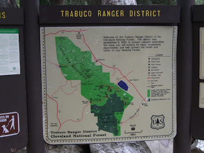
Also, technically, we have been in Cleveland National Forest for almost all of Silverado Canyon Road. However, this is the point where it will become obvious that you are in National Forest Land:
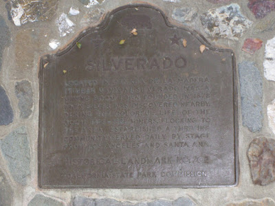
This is also where Silverado Canyon Road turns into Maple Springs Road (and is also a National Forest Trailhead). If you want to start your climb at the bottom of Maple Springs, you can park in a small lot here (note that you will need a Forest Adventure Pass to do so..go buy one and support access to great places like this!). This is also the location of Historical Landmark No. 202 (Silverado):
The picture is tough to read, I know. It was tough enough to read in person with the lighting and all as it was (click on it for a bigger version that is slightly more readable)! Anyway, cliff notes: Silverado was a booming mining town from 1878-1881. And it thrived. And stage coaches served it daily. That is about all (on the sign, at least).
The gate at this point is closed at times. When I was there, it was open to vehicular traffic. You can check to see if Maple Springs is closed on the Forest Service site here. Even when open, though, traffic is pretty light. When the road is closed, you should have no problem continuing up on bike (unless fun weather conditions block passage at some point) – and you will have the road all to yourself!
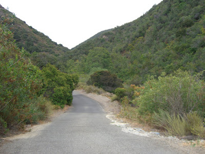
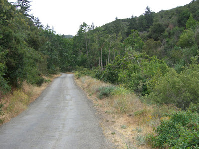
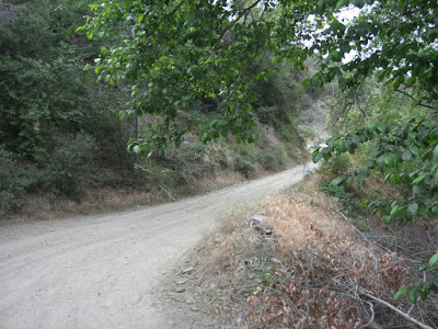
The road itself is one lane and paved from this point – 1900 ft or so – up until about 3000 ft where it turns to dirt. Maple Springs Road, from the “trailhead” start to the end of the paved section is 3 miles..so yes, you get some awesome climbing here. 3 miles of 7%+ climbing. Nice. Very nice. Initially, the road is not super steep, but is surrounded by some lush vegetation:
Looking back down from that vantage point:
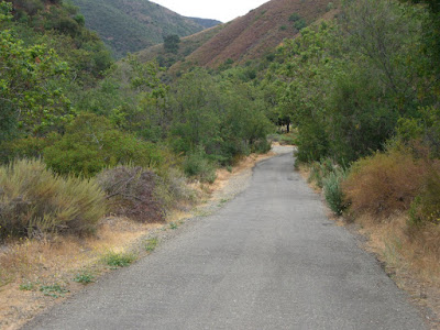
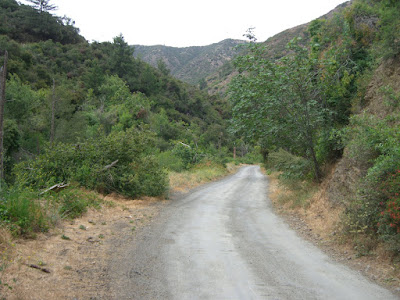
As you can see, skinny road..but what a beautiful canyon! While Silverado Canyon Road was nice, Maple Springs is the sort of road that would keep me coming back time and time again. A little farther up, and some beautiful, open canyon riding:
And watch the debris on the descent:
One of many mini-creek crossings (well, practically a river by SoCal standards):
So many beautiful hillsides you pass with many native shrubs and flowers:
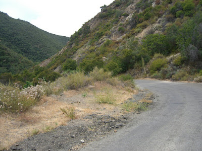
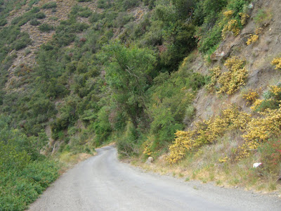
Heading up a bit more, some steeper sections (with some lovely yellow flowers on the hillside):
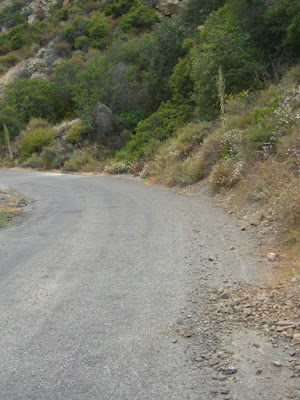
The last few hundred steep feet before it turns to dirt (unfortunately, no perspective to really give you a sense of its steepness):
Looking back down:
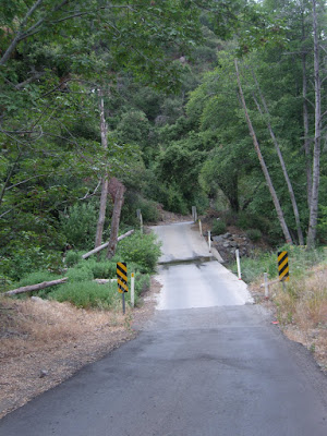
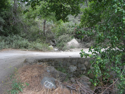
The curve and bridge that leads you to dirt:
And, the dirt road leading up to the over 5000 ft summit of Santiago Peak:
I am actually tempted to do this subsequent part on my road bike. Mainly because it has already been done. Although a mountain bike might make it more pleasant! Another day though. For today, this was a great climb. I never knew such roads existed behind the Orange Curtain.
Well, time for the descent! Maple Springs Road is a slow descent, that is for sure. One lane, bumpy and lots of debris. Oh, and chilly too. Well, today at least. There had been clouds all day and the sky was looking a little unsettled. Luckily no rain on the ride, but the radio was reporting possible rain at night. Glad I had the arm warmers..just barely enough clothing to stay warm. But yes, a rather sucky road for descending, so watch yourself going down. Once you hit Silverado Canyon Road though, all is good. Minimal debris and mostly sweeping curves. Of course, the grade is rather shallow at times so you will never hit ludicrous speed either. But not a bad descent by any means.
Finally, back down to Santiago Canyon for a repeat of those rolling hills, just in the opposite direction. The brief downhills are nice (and, in this case, scenic):
And looking into Limestone Canyon Regional Park:
29.4 miles and 2 hours, 20 minutes later and I am back to the car. Nice ride. I am definitely glad I did this one. Santiago Canyon is a good ride. Silverado Canyon, however, makes this great. Actually, just give me the Maple Springs section and I would be happy any day! A couple of stats on the paved portion of Maple Springs Road:
Length: 3 miles
Average Gradient: Just over 7%
Last Mile: About 9.3% average with some 15+% ramps
Last Half Mile: Almost 12% average
Progressively steeper? Yes, indeed! That road is awesome after having already climbed a thousand feet 😉
After all this, you might actually want the whole route map:
And, if you just want the Maple Springs Road paved section ascent, here you go (check out the elevation profile on this one!):
To wrap this long post up, here is the album link for all the pictures from this ride.
Cheers to cycling!