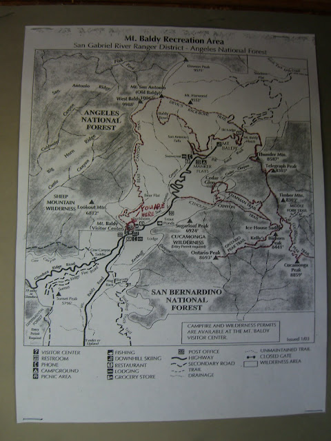
Mt. Baldy Road to the Ski Lifts!
Posted: June 24, 2010 at 1:49 am | Tags: Angeles National Forest, Mt Baldy Lodge, Mt Baldy Road, Mt Baldy Ski Lifts, San Bernardino National ForestMt. Baldy is always an epic adventure. Previously, I wrote a report on the climb up to Mt. Baldy ski lifts via Glendora Mountain Road and Glendora Ridge Road. If you are unfamiliar with that route, I would highly recommend reading up on it: Glendora Mountain Rd, Glendora Ridge Rd & Mt Baldy Rd (to the Ski Lifts!). It is arguably the most scenic, incredible ride in the area. This post, however, is about the more direct way up. First, a few stats:
Needless to say, this is a stout climb. It is definitely one of the hardest climbs in southern California. It is long enough that you can’t just power up it (unlike many of the Santa Monica climbs) and it gets progressively harder (just as your legs get tired and the elevation starts robbing you of oxygen).
For more stats and an excellent elevation profile (broken down into lots of sections and with landmarks noted), check out SoCalVelo’s Mt. Baldy Road Page.
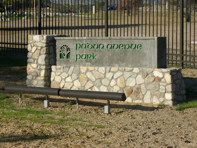
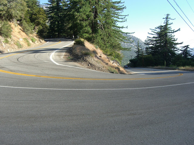
Anyway, despite all the riding and climbing I do, I had never actually ridden the portion of Mt. Baldy Rd from Claremont to Mt. Baldy Village (generally opting to ride Glendora Mountain Rd and Glendora Ridge Rd). Given how famous this climb is, I was long overdue. I started my ride today at Padua Avenue Park:
 |
| From 2010-06-23 – San Gabriel Mountains Cycling – Mt. Baldy |
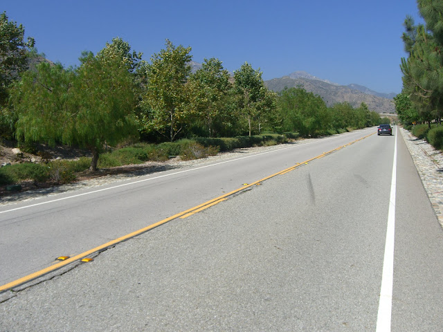
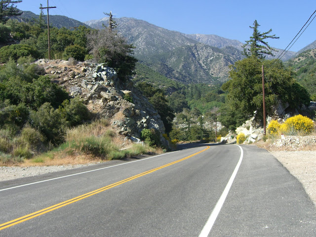
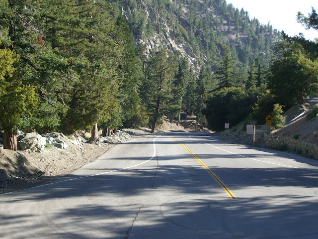
You can also start from the intersection of Mt. Baldy Rd and Mills Ave (the most common starting point). Either way, they are close to each other and both provide quick access to the climb. After turning onto Mt. Baldy Rd, the first part of the climb is easy as you pass through the last of Claremont’s residential neighborhoods:
 |
| From 2010-06-23 – San Gabriel Mountains Cycling – Mt. Baldy |
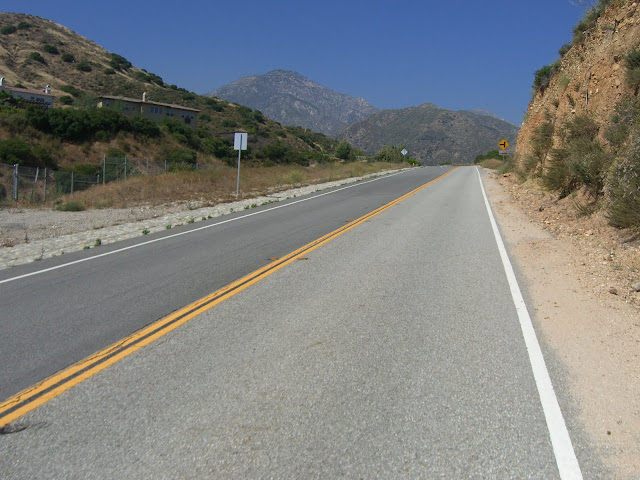
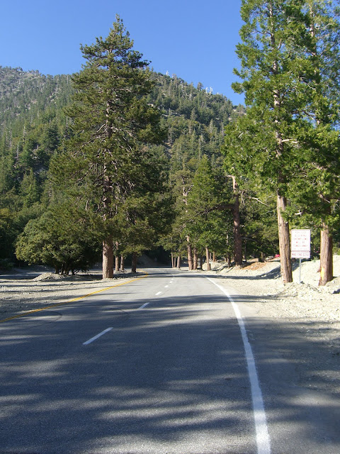
The climbing then ramps up a little bit (but at a still moderate grade):
 |
| From 2010-06-23 – San Gabriel Mountains Cycling – Mt. Baldy |
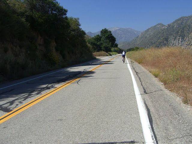
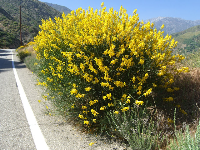
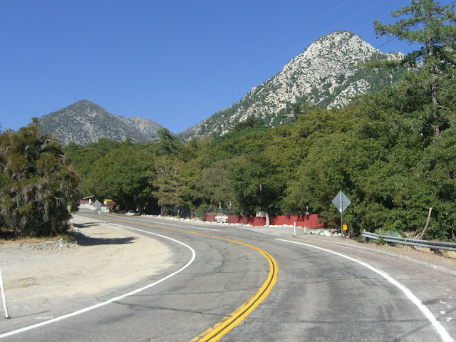
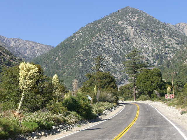
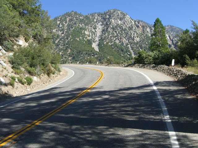
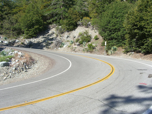
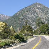
Very quickly, the scenery becomes very nice:
 |
| From 2010-06-23 – San Gabriel Mountains Cycling – Mt. Baldy |
Yup, one other cyclist braving the near 90 degree heat of the bottom section. While a slight breeze kept things almost tolerable, I would recommend an early start in the summer as the climb to the village can get rather hot. I was hoping to pace him for a while, but, sadly, he turned off onto Mountain Ave a short while later:
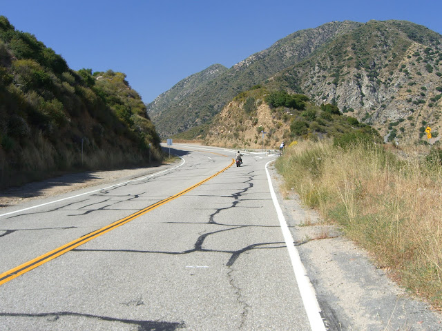 |
| From 2010-06-23 – San Gabriel Mountains Cycling – Mt. Baldy |
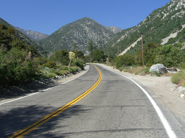
At this point, the mountains really start surrounding you:
 |
| From 2010-06-23 – San Gabriel Mountains Cycling – Mt. Baldy |
Impressive canyon to be riding up:
 |
| From 2010-06-23 – San Gabriel Mountains Cycling – Mt. Baldy |
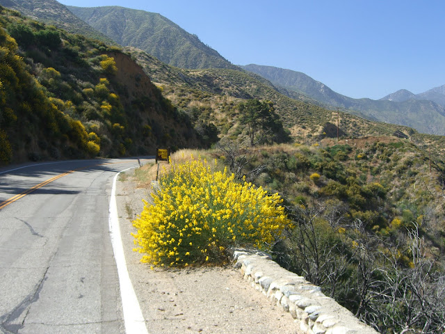
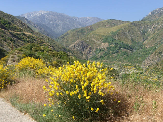
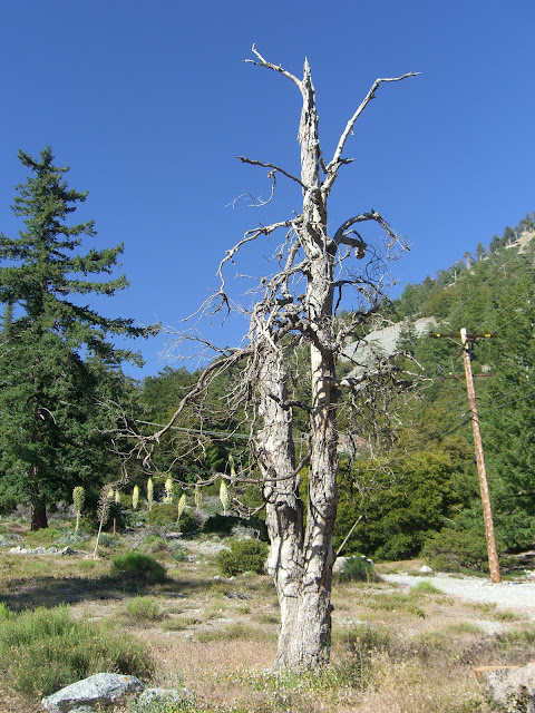
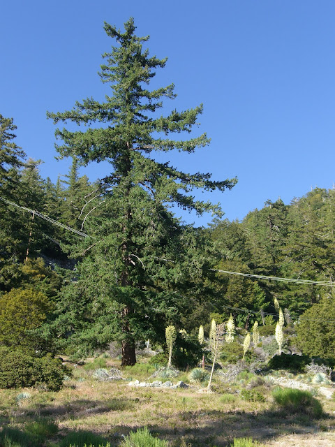
Still some nice color along the way:
 |
| From 2010-06-23 – San Gabriel Mountains Cycling – Mt. Baldy |
 |
| From 2010-06-23 – San Gabriel Mountains Cycling – Mt. Baldy |
 |
| From 2010-06-23 – San Gabriel Mountains Cycling – Mt. Baldy |
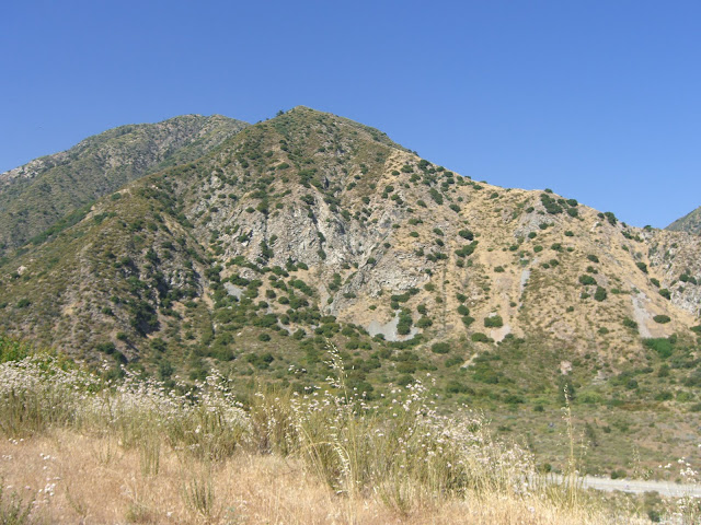
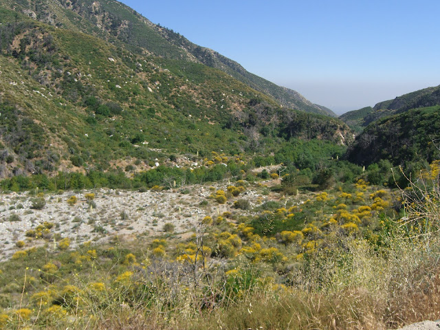
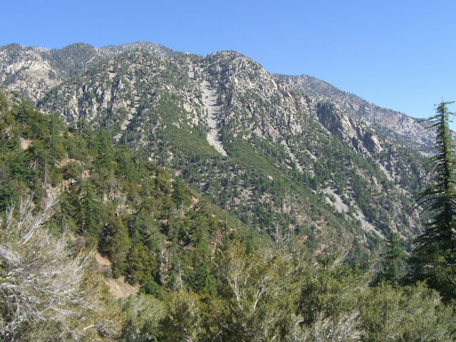
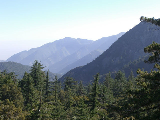
Keep in mind that some of the peaks you see as you go up hit 10,000 feet in elevation:
 |
| From 2010-06-23 – San Gabriel Mountains Cycling – Mt. Baldy |
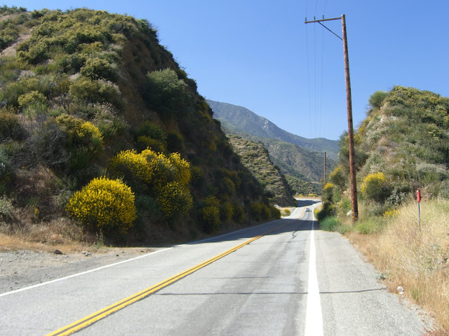
Enjoy the scenery along this section:
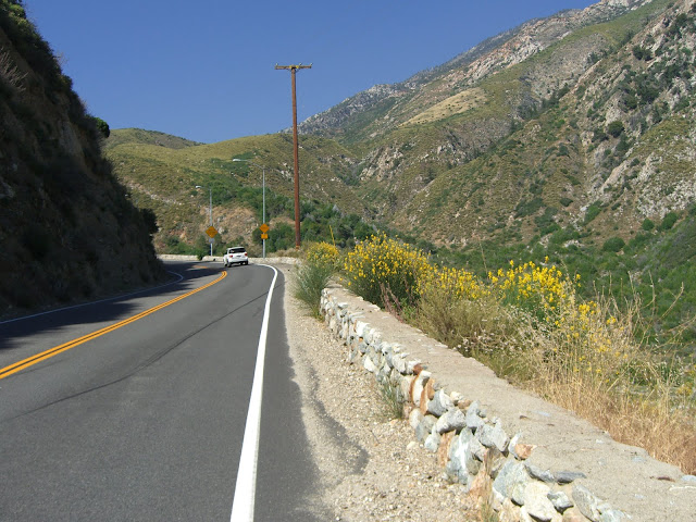 |
| From 2010-06-23 – San Gabriel Mountains Cycling – Mt. Baldy |
 |
| From 2010-06-23 – San Gabriel Mountains Cycling – Mt. Baldy |
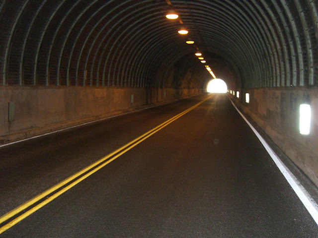
Why? Because this section is easy. That will change very, very soon. You soon hit the first of two tunnels. This first one was built in 1949 and is the longer of the two:
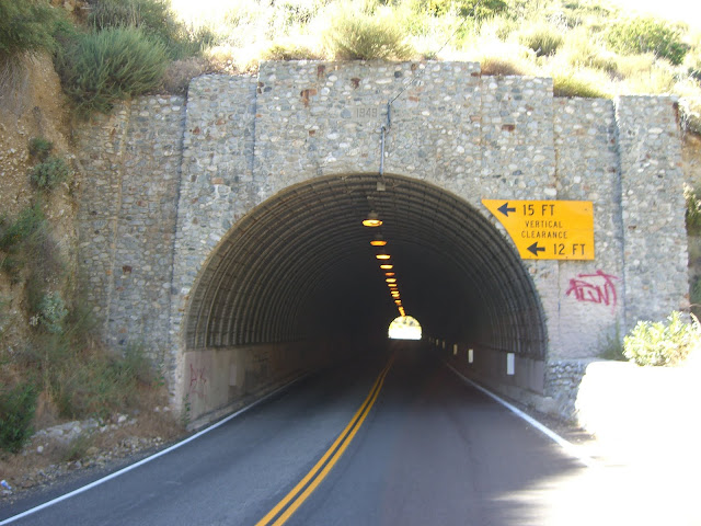 |
| From 2010-06-23 – San Gabriel Mountains Cycling – Mt. Baldy |
 |
| From 2010-06-23 – San Gabriel Mountains Cycling – Mt. Baldy |
And the second, shorter tunnel (built in 1954):
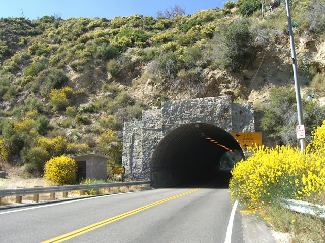 |
| From 2010-06-23 – San Gabriel Mountains Cycling – Mt. Baldy |
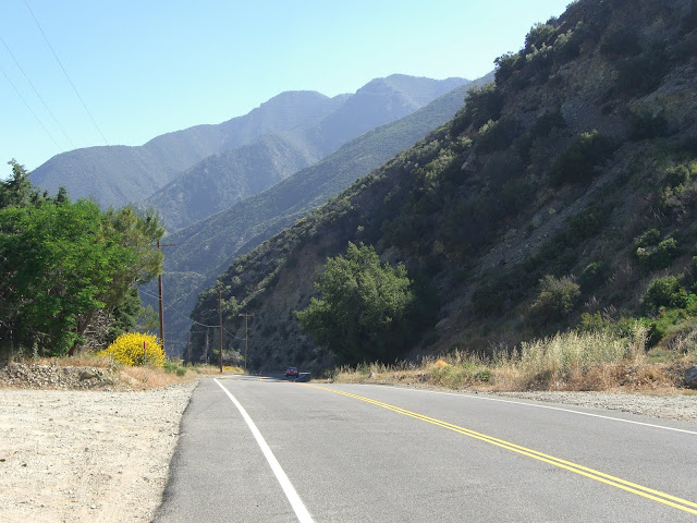
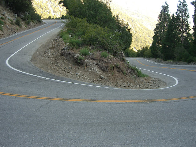
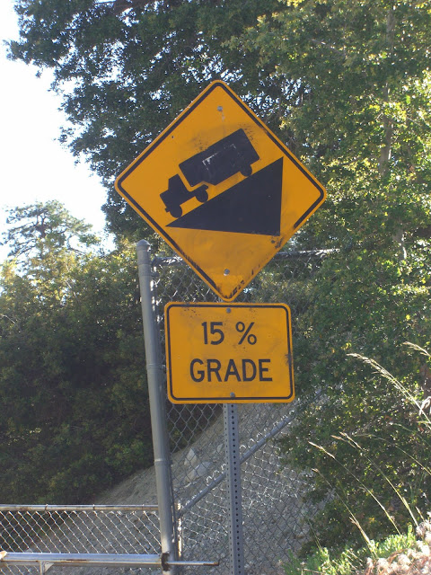
The 2 miles following the tunnels will be your first test. Averaging 9.2%, these 2 grueling miles known as the Hogsback will make you wish you had easier gearing. Making it mentally tougher, this section doesn’t ever look steep. Why? You are following a canyon uphill. Since the whole canyon and the surrounding environment is tilted upwards, you don’t get any flat frame-of-reference to visually let you know that the road is steep. The only way you will be able to gauge the steepness is by noticing that you are having trouble staying upright because you are going so slow 😉 Oh, and in this section, the heat may kill you too in the warmer summer months. Also, the following 7.2 mile stretch from here to the ski lifts averages 8.1%. So yeah, Hogsback is awfully…fun. Right.
Looking back down Hogsback from the top of this section:
 |
| From 2010-06-23 – San Gabriel Mountains Cycling – Mt. Baldy |
If you make it up Hogsback, you are greeted with a well-earned and altogether too short descent:
 |
| From 2010-06-23 – San Gabriel Mountains Cycling – Mt. Baldy |
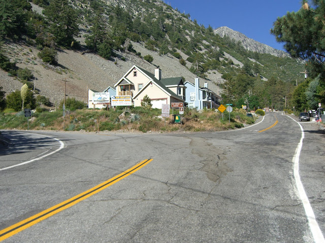
This is also the lead-in to the village of Mt. Baldy:
 |
| From 2010-06-23 – San Gabriel Mountains Cycling – Mt. Baldy |
 |
| From 2010-06-23 – San Gabriel Mountains Cycling – Mt. Baldy |
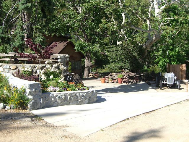
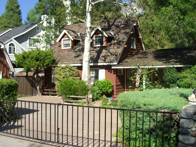
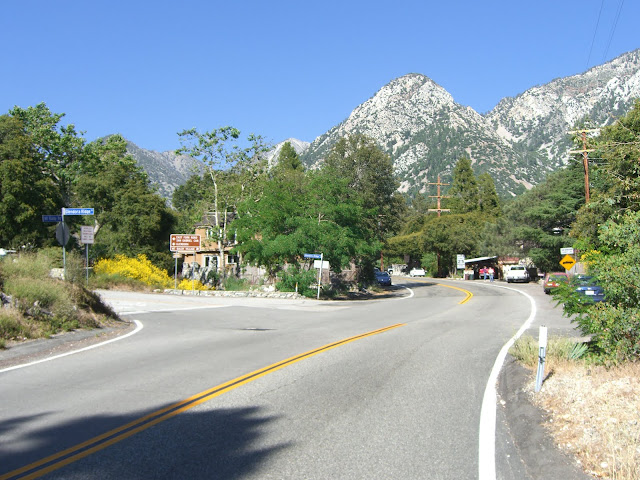
Lots of nice little residences up here. Coming up to the intersection with Glendora Ridge Rd:
 |
| From 2010-06-23 – San Gabriel Mountains Cycling – Mt. Baldy |
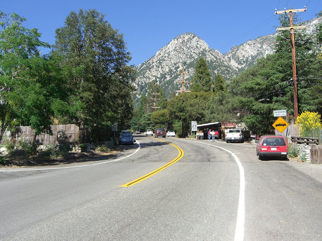 |
| From 2010-06-23 – San Gabriel Mountains Cycling – Mt. Baldy |
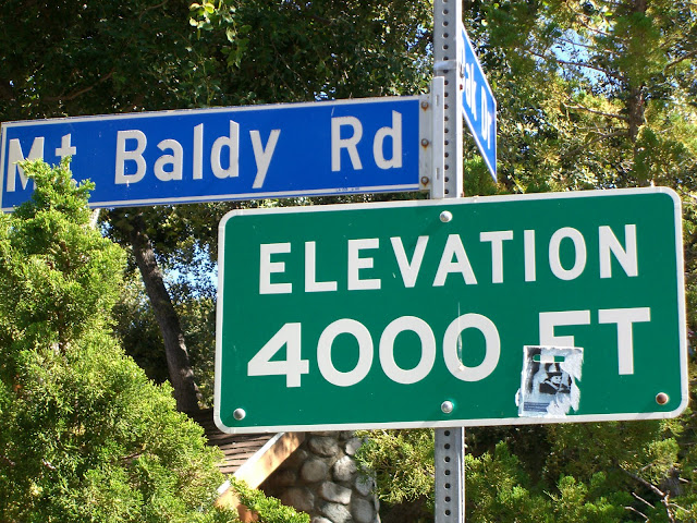
What a backdrop for this village! And, 4,000 feet elevation!
 |
| From 2010-06-23 – San Gabriel Mountains Cycling – Mt. Baldy |
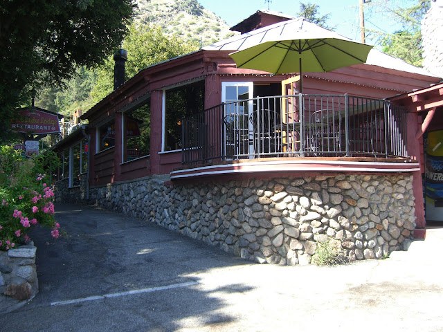
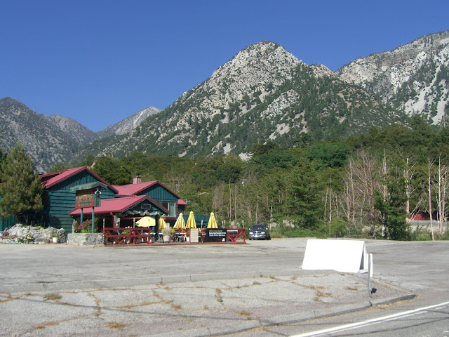
Also, Mt. Baldy Lodge Restaurant is an excellent place to grab a bite to eat after your climb:
 |
| From 2010-06-23 – San Gabriel Mountains Cycling – Mt. Baldy |
Get a burger and fries there after you finish your climbing – it will taste really, really good. In the village, there is also a visitor center where you can learn more about the area:
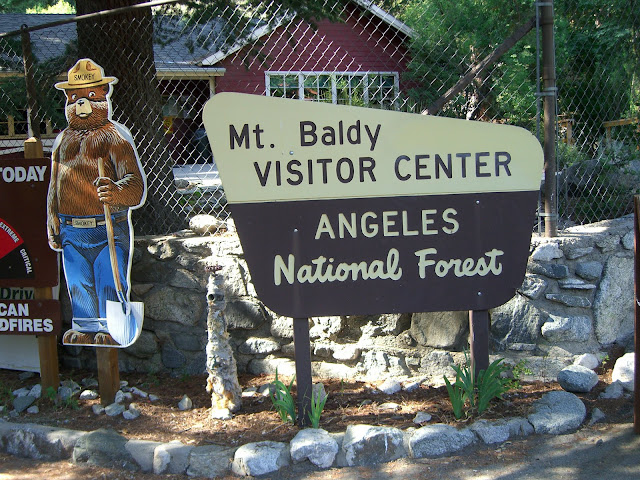 |
| From 2010-06-23 – San Gabriel Mountains Cycling – Mt. Baldy |
Lots of hiking trails in the area:
 |
| From 2010-06-23 – San Gabriel Mountains Cycling – Mt. Baldy |
Give Devil’s Backbone a try if you like hiking. The scenery and views are spectacular. One of the most amazing hikes..anywhere.
Buckhorn Lodge on the outskirts of the village:
 |
| From 2010-06-23 – San Gabriel Mountains Cycling – Mt. Baldy |
What a setting! And, the climbing starts in earnest again, right here:
 |
| From 2010-06-23 – San Gabriel Mountains Cycling – Mt. Baldy |
These last 4 miles to the ski lifts will give you almost 1900 feet in elevation gain – an average of 8.8%! 8.8% for 4 miles. Seriously. This is the part that really tests you. The fact that you have already climbed a few thousand feet and you are getting to elevations where there is less oxygen makes it all that much harder. Enjoy!
At least the scenery is good!
 |
| From 2010-06-23 – San Gabriel Mountains Cycling – Mt. Baldy |
 |
| From 2010-06-23 – San Gabriel Mountains Cycling – Mt. Baldy |
About a mile after the village, you hit the intersection with Icehouse Canyon:
 |
| From 2010-06-23 – San Gabriel Mountains Cycling – Mt. Baldy |
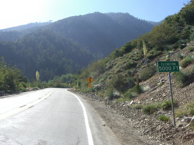
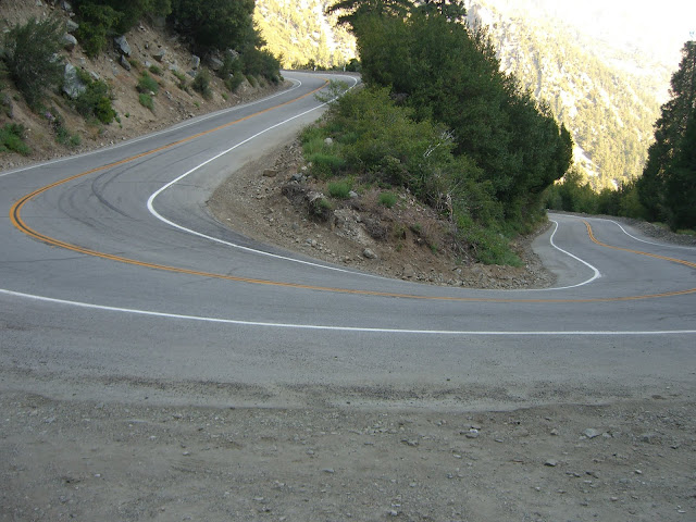
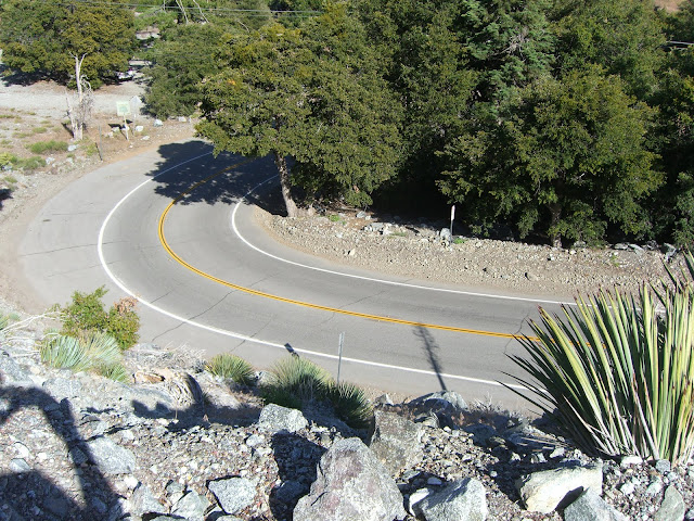
This is where the real punishment starts. The next 1.9 miles average about 10.0% grade (ouch!). Yes, 1,000 feet in elevation gain in less than 2 miles. This is the crazy switchback section of the climb. There are 8 distinct, tight and steep switchbacks in this section. This section is even hard to do in a car (see if you can drive this in a manual transmission car without shifting to 1st gear). On a bike, it is also rather hard!
You quickly pass 5,000 feet:
 |
| From 2010-06-23 – San Gabriel Mountains Cycling – Mt. Baldy |
One of those tight switchbacks:
 |
| From 2010-06-23 – San Gabriel Mountains Cycling – Mt. Baldy |
One of the insane switchbacks:
 |
| From 2010-06-23 – San Gabriel Mountains Cycling – Mt. Baldy |
 |
| From 2010-06-23 – San Gabriel Mountains Cycling – Mt. Baldy |
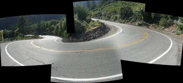
A panorama view:
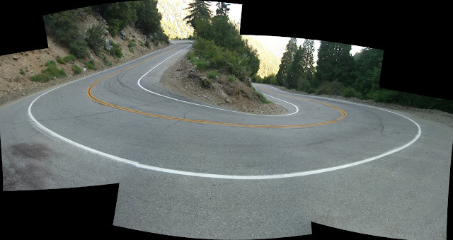 |
| From 2010-06-23 – San Gabriel Mountains Cycling – Mt. Baldy |
That is a steep road. The scenery, once again, is quite nice:
 |
| From 2010-06-23 – San Gabriel Mountains Cycling – Mt. Baldy |
As tough as this section is, try to look up on occasion and enjoy the scenery.
Another beautiful switchback (this one at the intersection with Iron Gate Rd):
 |
| From 2010-06-23 – San Gabriel Mountains Cycling – Mt. Baldy |
Rugged mountains:
 |
| From 2010-06-23 – San Gabriel Mountains Cycling – Mt. Baldy |
Push on a little longer and you get a very brief respite (a respite in this section simply means the grade is slightly less steep) with some more nice scenery:
 |
| From 2010-06-23 – San Gabriel Mountains Cycling – Mt. Baldy |
 |
| From 2010-06-23 – San Gabriel Mountains Cycling – Mt. Baldy |
You may want to take a little break here as the next push is the steepest yet. Midway along the this next super steep section, you get a nice view of the road just climbed:
 |
| From 2010-06-23 – San Gabriel Mountains Cycling – Mt. Baldy |
A bit later and a striking view down the valley:
 |
| From 2010-06-23 – San Gabriel Mountains Cycling – Mt. Baldy |
The final curve for this crazy section:
 |
| From 2010-06-23 – San Gabriel Mountains Cycling – Mt. Baldy |
Stretch your legs a bit and enjoy a small descent and some easy climbing through Manker Flats:
 |
| From 2010-06-23 – San Gabriel Mountains Cycling – Mt. Baldy |
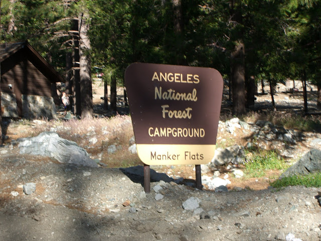 |
| From 2010-06-23 – San Gabriel Mountains Cycling – Mt. Baldy |
Cute snack bar here:
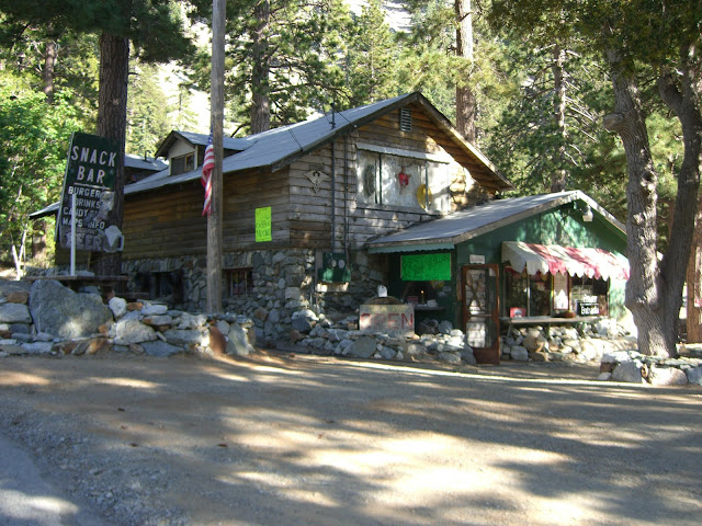 |
| From 2010-06-23 – San Gabriel Mountains Cycling – Mt. Baldy |
And, finally, the last push up to the ski lifts:
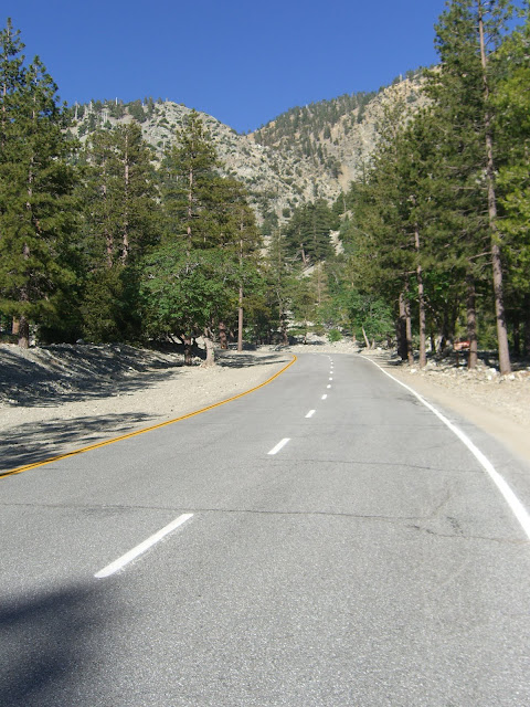 |
| From 2010-06-23 – San Gabriel Mountains Cycling – Mt. Baldy |
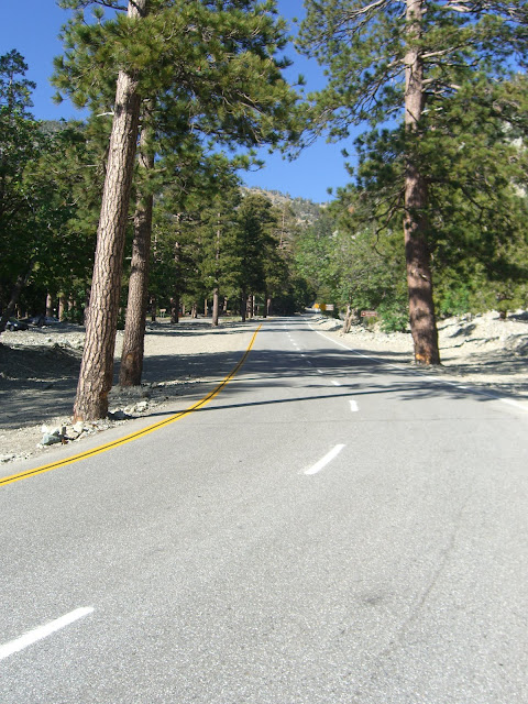 |
| From 2010-06-23 – San Gabriel Mountains Cycling – Mt. Baldy |
This last stretch is your final test. Averaging 14-15% for 3/10 of a mile, your legs will suffer.
 |
| From 2010-06-23 – San Gabriel Mountains Cycling – Mt. Baldy |
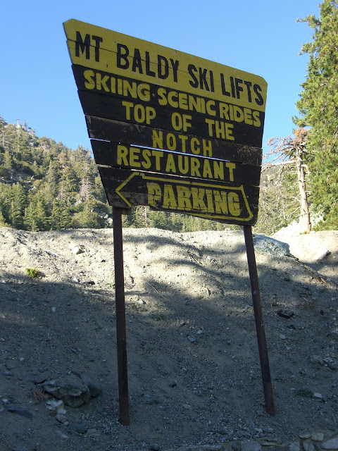
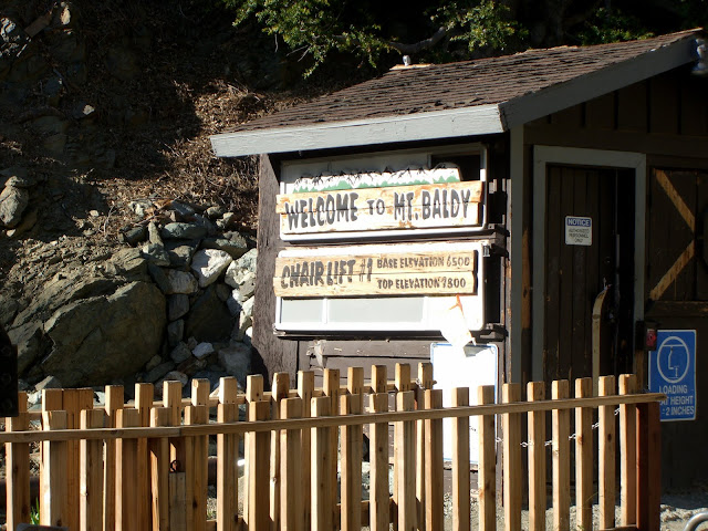
Tough, but very rewarding. As you crawl up this last stretch, you are greeted with this sign, marking the end of the true climb:
 |
| From 2010-06-23 – San Gabriel Mountains Cycling – Mt. Baldy |
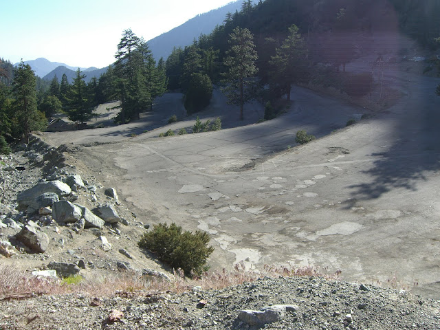
The last little bit of riding is through the multiple levels of parking for the ski area. This section climbs gently and gives you a last few dozen feet of gain to the chair lifts:
 |
| From 2010-06-23 – San Gabriel Mountains Cycling – Mt. Baldy |
Yeah, the pavement is even worse than it looks. On the other hand, it is a nice and easy finish to this epic climb.
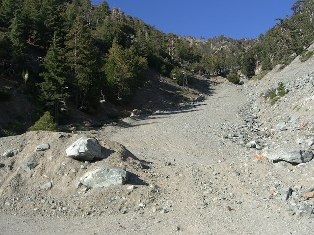
And, finally, the top of the climb – looking up the lift:
 |
| From 2010-06-23 – San Gabriel Mountains Cycling – Mt. Baldy |
6500 feet in elevation!
 |
| From 2010-06-23 – San Gabriel Mountains Cycling – Mt. Baldy |
The chairlift goes up to the notch at about 7800 feet in elevation:
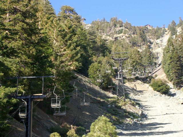 |
| From 2010-06-23 – San Gabriel Mountains Cycling – Mt. Baldy |
There is a restaurant up there (the building you see in the picture above at the top of the lift) with an incredible view. I would highly recommend, on a nice summer day, driving up to the lifts, riding the lift to the notch, hiking up Devil’s Backbone to the top of Mt. Baldy (aka Mt. San Antonio), then getting a burger and beer at the restaurant at the notch. The view from the deck is really, really incredible. Note that, during summer, they are only open on weekends and holidays.
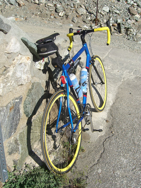
Anyway, obligatory shots of my bike at the top:
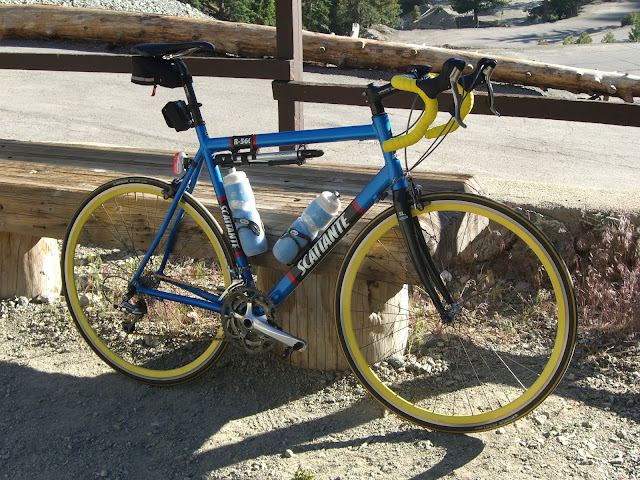 |
| From 2010-06-23 – San Gabriel Mountains Cycling – Mt. Baldy |
 |
| From 2010-06-23 – San Gabriel Mountains Cycling – Mt. Baldy |
After taking a well deserved rest at the top, it was finally time to descend:
 |
| From 2010-06-23 – San Gabriel Mountains Cycling – Mt. Baldy |
The descent from the ski lifts to the village is very technical. The road surface is not great, the grade is very steep and the curves are tight. Sections of it are definitely fun, but keep in mind that you will build speed extremely quickly and some of that speed will have to be quickly scrubbed for the switchbacks. Also, watch for rock debris from some of the crumbling hillsides. With that said, this section of the descent is a great test of your descending skills.
Once you hit the village, you are done with the technical section of the descent. The rest of your ride is a spectacular, fast descent. From the village all the way down to Claremont (over 7 miles), you will only hit the brakes a couple of times. That Hogsback section that was such a pain to climb? Easy 40+ mph on the descent (with the possibility of hitting 50mph if you pedal). The curves are gentle too, allowing you to sweep through them at that same 40+ mph.
After Hogsback, you hit the tunnels. I’d recommend scrubbing some speed here since your visibility goes down in the tunnels. After the tunnels and the one slightly harder right-hand curve, hammer a bit and get your speed back up. While you may not carry 40mph for the rest of the descent, you will still get to ride at 30+ with sections above 40. Just watch for occasional rocks on the road – especially through the sections that cut through the hillside.
With that said, this is an incredible descent overall. Very fast and very fun. A well earned reward after an epic climb.
Some MapMyRide maps below (click on them for more detail, elevation profiles, etc):
Full climb (Claremont to the ski lifts):
Hogsback section (the steep section between the last tunnel and the village of Mt. Baldy):
7.2 mile section from the last tunnel to the ski lifts (average 8.1%):
The last 4 miles (actually, slightly more than 4 miles) from the village to the ski lifts (average 8.8%!):
Icehouse Canyon to Manker Flats Switchback Section (ridiculous 10% grade for almost 2 miles!):
And, finally, the last super steep (14-15%) 3/10 of a mile climb to the ski lifts:
Make sure to click View Elevation on the maps above. The elevation profiles are rather impressive.
Also, here is my Garmin Connect data for this ride:
And, the rest of the photos:
 |
| 2010-06-23 – San Gabriel Mountains Cycling – Mt. Baldy |
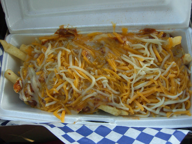
Oh, and my reward for conquering the climb:
 |
| From 2010-06-23 – San Gabriel Mountains Cycling – Mt. Baldy |
Legends Burgers has the most amazing and satisfying chili cheese fries in my opinion – loaded with salty fries and topped with tons of chili and cheese. Yum! Their burgers are really good too.
In summary, Mt. Baldy Road is one of the hardest climbs in southern California and is a must do for any serious cyclist. Give it a try. It is tough, but you will emerge a stronger rider having completed it.
Prost!
The Discussion
see what everyone is saying
Thanks for putting this up. I’ve always headed to Baldy from GMR, then tried up from Claremont and got nasty flats twice… So probably won’t do that again. Lots of beer bottles smashed on the shoulder, etc.
But it’s a great climb and glad to see your pics.
Get some Michelin Krylions or something along those lines and try the climb again! Actually, thankfully, the shoulder was pretty clean this time.
Looking at this post to get a feel for what the Tour of California stage will be like. Nice report. Doesn’t look like there’s much room at the summit for all the RVs, press, and finish line activities though… what do you think?
Baldy’s parking lot is actually pretty good size…but small compared to most ski areas. It is basically a mom and pop ski area. So, the lot should have more than enough room for all the team vehicles and other official things. For spectators, I imagine the parking will go quickly. That said, the last mile or so could accommodate a fair amount of parking of the police and race organizers allow it. Also, the turnoff to Ice House Canyon (about 3-4 mile down from the ski area and about 1 mile above the village of Mt. Baldy) could provide for some more parking.
With all that said, I think that Baldy should make for a great stage – this is an amazing set of roads with a truly tough and beautiful last 4 miles. Additionally, the stretch along Glendora Ridge Road will be very photo-worthy.
I am really looking forward to it. This is one stage that I will absolutely not miss.
Climbed this one today. Great story which helped me motivate and get to know the sections before riding it. Amazing climb which really got me digging deep. Heavy cramps in both legs from the last hairpins and up which had short ramps up to 13-16%. I actually had to walk a couple of hundred meters up to the parking area:( I started in the afternoon, after 4 pm and it was getting dark when I was going down. I also got a flat just down the road before the cool hairpins started. There was a really nasty dump of concrete blocks there and my tires didn’t luuuve me for hitting it in about 60kph. Fortunately, my girlfriend brought a car an let me ride down with her:)
Definitely think this one will rock ToC next year. Can’t wait to see the Schlecks shooting off from the front here.
Glad you were able to ride Baldy. Such a great climb. No shame in walking that last wall to the parking lot with cramps setting in. Those last couple hundred meters are possibly the steepest of the whole climb.
The concrete block section – are you talking about that one quick stream crossing (where there is rarely ever a stream) that transitions from asphalt to concrete and back? Just before the initial descent is slowed by a quick 20 foot climb? If so…yeah, that section is rough (especially descending). Bummer about the flat..but it sounds like you have an understanding girlfriend. Always helpful.
ToC next year should be sweet. I can’t wait for the Baldy stage. I’m going to try my hardest to be there to see it in person. Epic stage.
Yup, the stream crossing was the guilty one. It was too dark and cold that I cared to slow down and made me learn a lesson. Too bad I can’t be there at ToC as I’m heading back to Europe after three months in California (living in Norway).
As it seems that you are serious about going for new, steep climbs, you should check out http://www.vikingtour.no if you ever consider going to northern Europe for a vacation in the summer. Great climbs, great views and a great social experience which I took part of with a couple of friends some years ago. It is a ride-at-your-own pace kinda race and you get the feeling of riding a real stage race for free.
I know that stream crossing well. The one big bump in the road every time I drive up to Baldy for skiing!
Thanks for the link to Viking Tour. I’d love to cycle in that area of the world some day. Or anywhere in Europe, for that matter. How do you like living in Norway? The pictures and videos I see of parts of Norway always blow me away.
Going to ride this on Saturday. Can’t wait. !
Did you get a chance to ride this today? How’d you like it?
Rode up to Baldy Village today starting in Glendora, along baseline, then up the direct route you outlined here. The tunnel section killed me. I was bonking hard and just envisioning food at the Lodge. Then got there and realized I didn’t have my wallet, just $2.50 stashed in a pocket. argh. I didn’t do the ski lifts yet, but will soon (trying to get ready for L’etape du California). Instead, headed back along GRR and GMR to make a full ~45 mile loop.
Appreciate your photos and writeups on various climbs around here!
Thanks for the excellent report of this route. It inspired me to do this in preparation for the L’etape du California. I actually did this route twice today, back-to-back. It was a tough training day, but I wanted to simulate the amount of climbing for the event, and now I think I’m ready for the du cali ride. Thank you for your help!
Also, I did the GMR to GRR to Baldy lifts to Mt Baldy road loop last week (inspired by your GMR report). Keep up the great work!
Thanks! And sorry for the seriously long delay in responding.
Hope L’Etape was a good ride for you. I ended up riding it as well – such great roads and fun to do with lots of other cyclists. That last climb to the ski lifts is always a killer.
Thanks for posting this. It brings back fun memories from college over 20 years ago, when I learned how to ride a bike up a hill (key: don’t stop).
Back then we didn’t have the GPS fun toys and easy access to GIS tools, so I studied the USGS topo maps and concluded that if you start down at about Bonita Ave in Claremont (e.g., on the Pomona College campus), then the ski lifts are almost exactly a vertical mile above (more than a mile of climbing, given the short sections of descent), in about 17 miles of road.
Nice. I’m a fan of the not stopping technique. Also, looking at the topo maps is still great for checking out new climbs. It can still be a quick way to get a feel for a climb.
Nice pictures on your flickr account, by the way.
[…] Great photos and more at: http://www.toughascent.com/blog/?p=161 […]
what a huge accomplishment for me ,i climb gmr about a month ago and that was fun to. we started out with seven riders ended up with six but he made it all the way up to the village but i dont think he can go all the way up to the ski lift ,cant wait to do this again the descent was awesome
started out on baseline was, great after taking a well needed break at the village on the way up i start having nasty cramps on both thigh so i ended up doing a little bit of walking and cramping again and then after passing the campsite from there you can see the ski lift sign that gave a burst of energy to hammer down again and go all the way up to the ski lift itself man that feels awsome finishing that ride
Hi there- I’m curious about riding to the notch in lieu of taking the chair lift. After asking around to the Notch staff, I was told that the fire road was the way to go, rather than the alternative technical climb whose surface was not exactly smooth. I intend to ride up this fire road “Paris-Roubaix” style (cyclocross tires), but would be so grateful for someone to share their experience doing this particular section of climbing. Anything at all would be appreciated, including training tips, riding advice, etc. Hope to hear from someone. Thank you
Hula, the climb to the notch is fun! Taking the fire road from manker flat is the best choice. You also get a paved start and get to see San Antonio falls. It is a fun short climb from the gate, the descent should be fine on cx tires, just make note on the way up of any sections that might cause issue. They do a nice job of maintaing the road.
Thanks for the nice documentation of this epic climb. My buddy and I did this ride on 11/24/2013. We went up from Glendora Mountain Road to Glendora Ridge Road and to the Village. After stopping at Buckhorn lodge for chips, cup-o-noodles and refill our bottles, we did the final climb to the lifts. It was tough, I had to stop several times after hitting the switch back to regain my breath. The final push to the end of the road was hard but inspirational. On our way down, we took the route as you documented here and went through the tunnels. It was fun but it was cold (41 F) going at 35-40 MPH.
I think we picked a perfect day/time to do this because it wasn’t too hot or too cold. We started riding at 9 am and arrived at the lifts around 2 pm. I lost 7 lbs … what a hard way to loose weight :-).
[…] Great photos and more at: http://www.toughascent.com/blog/?p=161 […]
What a fabulous writeup! Thanks Ryan for the detailed and EXACT report of this epic ride! Photos are fantastic as well. Two Thumbs Way UP!!! And I’m glad I saw it, although several years later. Hey, better late than never. I wouldn’t have been riding it 3 years ago, but I am this year. So, PERFECT timing 😉
I much enjoyed your detailed measurements of the climb to the ski lifts! Also the photos and your comments were great to view/read. Yes, I have rode to the ski lifts on my bike on a few occasions; and have personal notes of the dates I have achieved the “up”ortunity to make it to the top.
Thanks for your writeup!
[…] Before today I had not yet made it to the top of Mt. Baldy “the hard way.” From bottom to top it is 13 miles and averages 7.4%, ending with a half mile of 15% incline at the top. Click here for a description of the climb with pictures. […]
Thanks for your great post! My son and I rode up from Claremont to the ski lifts for the first time this morning. Your information about the route was really helpful. Glad I still had something left in the tank for the climb from Baldy Village to the lifts. The switchbacks were killer!
Tributes movement intended for bicyclist Erina Pinkerton”He familiar with c greatwall runches right now there wit http://pilky.mcubedsw.com/index.php?/site/trackbacks/27/ h the older projectors and when anything proceeded to go completely wrong along with them he previously mend these individuals,” Trevor stated.Trevor asserted jo http://body-lightening.com/modules/m_beaute/details.php?bid=10/ b made it simpler for assemble Mr Pin
[…] Great photos and more at: http://www.toughascent.com/blog/?p=161 […]
。これは、このトピックについて知りたい人のための完璧なブログです
私はコメントを抵抗できませんでした。良い情報と
|サイト|ウェブサイトあなたのインターネットサイト。 投稿あなたの 行く経験本当の 。私のようなアカウントの読者にご協力いただきありがとうございました、と私はあなたのために望むトップのための成果の専門面場所。
おかげので多くの 素晴らしい共有するための情報! 私はが検索 はるかに多くを記事を前方には、参照してください!
I was curious about the road up to Mt. Baldy from Claremont since I had made the trip a few times with my parents over 60 years ago. Looking the route up I found your site. So glad. The pics brought back many memories. Went up in the spring when it was t-shirt and shorts weather in Pomona and when we got to the ski lift it started to snow totally unexpectedly. We froze on the lift but it was beautiful.
????????????????
?????????????????
?????????????????????????????????????????????????????????????????????????
??????????????????????????