Santa Monica Mountains Leg Burner – Tuna Canyon, Fernwood & Corral Canyon
Posted: June 8, 2010 at 3:52 am | Tags: Corral Canyon Rd, Fernwood, Saddle Peak Rd, Santa Monica Mountains, Tuna Canyon RdIt’s been too long since I hit the Santa Monica Mountains, so it was about time for me to get back out there. Tuna Canyon was high on my list from reading about it on bikeforums and from having driven down it, so that was on the must-do list. The community of Fernwood is up there as well and, having driven through Fernwood, I knew a super steep climb there that I wanted to do as well (Grand View, specifically). This road is even tough in a car – I saw an SUV almost eat it coming down around a corner and almost going off the side. Finally, to round out the climbing, I found some threads on bikeforums mentioning Corral Canyon as a really tough climb in the area. With this in mind, I figured I could get in a 40-50 mile ride with 4-5k of climbing.
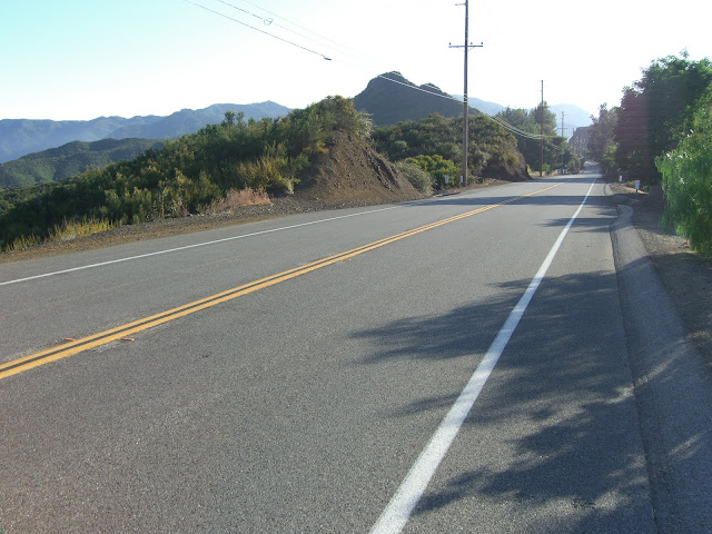
Starting out, you can either park near Tuna Canyon (lots of roadside parking) as I did, or you can park at Malibu Bluffs Park (at the intersection of Malibu Canyon Rd and PCH). I would actually recommend parking at Malibu Bluffs Park as this will give you some relatively flat warm-up before starting to really climb. The rest of this assumes Malibu Bluffs as the starting point (by the way, there are water fountains at the park for those needing water). From here, you head east along PCH for just under 7 miles until hitting Tuna Canyon. Note that it will be easy to miss the turn. Tuna Canyon is one-way downhill, so there are few markings for the road from PCH.
Important Note: As mentioned in the comments section, there is concern about descending cyclists running into ascending cyclists around the blind curves (as you might not be able to hear them). If you do decide you must climb Tuna, please keep this in mind and stay as far right as possible on the curves. And, if you descend Tuna (or any other road, for that matter), don’t assume a blind curve is free from obstacles.
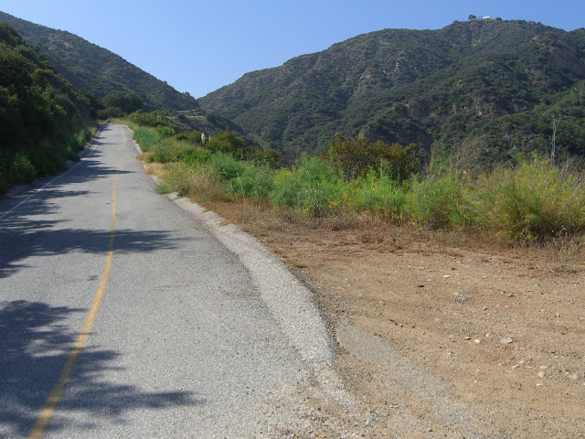
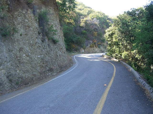
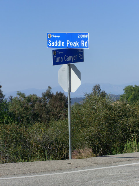
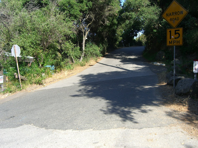
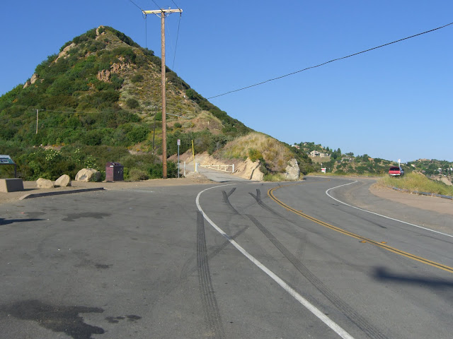
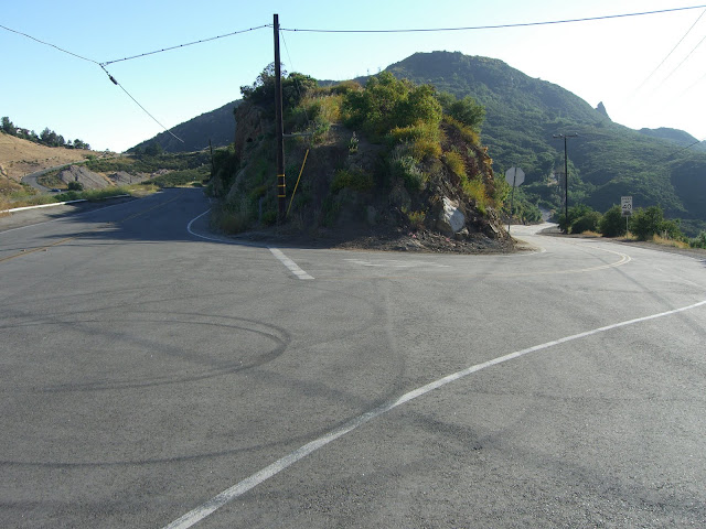
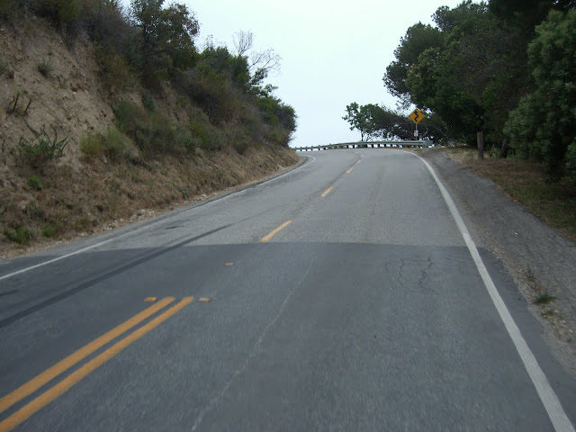
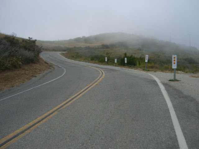
Anyway, moving on. The intersection:
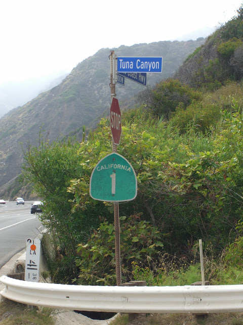 |
| From 2010-06-06 – Santa Monica Mountains Cycling – Tuna Canyon, Fernwood, Saddle Peak, Corral Canyon |
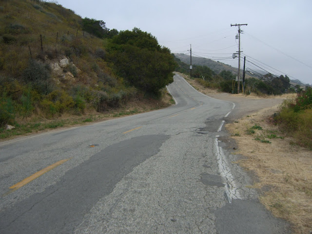
The start of Tuna Canyon:
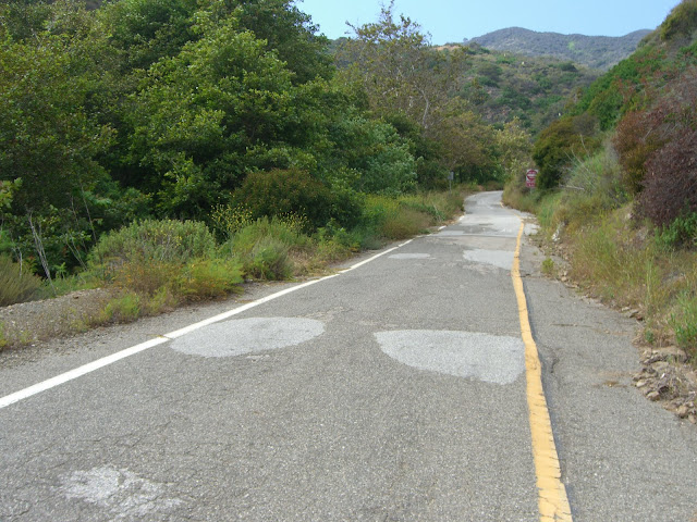 |
| From 2010-06-06 – Santa Monica Mountains Cycling – Tuna Canyon, Fernwood, Saddle Peak, Corral Canyon |
Do note that this is technically one-way downhill, so I cannot really recommend that you ride up this. However, if you do decide to ride Tuna, keep a couple of things in mind. First, downhill traffic (very light, thankfully) will not be expecting to see you. Ride as far right as you can and try not to zig-zag. Second, traffic is light – and audible. You will be able to hear any approaching cars or motorcycles. If coming to a blind corner, exercise caution if you hear a vehicle. This might involve pausing for a few seconds until the vehicle has passed. Basically, use some common sense and put yourself in the shoes of a driver not expecting uphill traffic. With that said, traffic is extremely light (expect anywhere from a couple of vehicles to a dozen on your ride).
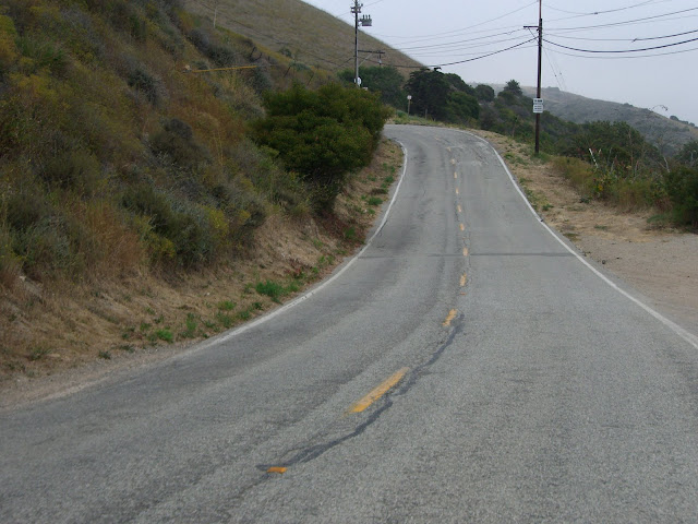
Anyway, the first part is very skinny, rather sheltered and easy:
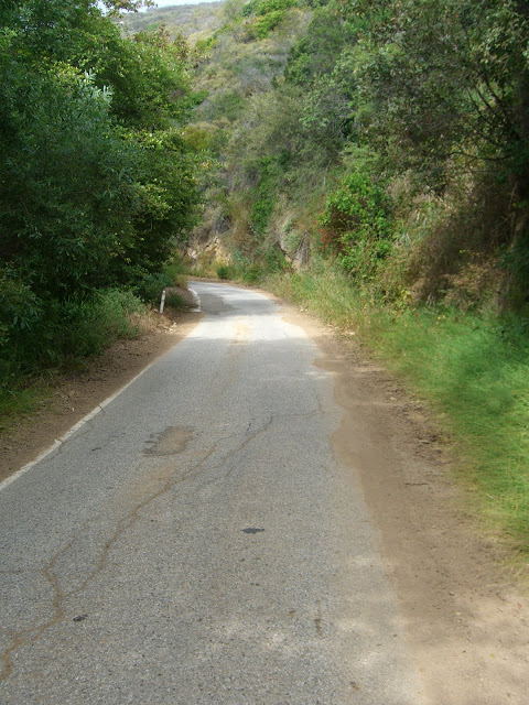 |
| From 2010-06-06 – Santa Monica Mountains Cycling – Tuna Canyon, Fernwood, Saddle Peak, Corral Canyon |
 |
| From 2010-06-06 – Santa Monica Mountains Cycling – Tuna Canyon, Fernwood, Saddle Peak, Corral Canyon |
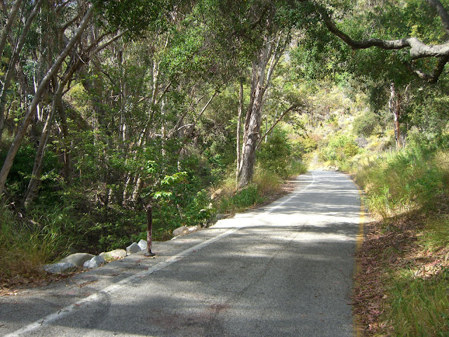
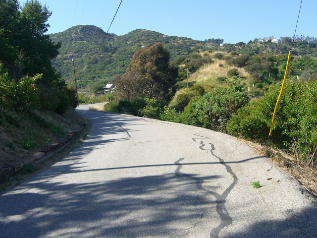
This quickly changes and the climbing really ramps up:
 |
| From 2010-06-06 – Santa Monica Mountains Cycling – Tuna Canyon, Fernwood, Saddle Peak, Corral Canyon |
 |
| From 2010-06-06 – Santa Monica Mountains Cycling – Tuna Canyon, Fernwood, Saddle Peak, Corral Canyon |
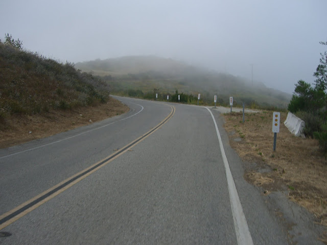
Escaping from the fog (I wished the fog had stayed around though…this climb is tough in the sun with no wind):
 |
| From 2010-06-06 – Santa Monica Mountains Cycling – Tuna Canyon, Fernwood, Saddle Peak, Corral Canyon |
One of the steep switchbacks along Tuna:
 |
| From 2010-06-06 – Santa Monica Mountains Cycling – Tuna Canyon, Fernwood, Saddle Peak, Corral Canyon |
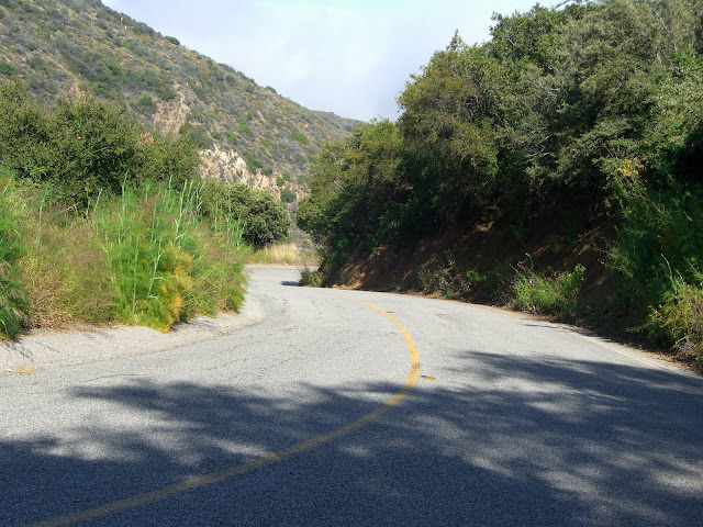
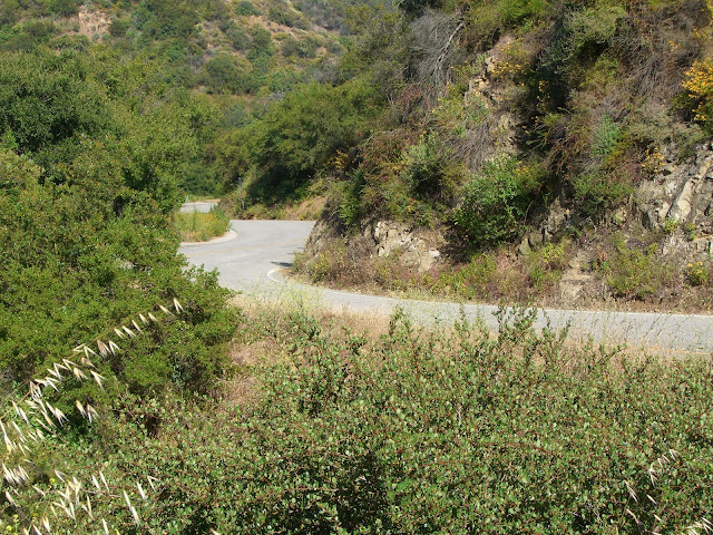
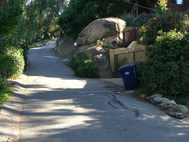
Continuing up the canyon:
 |
| From 2010-06-06 – Santa Monica Mountains Cycling – Tuna Canyon, Fernwood, Saddle Peak, Corral Canyon |
This last section is really, really tough. While the initial lead out is perfectly sane, the same cannot be said for Tuna for the 1.5 miles after the first sharp curve. Averaging about 12.4% for those 1.5 miles and a staggering 14.2% for the first mile after the curve, your legs and lungs will be hurting. There also seems to be a lack of wind along this stretch so, on a sunny day, you will sweat profusely yet not cool down.
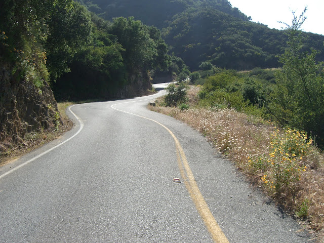
That said, you will eventually overcome the staggering steepness of the first section and start to enjoy the beauty of the road:
 |
| From 2010-06-06 – Santa Monica Mountains Cycling – Tuna Canyon, Fernwood, Saddle Peak, Corral Canyon |
 |
| From 2010-06-06 – Santa Monica Mountains Cycling – Tuna Canyon, Fernwood, Saddle Peak, Corral Canyon |
 |
| From 2010-06-06 – Santa Monica Mountains Cycling – Tuna Canyon, Fernwood, Saddle Peak, Corral Canyon |
Finally you come to some civilization (and a two-way road):
 |
| From 2010-06-06 – Santa Monica Mountains Cycling – Tuna Canyon, Fernwood, Saddle Peak, Corral Canyon |
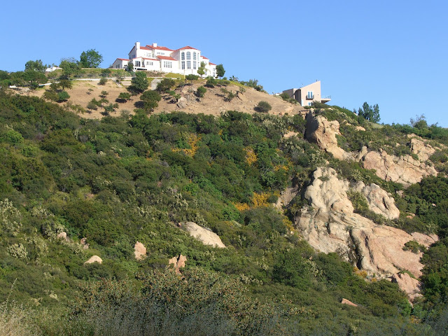
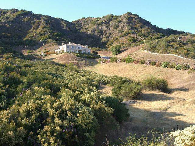
Some amazing houses in the area:
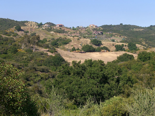 |
| From 2010-06-06 – Santa Monica Mountains Cycling – Tuna Canyon, Fernwood, Saddle Peak, Corral Canyon |
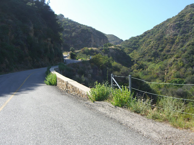
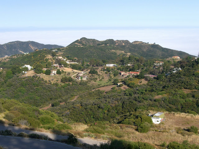
Looking back on the ridge you just rode:
 |
| From 2010-06-06 – Santa Monica Mountains Cycling – Tuna Canyon, Fernwood, Saddle Peak, Corral Canyon |
Yay, finally the top of this climb!
 |
| From 2010-06-06 – Santa Monica Mountains Cycling – Tuna Canyon, Fernwood, Saddle Peak, Corral Canyon |
Elevation here is about 1900 feet – over 1800 feet climbed from the intersection of PCH and Tuna. Tuna is one tough climb. The first section is insanely steep. The middle section is mellow, giving you a respite. The last section, however, reminds you that this is the infamous Tuna Canyon. The last half mile, at 9% or so, is a sober reminder of the difficulty of the climb. Sure, it isn’t as tough as the first section. But, with your legs already wrecked from that section, that 9% will make you take notice.
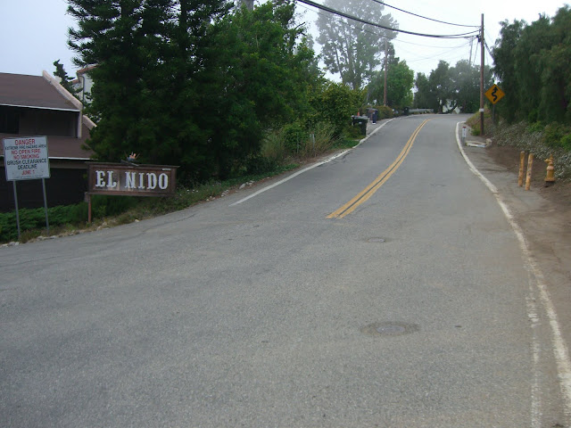
Finally, though, a true descent. Fernwood Pacific is a relatively steep, twisting descent that passes through the quaint town of Fernwood and is definitely appreciated after climbing Tuna..despite having to use the brakes a fair amount. Once descended to Topanga Canyon and turning right, you will pass by Fernwood Market:
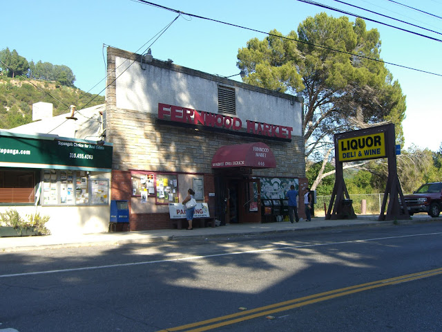 |
| From 2010-06-06 – Santa Monica Mountains Cycling – Tuna Canyon, Fernwood, Saddle Peak, Corral Canyon |
Before beginning the ridiculous ascent up Grand View Drive:
 |
| From 2010-06-06 – Santa Monica Mountains Cycling – Tuna Canyon, Fernwood, Saddle Peak, Corral Canyon |
This picture doesn’t really do justice to the wall that you climb:
 |
| From 2010-06-06 – Santa Monica Mountains Cycling – Tuna Canyon, Fernwood, Saddle Peak, Corral Canyon |
While this 1.1 mile stretch averages only 10.2%, that is not truly representative. Some stretches are relatively flat, while two ~tenth of a mile stretches are in the 20-30% range. I really don’t know how steep they are. I can, however, say that they were some of the steepest sections of road I have ever climbed (and this is coming from someone who seeks out – and enjoys – the absolute steepest roads around).
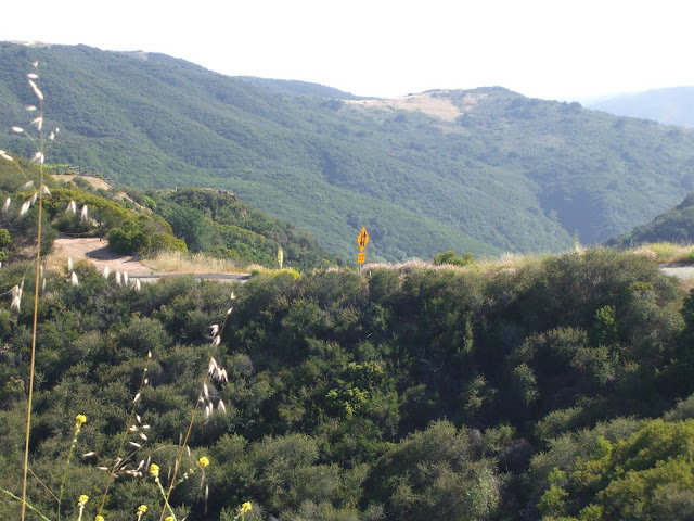
Needless to say, I didn’t take many photos here as I was focused on simply making it up without falling over. The latter part of this climb is back along Fernwood Pacific – a worthy and popular climb on its own. This climb starts at about 740 feet elevation (intersection of Topanga Canyon and Grand View), climbs to about 1320 feet at the top of Grand View, takes you to about 1900 feet at the intersection of Tuna Canyon and Saddle Peak before finally climbing up Saddle Peak to a high point of nearly 2500 feet. Not a bad climb. The scenery along Saddle Peak is not too shabby either:
 |
| From 2010-06-06 – Santa Monica Mountains Cycling – Tuna Canyon, Fernwood, Saddle Peak, Corral Canyon |
 |
| From 2010-06-06 – Santa Monica Mountains Cycling – Tuna Canyon, Fernwood, Saddle Peak, Corral Canyon |
 |
| From 2010-06-06 – Santa Monica Mountains Cycling – Tuna Canyon, Fernwood, Saddle Peak, Corral Canyon |
 |
| From 2010-06-06 – Santa Monica Mountains Cycling – Tuna Canyon, Fernwood, Saddle Peak, Corral Canyon |
And finally, Saddle Peak itself:
 |
| From 2010-06-06 – Santa Monica Mountains Cycling – Tuna Canyon, Fernwood, Saddle Peak, Corral Canyon |
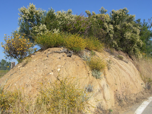
Nice rock formations back along Schueren:
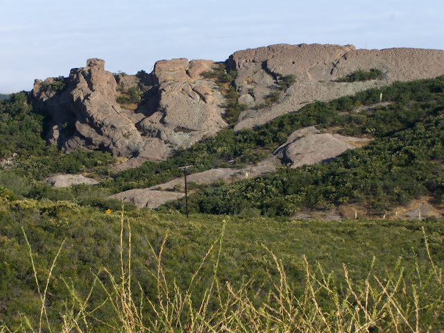 |
| From 2010-06-06 – Santa Monica Mountains Cycling – Tuna Canyon, Fernwood, Saddle Peak, Corral Canyon |
Time for a sweet (and fast) descent down Stunt:
 |
| From 2010-06-06 – Santa Monica Mountains Cycling – Tuna Canyon, Fernwood, Saddle Peak, Corral Canyon |
No photos along the way due to a most excellent descent. Sorry.
Connecting with Mulholland Highway…one rather nice house:
 |
| From 2010-06-06 – Santa Monica Mountains Cycling – Tuna Canyon, Fernwood, Saddle Peak, Corral Canyon |
The road itself:
 |
| From 2010-06-06 – Santa Monica Mountains Cycling – Tuna Canyon, Fernwood, Saddle Peak, Corral Canyon |
Rather representative of this section. Rolling hills, high speed and easy curves. From here, you eventually hit Las Virgenes Rd/Malibu Canyon Rd. At this intersection there is often a hot dog stand. You may find this rather awesome after riding this far. I did, that is for sure.
Once you turn left onto Las Virgenes, the traffic gets much heavier:
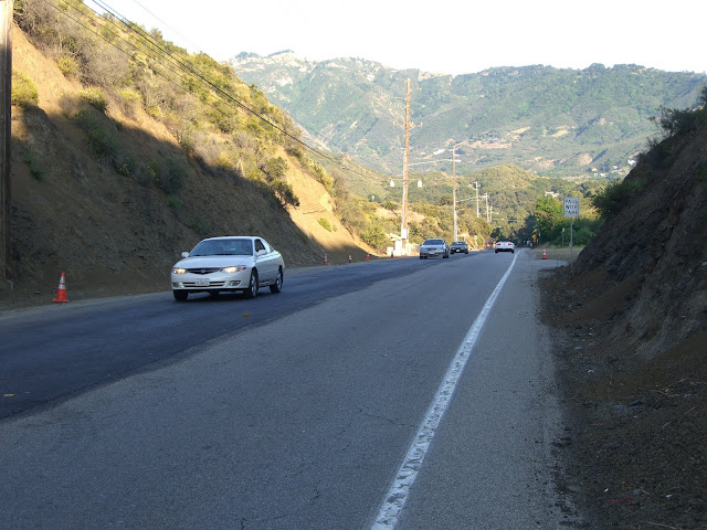 |
| From 2010-06-06 – Santa Monica Mountains Cycling – Tuna Canyon, Fernwood, Saddle Peak, Corral Canyon |
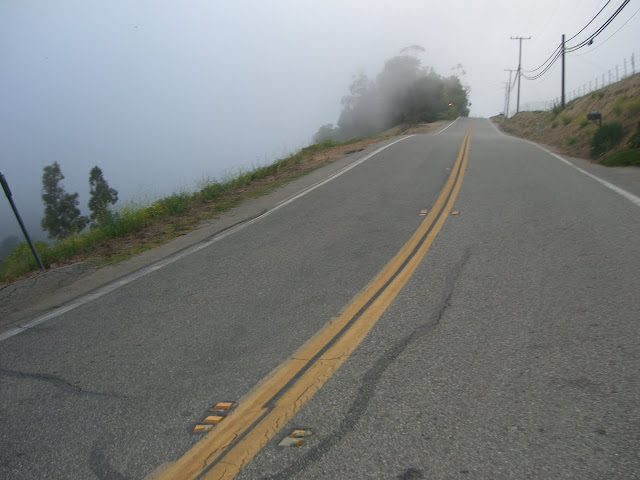
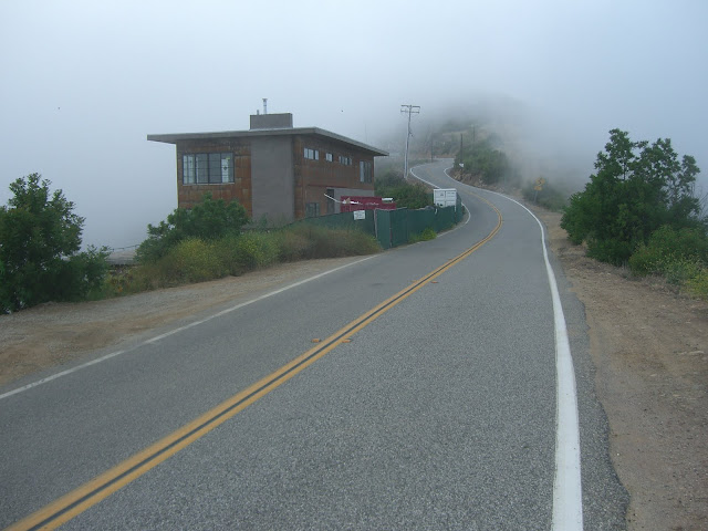
Fog creeps in over the mountains at the intersection with Piuma Rd (a famous climb in the area):
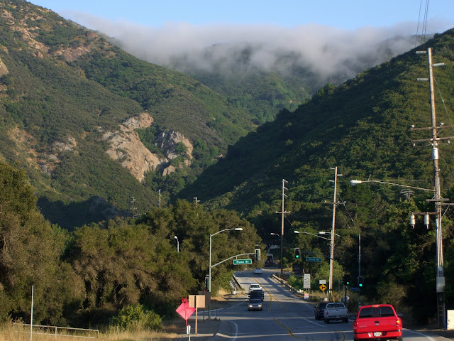 |
| From 2010-06-06 – Santa Monica Mountains Cycling – Tuna Canyon, Fernwood, Saddle Peak, Corral Canyon |
The tunnel you pass through along the way:
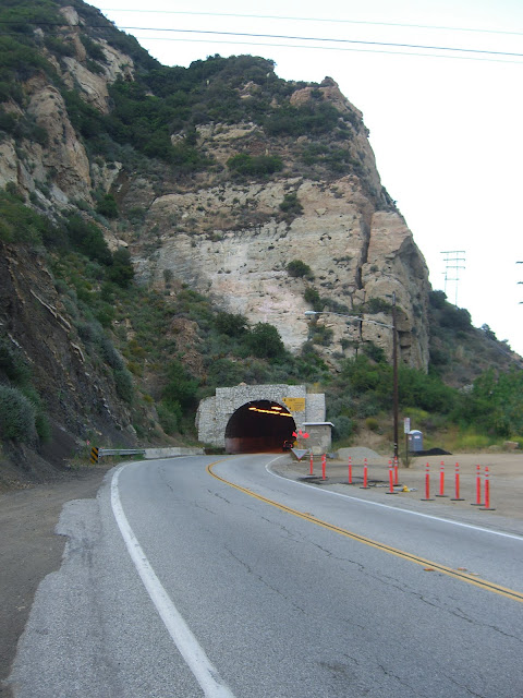 |
| From 2010-06-06 – Santa Monica Mountains Cycling – Tuna Canyon, Fernwood, Saddle Peak, Corral Canyon |
Malibu Canyon is actually quite scenic..would be an incredible ride if not for the cars:
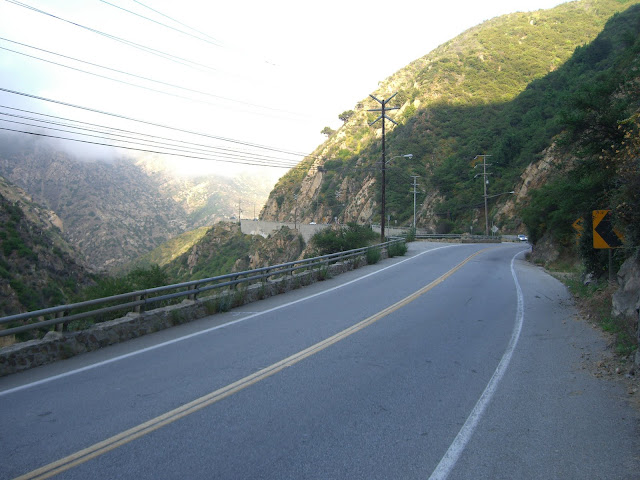 |
| From 2010-06-06 – Santa Monica Mountains Cycling – Tuna Canyon, Fernwood, Saddle Peak, Corral Canyon |
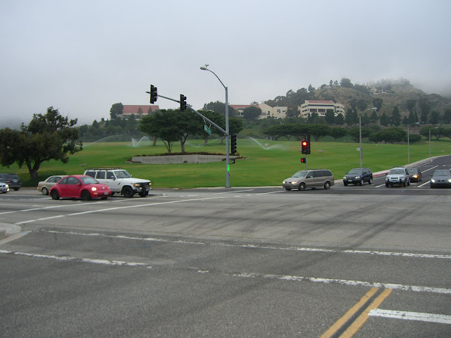
Descending to the bottom and you hit Pepperdine:
 |
| From 2010-06-06 – Santa Monica Mountains Cycling – Tuna Canyon, Fernwood, Saddle Peak, Corral Canyon |
 |
| From 2010-06-06 – Santa Monica Mountains Cycling – Tuna Canyon, Fernwood, Saddle Peak, Corral Canyon |
Yeah, it got foggy. And it was only to get worse…
Heading west on PCH, you hit Corral Canyon Rd in just a couple of miles. After a brief flat section, you cross a creek and round a bend and start climbing:
 |
| From 2010-06-06 – Santa Monica Mountains Cycling – Tuna Canyon, Fernwood, Saddle Peak, Corral Canyon |
Ok, not so bad. Not that steep. But, as you continue climbing, you see that the grade only increases:
 |
| From 2010-06-06 – Santa Monica Mountains Cycling – Tuna Canyon, Fernwood, Saddle Peak, Corral Canyon |
 |
| From 2010-06-06 – Santa Monica Mountains Cycling – Tuna Canyon, Fernwood, Saddle Peak, Corral Canyon |
Climbing up and up into the fog:
 |
| From 2010-06-06 – Santa Monica Mountains Cycling – Tuna Canyon, Fernwood, Saddle Peak, Corral Canyon |
 |
| From 2010-06-06 – Santa Monica Mountains Cycling – Tuna Canyon, Fernwood, Saddle Peak, Corral Canyon |
These pictures do absolutely no justice to the grade.
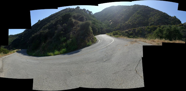
One of the steep switchbacks (sorry for the sucky stitching on the panorama):
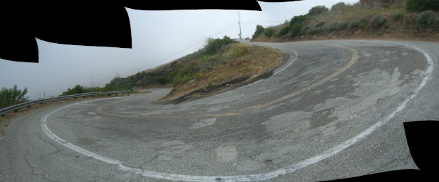 |
| From 2010-06-06 – Santa Monica Mountains Cycling – Tuna Canyon, Fernwood, Saddle Peak, Corral Canyon |
The first community you come upon:
 |
| From 2010-06-06 – Santa Monica Mountains Cycling – Tuna Canyon, Fernwood, Saddle Peak, Corral Canyon |
Some more steep stuff right above that:
 |
| From 2010-06-06 – Santa Monica Mountains Cycling – Tuna Canyon, Fernwood, Saddle Peak, Corral Canyon |
Cool spot for a house:
 |
| From 2010-06-06 – Santa Monica Mountains Cycling – Tuna Canyon, Fernwood, Saddle Peak, Corral Canyon |
At this point, sadly, I had to turn around. It was getting dark and I still had over 10 miles of riding left to get back to my car. The road itself goes up further (and steeply as well I believe). That said, it seems that it is this first section that is known as the tough climbing section, so I am glad I got to tackle it.
Looking back:
 |
| From 2010-06-06 – Santa Monica Mountains Cycling – Tuna Canyon, Fernwood, Saddle Peak, Corral Canyon |
And finally, after descending Corral and riding back along PCH, then driving home, I treated myself to a well earned reward:
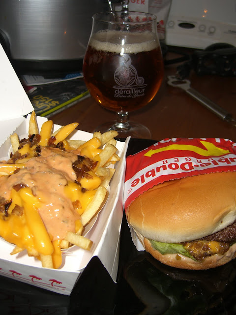 |
| From 2010-06-06 – Santa Monica Mountains Cycling – Tuna Canyon, Fernwood, Saddle Peak, Corral Canyon |
So, so yummy.
Ok, now some maps! The whole route:
Note that, if you prefer to skip Las Virgenes/Malibu Canyon in order to avoid traffic, you could descend Schueren/Rambla Pacifico/Las Flores. Doing so will give you about 4 extra miles along PCH.
And now, here are the specific climbs conquered on this route..
Tuna Canyon:
Tuna Canyon – the steepest 1.5 mile stretch:
Tuna Canyon – the steepest 1 mile stretch:
Definitely click the elevation profile for those. They are rather insane.
Here is the Fernwood-Grand View ascent to Saddle Peak:
And here is the super steep Grand View portion:
The elevation profile does it no justice. You just need to get on your bike and try it.
Finally, here is the steep climbing section of Corral Canyon:
Definitely check out the elevation profile on that one as well. Yes, it is that tough.
A few stats – some repeated from above:
Tuna Canyon:
Steepest 1 mile: ~14.2% (~750 feet elevation gain)
Steepest 1.5 miles: 12.4% (970 feet elevation gain)
Fernwood – Grand View Ascent:
581 feet in 1.08 miles – 10.2% average
2 separate tenth of a mile sections in the 20-30% range (estimated, but really steep and tough)
Corral Canyon:
741 feet in 1.19 miles – 11.8% average
First section is easier…meaning the rest is even tougher than that 11.8% average 😉
Specifically…Steepest 1/2 mile: Over 14.2% (360 feet in ~0.5 miles)
If you are getting bored with your standard mountain climbs and need some steep climbs, give this route a try. These are some of the steepest climbs in the Santa Monicas…and some of the steepest in the country. The only knock is that they are somewhat short..however, this is partially overcome by combining 3 separate, solid climbs into one ride. The views and scenery are also not too bad.
Cheers to riding!
The Discussion
see what everyone is saying
I enjoy your website and climbing reports. However, I’m slightly concerned about your report of climbing Tuna Canyon, as I have been descending that somewhat frequently on my bike. You mention that you can hear cars and motorcycles coming, but would you be able to hear a bike? Probably not. I’m just scared that I’ll be going down around a blind curve one day and run into someone going the wrong way that I didn’t know was there.
Fair Point. That is a concern and also why I hesitate a bit on recommending that others do this climb. The only reason I rode – and did a ride report – on Tuna is because it is a climb that is known and done by cyclists. If you are descending Tuna – or any road for that matter – I would advise caution coming around blind curves. You always want to give yourself a margin for error on an open course. With that said, I am not going to make Tuna a staple of my climbs as I do not want to tempt fate too much. And, if I do make it back, I’ll be as far to the right as possible (just as this time) – something I would hope anyone climbing it would do.
I do appreciate the comment. I’ll add an extra note at the top covering this.
I’ve been stuck in Woodland Hills the past few months, enduring the heat on Fernwood, Stunt, Topanga and Mullholland. Once, I used Grand View as a warm up for intervals on Fernwood. Used it, that is, until I reached the wall in your picture. Then I realized it might negatively impact my repeats, so I ducked the challenge. Next time.
I read your blog and decided to go out and try the infamous Tuna and yesterday evening, the equally infamous Coral.
By paying great attention to pacing I succesfully climbed Tuna last week. It’s hard, very hard. Had me standing a lot with my 39/25. It’s amazing how thin the air can get 1000′ above sea level. Very nice finish, the 9% seemed flat by comparison. I’ve done Fernwood many times and, if you have the time, would strongly recommend descending it and Topanga rather than returning the way you came, which turned my arms to jelly.
The best thing about Tuna, is that when it’s over, it’s over.
The same cannot be said about Coral, you pace yourself up similarly steep grades for slightly less time and then get a break from 0-5% among the first houses. Then it ramps up again, not all the way, but with short hard rolling pitches and then a sustained period 8-10%, or possibly higher. By then it feels a lot harder of course. At last, after 3 miles, it really is over, gently rising the for last 2 miles until you reach the end of maintained pavement. Another arm breaking descent follows, smooth at first, but then nasty and jarring, as you return to sea level. Don’t know what the altitude was at the end, looked like 1500+, that’s in just over 5 miles.
Definitely found Coral the harder of the 2 and prettier, some of those perched houses have views forever.
Don’t think I could do both in the same ride yet though.
I plan on doing them every week this summer.
Thanks for detailed comment!
Yeah, that wall on Grand View is ridiculous. One of the steepest bits of road I’ve seen anywhere (and this is coming from someone who aggressively seeks out such roads!).
Congrats on climbing Tuna – that is not an easy feat with 39/25 gearing. It is hard enough climbing it in my 30/25! As for the turning your arms to jelly, did you descend down Las Flores? If that is what you are talking about, I can definitely understand – Las Flores is a steep road for descending. Good idea on Fernwood to Topanga.
Corral is pretty tough up to the housing area. I didn’t even get to go much beyond it due to time, but it sounds like it is pretty nasty above there as well. As for prettier…I’ll trust you since the whole area was completely fogged in when I climbed it! Guess I need to go and climb it again…during clear skies and all the way to the end.
Also, with the climbs you are doing, you’ll be physically up for both in the same ride sooner than you might think. Keep on riding.
No, I came back down Tuna, just to do it legally. Very hard braking from the hoods.
I had no choice on Coral, it’s a dead end, though one day I might continue past the end of the maintained road, it looks like it might connect to Latigo, a far easier descent(and climb, for that matter).
I really appreciate your blog. Got me off the easier climbs, doing some real work.
Ah, I see. I didn’t descend Tuna, but I can believe that it is a rather brake-heavy descent. As for Corral – the dirt portion appears to eventually connect to Latigo according to Google Maps Satellite View..but that is assuming none of the road is closed off or private of course. You could always do recon in a car first. If you ever try it, let me know how if it works and if a standard road bike would be good enough to climb the dirt section. Also, with regard to descending Tuna on the hoods – next time try descending in the drops. You should have greater control and strength over your braking.
And, glad you like the blog and glad that it has pushed you to try some tougher climbs! There is nothing better than that feeling of accomplishment when you conquer a tough climb.
On to Grand View. Hoofta!
Not for the weak hearted. If you find the approach difficult, better come back another day. At the cadence I could sustain in 39/25 it was almost more a question of balance than leg strength and even arm strength became a factor. Also technical for the arms, had to pull backwards rather than up to prevent front wheel lift off.
Could be a difficult dismount wearing bike shoes.
Nicely done with the 39/25. Grades like that are very much a matter of balance – both to keep from toppling over and to keep from lifting the front wheel. Screw it up and you may go sliding backwards for a bit!
I’m looking forward for the write-up on Yellowhill Road and Noranda Lane!
Ben,
My apologies for not responding way back when. Life gets busy sometimes, but that is not really an excuse.
I actually finally got to climb Noranda recently. I have a few choice words for that mini-climb. Yellowhill is still (I know, I know) on the to do list.
When did Tuna Canyon Rd become one-way? I climbed it on 8 different occasions when I lived in west Los Angeles, but I always used less-steep Topanga for the downhill return. Tuna would be a pretty tricky or scary descent on a bicycle, and I did hear accounts of guys melting their tire glue on it.
Thank you so much for this informative write up. I was out to dinner last night and could not help but notice Grand View. I knew after dinner from Inn of the Seventh Ray that we would drive up that steep climb. I was thinking I’d take Observation Dr/Sischo Dr. and make a loop out of it. Looking forward to checking out more of your places with caution and common sense. It takes a certain kind of sanity to want to do these epic climbs. Thanks for sharing, Trish