Old Waterman Canyon Rd, CA-18 (Rim of the World Hwy) & CA-138 to Crestline Loop
Posted: August 6, 2009 at 12:16 am | Tags: CA-138, CA-18, Crestline, Old Waterman Canyon Rd, Rim of the World HighwayA few weeks ago I was hunting for a new, long climb to do within an hour or so of Long Beach. Flipping through my Complete Guide to Climbing book (a must have for anyone who enjoys climbing), I decided on CA-18 heading up to Crestline and the Lake Arrowhead area. 18 is pretty heavily trafficked and the speeds are high (55mph speed limit), so early Sunday morning was the chosen day. And, more importantly, I found out about Old Waterman Canyon Road – a steep, super low traffic road that takes the place of 18 for about half of the climb.
Sunday morning. 6:15AM. Already around 80 degrees. Luckily, a layer of clouds took the edge off of the heat. Climbing in hot weather can, of course, be masochistically grueling. Those clouds stuck around though, so the heat was bearable for the day.
After climbing a bit on 18, I turn on Old Waterman Canyon Road. This road takes a route mostly parallel to 18, but, instead of lazily winding up along the hill, basically goes straight up it. This is a tough, almost 3 mile climb. The average gradient is around 8.6%, with the last mile and a quarter averaging 10%. I would have taken pictures, but I was too busy suffering my way up. Next time!
After those tough 3 miles, 18 was a nice relief when it came to the grade. 5.3% grade for just over 4 miles and 1200 feet more of gain. The road itself is huge – two lanes each way winding up into the mountains:
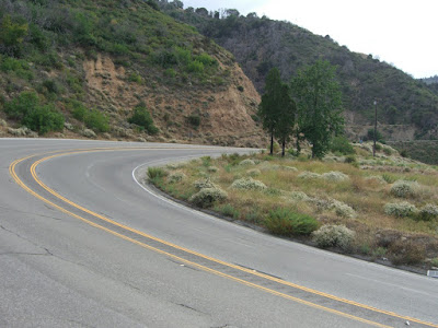 |
| From 2009-07-19 – CA-18, Crestline Cycling |
The views along the way are very good – Rim of the World Highway is a very appropriate name for the road:
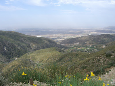 |
| From 2009-07-19 – CA-18, Crestline Cycling |
This would qualify as an exceptional climb in my book – lots of elevation gain, great views along almost the whole thing – if it weren’t for the traffic. 7 or so in the morning on a Sunday and there was already a somewhat consistent stream of cars heading up at the 55mph speed limit. The shoulder was decent enough for most of the way, but there are a couple of spots where you will have to hop into a traffic lane for a few feet. That said, the road itself is pretty impressive:
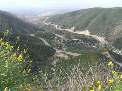 |
| From 2009-07-19 – CA-18, Crestline Cycling |
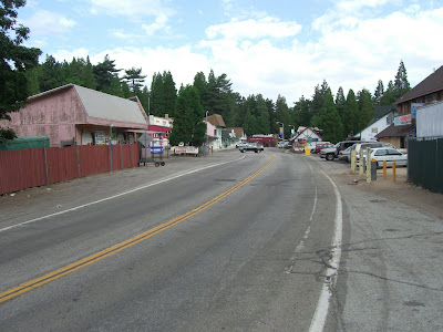
4 more miles down and I am to the junction with 138. This rather precariously placed junction itself is rather amazing to look at:
 |
| From 2009-07-19 – CA-18, Crestline Cycling |
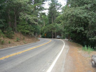
By the way, if descending 138, make sure to scrub some speed before hitting the junction. Unless, of course, you like descending a couple thousand feet in a matter of seconds. 138 itself is quite steep for this portion. This shot gives a rather accurate idea of the grade:
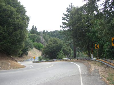 |
| From 2009-07-19 – CA-18, Crestline Cycling |
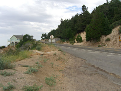
My legs were burning going up a couple of the steep switchbacks. This portion is only a mile long, but averages around 10%. And, finally, civilization:
 |
| From 2009-07-19 – CA-18, Crestline Cycling |
There are a couple of restaurants here to grab a bite to eat..well deserved after nearly 4000 feet of climbing. From here, Lake Gregory is very nearby and Lake Arrowhead is only a few miles away. While I didn’t have time to do this, grabbing a sandwich at a store or restaurant up here and bringing it to one of the lakes would probably be quite pleasant. Continuing on Crest Forest Drive, I enjoyed the peace and quiet of this heavily forested road:
 |
| From 2009-07-19 – CA-18, Crestline Cycling |
Light traffic, thankfully. Additionally, it got me above 5,000 feet – no way I was finishing at 4,800 feet at the village when I could continue going up and get above 5,000. Rolling over those thousand foot increments is just so satisfying. I also found a road called Great View that I figured would lead to some great views. There were some great views along the way and some rather amazingly located houses. Imagine your backyard looking down 4000 feet, unobstructed, to the valley below. I also found that this road is private (it is only posted at such at the other entrance to the road…grrrr…) and, more importantly, contains two dogs that will chase you for daring to glance at them. Actually, I imagine they will chase you no matter what. So, yeah, you may want to avoid this road. Aside from that, riding around here was very pleasant!
Finally, you reconnect with 18:
 |
| From 2009-07-19 – CA-18, Crestline Cycling |
From here, the descent is great. 9 miles of almost continuous 35+ mph riding. With two lanes descending, taking the lane was no problem at all (and traffic wasn’t going that much faster). Top speed of 45 mph – while pacing a car to my left and watching an officer run radar on the side. Fun!
Ultimately, I enjoyed the ride. I just wish the 4 mile stretch ascending along 18 was nicer. The rest of it was great. And Old Waterman Canyon would make for a great training road or repeat road if you lived in the area.
Back down by about 9:30AM and the temperature was already approaching 100! Glad I left when I did!
The whole ride:
Just the Old Waterman Canyon part:
Make sure to click View Elevation for that. It is a nice graph 😉
And, the full set of pictures can be viewed here.
Cheers!
The Discussion
see what everyone is saying
I still think that is amazing that you can find yourself amongst pine trees in southern California. Looks like a great ride, with fantastic views.
Think I will pass on the multi-thousand feet descent in a few seconds though!
Good climbing route!
Thanh lý Laptop ( full c?a hàng) c?m ??.
C) Treo, d?ng, ??t, g?n bi?n hi?u làm m?t m? quan.