Mt. Tamalpais (Bolinas Fairfax Rd Ascent)
Posted: December 31, 2009 at 4:24 am | Tags: Bolinas Fairfax, Mt. Tam, Mt. TamalpaisFinally, a true Bay Area climb. Ok, actually, I have done some of the great, shorter climbs around Pescadero (Tunitas Creek for example), but this was the first of the big Bay Area climbs for me (the other two being Mt. Diablo and Mt. Hamilton..hoping to do those soon!).
Here is a slideshow of the ride for those who are too lazy to read the rest of the ride description (I don’t blame you..I often look for the cliff notes myself):
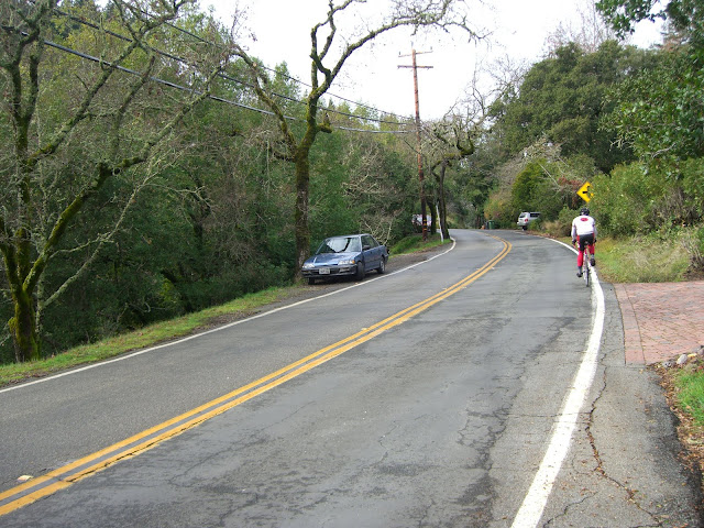
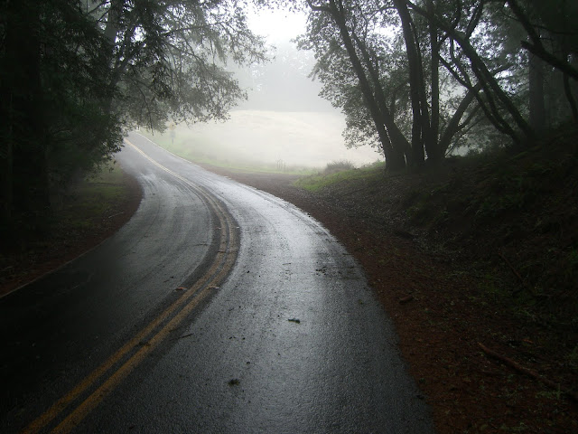
After doing some research, I settled on going with the Bolinas Fairfax Rd approach – general consensus seemed to be that it was the coolest way up with minimal traffic, changing scenery and a couple of tough sections. This route had me starting out in the rather nice town of Fairfax. From Center Boulevard I turned left on Bolinas Road and couldn’t wait to start climbing. About a half mile later my wish was answered with some nice climbing through a residential area in which I wouldn’t mind having a house..
 |
| From 2009-12-28 – Bay Area – Mt. Tamalpais Cycling |
After a bit the houses start to thin out..
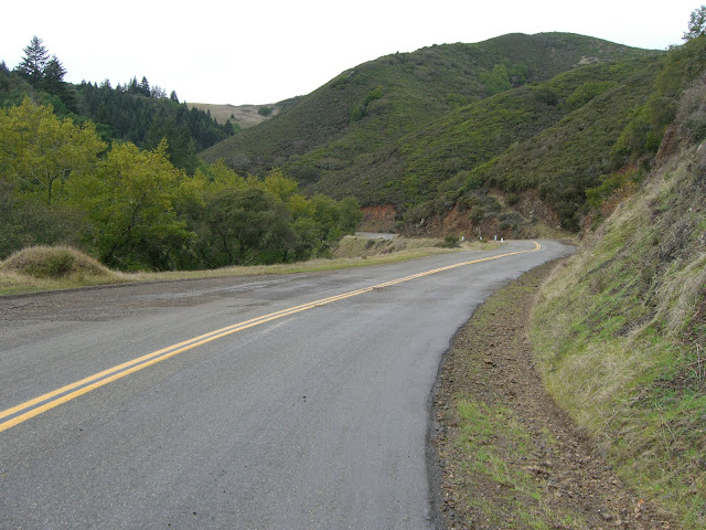
This section really starts to get scenic. After the initial climbing section, you get a pleasant descent:
 |
| From 2009-12-28 – Bay Area – Mt. Tamalpais Cycling |
After the descent, a relatively flat section:
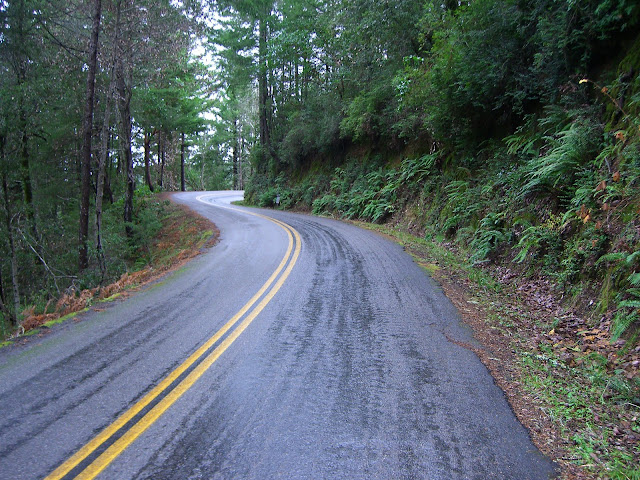
The cool thing about this ride is the ever-changing scenery. Not a mile later and I hit some redwoods..
Scenic, yes.
 |
| From 2009-12-28 – Bay Area – Mt. Tamalpais Cycling |
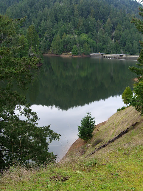
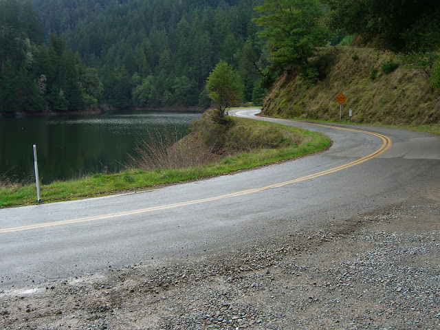
A short while later and I stumble upon the incredibly scenic Alpine Lake:
 |
| From 2009-12-28 – Bay Area – Mt. Tamalpais Cycling |
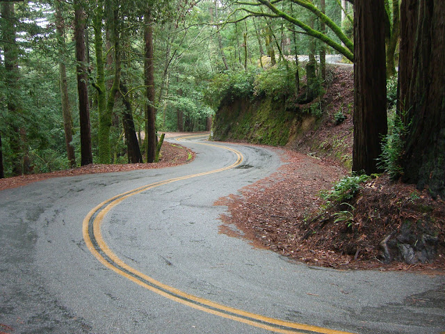
This really is a nice road to ride on..
 |
| From 2009-12-28 – Bay Area – Mt. Tamalpais Cycling |
Even better in motion!
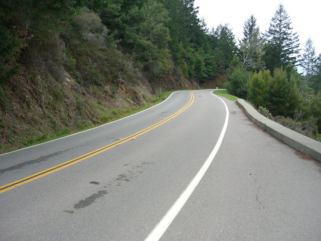
While this last stretch was beautiful, scenic and awfully nice, it is time to start climbing again. This next stretch climbs through the redwoods and averages over 7%…about 1,000 feet gained in just over 2 miles. This section is really scenic…but, yes, you will notice that you are going uphill.
Tough, but beautiful.
Seriously, how often do you get scenes like this?
 |
| From 2009-12-28 – Bay Area – Mt. Tamalpais Cycling |
Small panorama of that view:
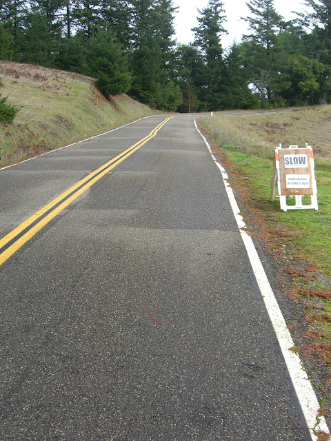
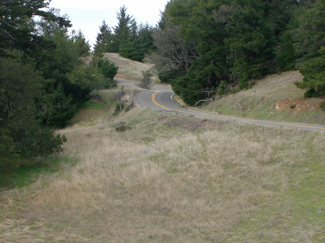
Finally, the climbing finishes and I get a brief respite after turning onto Ridgecrest and officially entering Mount Tamalpais State Park:
 |
| From 2009-12-28 – Bay Area – Mt. Tamalpais Cycling |
Video:
Don’t forget to leave by sunset!
 |
| From 2009-12-28 – Bay Area – Mt. Tamalpais Cycling |
More beautiful redwoods:
 |
| From 2009-12-28 – Bay Area – Mt. Tamalpais Cycling |
Again, video:
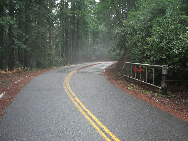
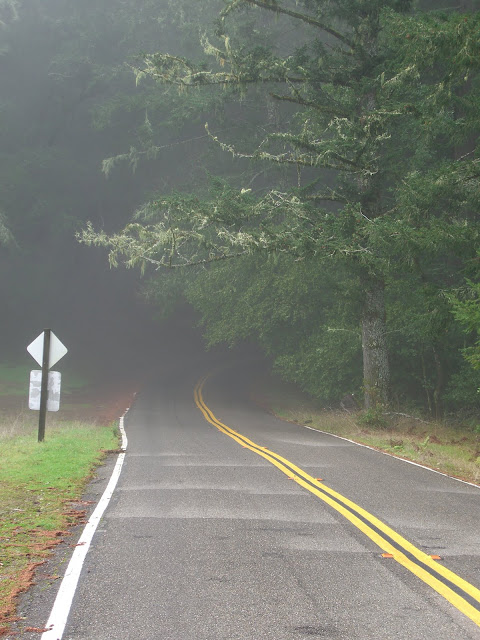
Just about to leave the redwoods (and fog):
 |
| From 2009-12-28 – Bay Area – Mt. Tamalpais Cycling |
Looking back into the fog (spooky!):
 |
| From 2009-12-28 – Bay Area – Mt. Tamalpais Cycling |
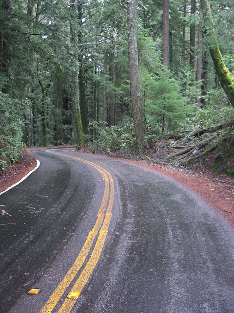
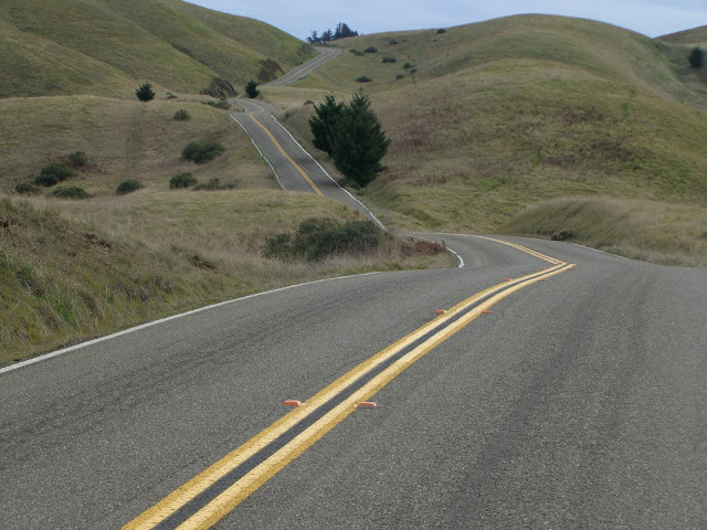
The road about to be conquered:
 |
| From 2009-12-28 – Bay Area – Mt. Tamalpais Cycling |
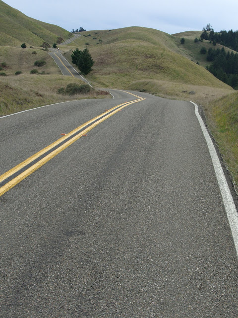
The beginning of the lovely Seven Sisters:
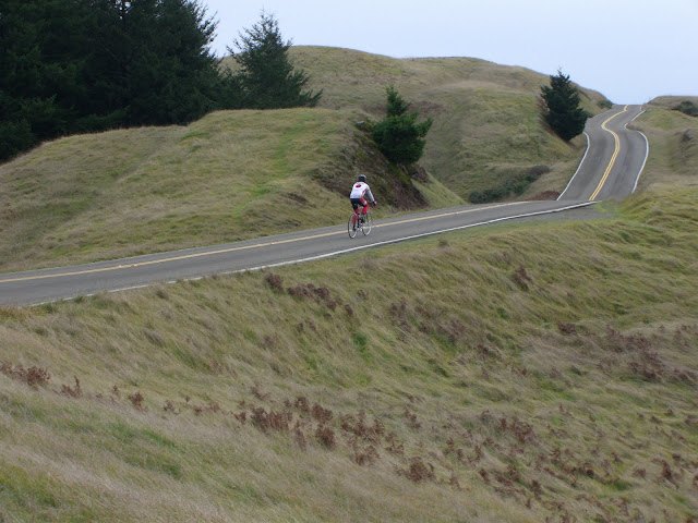 |
| From 2009-12-28 – Bay Area – Mt. Tamalpais Cycling |
Cycling along here is really, really tough to beat:
Seriously?
 |
| From 2009-12-28 – Bay Area – Mt. Tamalpais Cycling |
 |
| From 2009-12-28 – Bay Area – Mt. Tamalpais Cycling |
I won’t even attempt to describe that. My words would not do justice.
Short video a bit later:
And a bit later:
 |
| From 2009-12-28 – Bay Area – Mt. Tamalpais Cycling |
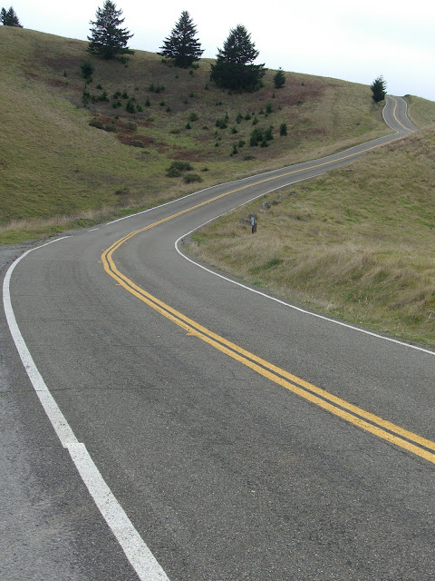
Seven Sisters have been conquered! The road winding through the trees shortly after:
 |
| From 2009-12-28 – Bay Area – Mt. Tamalpais Cycling |
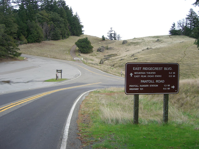
A bit later and the junction of PanToll Rd and Ridgecrest (to the peaks) is hit:
 |
| From 2009-12-28 – Bay Area – Mt. Tamalpais Cycling |
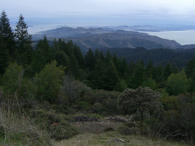
West Peak views:
 |
| From 2009-12-28 – Bay Area – Mt. Tamalpais Cycling |
 |
| From 2009-12-28 – Bay Area – Mt. Tamalpais Cycling |
The final ascent to the east peak gives you a nice, short but steep section:
And, finally, success! The east peak!
 |
| From 2009-12-28 – Bay Area – Mt. Tamalpais Cycling |
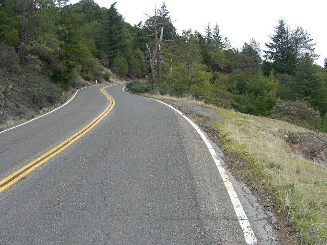
The descent back to the junction of Pantoll and Ridgecrest is excellent – these curves are just begging for a decent cyclist.
After this, I descended down Panoramic Highway. This was decently scenic, but nothing special after what I had already cycled through. Some pictures:
 |
| From 2009-12-28 – Bay Area – Mt. Tamalpais Cycling |
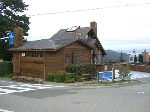
The cute Mountain Home Inn:
 |
| From 2009-12-28 – Bay Area – Mt. Tamalpais Cycling |
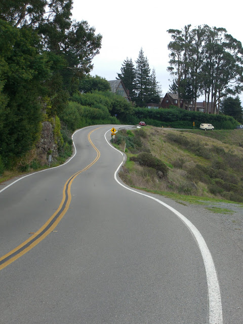
Twisty roads!
 |
| From 2009-12-28 – Bay Area – Mt. Tamalpais Cycling |
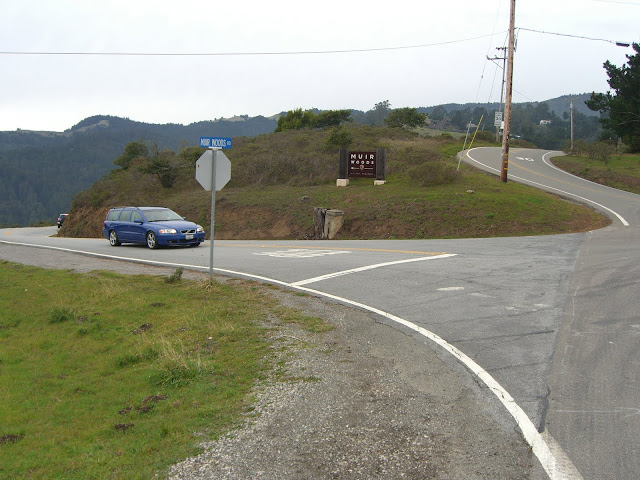
Muir Woods cutoff:
 |
| From 2009-12-28 – Bay Area – Mt. Tamalpais Cycling |
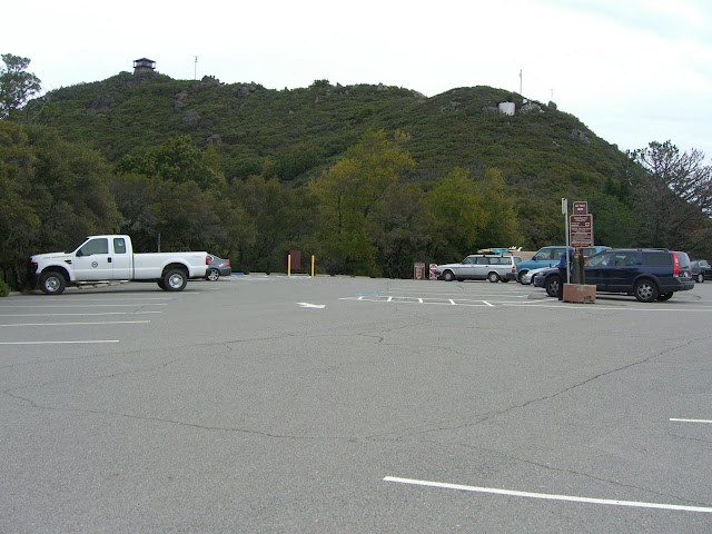
And the reward for finishing the ride:
 |
| From 2009-12-28 – Bay Area – Mt. Tamalpais Cycling |
Here is the MapMyRide routemap:
The Discussion
see what everyone is saying
Excellent write up. I still haven’t gone to the top of Mt. Tam (only went as far as Pantoll). If you are in the Bay Area, and want some company up some tough climbs, let me know (twitter id spingineer).
If you love this, you gotta do Diablo, and both sides of Hamilton
Great report! I just road this route a few days ago but forgot my camera. Nice to have some pictures available to remind me of the beautiful scenery. The climb up Mt. Tam from Fairfax is very scenic and I only saw five cars over the entire route (on a Thursday afternoon).
Dan
Thanks Dan!
Mt Tam was one of my favorite rides – the scenery and the terrain change so much that there is no way to get bored…and yet somehow every single mile just seems to keep on getting better. It really is a great ride. I can’t wait to get up there and ride it again!
Oh, and yes, the lack of cars is nice too!
Nice description! On behalf of the Cyclorama Club, however, you NEED to stop using the term “seven sisters” to describe “ridgecrest” or “bolinas ridge” .. The simple reason? There are NOT seven anything up there. Next time you are up there try to count them! The ride is called “ridgecrest” or “mt tam ridge”. When you use the “sisters” terminology you damage your brain and the brain of others!
I’m not sure where I first heard the term for that stretch of road, but it does seem to be somewhat commonly used. I thought it referred to the number of rolling little hills you climb on that section. I appreciate the comment though. Is Cyclorama a cycling club in the SF area?
I love this write up. I stumbled upon it last year and it inspired me to try out this route. It’s now my favorite ride. Thank you!!!
The stretch of road that I also call 7 Sisters is the toughest part of the climb. For some reason, I always think Pantoll is right around the next corner, but it never is.
2f6zw8